


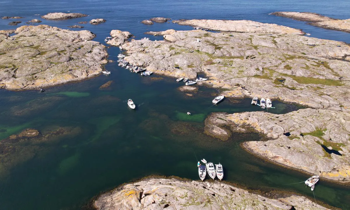
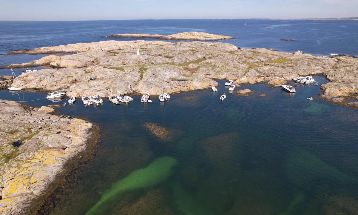
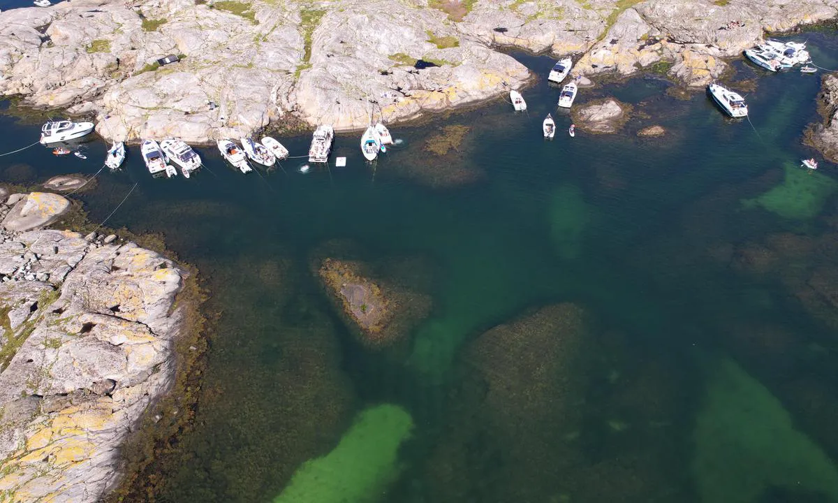
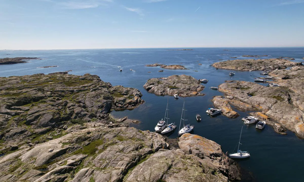
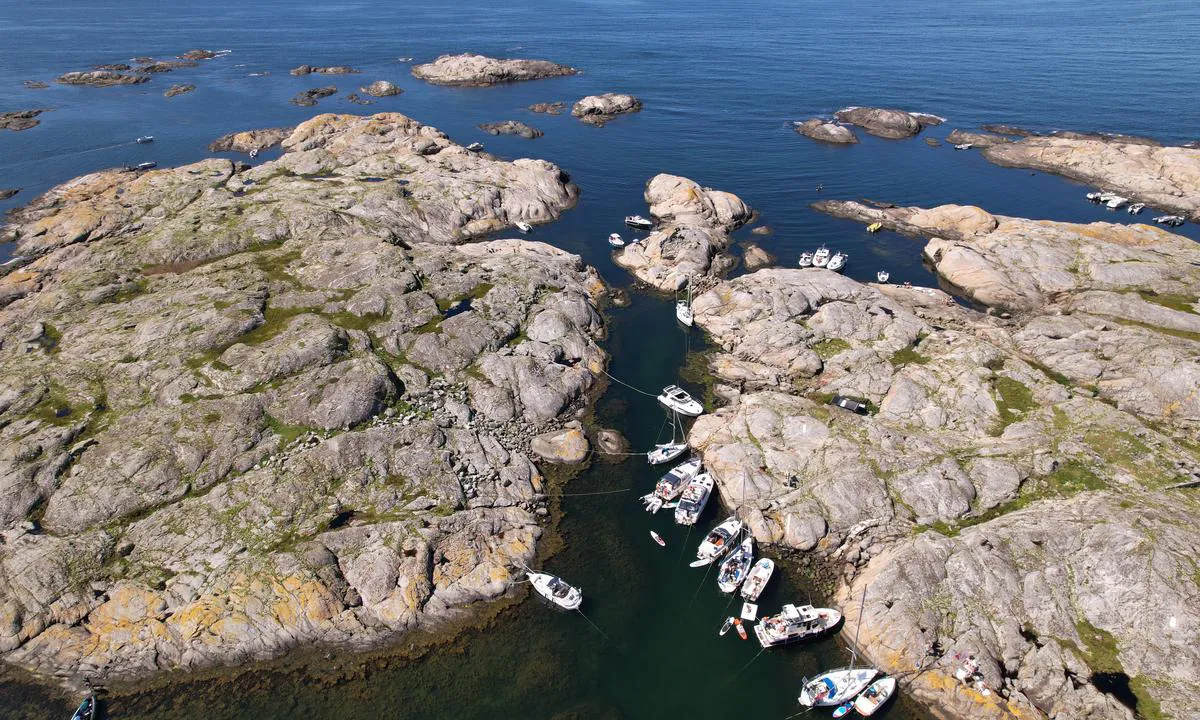
Altarholmen - Kyrkesund
Naturalny port

Region: Sweden (2144), Västra Götaland (661), Västkusten (532), Bohuslän (502), Tjörn (66) and Kyrkesund (10)


 , uploaded on 22. Jul 2024


Opisy i recenzje
Czy znasz ten port? To ogromna pomoc dla innych żeglarzy, jeśli dodasz krótką opis lub recenzję tego portu.
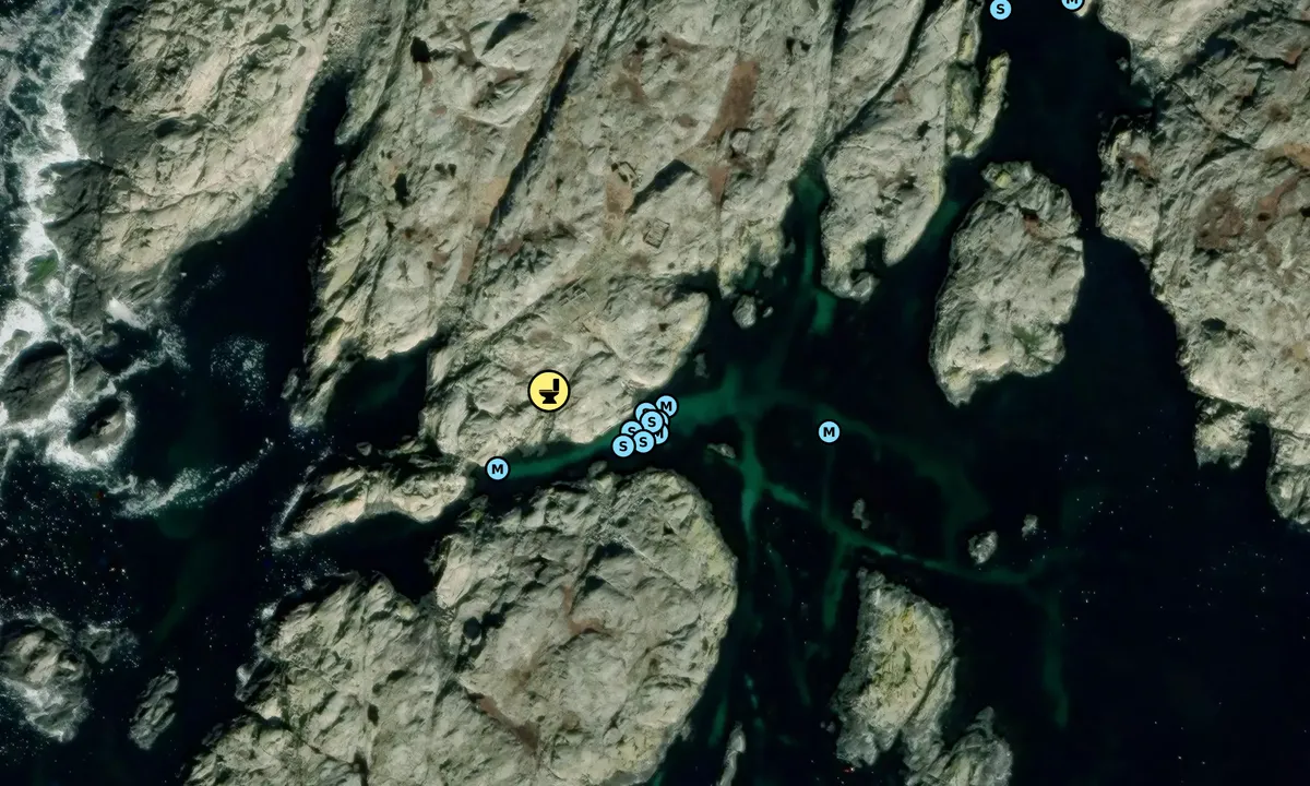
Mapa Altarholmen - Kyrkesund
Aby korzystać z map, musisz się zalogować lub utworzyć konto użytkownika

Ochrona przed wiatrem
Ochrona następnej nocy
90 punkty


Chcesz wiedzieć, jak działa wskaźnik wiatru? W takim razie powinieneś przeczytać to wyjaśnienie.
Prognozy wiatru pochodzą z yr.no (Norweski Instytut Meteorologiczny), i zostały ostatnio zaktualizowane 1 hour and 20 minutes ago (Poniedziałek 22 Czerwiec 12:27). Następna nocna ocena pokazuje najgorszą godzinę między 22:00 a 08:00 następnej nocy. Zalecamy sprawdzenie kilku źródeł prognoz wiatru.windy.com jest dobrą stroną do pokazywania większych systemów wiatrowych.
Bezpieczne kierunki dla tego portu zostały dodane o 21. Aug 2022. Kliknij tutaj, aby edytować.
Ostatnie wizyty w Altarholmen - Kyrkesund
Śro 17 Cze 2026 |
|
|
Pią 22 Maj 2026 |
|
|
Czw 14 Sie 2025 |
|
|
Pią 18 Lip 2025 |
|
|
Czw 10 Lip 2025 |
|
|
 OCCASUM [MMSI: 265729410]
 NEMO [MMSI: 265049530]
The visits are retrieved from AIS data. You can click to see all visiting ships to Altarholmen - Kyrkesund, as well as statistics about the ships that visits
Dodaj ten port do podróży
Wybierz inny dzień niż dzisiaj
Ważne: Kiedy meldować się w porcie, dodajesz go do podróży na tej stronie internetowej. Nie rezerwujesz miejsca w marinie.
Współtwórcy
Użytkownicy, którzy przyczynili się do tej strony: Olav Pekeberg and Lars Hatletveit
harbourmaps.com jest aktualizowana przez społeczność żeglarską. Gdy dodajesz informacje, recenzję lub zdjęcia do tej strony, jesteś wymieniony tutaj wraz z innymi współtwórcami (podajemy Twoją nazwę użytkownika, która może być Twoim prawdziwym imieniem lub pseudonimem).
Najbliższe porty do Altarholmen - Kyrkesund
Filtruj według
Sortuj według
0 porty
Pokaż więcej portów
