


Contributions by Jon Andreassen
Jon Andreassen has uploaded 3 images and written 7 reviews. Click on the images and reviews below to see the harbour pages.
Jon Andreassen has 247 contribution points.
Harbour images
See an image you like? Please click the 👍 below the image to let Jon Andreassen know you liked it. The images are sorted by popularity.
Kuvauen
natural_harbour
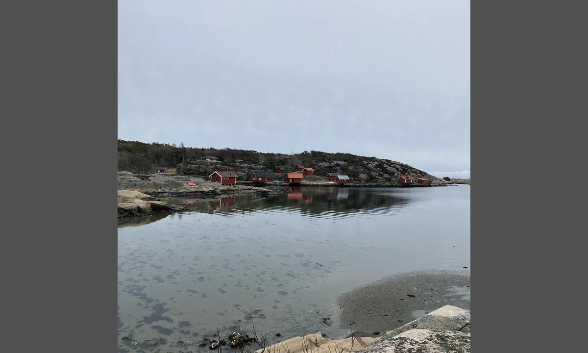

0 liker bildet
Image uploaded on 8. Jun 2021
Kuvauen
natural_harbour
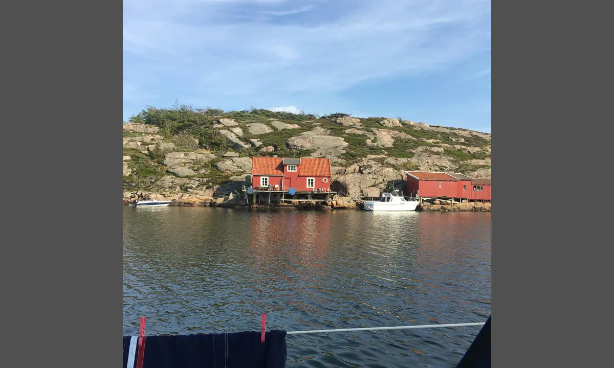
0 liker bildet
Image uploaded on 8. Jun 2021
Kuvauen
natural_harbour
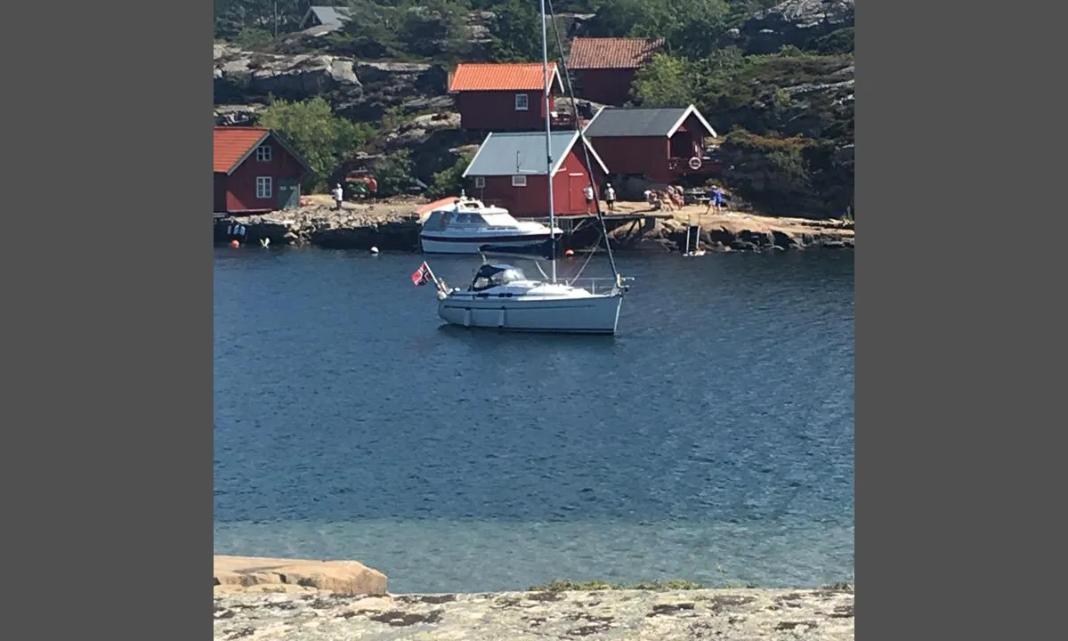
0 liker bildet
Image uploaded on 8. Jun 2021
Reviews
See a helpful review? Please click the 👍 below the review to let Jon Andreassen know that you found it helpful.
Jon Andreassen says:
description
Entry and Maritime Conditions: Løvøya is located outside Horten. There are a total of four buoys located on the southeast side of Løvøya. If your boat is lower than 2.8 meters, you can pass through Løvøysundet. If it is higher, you must enter through Vealøsrenna further south.
Anchorage: Approximately 7m
The Area: Løvøya is a popular island just north of Horten center. Here, you can stay overnight safely in all wind directions. To get to Horten, it is best to use a tender. There is a canal from the Horten shipyard area to Fyllingen marina. Løvøysund is a well-known fishing spot. The island itself is a great hiking area with attractions such as the old chapel built in the 1300s. It was at Løvøysund that Skagerrak's sea hero Tordenskjold had his vessels careened.
2 x helpful | written on 15. Jul 2021
Jon Andreassen says:
description
Approach and maritime conditions: Easy, well-marked approach. Be aware of a shoal on the starboard side when entering. Swinging room.
Anchoring: 7m. Here, people moor both to land and at anchor. Many cottages around the bay. A privately-owned buoy with a request to use it when the owner is away.
2 x helpful | written on 9. Jun 2021
Jon Andreassen says:
description
Approach and maritime conditions: Bile south of Bevøya in Moss municipality Both from northwest and south
Anchoring: 3.6m
The area: Bile is a low small islet that is frequently used by the locals. You are well sheltered from southern and southwestern winds. There are 3 mooring buoys just outside the sandy beach on the east side of the island. In olden times, Bile Harbor was often used as an overnight stop for cargo ships on their way in and out of the Oslofjord.
1 x helpful | written on 9. Jun 2021
Jon Andreassen says:
description
Entry and maritime conditions: Hankøsundet is the strait between Hankø and Vest Vikene, approximately 6 km west of Fredrikstad.
Anchorage: 6 meters.
The area: Frequently used anchorage spot for boaters. Good night harbor in all kinds of weather. A blue buoy for OF members. Well-marked entry from both directions. Guest harbor at the marina and the sailing club.
1 x helpful | written on 9. Jun 2021
Jon Andreassen says:
description
Approach and maritime conditions: There is a fair amount of boat traffic since this is one of the routes out from Fredrikstad.
Anchoring: Outdoor Council's mooring buoy, about 6m deep. Watch out for a couple of shallows. The bay is called Kjøkkenbukta.
The Area: The house on Arisholmen is an old coach station from the sailing ship era. See: https://www.xn--krkery-jua9m.net/hjem/sted/sted-arisholmen/ Arisholmen is a popular destination for families with children. The best bathing bays are at the western end of the island.
1 x helpful | written on 2. Jun 2021
Jon Andreassen says:
area


maritime qualities
description
Approach and maritime conditions: Southeast of Røsholmen, north of Kirkøy, Hvaler
Anchoring: 3 meters
Muddy bottom
The area: Plenty of space both for swinging at anchor and for going ashore.
A blue OF-buoy available.
Nice place to stay overnight before crossing over Sekken to Sweden.
1 x helpful | written on 3. Jul 2021 | updated_on 8. Jul 2022
Jon Andreassen says:
description
Navigation and maritime conditions: Anchoring depth 10 - 15m. Sailboats can dock at the pier. Easy approach, well marked.
Shelter from all wind directions.
Freshwater available at the floating pier at the innermost part of the bay.
Anchoring: Large bay with space for all. Well protected from all wind directions. Pier along the shore on Geitøya. 3 blue mooring buoys.
Area: When sailing from Hankøsundet towards Slevikkilen, you pass a memorial of King Olav, the Sailing King. Marked trails. Nearby Mærrapanna is a popular outing/swimming area.
1 x helpful | written on 3. Jul 2021
