Kallholmen

Natural harbour

favoritt

Region: Norway (3311), Trøndelag (296), Sør-Trøndelag (177), Frøya (24) and Sula (16)

{"base": "no", "no": "Utsikt fra fyret p\u00e5 Kallholmen. Ankringsplassen er ned til h\u00f8yre i forhold til der bildet er tatt.", "se": "Utsikt fr\u00e5n fyren p\u00e5 Kallholmen. Ankringsplatsen \u00e4r ned till h\u00f6ger i f\u00f6rh\u00e5llande till d\u00e4r bilden \u00e4r tagen.", "en": "View from the lighthouse on Kallholmen. The anchorage is down to the right in relation to where the picture is taken.", "da": "Udsigt fra fyret p\u00e5 Kallholmen. Ankerpladsen er ned til h\u00f8jre i forhold til, hvor billedet er taget."}
{"base": "no", "no": "Utsikt fra Kallholmen og ned p\u00e5 ankringsplassen. Bildet er tatt mot \u00f8st, og bakgrunnen ser du det karakteristiske fyret p\u00e5 Sula. Du ser den hvite fyrbygningen p\u00e5 toppen av berget i lang tid f\u00f8r du kommer inn mot Sula.", "se": "Utsikt fr\u00e5n Kallholmen och ner p\u00e5 ankringsplatsen. Bildet \u00e4r taget mot \u00f6st, och i bakgrunden ser du den karakt\u00e4ristiska fyren p\u00e5 Sula. Du ser den vita fyrbyggnaden p\u00e5 toppen av berget en l\u00e5ng tid innan du kommer in mot Sula.", "en": "View from Kallholmen down to the anchorage. The picture is taken facing east, and in the background you can see the characteristic lighthouse on Sula. You can see the white lighthouse building on top of the rock long before you approach Sula.", "da": "Udsigt fra Kallholmen og ned p\u00e5 ankerpladsen. Billedet er taget mod \u00f8st, og i baggrunden ser du det karakteristiske fyr p\u00e5 Sula. Du ser den hvide fyrbygning p\u00e5 toppen af bjerget i lang tid f\u00f8r du kommer ind mod Sula."}
{"base": "no", "no": "I sydenden av ankringsplassen ved Kallholmen er det en kraftig bolt i fjellet. Hvis du vil fort\u00f8ye mot denne m\u00e5 du ha lange liner, da det er grunt et stykke ut fra holmen den st\u00e5r p\u00e5. .", "se": "I syd\u00e4nden av ankringsplatsen vid Kallholmen finns en kraftig bult i berget. Om du vill f\u00f6rt\u00f6ja vid denna m\u00e5ste du ha l\u00e5nga linor, eftersom det \u00e4r grunt en bit ut fr\u00e5n holmen d\u00e4r den st\u00e5r.", "en": "At the southern end of the anchorage at Kallholmen, there is a sturdy bolt in the rock. If you want to moor against this, you must have long lines, as it is shallow a bit out from the islet it stands on.", "da": "I sydenden af ankringspladsen ved Kallholmen er der en kraftig bolt i klippen. Hvis du vil fort\u00f8je til denne, skal du have lange liner, da det er lavvandet et stykke ud fra holmen, den st\u00e5r p\u00e5."}
Satelite image of Kallholmen

📸 Upload a photo

Show off your photos and help others plan their journey to Kallholmen.harbourmaps.com is created by the sailing community, in a collective effort to make cruising simpler and more fun. Uploading a photo takes less than a minutes and can be done from your phone, tablet or laptop.

📸 Upload a photo

Facilities

We don't have any data on available facilities in this harbour. If you know which facilities are available here, please update this site to help your fellow sailors. Update facilities.

Mooring

Options for mooring in this harbour: Anchoring, Towards land.

Updated on 1. Jun 2021. Update mooring.

Descriptions and reviews

Olav Pekeberg says:

description

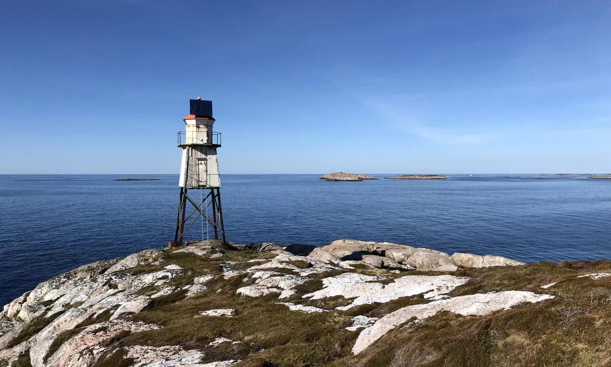
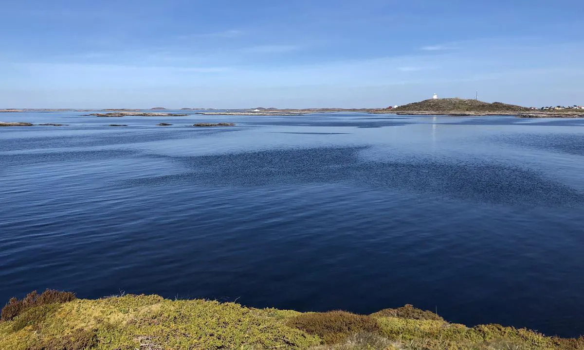
Approach and maritime conditions: The anchorage is located on the inside of Kallholmen, less than 1nm west of Sula Lighthouse. There are several unmarked shoals in the area, and it is especially important to be cautious of the one located in the middle of the approach. The anchorage offers good protection from seas from the south, but it is poorly protected from wind. It is typically a fair-weather harbor.
Anchoring: The anchoring depth is around 10 meters. The bottom conditions are unknown exactly at the anchorage, but there is a lot of sandy bottom in the surrounding shallow areas.

[translated from Norwegian with AI]

0 x helpful | written on 1. Jun 2021

Do you know this harbour? It's a huge help to other sailors if you add a short description or review of the harbour.
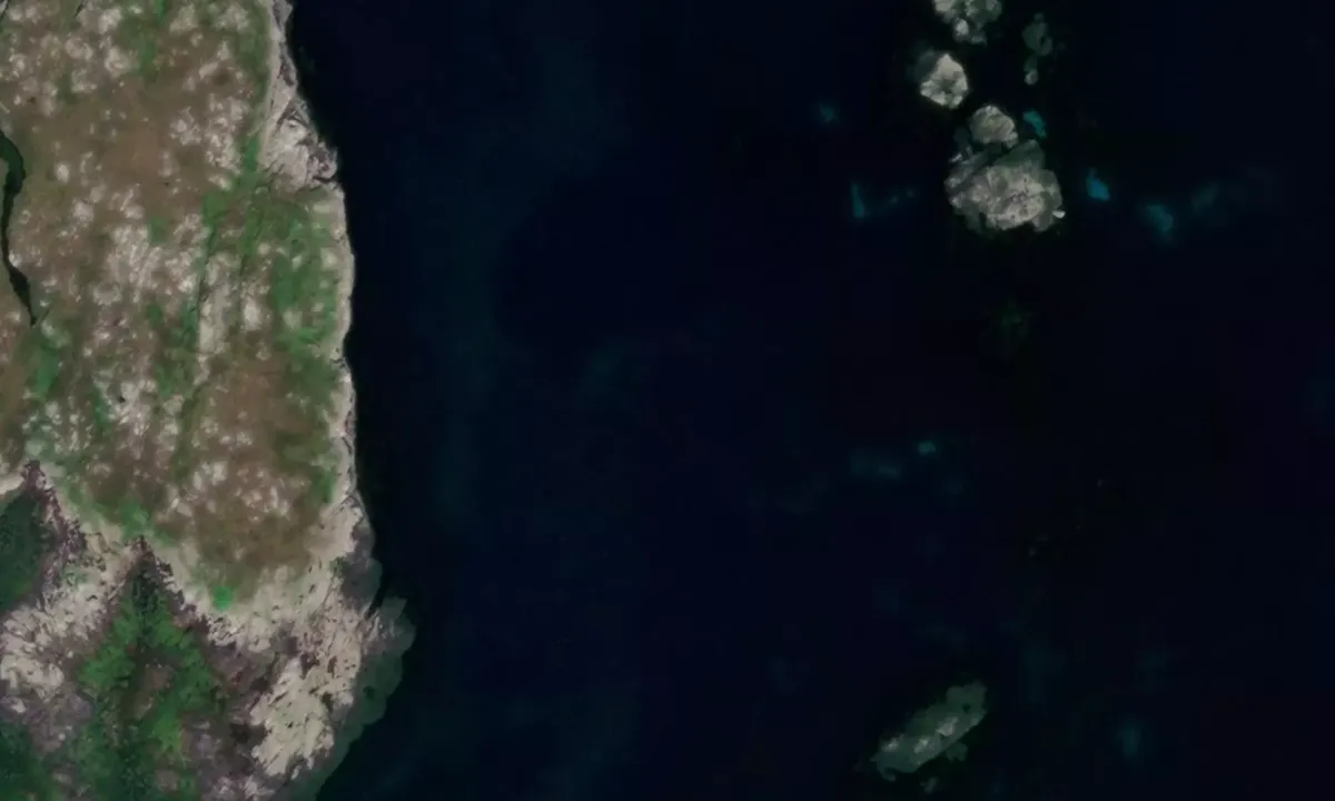
📜 Add description

Map of Kallholmen

Facilities

We don't have any data on available facilities in this harbour. If you know which facilities are available here, please update this site to help your fellow sailors. Update facilities.

Mooring

Options for mooring in this harbour: Anchoring, Towards land.

Updated on 1. Jun 2021. Update mooring.

Wind protection

Protection next night

75 points

N E S W --> } } } } } } } } } } } } } } } } } } } } } } } } } } } } } } } } } } } } } } } } } } } } } } } } } } } } } } } } } } } } } } } } } } } } } } } } } } } } } } } } } } } } } } } } } } } } } } } } } } } } } } } } } } } } } } } } } } } } } } } } } } } } } } } } } } } } } } } } } } } } } } } } } } } } } } } } } } } } } } } } } } } } } } } } } } } } } } } } } } } } } } } } } } } } } } } } } } } } } } } } } } } } } } } } } } } } } } } } } } } } } } } } } } } } } } } } } } } } } } } } } } } } } } } } } } } } } } } } } } } } } } } } } } } } } } } } } } } } } } } } } } } } } } } } } } } } } } } } } } } } } } } } } } } } } } } } } } } } } } } } } } } } } } } } } } } } } } } } } } } } } } } } } } } } } } } } } } } } } } } } } } } } } } } } } } } } } } } } } } } } } } } } } } } } } } } } } } } } } } } } } } } } } } } } } } } } } } } } } } } } } } } } } } } } } } } } } } } } } } } } } } } } } } } } } } } } } } } } } } } } } } } } } } } } } } } } } } } } } } } } } } } } } } } } } } } } } } } } } } } } } } } } } } } } } } } } } } } } } } } } } } } } } } } } } } } } } } } } } } } } } } } } } } } } } } } } } } } } } } } } } } } } } } } } } } } } } } } } } } } } } } } } } } } } } } } } } } } } } } } } } } } } } } } } } } } } } } } } } } } } } } } } } } } } } } } } } } } } } } } } } } } } } } } } } } } } } } } } } } } } } } } } } } } } } } } } } } } } } } } } } } } } } } } } } } } } } } } } } } } } } } } } } } } } } } } } } } } } } } } } } } } } } } } } } } } } } } } } } } } } } } } } } } } } } } } } } } } } } } } } } } } } } } } } } } } } } } } } } } } } } } } } } } } } } } } } } } } } } } } } } } } } } } } } } } } } } } } } } } } } } } } } } } } } } } } } } } } } } } } } } } } } } } } } } } } } } } } } } } } } } } } } } } } } } } } } } } } } } } } } } } } } } } } } } } } } } } } } } } } } } } } } } } } } } } } } } } } } } } } } } } } } } } } } } } } } } } } } } } } } } } } } } } } } } } } } } } } } } } } } } } } } } } } } } } } } } } } } } } } } Next night 6:00 12:00 Tir 17 Jun 18:00 0:00 6:00 12:00 Ons 18 Jun 12m/s 2m/s

Want to know how the wind score works? Then you should read this explanation.

The wind forecasts come from yr.no (Norwegian Meteorological Institute), and was last updated 1 hour and 48 minutes ago (Tuesday 17 June 04:28 AM). The next night score shows you the worst hour between 22:00 and 08:00 the next night. We recommend that you check multiple sources for wind forecasts. windy.com is a good website to show larger wind systems.

The safe directions for this harbour was added at 1. Jun 2021. Click here to edit.

Kallholmen and/or the surrounding seas is not well protected from strong winds and waves, and you should take caution in foul weather. Click to edit protection level.

Last visits to Kallholmen

The visits are retrieved from AIS data. You can click to see all visiting ships to Kallholmen, as well as statistics about the ships that visits

Add this harbour to a journey

Check in now

Choose a different date than today

Important: When you check in to a harbour, you add it to a journey on this website. You are not booking a place in the marina.

Contributors

Users that contributed to this page: Olav Pekeberg

harbourmaps.com is updated by the boating community. When you add information, a review or pictures to this page you are listed here with the other contributors (we list your user-name, which can be your real name or a pseudonym).

Closest harbours to Kallholmen

Filter by

Natural harbour
Marina
Safe wind next night

Order by

ABC
Popularity
Wind score next night

0 harbours

Show more harbours