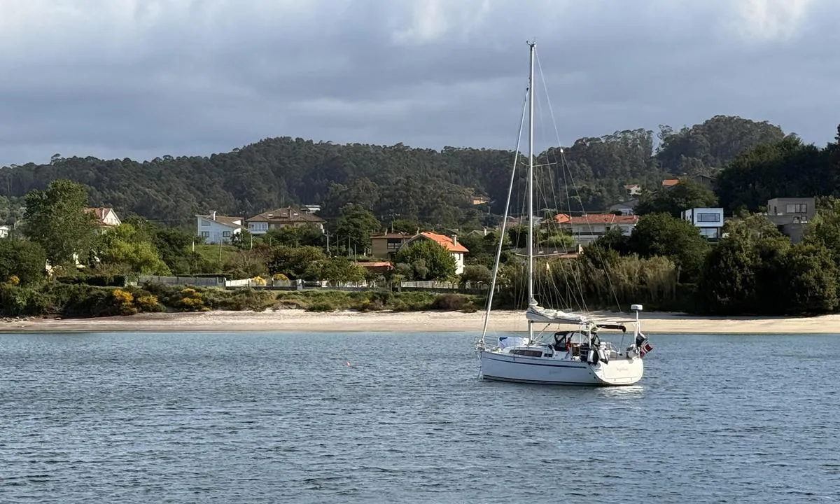
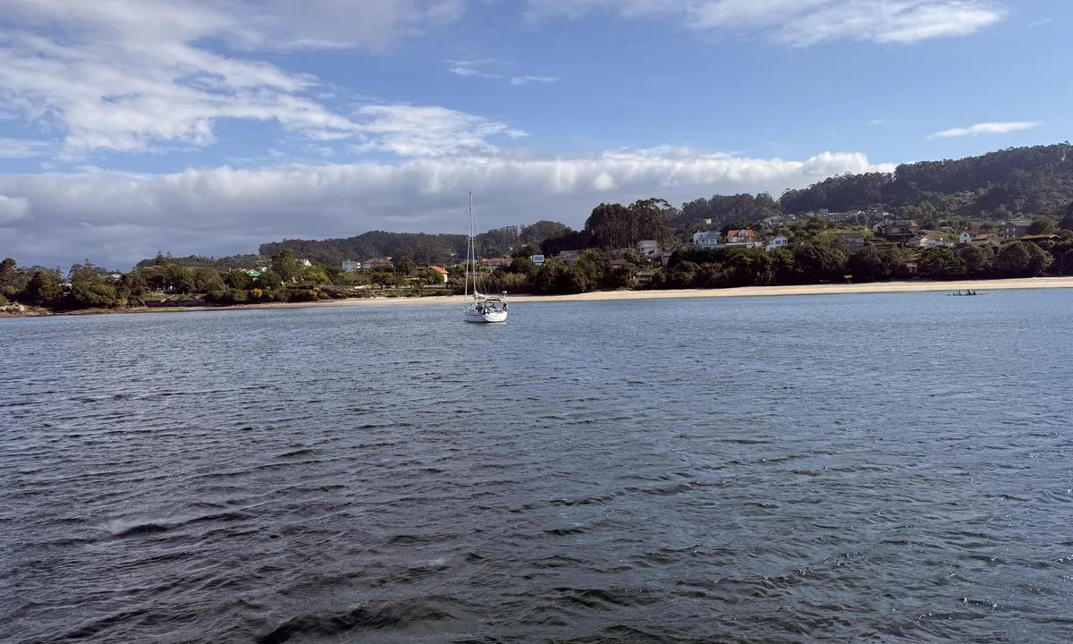
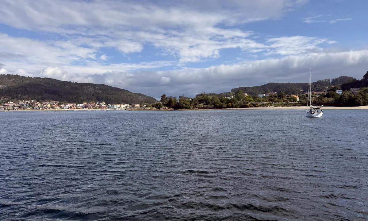
Praia di Vilariño

Natural harbour

favoritt

Region: Spain (1287), Galicia (178), Pontevedra (89), Cangas (7), O Igrexario (2) and Aldán (1)

Praia di Vilariño
Praia di Vilariño: {"base": "no", "no": "Oobs noen skvalpeskjer innerst  i havna kun merket med n tynn jernstang. Denne er under bann p\u00e5 h\u00f8yvann.  Ikke eller d\u00e5rlig merket i navionics kart men tydelig i orca kartene", "se": "Oobs n\u00e5gra grynnor l\u00e4ngst in i hamnen endast markerade med ett tunt j\u00e4rnst\u00e5ng. Den h\u00e4r \u00e4r under vatten vid h\u00f6gvatten. Inte eller d\u00e5ligt markerad i Navionics-kartor men tydligt i Orca-kartorna.", "en": "Beware of some submerged rocks in the innermost part of the harbor, only marked with a thin iron rod. This is submerged at high tide. Not or poorly marked in Navionics charts but clearly visible in Orca charts.", "da": "Oobs nogle skvalpesk\u00e6r inderst i havnen kun markeret med en tynd jernstang. Denne er under vand ved h\u00f8jvande. Ikke eller d\u00e5rligt markeret i navionics kort men tydelig i orca kortene.", "fr": "Attention, quelques \u00e9cueils dans le fond du port sont seulement signal\u00e9s par un mince poteau en fer. Celui-ci est submerg\u00e9 \u00e0 mar\u00e9e haute. Pas ou mal indiqu\u00e9 sur les cartes de Navionics mais clairement visible sur les cartes Orca.", "de": "Achtung, einige Klippen im innersten Bereich des Hafens sind nur mit einer d\u00fcnnen Eisenstange markiert. Diese ist bei Hochwasser unter Wasser. Nicht oder schlecht markiert auf Navionics-Karten, aber deutlich sichtbar auf Orca-Karten.", "es": "\u00a1Ojo! Unos escollos sumergidos en el interior del puerto, solo se\u00f1alizados con una delgada barra de hierro. Esta queda sumergida durante la marea alta. No o mal se\u00f1alizados en los mapas de Navionics pero claramente visibles en los mapas de Orca.", "it": "Attenzione, alcuni bassifondi nella parte interna del porto sono segnalati solo con una sottile barra di ferro. Questa \u00e8 sommersa durante l'alta marea. Non segnalato, o segnalato male, nelle carte navionics ma chiaramente visibile nelle carte orca.", "pt": "Aten\u00e7\u00e3o a alguns recifes rasos no canto mais interno do porto, sinalizados apenas por uma vara de ferro fina. Esta vara fica submersa na mar\u00e9 alta. N\u00e3o est\u00e1, ou est\u00e1 mal sinalizada nos mapas da Navionics, mas est\u00e1 claramente vis\u00edvel nos mapas da Orca.", "nl": "Let op enkele klotsende riffen aan het uiteinde van de haven, alleen gemarkeerd met een dunne ijzeren staaf. Deze is ondergedompeld bij hoogwater. Niet of slecht gemarkeerd op Navionics-kaarten maar duidelijk zichtbaar op Orca-kaarten.", "pl": "Uwaga, niekt\u00f3re mielizny w najg\u0142\u0119bszej cz\u0119\u015bci portu s\u0105 oznaczone jedynie cienkim \u017celaznym pr\u0119tem. Ta oznaka jest zanurzona podczas wysokiej wody. Nie oznaczone lub s\u0142abo oznaczone na mapach Navionics, ale wyra\u017anie widoczne na mapach Orca.", "uk": "\u0423\u0432\u0430\u0433\u0430! \u0414\u0435\u043a\u0456\u043b\u044c\u043a\u0430 \u043d\u0435\u043e\u0431\u043b\u0430\u0434\u043d\u0430\u043d\u0438\u0445 \u0441\u043a\u0435\u043b\u044c \u0432 \u043d\u0430\u0439\u0433\u043b\u0438\u0431\u0448\u0456\u0439 \u0447\u0430\u0441\u0442\u0438\u043d\u0456 \u0433\u0430\u0432\u0430\u043d\u0456 \u043f\u043e\u0437\u043d\u0430\u0447\u0435\u043d\u0456 \u0442\u0456\u043b\u044c\u043a\u0438 \u0442\u043e\u043d\u043a\u043e\u044e \u0437\u0430\u043b\u0456\u0437\u043d\u043e\u044e \u0441\u0442\u0435\u0440\u0436\u043d\u0435\u043c. \u0412\u043e\u043d\u0438 \u0437\u0430\u043d\u0443\u0440\u044e\u044e\u0442\u044c\u0441\u044f \u043f\u0456\u0434 \u0432\u043e\u0434\u0443 \u043f\u0456\u0434 \u0447\u0430\u0441 \u043f\u0440\u0438\u043f\u043b\u0438\u0432\u0443. \u041d\u0435 \u043f\u043e\u0437\u043d\u0430\u0447\u0435\u043d\u0456 \u0430\u0431\u043e \u043f\u043e\u0433\u0430\u043d\u043e \u043f\u043e\u0437\u043d\u0430\u0447\u0435\u043d\u0456 \u043d\u0430 \u043a\u0430\u0440\u0442\u0430\u0445 Navionics, \u0430\u043b\u0435 \u0447\u0456\u0442\u043a\u043e \u0432\u0438\u0434\u043d\u043e \u043d\u0430 \u043a\u0430\u0440\u0442\u0430\u0445 \u043e\u0440\u043a\u0430.", "ro": "Aten\u021bie, c\u00e2teva st\u00e2nci scufundate \u00een cap\u0103tul portului, marcate doar cu o tij\u0103 sub\u021bire de fier. Aceasta este sub ap\u0103 la maree mare. Marcate prost sau deloc pe h\u0103r\u021bile Navionics, dar clar vizibile pe h\u0103r\u021bile Orca.", "tr": "Oobs, limanda i\u00e7eride birka\u00e7 s\u0131\u011f kayal\u0131k, sadece ince bir demir \u00e7ubuk ile i\u015faretlenmi\u015f. Bu, y\u00fcksek su seviyesinde su alt\u0131nda kal\u0131yor. Navionics haritalar\u0131nda ya hi\u00e7 ya da k\u00f6t\u00fc i\u015faretlenmi\u015f, fakat orca haritalar\u0131nda belirgin.", "el": "\u03a0\u03c1\u03bf\u03c3\u03bf\u03c7\u03ae \u03ba\u03ac\u03c0\u03bf\u03b9\u03bf\u03b9 \u03c1\u03b7\u03b3\u03bc\u03b1\u03c4\u03ce\u03b4\u03b5\u03b9\u03c2 \u03b2\u03c1\u03ac\u03c7\u03bf\u03b9 \u03c0\u03b9\u03bf \u03bc\u03ad\u03c3\u03b1 \u03c3\u03c4\u03bf \u03bb\u03b9\u03bc\u03ac\u03bd\u03b9 \u03c3\u03b7\u03bc\u03b5\u03b9\u03ce\u03bd\u03bf\u03bd\u03c4\u03b1\u03b9 \u03bc\u03cc\u03bd\u03bf \u03bc\u03b5 \u03bc\u03af\u03b1 \u03bb\u03b5\u03c0\u03c4\u03ae \u03c3\u03b9\u03b4\u03b5\u03c1\u03ad\u03bd\u03b9\u03b1 \u03c1\u03ac\u03b2\u03b4\u03bf. \u0391\u03c5\u03c4\u03ae \u03b5\u03af\u03bd\u03b1\u03b9 \u03ba\u03ac\u03c4\u03c9 \u03b1\u03c0\u03cc \u03c4\u03bf \u03bd\u03b5\u03c1\u03cc \u03c3\u03b5 \u03c0\u03b1\u03bb\u03af\u03c1\u03c1\u03bf\u03b9\u03b1. \u038c\u03c7\u03b9 \u03ae \u03ba\u03b1\u03ba\u03ce\u03c2 \u03c3\u03b7\u03bc\u03b5\u03b9\u03c9\u03bc\u03ad\u03bd\u03bf\u03b9 \u03c3\u03c4\u03b1 \u03c7\u03ac\u03c1\u03c4\u03b5\u03c2 \u03c4\u03b7\u03c2 Navionics \u03b1\u03bb\u03bb\u03ac \u03b5\u03bc\u03c6\u03b1\u03bd\u03b5\u03af\u03c2 \u03c3\u03c4\u03bf\u03c5\u03c2 \u03c7\u03ac\u03c1\u03c4\u03b5\u03c2 \u03c4\u03b7\u03c2 Orca.", "cs": "D\u00e1vejte pozor na n\u011bkolik vlnolam\u016f v nejhlub\u0161\u00ed \u010d\u00e1sti p\u0159\u00edstavu, ozna\u010den\u00fdch pouze tenkou \u017eeleznou ty\u010d\u00ed. Tyto jsou p\u0159i vysok\u00e9m p\u0159\u00edlivu pod vodou. Na naviga\u010dn\u00edch map\u00e1ch nejsou nebo jsou \u0161patn\u011b ozna\u010deny, ale na orca map\u00e1ch jsou z\u0159eteln\u00e9.", "hu": "Figyelem, n\u00e9h\u00e1ny szikla tal\u00e1lhat\u00f3 a kik\u00f6t\u0151 legbels\u0151 r\u00e9sz\u00e9n, amelyeket csak egy v\u00e9kony vaskoszlop jel\u00f6l. Ezek a v\u00edzszint alatt vannak dag\u00e1lykor. Nincs vagy rosszul van jel\u00f6lve a Navionics t\u00e9rk\u00e9peken, de j\u00f3l l\u00e1that\u00f3 az Orca t\u00e9rk\u00e9peken.", "fi": "Varo laitureiden luona olevia karikoita, jotka on merkitty vain ohuilla rautatangoilla. N\u00e4kyviss\u00e4 vain nousuvedell\u00e4. Navionics-kartoissa merkitsem\u00e4tt\u00e4 tai huonosti merkityt, mutta selv\u00e4sti n\u00e4kyviss\u00e4 Orca-kartoissa.", "bg": "\u041e\u043e\u043e\u0431\u0441, \u0438\u043c\u0430 \u043d\u044f\u043a\u043e\u043b\u043a\u043e \u043d\u0438\u0441\u043a\u043e\u0432\u044a\u043b\u043d\u0435\u0449\u0438 \u0441\u043a\u0430\u043b\u0438 \u0434\u044a\u043b\u0431\u043e\u043a\u043e \u0432 \u043f\u0440\u0438\u0441\u0442\u0430\u043d\u0438\u0449\u0435\u0442\u043e, \u043a\u043e\u0438\u0442\u043e \u0441\u0430 \u043c\u0430\u0440\u043a\u0438\u0440\u0430\u043d\u0438 \u0441\u0430\u043c\u043e \u0441 \u0442\u044a\u043d\u043a\u0430 \u043c\u0435\u0442\u0430\u043b\u043d\u0430 \u043f\u0440\u044a\u0447\u043a\u0430. \u0422\u044f \u0435 \u043f\u043e\u0434 \u0432\u043e\u0434\u0430 \u043f\u0440\u0438 \u0432\u0438\u0441\u043e\u043a\u0430 \u043f\u0440\u0438\u043b\u0438\u0432\u043d\u0430 \u0432\u044a\u043b\u043d\u0430. \u041b\u043e\u0448\u043e \u043c\u0430\u0440\u043a\u0438\u0440\u0430\u043d\u0438 \u0438\u043b\u0438 \u0438\u0437\u043e\u0431\u0449\u043e \u043d\u0435 \u0441\u0430 \u043e\u0442\u0431\u0435\u043b\u044f\u0437\u0430\u043d\u0438 \u0432 \u043d\u0430\u0432\u0438\u0433\u0430\u0446\u0438\u043e\u043d\u043d\u0438\u0442\u0435 \u043a\u0430\u0440\u0442\u0438, \u043d\u043e \u0441\u0430 \u044f\u0441\u043d\u043e \u0432\u0438\u0434\u0438\u043c\u0438 \u0432 'orca' \u043a\u0430\u0440\u0442\u0438\u0442\u0435.", "sr": "Oprez, nekoliko pli\u0107aka u unutra\u0161njem delu luke su ozna\u010deni samo tankim gvozdenim \u0161tapom. Ovi su potopljeni za vrijeme plime. Lo\u0161e ili uop\u0161te nisu ozna\u010deni na navionics kartama, ali su jasno vidljivi na orca kartama.", "et": "Oht, m\u00f5ned madalikud sadama sisemuses on m\u00e4rgistatud ainult \u00f5hukese raudlatiga. Need j\u00e4\u00e4vad \u00fcle ujutatud k\u00f5rge veetaseme ajal. Navionicsi kaartidel pole need h\u00e4sti m\u00e4rgistatud v\u00f5i puuduvad \u00fcldse, kuid Orca kaartidel on need selgelt n\u00e4ha.", "lv": "Oobs, da\u017ei s\u0113k\u013ci pa\u0161\u0101 ostas dzi\u013cum\u0101 ir atz\u012bm\u0113ti tikai ar pl\u0101nu dzelzs stieni. Tie ir zem \u016bdens pl\u016bdmai\u0146\u0101s. Nav vai ir slikti atz\u012bm\u0113ti Navionics kart\u0113s, bet skaidri redzami Orca kart\u0113s.", "lt": "D\u0117mesio kelias seklumos prieplaukos gilumoje \u017eymimos tik plona gele\u017eine lazdele. Potvynio metu \u0161i vieta yra po vandeniu. Ne\u017eym\u0117ta arba blogai \u017eym\u0117ta Navionics \u017eem\u0117lapiuose, ta\u010diau ai\u0161kiai matoma Orca \u017eem\u0117lapiuose."}
Praia di Vilariño
Praia di Vilariño
Praia di Vilariño
Praia di Vilariño
Praia di Vilariño
Satelite image of Praia di Vilariño

📸 Upload a photo

Show off your photos and help others plan their journey to Praia di Vilariño.harbourmaps.com is created by the sailing community, in a collective effort to make cruising simpler and more fun. Uploading a photo takes less than a minutes and can be done from your phone, tablet or laptop.

📸 Upload a photo

Facilities

We don't have any data on available facilities in this harbour. If you know which facilities are available here, please update this site to help your fellow sailors. Update facilities.

Mooring

Options for mooring in this harbour: Anchoring.

Updated on 29. Apr 2026. Update mooring.

Descriptions and reviews

Odd Tufte. S/Y Vindreken says:

area

maritime qualities

description

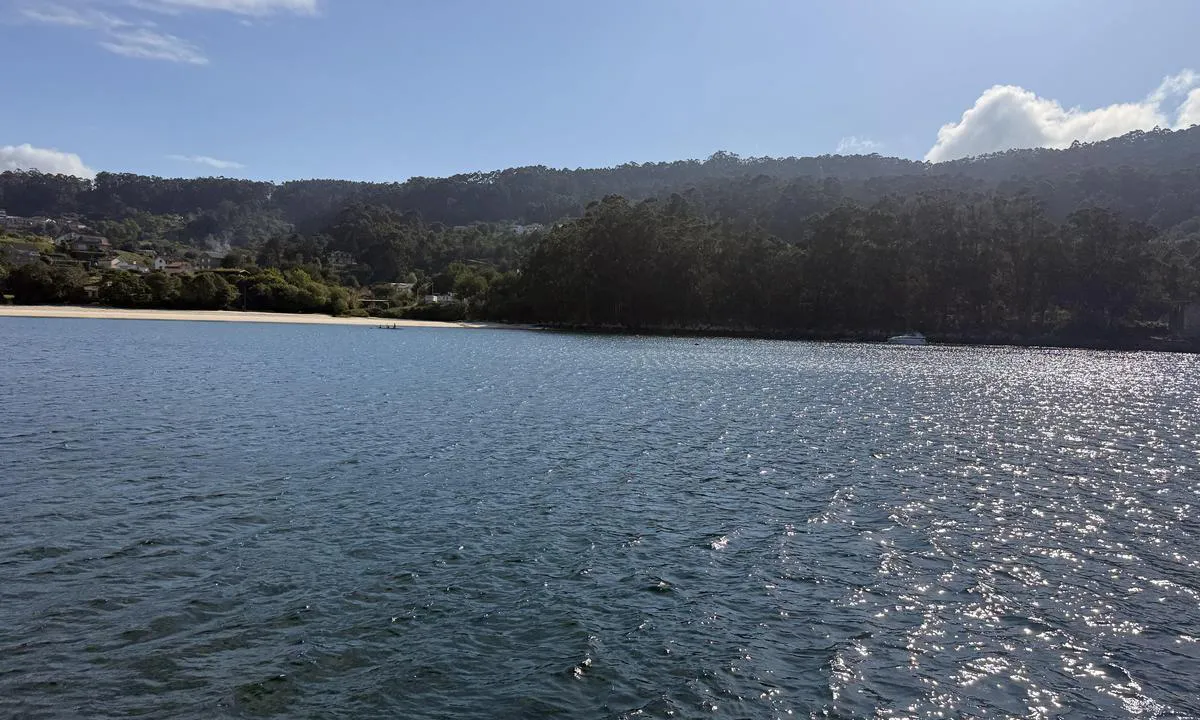
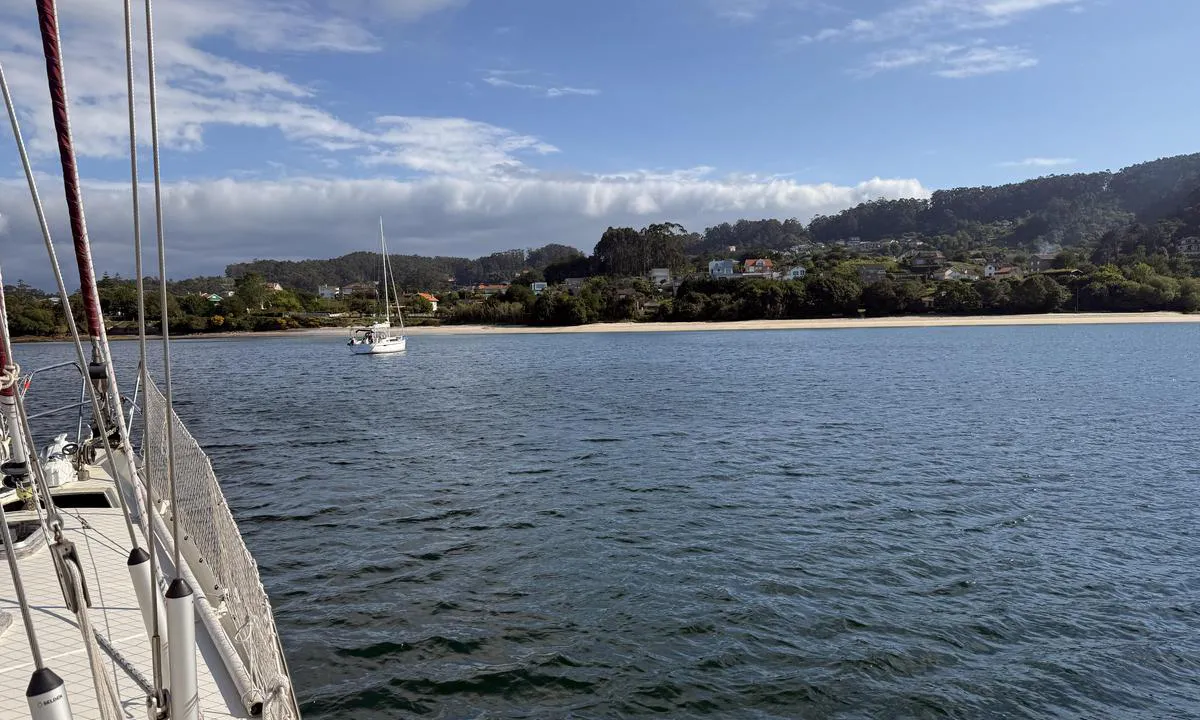
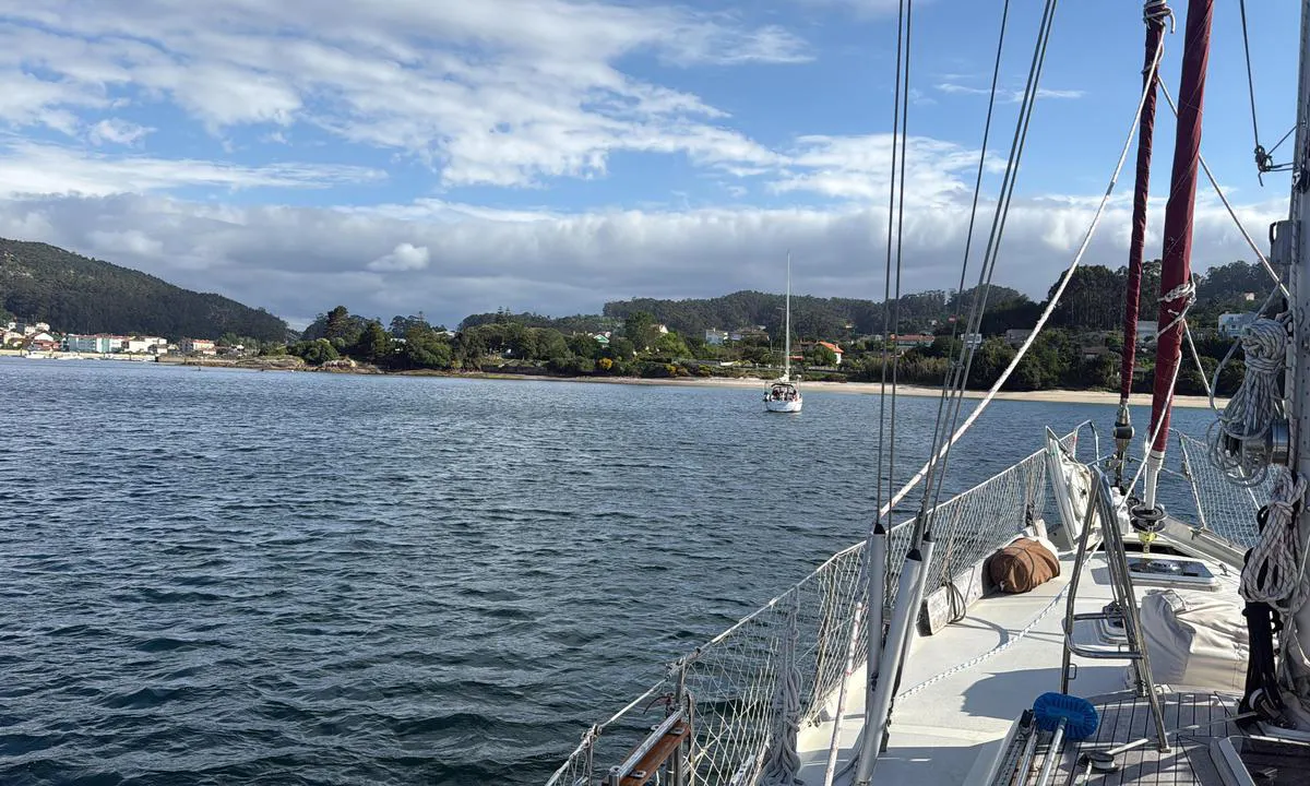
Good anchorage. Sheltered from everything except northwesterly winds. Beach
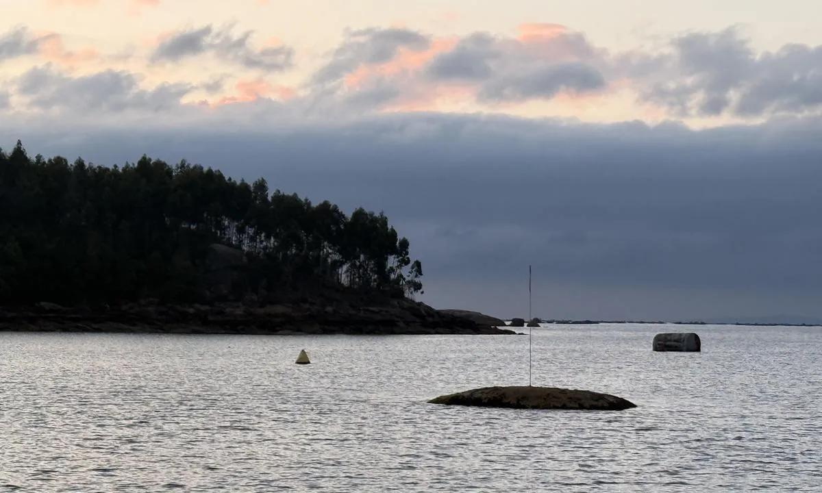
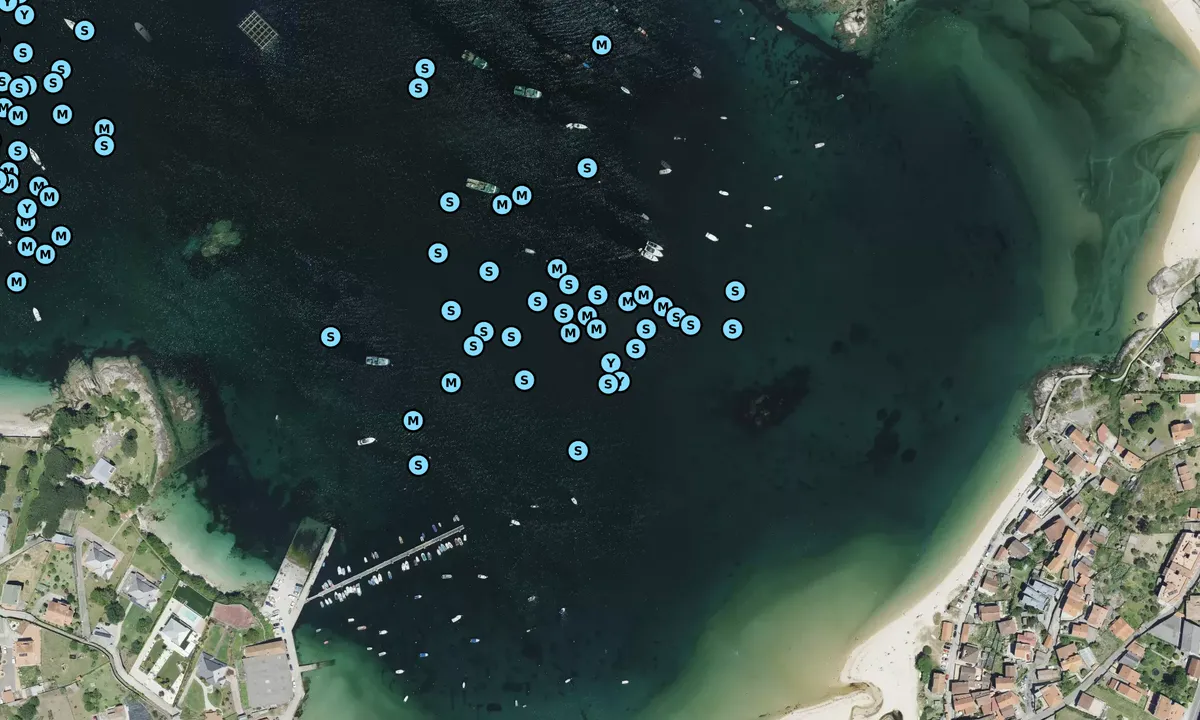
Very many fish farms in the bay. Keep to the east.
Probably best to enter during daylight hours.

[translated from Norwegian with AI]

1 x helpful | written on 29. Apr 2026

Do you know this harbour? It's a huge help to other sailors if you add a short description or review of the harbour.

📜 Add description

Map of Praia di Vilariño

Facilities

We don't have any data on available facilities in this harbour. If you know which facilities are available here, please update this site to help your fellow sailors. Update facilities.

Mooring

Options for mooring in this harbour: Anchoring.

Updated on 29. Apr 2026. Update mooring.

Wind protection

Protection next night

74 points

N E S W --> } } } } } } } } } } } } } } } } } } } } } } } } } } } } } } } } } } } } } } } } } } } } } } } } } } } } } } } } } } } } } } } } } } } } } } } } } } } } } } } } } } } } } } } } } } } } } } } } } } } } } } } } } } } } } } } } } } } } } } } } } } } } } } } } } } } } } } } } } } } } } } } } } } } } } } } } } } } } } } } } } } } } } } } } } } } } } } } } } } } } } } } } } } } } } } } } } } } } } } } } } } } } } } } } } } } } } } } } } } } } } } } } } } } } } } } } } } } } } } } } } } } } } } } } } } } } } } } } } } } } } } } } } } } } } } } } } } } } } } } } } } } } } } } } } } } } } } } } } } } } } } } } } } } } } } } } } } } } } } } } } } } } } } } } } } } } } } } } } } } } } } } } } } } } } } } } } } } } } } } } } } } } } } } } } } } } } } } } } } } } } } } } } } } } } } } } } } } } } } } } } } } } } } } } } } } } } } } } } } } } } } } } } } } } } } } } } } } } } } } } } } } } } } } } } } } } } } } } } } } } } } } } } } } } } } } } } } } } } } } } } } } } } } } } } } } } } } } } } } } } } } } } } } } } } } } } } } } } } } } } } } } } } } } } } } } } } } } } } } } } } } } } } } } } } } } } } } } } } } } } } } } } } } } } } } } } } } } } } } } } } } } } } } } } } } } } } } } } } } } } } } } } } } } } } } } } } } } } } } } } } } } } } } } } } } } } } } } } } } } } } } } } } } } } } } } } } } } } } } } } } } } } } } } } } } } } } } } } } } } } } } } } } } } } } } } } } } } } } } } } } } } } } } } } } } } } } } } } } } } } } } } } } } } } } } } } } } } } } } } } } } } } } } } } } } } } } } } } } } } } } } } } } } } } } } } } } } } } } } } } } } } } } } } } } } } } } } } } } } } } } } } } } } } } } } } } } } } } } } } } } } } } } } } } } } } } } } } } } } } } } } } } } } } } } } } } } } } } } } } } } } } } } } } } } } } } } } } } } } } } } } } } } } } } } } } } } } } } } } } } } } } } } } } } } } } } } } } } } } } } } } } } } } } } } } } } } } } } } } } } } } } } } } } } } } } } } } } } } } } } } } } } } } } } } } } } } } } } } } } } Next night 0:00 6:00 12:00 Tor 04 Jun 18:00 0:00 6:00 9m/s 2m/s

Want to know how the wind score works? Then you should read this explanation.

The wind forecasts come from yr.no (Norwegian Meteorological Institute), and was last updated 2 hours and 51 minutes ago (Wednesday 03 June 08:14 PM). The next night score shows you the worst hour between 22:00 and 08:00 the next night. We recommend that you check multiple sources for wind forecasts. windy.com is a good website to show larger wind systems.

The safe wind directions for this harbour has been decided by an algorithm, based on how elevated the land around the harbour is. It's mostly correct, but sometimes the underlying data about elevation levels is not good enough to make correct decisions. It's a great help to other if you can validate or adjust the safe wind directions. You can see the data used by the algorithm to decide the safe wind directions by clicking here.

Last visits to Praia di Vilariño

Tue 30 Sep 2025

COCKLE [MMSI: 224628790]

Wed 17 Sep 2025

LIBERO [MMSI: 225987252]

Mon 25 Aug 2025

AVSTAND [MMSI: 211822190]

Sat 23 Aug 2025

YESS TOO [MMSI: 263959672]

Sat 16 Aug 2025

MOURISCA [MMSI: 225989005]

The visits are retrieved from AIS data. You can click to see all visiting ships to Praia di Vilariño, as well as statistics about the ships that visits

Add this harbour to a journey

Check in now

Choose a different date than today

Important: When you check in to a harbour, you add it to a journey on this website. You are not booking a place in the marina.

Contributors

Users that contributed to this page: Odd Tufte. S/Y Vindreken

harbourmaps.com is updated by the boating community. When you add information, a review or pictures to this page you are listed here with the other contributors (we list your user-name, which can be your real name or a pseudonym).

Closest harbours to Praia di Vilariño

Filter by

Natural harbour
Marina
Safe wind next night

Order by

ABC
Popularity
Wind score next night

0 harbours

Show more harbours