


















Trandal - Christian Gaard
Marina

Region: Norway (3538), Møre og Romsdal (311), Ørsta (11), Hjørundfjorden (6), Store Standal (1) and Trandal (1)


Pochwal się swoimi zdjęciami i pomóż innym w planowaniu ich podróży do Trandal - Christian Gaard.



















Informacje kontaktowe
strona internetowa: Add website
telefon: Dodaj numer telefonu
e-mail: Add email
Opisy i recenzje
Dominig ar Foll mówi:
mówi:
obszar

morskie cechy

opis
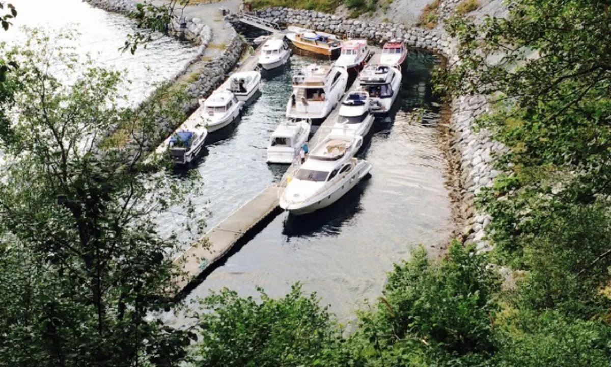
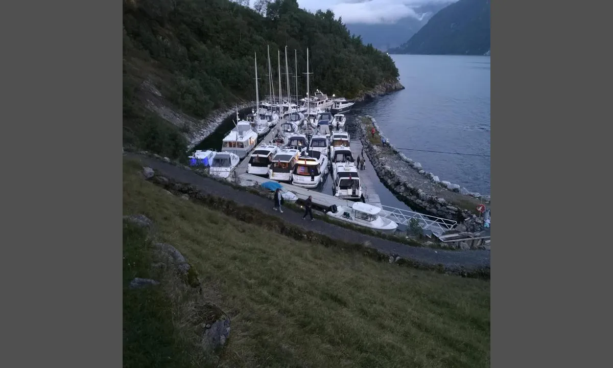
Great harbour but narrow and not deep everywhere. Don't let that put you off.
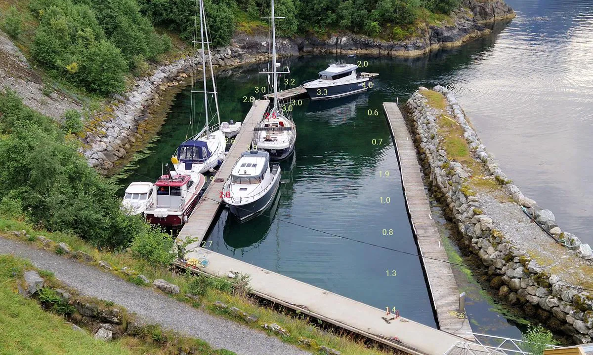
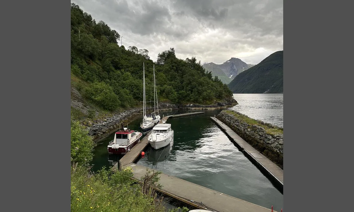
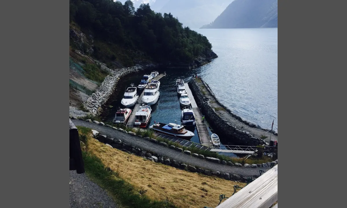
Many with sailing boats could be put off to moor in the inner harbour where shelter is very good. In reality the depth on the central pontoon is not incompatible with most sailing boats at least up to the middle section.
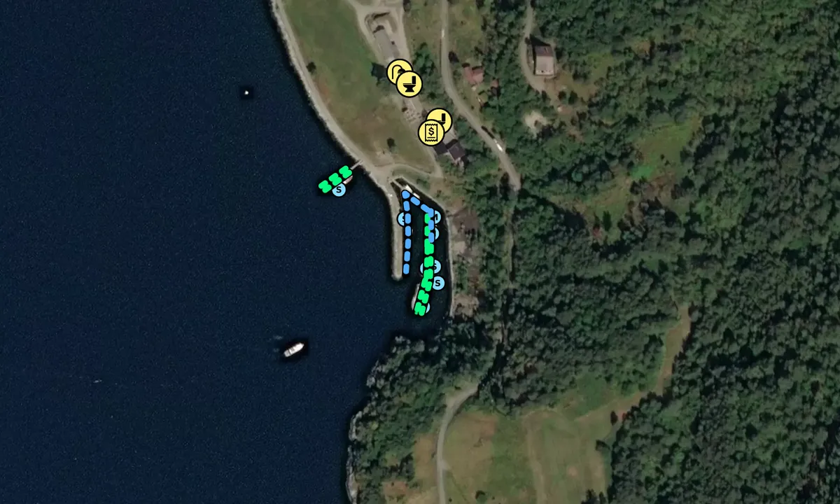
You can check on my photo where the depths are given for each section of the harbour. You just have to add the tide of the day (Alesund) to decide if you can use it or not. There is a small bump at the entrance of the second section of the middle pontoon (it's not a print error).
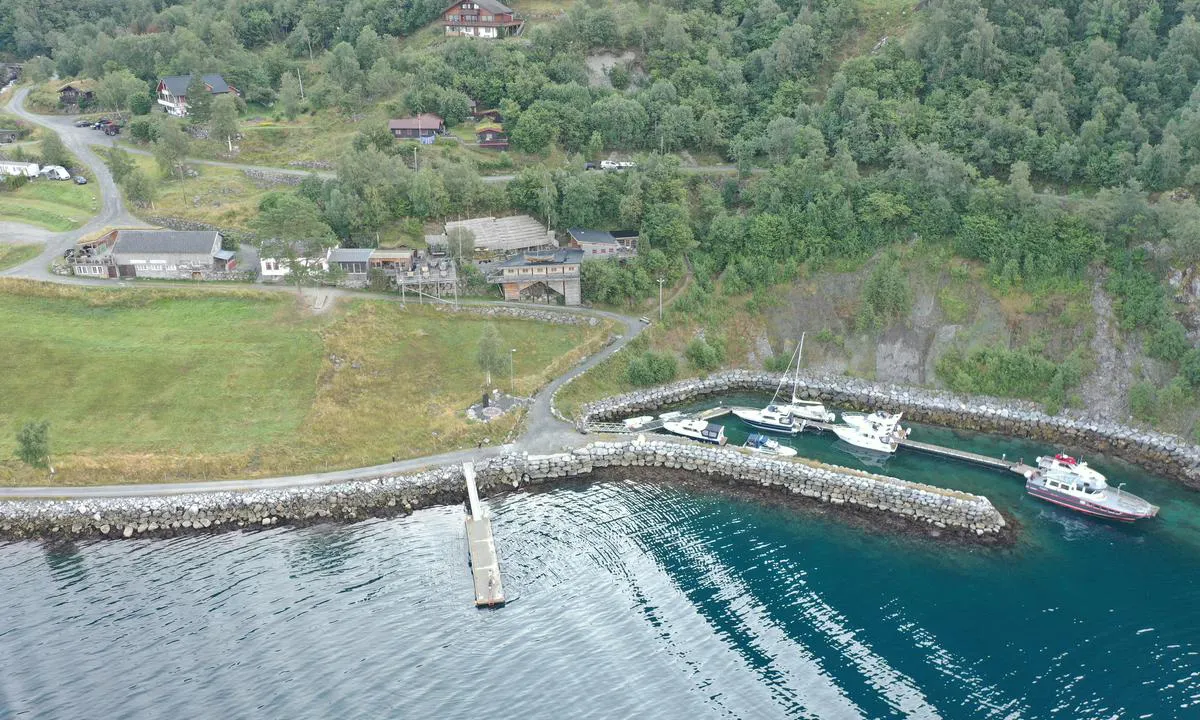
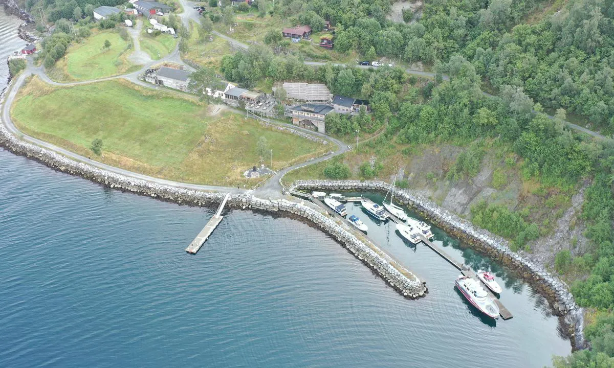
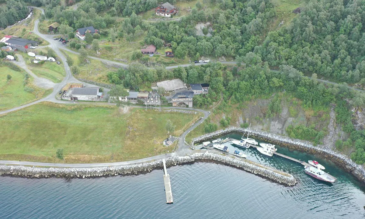
There is also and external pontoon where depth is no issue but it provides no shelter from potential swell.
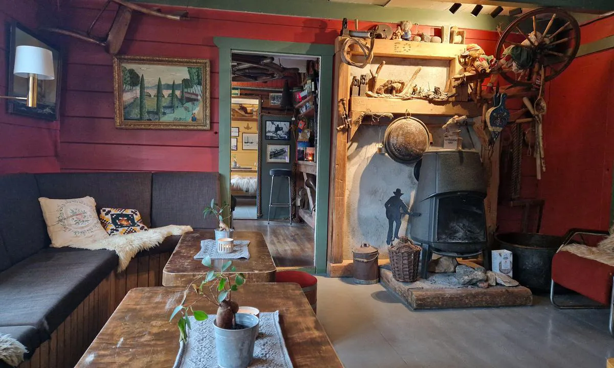
The place definitely worth a visit. One of the most friendly bar and restaurant that I have been visiting during my tour in Norway.
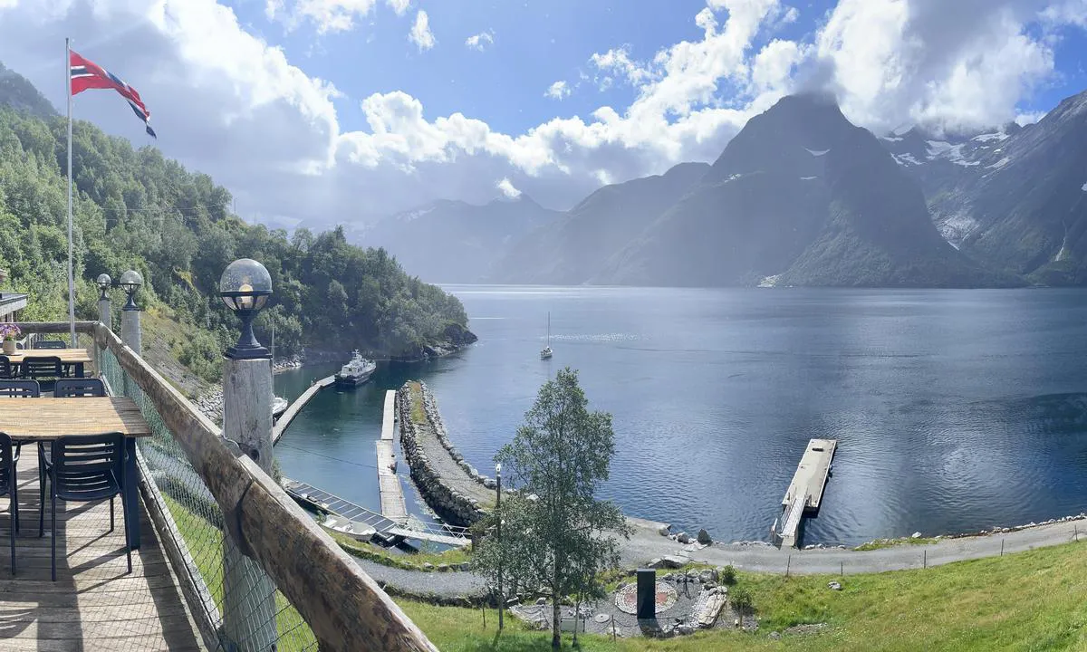
The view from the bar as well as from your boat in the harbour is stunning.
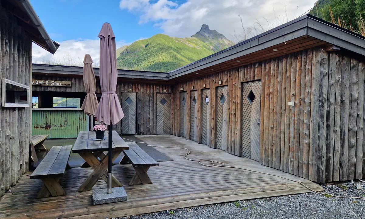
You pay at the bar (100m up the hill). 50m up the path You will find toilets and two showers (see photo).
(July 2026) Water pipes were present but, due to leaks in, the sytem, were not active. Would you require water, you will have to open the tap bellow the pontoon (accessible via a scare hole).
Electricity sockets work fine.

3 x helpful | written on 28. Jul 2026 | updated_on 29. Jul 2026
Runar Aarseth mówi:
obszar
morskie cechy
opis
Jest restauracja, z urządzeniami sanitarnymi, organizowane są festiwale, rock, blues i country festival, jest także olej napędowy morski i benzyna 95 oktanów na nabrzeżu wschodnim, polecane.
[translated from Danish with AI]
1 x helpful | written on 11. Jul 2024
Torgeir Næve mówi:
mówi:
opis
Wpłynięcie i warunki morskie: Leży przy trasie statków w Hjørrundfjorden.
Port posiada własny falochron, który nie jest uwzględniony na wszystkich mapach lub ploterach.
Cumowanie: W porcie jest płytko, ale żaglówki mogą cumować po obu stronach betonowego nabrzeża (najbardziej zewnętrzna część pływającego pomostu w środku) i prawdopodobnie trochę dalej w głąb tego. Żaglówki nie powinny cumować przy nabrzeżu przy falochronie, ponieważ jest tam bardzo płytko.
Okolica: Wyjątkowe miejsce z gastronomią i wydarzeniami kulturalnymi. Spektakularna huśtawka, którą trzeba wypróbować.
[translated from Norwegian with AI]
1 x helpful | written on 30. Jul 2021
Czy znasz ten port? To ogromna pomoc dla innych żeglarzy, jeśli dodasz krótką opis lub recenzję tego portu.
Mapa Trandal - Christian Gaard
Aby korzystać z map, musisz się zalogować lub utworzyć konto użytkownika
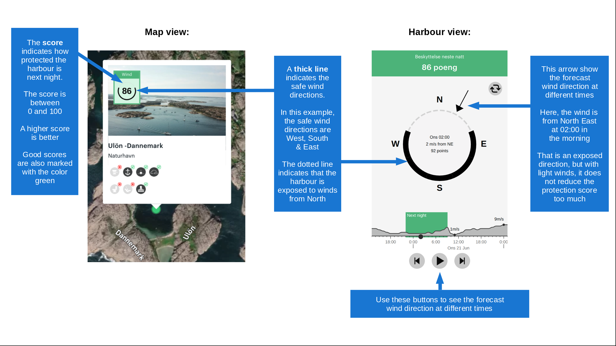
Ochrona przed wiatrem
Ochrona następnej nocy
89 punkty



Chcesz wiedzieć, jak działa wskaźnik wiatru? W takim razie powinieneś przeczytać to wyjaśnienie.
Prognozy wiatru pochodzą z yr.no (Norweski Instytut Meteorologiczny), i zostały ostatnio zaktualizowane 1 hour and 21 minutes ago (Środa 23 Wrzesień 10:31). Następna nocna ocena pokazuje najgorszą godzinę między 22:00 a 08:00 następnej nocy. Zalecamy sprawdzenie kilku źródeł prognoz wiatru.windy.com jest dobrą stroną do pokazywania większych systemów wiatrowych.
Bezpieczne kierunki dla tego portu zostały dodane o 11. Jun 2021. Kliknij tutaj, aby edytować.

Trandal - Christian Gaard jest otoczony wysokimi wzgórzami lub górami. Kiedy silne wiatry nadchodzą z górskiej strony, istnieje ryzyko turbulentnych lub katabatycznych wiatrów (zwanych również 'wiatrami spadającymi'), które mogą być dość nieprzyjemne. W takich warunkach nie powinieneś polegać na ocenie ochrony przed wiatrem na nadchodzącą noc.. Kliknij, aby edytować.
Ostatnie wizyty w Trandal - Christian Gaard
Pią 17 Kwi 2026 |
|
|
Nie 11 Maj 2025 |
|
|
Wto 16 Lip 2024 |
|
|
|
|
Pon 15 Lip 2024 |
|
|
 AURVANDIL [MMSI: 257603190]
 LYKKE IV [MMSI: 259043070]
The visits are retrieved from AIS data. You can click to see all visiting ships to Trandal - Christian Gaard, as well as statistics about the ships that visits
Dodaj ten port do podróży
Wybierz inny dzień niż dzisiaj
Ważne: Kiedy meldować się w porcie, dodajesz go do podróży na tej stronie internetowej. Nie rezerwujesz miejsca w marinie.
Współtwórcy
Użytkownicy, którzy przyczynili się do tej strony: Cato Helgesen, Olav Pekeberg, Torgeir Næve, Runar Aarseth, Anonymous sailor 1110, Kjetil Hasselø, Dominig ar Foll and Olav Heggemsnes
harbourmaps.com jest aktualizowana przez społeczność żeglarską. Gdy dodajesz informacje, recenzję lub zdjęcia do tej strony, jesteś wymieniony tutaj wraz z innymi współtwórcami (podajemy Twoją nazwę użytkownika, która może być Twoim prawdziwym imieniem lub pseudonimem).
Najbliższe porty do Trandal - Christian Gaard
Filtruj według
Sortuj według
0 porty
Pokaż więcej portów