























Paradisbukta - Langesund

Natural harbour

favoritt

Region: Norway (3528), Vestfold og Telemark (228), Vestfold (187), Telemark (70), Porsgrunn (12) and Helgeroa (8)

Paradisbukta - Langesund
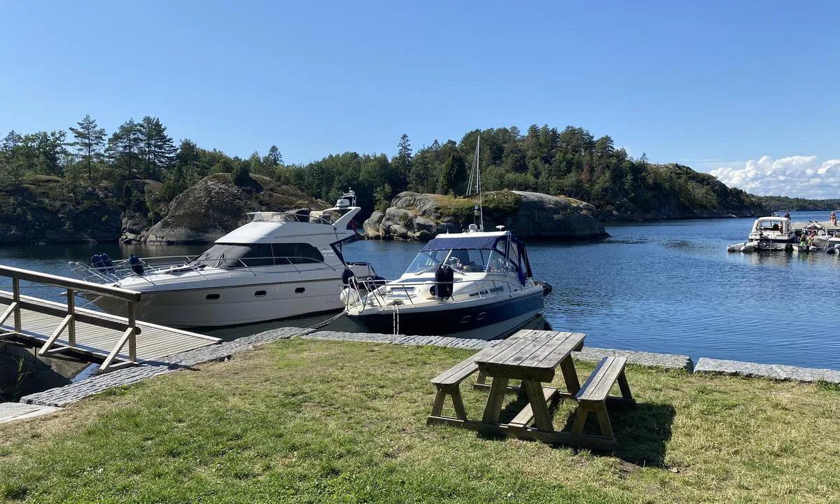
Paradisbukta - Langesund: {"base": "en", "no": "30. september 2025. Alene i paradiset", "se": "30 september 2025. Ensam i paradiset", "en": "September 30 2025. Alone in paradise", "da": "30. september 2025. Alene i paradis", "fr": "30 septembre 2025. Seul au paradis", "de": "30. September 2025. Allein im Paradies", "es": "30 de septiembre de 2025. Solo en el para\u00edso", "it": "30 settembre 2025. Solo in paradiso", "pt": "30 de setembro de 2025. Sozinho no para\u00edso", "nl": "30 september 2025. Alleen in het paradijs", "pl": "30 wrze\u015bnia 2025. Samotnie w raju", "uk": "30 \u0432\u0435\u0440\u0435\u0441\u043d\u044f 2025 \u0440\u043e\u043a\u0443. \u041e\u0434\u0438\u043d \u0443 \u0440\u0430\u044e", "ro": "30 septembrie 2025. Singur \u00een paradis", "tr": "30 Eyl\u00fcl 2025. Cennette yaln\u0131z", "el": "30 \u03a3\u03b5\u03c0\u03c4\u03b5\u03bc\u03b2\u03c1\u03af\u03bf\u03c5 2025. \u039c\u03cc\u03bd\u03bf\u03c2 \u03c3\u03c4\u03bf\u03bd \u03c0\u03b1\u03c1\u03ac\u03b4\u03b5\u03b9\u03c3\u03bf", "cs": "30. z\u00e1\u0159\u00ed 2025. Sami v r\u00e1ji", "hu": "2025. szeptember 30. Egyed\u00fcl a paradicsomban", "fi": "30. syyskuuta 2025. Yksin paratiisissa", "bg": "30 \u0441\u0435\u043f\u0442\u0435\u043c\u0432\u0440\u0438 2025 \u0433. \u0421\u0430\u043c \u0432 \u0440\u0430\u044f", "sr": "30. septembar 2025. Sam u raju", "et": "30. september 2025. \u00dcksi paradiisis", "lv": "2025. gada 30. septembris. Viens parad\u012bz\u0113", "lt": "2025 m. rugs\u0117jo 30 d. Vienas rojuje"}
Paradisbukta - Langesund
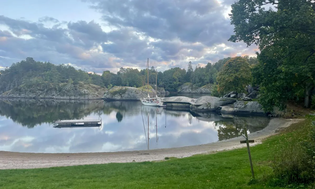
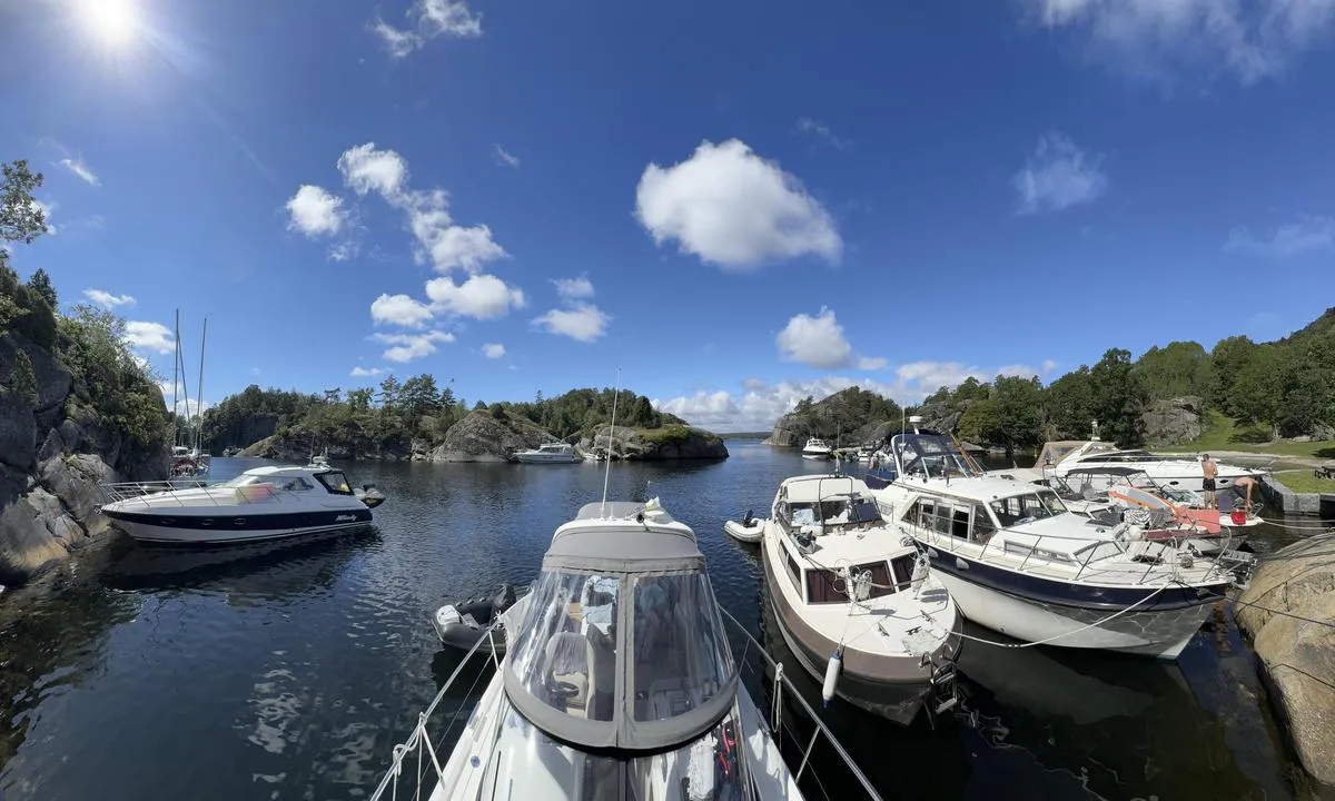
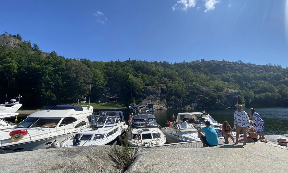
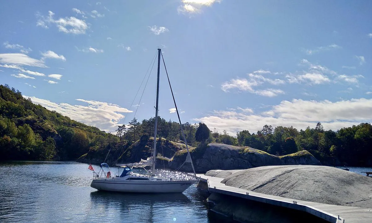
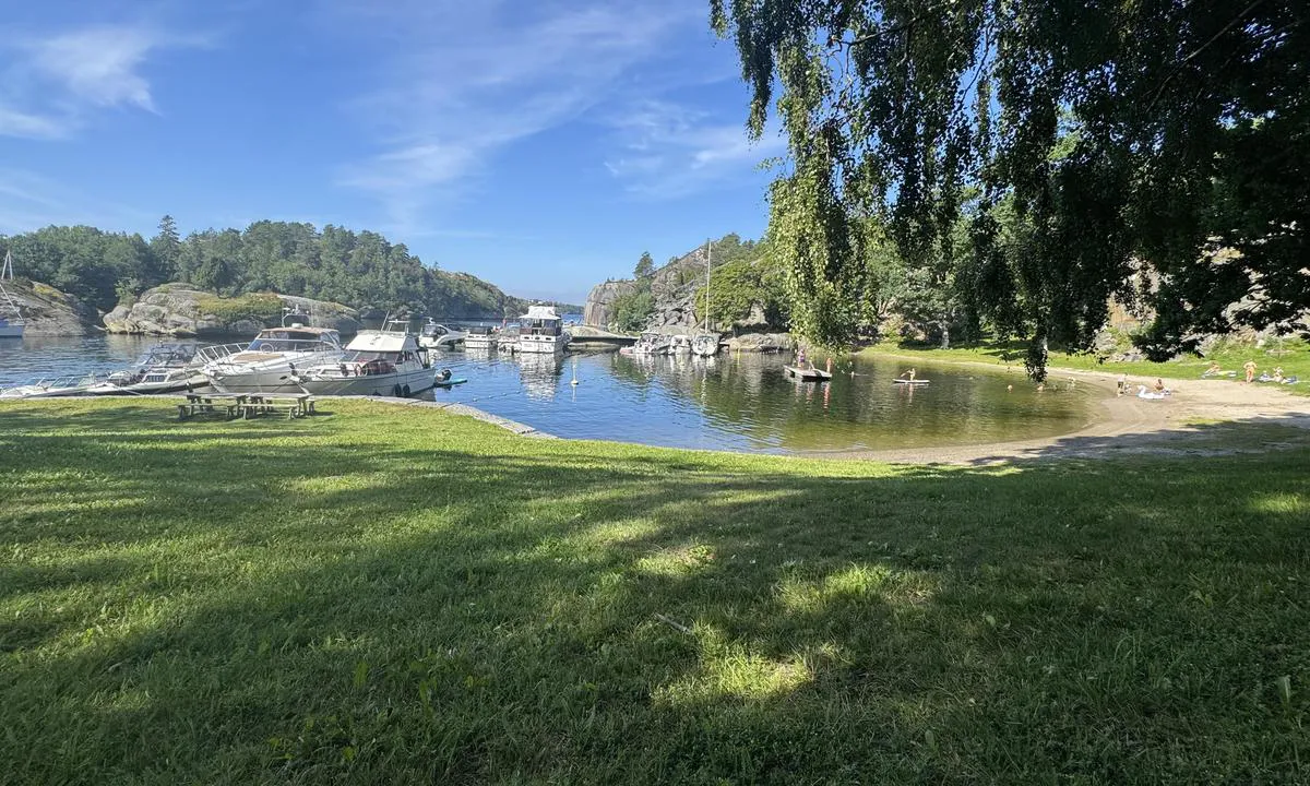
{"base": "no", "no": "Panoramabilde innenfra brygga og utover mot innl\u00f8pet til Paradisbukta", "se": "Panoramavy fr\u00e5n bryggan och ut mot inloppet till Paradisbukten", "en": "Panoramic view from inside the pier looking out towards the entrance to Paradisbukta", "da": "Panoramabillede indenfra broen og ud mod indl\u00f8bet til Paradisbukten"}
Paradisbukta - Langesund
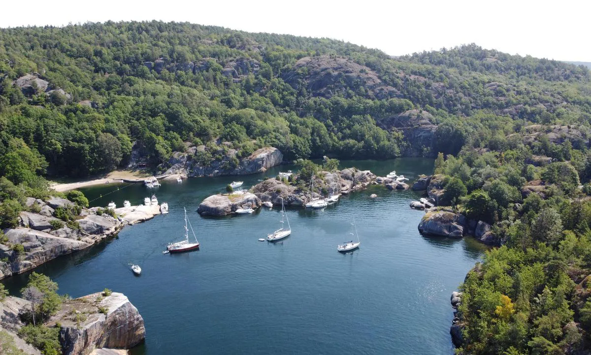
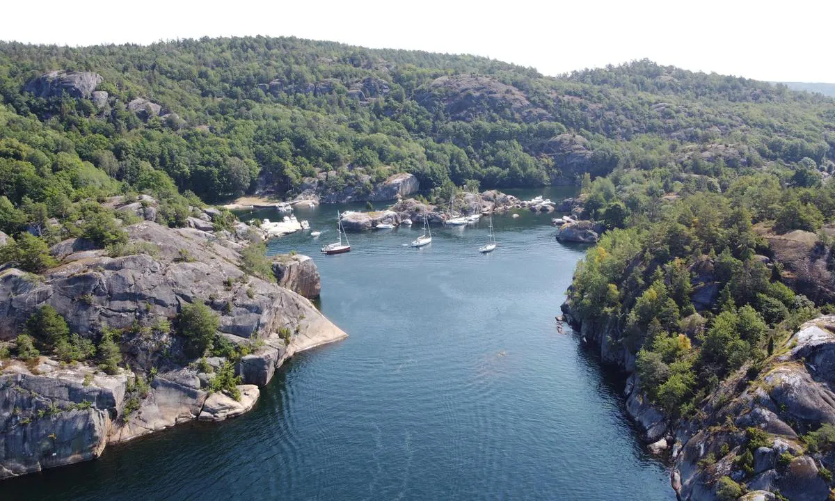
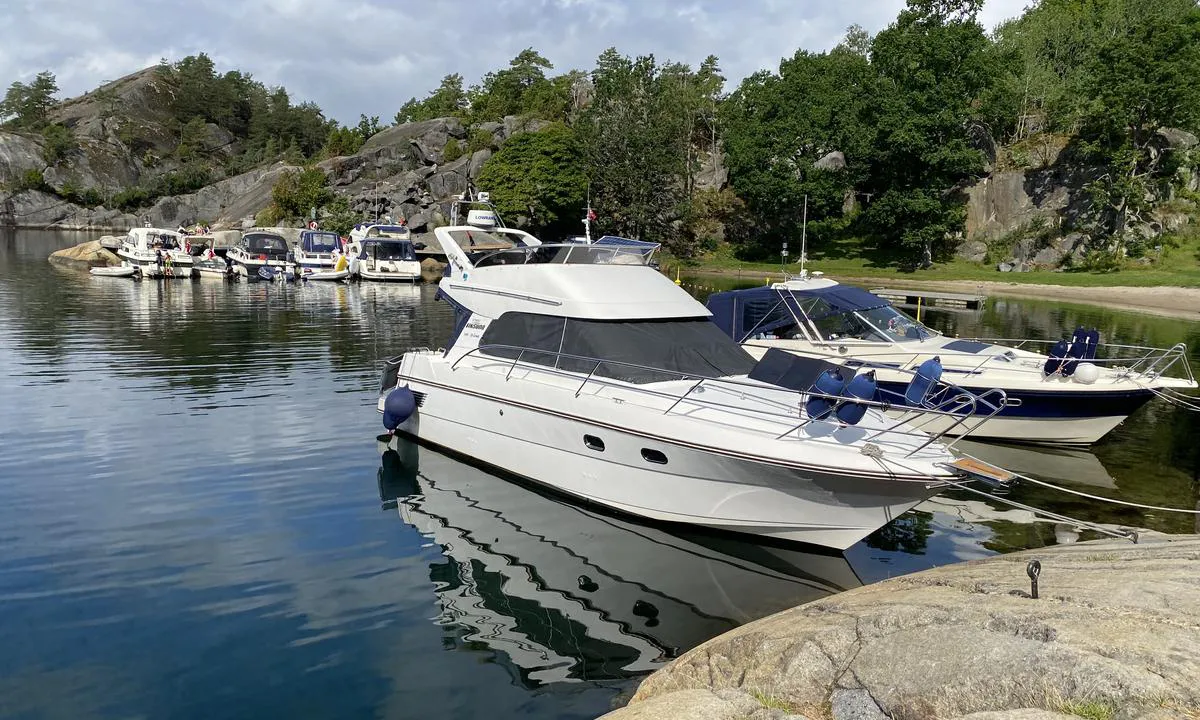
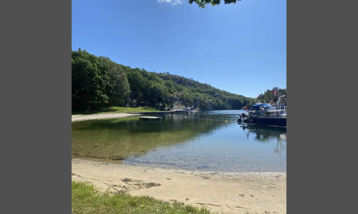
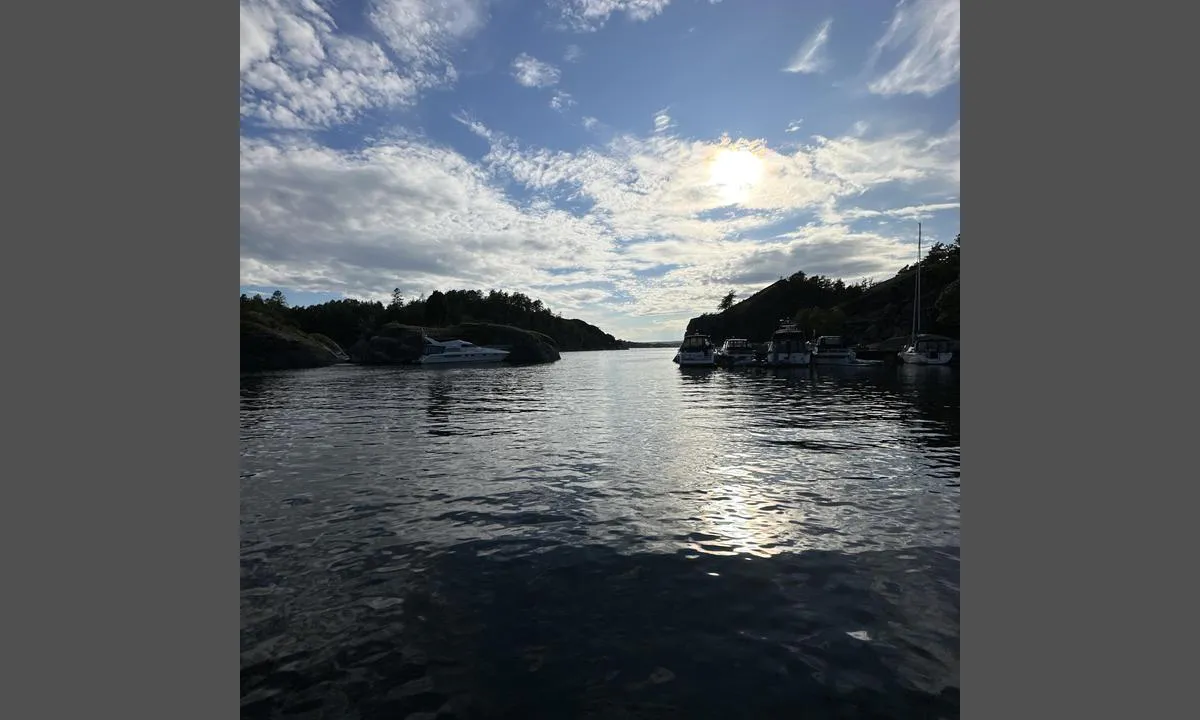
{"base": "no", "no": "Innseiling i Paradisbukta.", "se": "Insegling i Paradisviken.", "en": "Approach to Paradise Bay.", "da": "Indsejling i Paradisbukten."}
Paradisbukta - Langesund
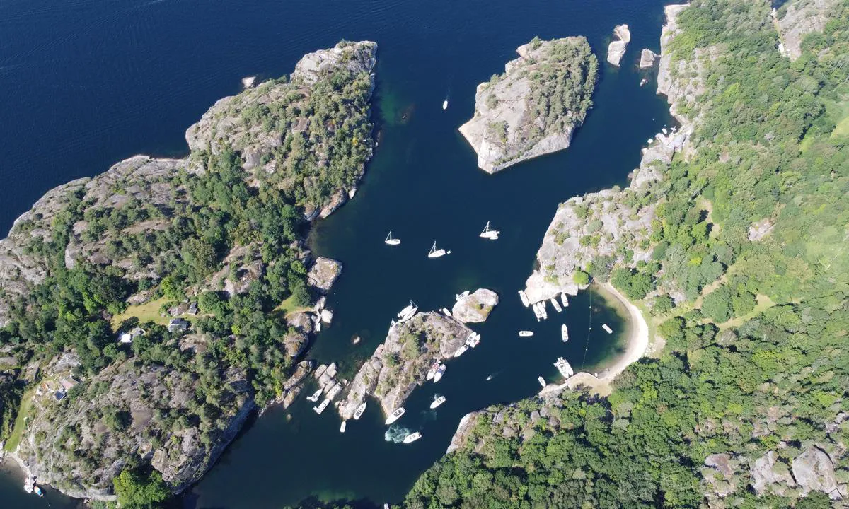
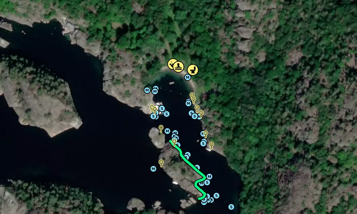
Satelite image of Paradisbukta - Langesund

📸 Upload a photo

Show off your photos and help others plan their journey to Paradisbukta - Langesund.harbourmaps.com is created by the sailing community, in a collective effort to make cruising simpler and more fun. Uploading a photo takes less than a minutes and can be done from your phone, tablet or laptop.

📸 Upload a photo

Facilities

Available facilities: Toilet, Playground, Swimming area.

Updated on 12. Jul 2024. Update facilities.

Mooring

Options for mooring in this harbour: To pier/wharf, Anchoring, Towards land.

Updated on 12. Jul 2024. Update mooring.

Descriptions and reviews

Johann Kjartansson says:

area

maritime qualities

description

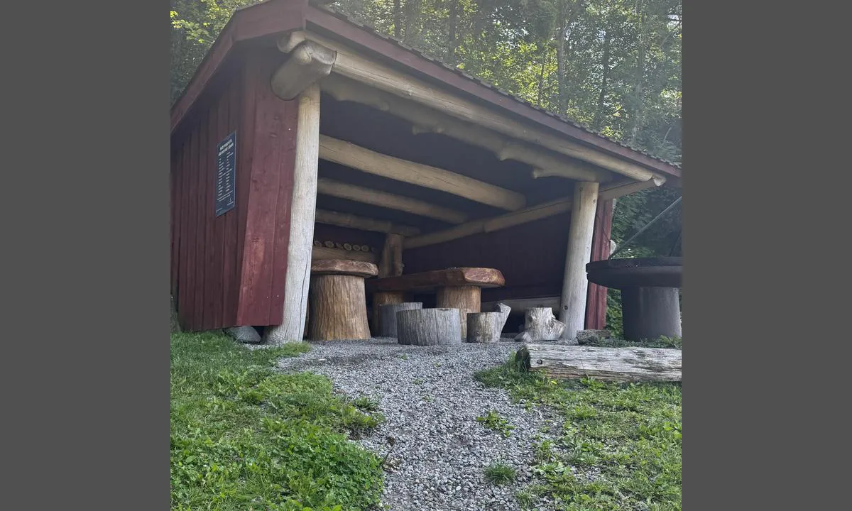
Fantastic place with many places to Moore against cliffs or stone harbour. Everything you need for a summer day out; beach, benches, bbq stations and gapahuk for the rainy days. Very SUP friendly natural harbour. Sailing yachts can Moore in the inner area easy, it's deep enough and steep cliffs

1 x helpful | written on 13. Jul 2023 | updated_on 13. Jul 2023

Olav Pekeberg says:


description

Anchoring: Anchoring depth 3.3m

[translated from Norwegian with AI]

1 x helpful | written on 1. Jul 2021

Do you know this harbour? It's a huge help to other sailors if you add a short description or review of the harbour.

📜 Add description

Map of Paradisbukta - Langesund

Facilities

Available facilities: Toilet, Playground, Swimming area.

Updated on 12. Jul 2024. Update facilities.

Mooring

Options for mooring in this harbour: To pier/wharf, Anchoring, Towards land.

Updated on 12. Jul 2024. Update mooring.

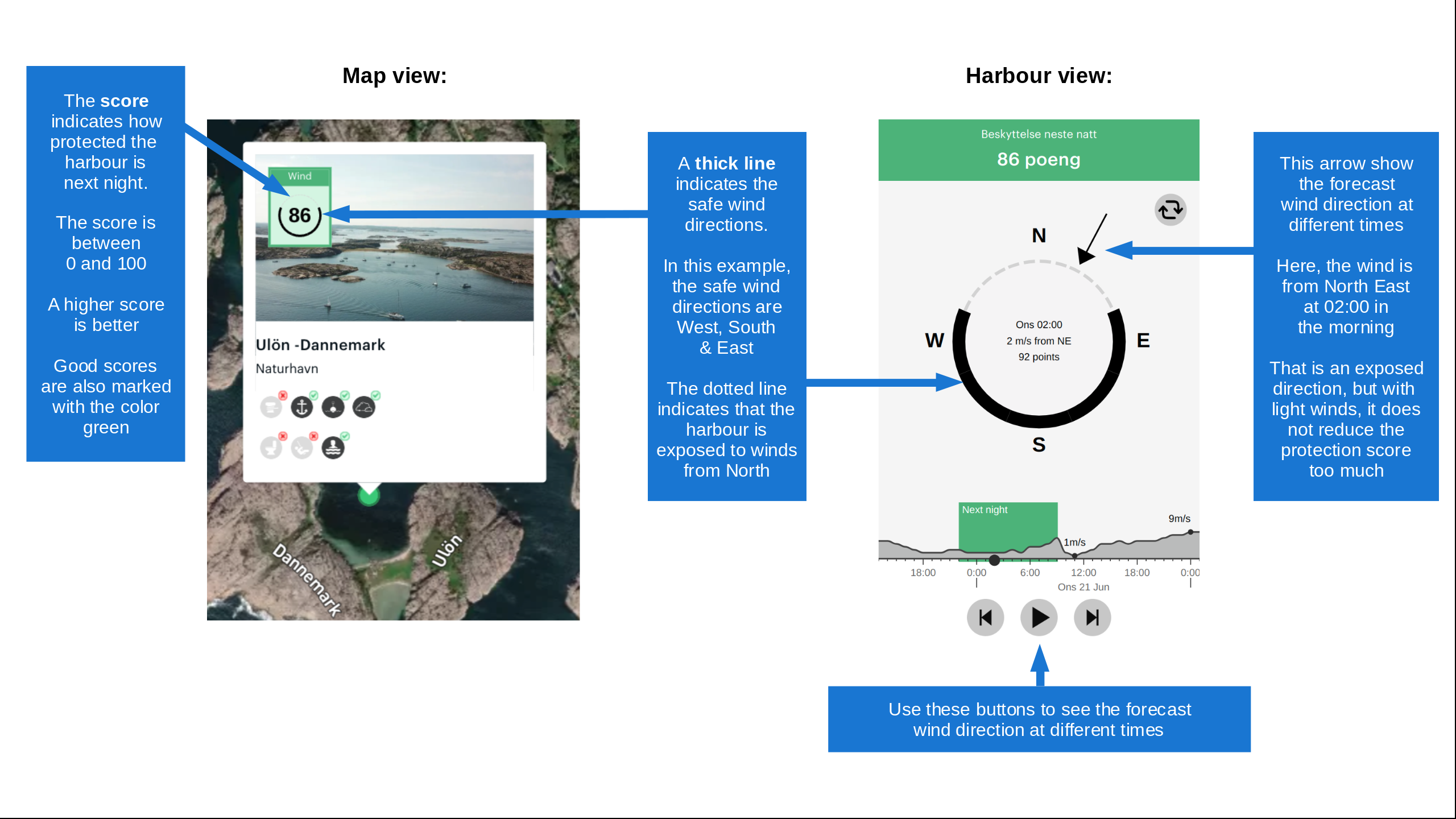
Wind protection

Protection next night

97 points

N E S W --> } } } } } } } } } } } } } } } } } } } } } } } } } } } } } } } } } } } } } } } } } } } } } } } } } } } } } } } } } } } } } } } } } } } } } } } } } } } } } } } } } } } } } } } } } } } } } } } } } } } } } } } } } } } } } } } } } } } } } } } } } } } } } } } } } } } } } } } } } } } } } } } } } } } } } } } } } } } } } } } } } } } } } } } } } } } } } } } } } } } } } } } } } } } } } } } } } } } } } } } } } } } } } } } } } } } } } } } } } } } } } } } } } } } } } } } } } } } } } } } } } } } } } } } } } } } } } } } } } } } } } } } } } } } } } } } } } } } } } } } } } } } } } } } } } } } } } } } } } } } } } } } } } } } } } } } } } } } } } } } } } } } } } } } } } } } } } } } } } } } } } } } } } } } } } } } } } } } } } } } } } } } } } } } } } } } } } } } } } } } } } } } } } } } } } } } } } } } } } } } } } } } } } } } } } } } } } } } } } } } } } } } } } } } } } } } } } } } } } } } } } } } } } } } } } } } } } } } } } } } } } } } } } } } } } } } } } } } } } } } } } } } } } } } } } } } } } } } } } } } } } } } } } } } } } } } } } } } } } } } } } } } } } } } } } } } } } } } } } } } } } } } } } } } } } } } } } } } } } } } } } } } } } } } } } } } } } } } } } } } } } } } } } } } } } } } } } } } } } } } } } } } } } } } } } } } } } } } } } } } } } } } } } } } } } } } } } } } } } } } } } } } } } } } } } } } } } } } } } } } } } } } } } } } } } } } } } } } } } } } } } } } } } } } } } } } } } } } } } } } } } } } } } } } } } } } } } } } } } } } } } } } } } } } } } } } } } } } } } } } } } } } } } } } } } } } } } } } } } } } } } } } } } } } } } } } } } } } } } } } } } } } } } } } } } } } } } } } } } } } } } } } } } } } } } } } } } } } } } } } } } } } } } } } } } } } } } } } } } } } } } } } } } } } } } } } } } } } } } } } } } } } } } } } } } } } } } } } } } } } } } } } } } } } } } } } } } } } } } } } } } } } } } } } } } } } } } } } } } } } } } } } } } } } } } } } } } } } } } } } } } } } } } } } } } } } } } } } } } } } } } } } } } } } } } } } } } } } } } } } } Next night 6:00 12:00 Ons 19 Aug 18:00 0:00 6:00 12:00 Tor 20 Aug 4m/s 1m/s

Want to know how the wind score works? Then you should read this explanation.

The wind forecasts come from yr.no (Norwegian Meteorological Institute), and was last updated 1 hour and 30 minutes ago (Wednesday 19 August 01:28 AM). The next night score shows you the worst hour between 22:00 and 08:00 the next night. We recommend that you check multiple sources for wind forecasts. windy.com is a good website to show larger wind systems.

The safe directions for this harbour was added at None. Click here to edit.

Last visits to Paradisbukta - Langesund

Sun 02 Aug 2026

SY MERIT AMUN [MMSI: 211438800]

Sat 10 Aug 2024

LELIEL [MMSI: 258265070]

BLAANE [MMSI: 257026110]

Thu 26 Oct 2023

RABALDER [MMSI: 259005920]

Tue 17 Oct 2023

VAARE [MMSI: 257729630]

The visits are retrieved from AIS data. You can click to see all visiting ships to Paradisbukta - Langesund, as well as statistics about the ships that visits

Add this harbour to a journey

Check in now

Choose a different date than today

Important: When you check in to a harbour, you add it to a journey on this website. You are not booking a place in the marina.

Contributors

Users that contributed to this page: Andyve, fredriso, Magnus Rygge Fimreite, Vegar Lauritzsen, Anonymous sailor 196574, Michael Engman, Olav Pekeberg, Marianne Van Iperen and Tove Lunde

harbourmaps.com is updated by the boating community. When you add information, a review or pictures to this page you are listed here with the other contributors (we list your user-name, which can be your real name or a pseudonym).

Closest harbours to Paradisbukta - Langesund

Filter by

Natural harbour
Marina
Safe wind next night

Order by

ABC
Popularity
Wind score next night

0 harbours

Show more harbours