


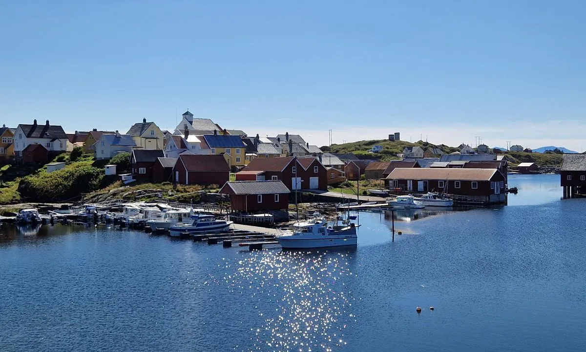
Nordre Bjørnsund
Marina

Region: Norway (3468), Møre og Romsdal (309), Hustadvika (19), Bud (6) and Nørdre Bjørnsund (2)


Descriptions and reviews
Olav Pekeberg
 says:
says:
area

maritime qualities

description
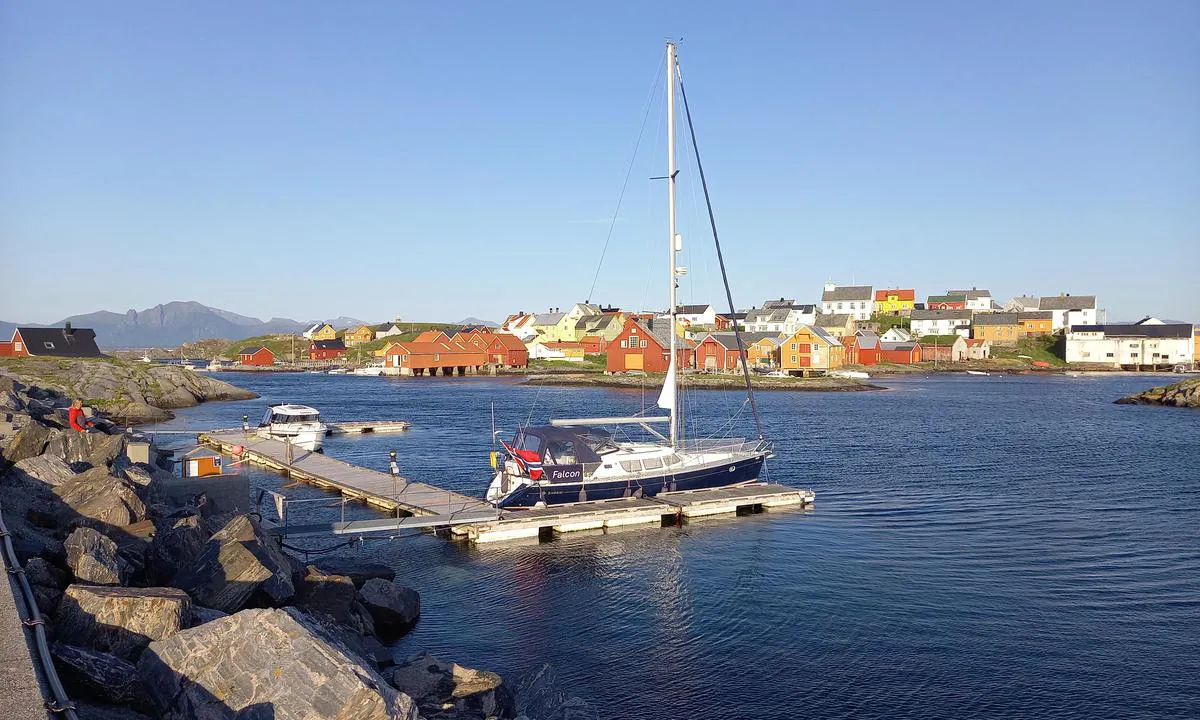
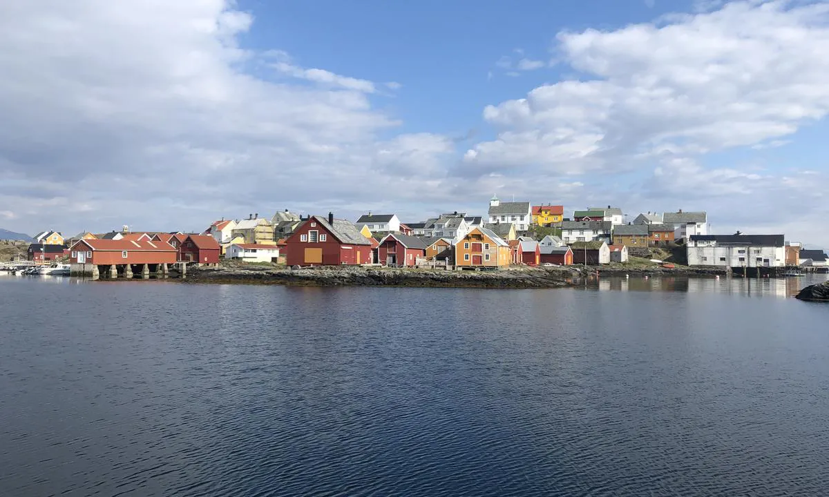
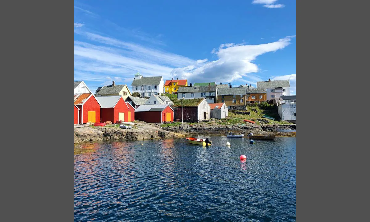
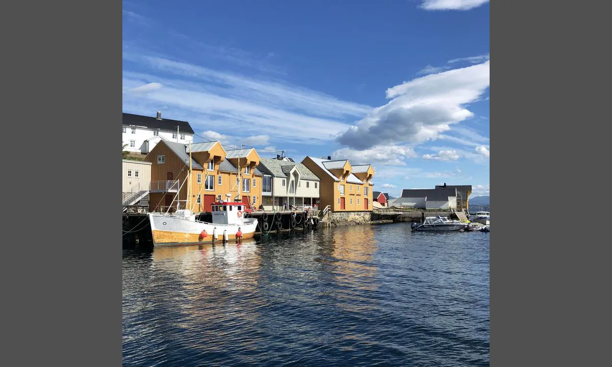
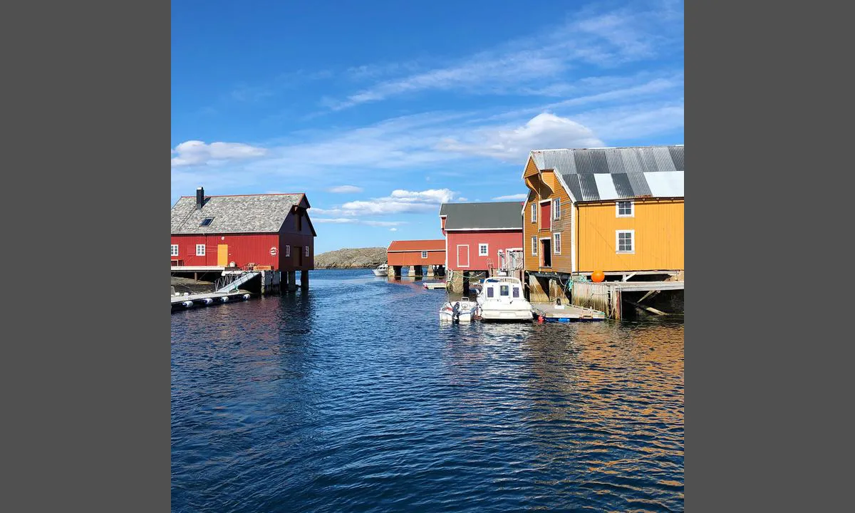
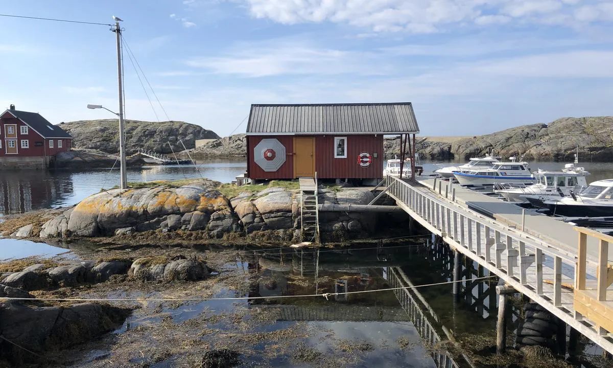
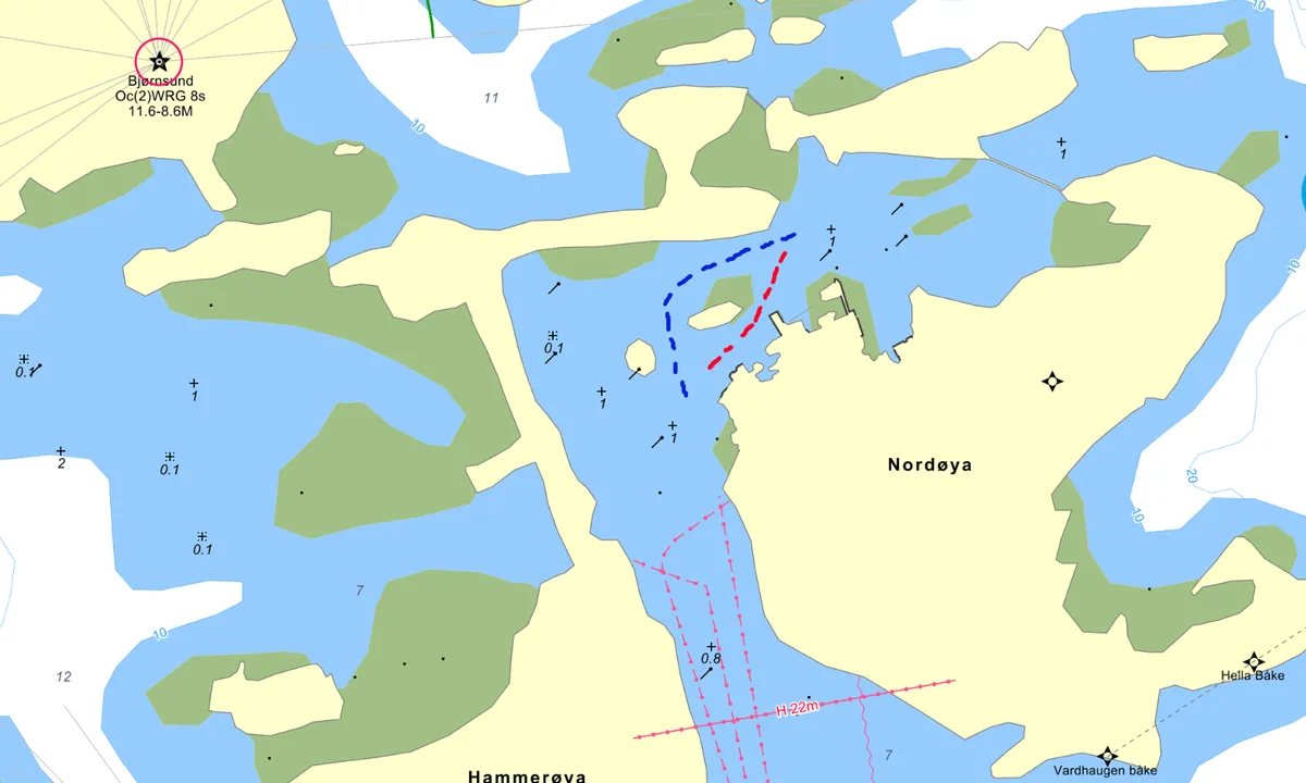
Approach and maritime conditions: Bjørnsund is located at the southern end of Hustadvika, a couple of nautical miles offshore from Bud. The fishing village consists of three main islands: Søndre Bjørnsund, Hammarøya, and Nordre Bjørnsund.
Approach
It is possible to approach the islands from various directions. If you are coming from the north through the inner route via Hustadvika, turn west at Bud and pass through Bjørnøysundet (between Nordre Bjørnsund and Bjørnøya). Watch out for the unmarked Digergallet to port before you go through Bjørnøysundet. If you come from the north along the outer route past Hustadvika, keep well inside Galdeskjæra and head towards Bjørnsund Lighthouse. If the sea is not rough, pass between the small island Bollen and the lighthouse island (Måøya), and then navigate around the east or west side of Søndre Bjørnsund. If the sea is rough, it may be safer to head towards Bud and arrive at Bjørnsund through Bjørnøysundet. If you are coming from the south along the route from Ålesund, either continue towards outer Hustadvika and turn in between Bollen and the lighthouse island (Måøya), or go south of Søre Orholmskjæret and navigate carefully past the stakes. Common to all approaches is that the waters are treacherous, and you must closely monitor the chart/GPS.
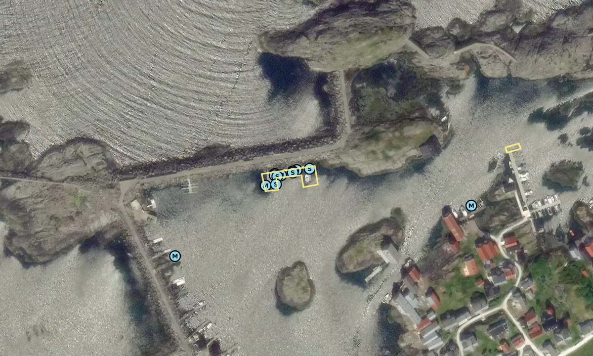
The harbor at Nordre Bjørnsund is shallow and has several unmarked reefs. See the pictures, where a typical spot where many sailboats ground is marked. There is also a 22-meter air clearance on the way into the harbor.
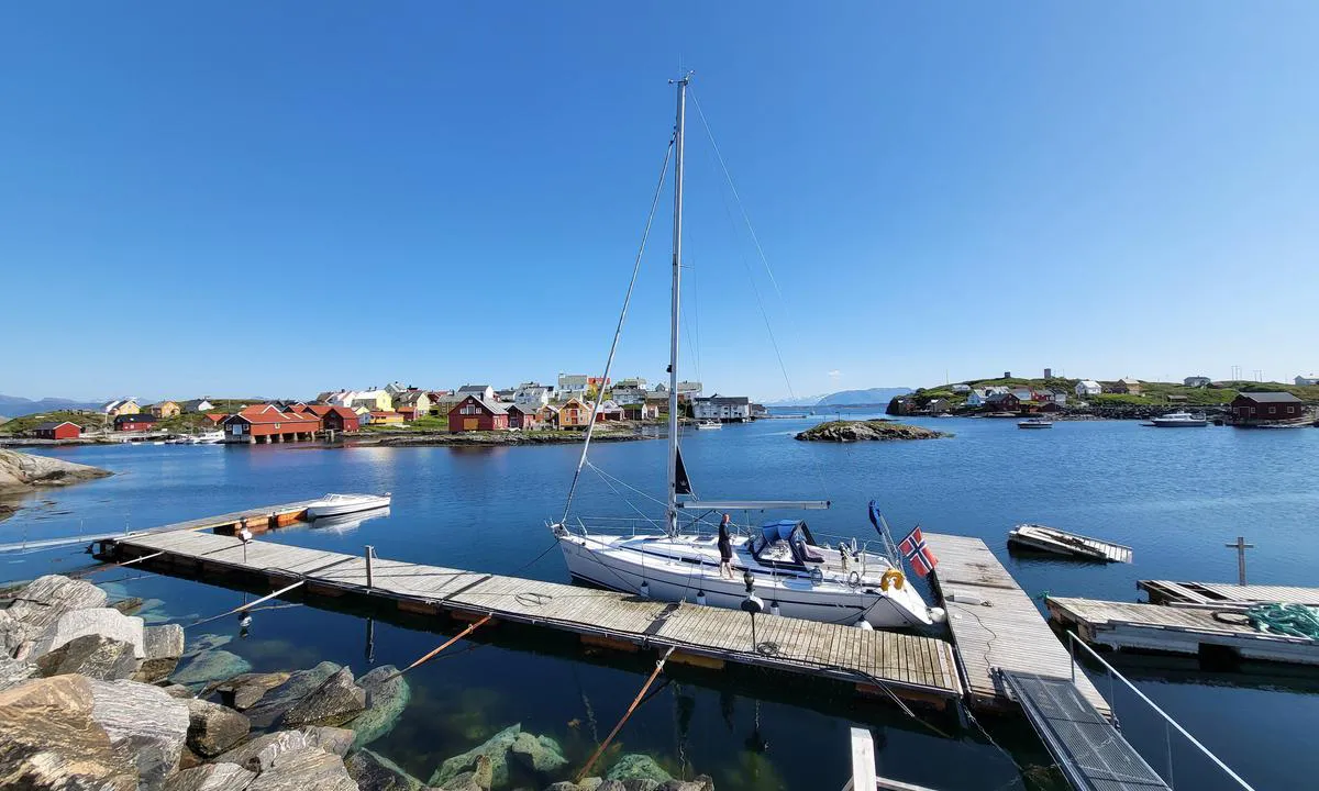
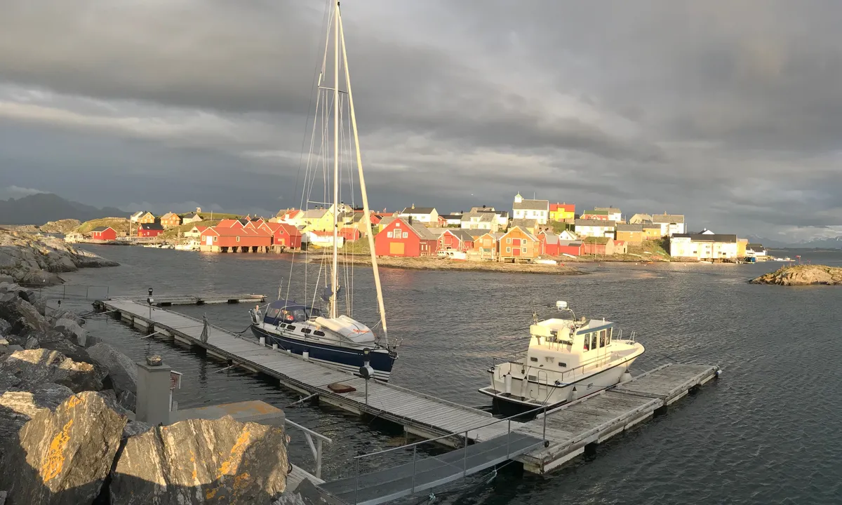
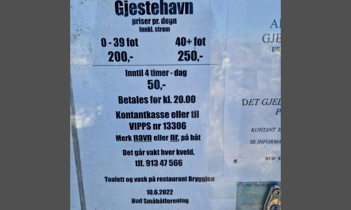
Mooring: In Bjørnsund, there are two docks with space for guests. The first is a floating dock located by the breakwater, right inside the harbor. A bit further into the harbor (keep starboard) there is also a new floating dock (2021), with space for two guests at the outermost part (longside on the corner you reach first, and on the outside of the first finger pier you come to). Both places accept payment via Vipps. Some boats also moor longside on the breakwater at the innermost part of the harbor.
[translated from Norwegian with AI]

3 x helpful | written on 1. Jul 2021 | updated_on 7. Jul 2022
Do you know this harbour? It's a huge help to other sailors if you add a short description or review of the harbour.
Map of Nordre Bjørnsund

Wind protection
Protection next night
84 points


Want to know how the wind score works? Then you should read this explanation.
The wind forecasts come from yr.no (Norwegian Meteorological Institute), and was last updated 23 timer siden (Thursday 25 June 01:28 PM). The next night score shows you the worst hour between 22:00 and 08:00 the next night. We recommend that you check multiple sources for wind forecasts. windy.com is a good website to show larger wind systems.
The safe directions for this harbour was added at 28. May 2021. Click here to edit.
Last visits to Nordre Bjørnsund
Sat 30 Dec 2023 |
|
|
Sat 21 Oct 2023 |
|
|
Tue 17 Oct 2023 |
|
|
|
|
Fri 06 Oct 2023 |
|
|
 NORVAAG [MMSI: 257881510]
 BARFOT [MMSI: 825802628]
The visits are retrieved from AIS data. You can click to see all visiting ships to Nordre Bjørnsund, as well as statistics about the ships that visits
Add this harbour to a journey
Choose a different date than today
Important: When you check in to a harbour, you add it to a journey on this website. You are not booking a place in the marina.
Contributors
Users that contributed to this page: Toon Sol, Per Arne Karlsvik, Helge Jarle Haaland Sirum, Frank Skogvoll and Olav Pekeberg
harbourmaps.com is updated by the boating community. When you add information, a review or pictures to this page you are listed here with the other contributors (we list your user-name, which can be your real name or a pseudonym).
Thematic lists of harbours
This harbour is part of these lists:
Norway: Fishing villages and old trading posts along the coast
Closest harbours to Nordre Bjørnsund
Filter by
Order by
0 harbours
Show more harbours
