


Contributions by Chris SV Blue Peter
Chris SV Blue Peter has uploaded 323 images and written 134 reviews. Click on the images and reviews below to see the harbour pages.
Chris SV Blue Peter has 5989 contribution points and is a top contributor to this site. See all the top contributing users.
Harbour images
See an image you like? Please click the 👍 below the image to let Chris SV Blue Peter know you liked it. The images are sorted by popularity.
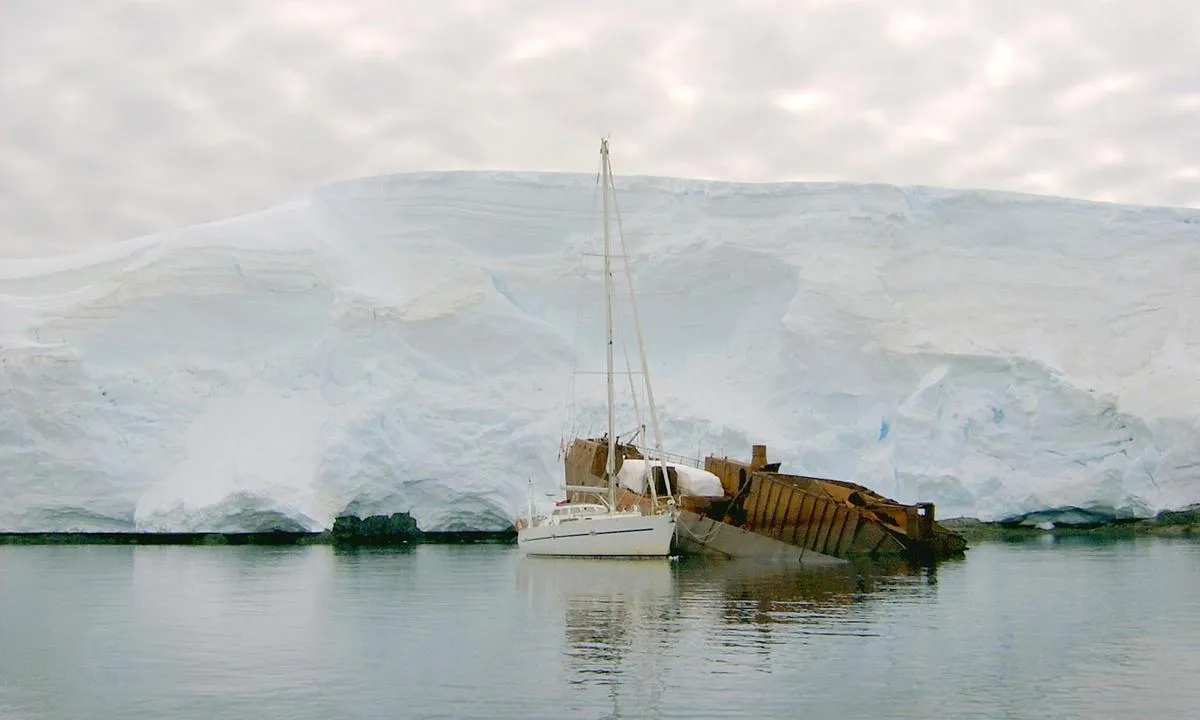
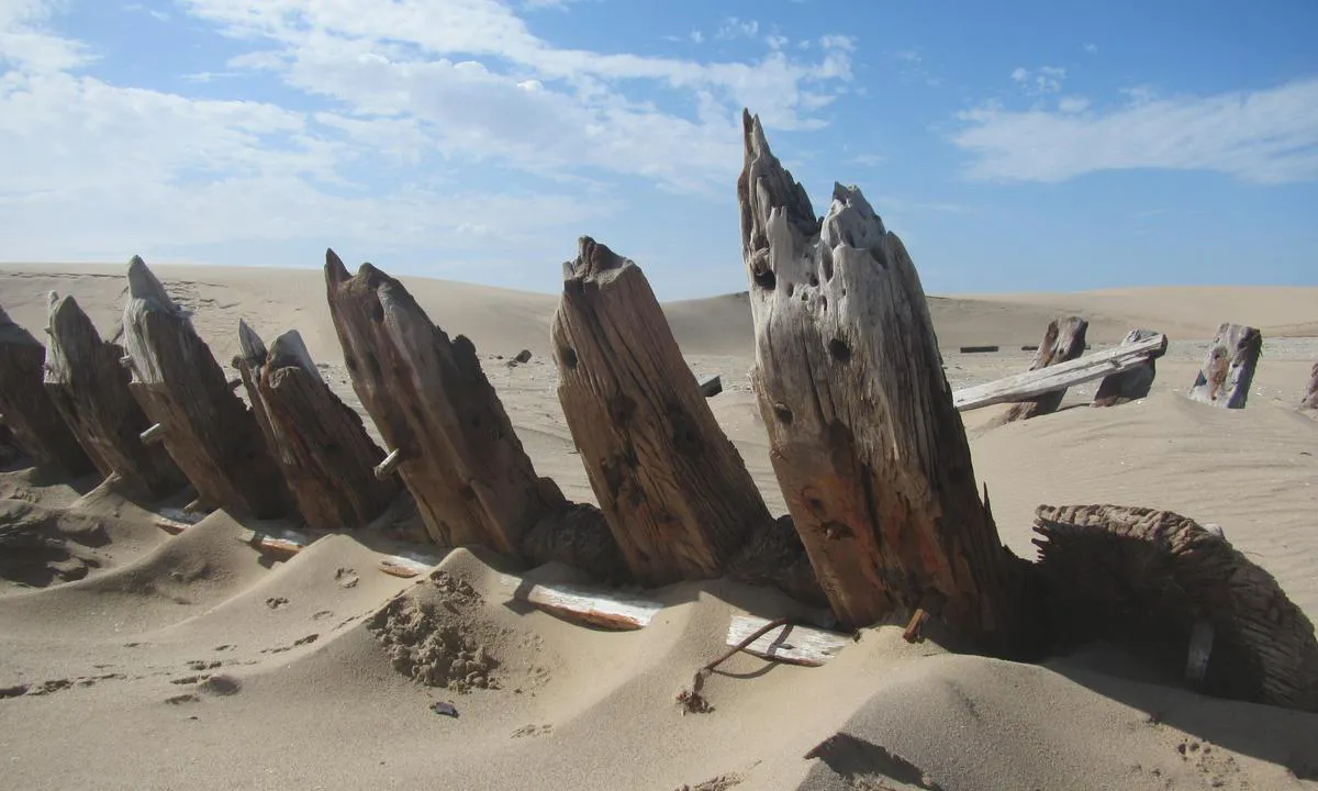
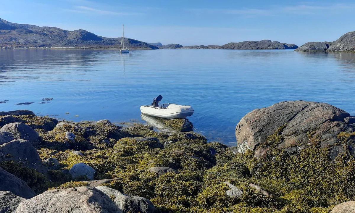
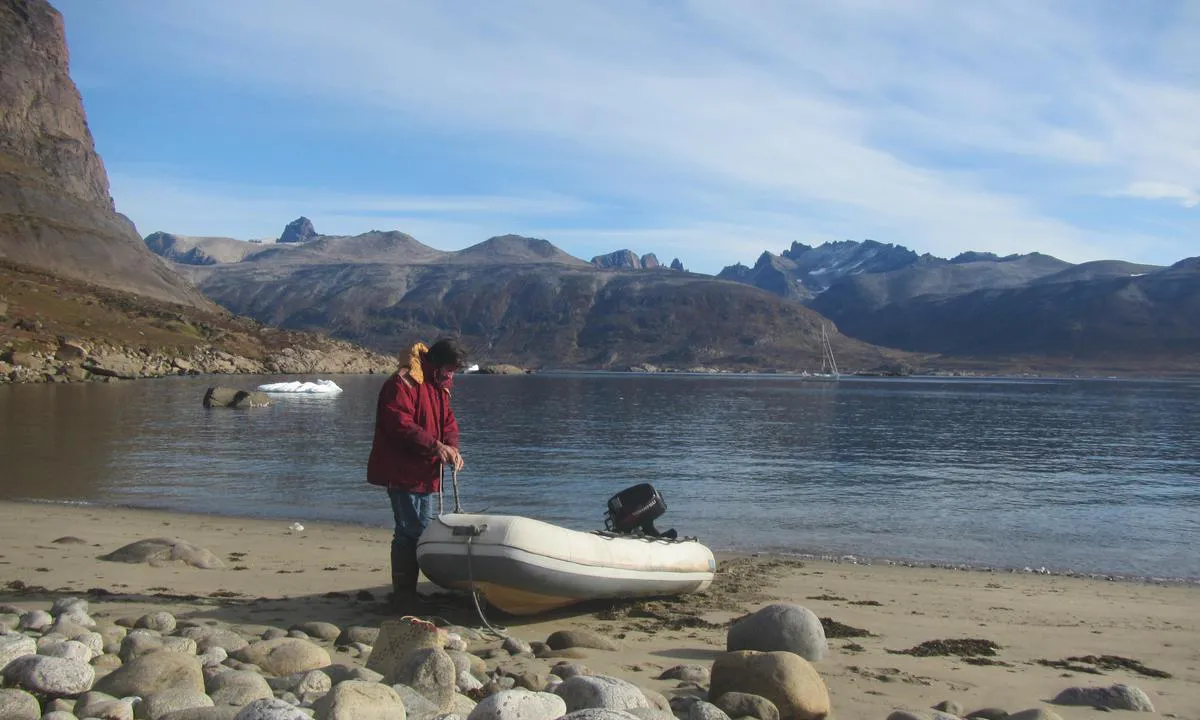
Enterprise Island (ship wreck of SS Guvernøren).
natural_harbour

3 liker bildet
Image uploaded on 28. Jul 2025
Ocean Harbour (New Fortuna Bay)
natural_harbour
2 liker bildet
Image uploaded on 26. Jul 2025
Ocean Harbour (New Fortuna Bay)
natural_harbour
2 liker bildet
Image uploaded on 26. Jul 2025
Magerøy
natural_harbour
2 liker bildet
Image uploaded on 2. Apr 2025
Magerøy
natural_harbour
2 liker bildet
Image uploaded on 2. Apr 2025
Ny-Ålesund ankringsplass
natural_harbour
2 liker bildet
Image uploaded on 12. Jun 2025
Magerøy
natural_harbour
2 liker bildet
Image uploaded on 2. Apr 2025
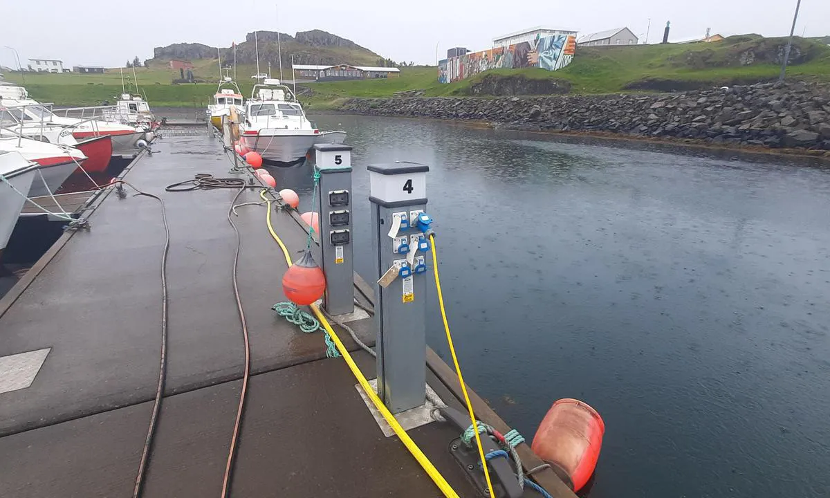
Marinepollen - Svolvær
marina
2 liker bildet
Image uploaded on 30. Apr 2025
Kangaarssuk
natural_harbour
2 liker bildet
Image uploaded on 19. May 2026
Svolværvågen
natural_harbour
2 liker bildet
Image uploaded on 30. Apr 2025
Kangaarssuk
natural_harbour
2 liker bildet
Image uploaded on 19. May 2026
Ny-Ålesund ankringsplass
natural_harbour
2 liker bildet
Image uploaded on 12. Jun 2025
Cabo de Hornos – Lighthouse anchorage
natural_harbour
2 liker bildet
Image uploaded on 25. Jul 2025
Thytur sailingclub
marina
2 liker bildet
Image uploaded on 9. Aug 2025
Mushamna
natural_harbour
2 liker bildet
Image uploaded on 22. Jun 2025
Thytur sailingclub
marina
2 liker bildet
Image uploaded on 9. Aug 2025
Kvalrossbukta - Bjørnøya
natural_harbour
2 liker bildet
Image uploaded on 7. Feb 2026
Thytur sailingclub
marina
2 liker bildet
Image uploaded on 9. Aug 2025
Kvalrossbukta - Bjørnøya
natural_harbour
2 liker bildet
Image uploaded on 7. Feb 2026
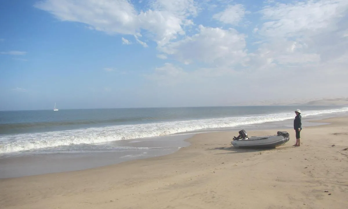
Anchorage Bay
natural_harbour
2 liker bildet
Image uploaded on 26. Jul 2025
Diesel-only pontoon
marina
2 liker bildet
Image uploaded on 6. May 2025
Anchorage Bay
natural_harbour
2 liker bildet
Image uploaded on 26. Jul 2025
Kangaamiut (old Sukkertoppen)
marina
2 liker bildet
Image uploaded on 16. Jun 2026
Diesel-only pontoon
marina
2 liker bildet
Image uploaded on 6. May 2025
Kangaamiut (old Sukkertoppen)
marina
2 liker bildet
Image uploaded on 16. Jun 2026
Diesel-only pontoon
marina
2 liker bildet
Image uploaded on 6. May 2025
Kangaamiut (old Sukkertoppen)
marina
2 liker bildet
Image uploaded on 16. Jun 2026
Reinevågen
natural_harbour
2 liker bildet
Image uploaded on 27. Apr 2025
Great Blasket
natural_harbour
2 liker bildet
Image uploaded on 21. Apr 2025
Reinevågen
natural_harbour
2 liker bildet
Image uploaded on 27. Apr 2025
Great Blasket
natural_harbour
2 liker bildet
Image uploaded on 21. Apr 2025
Reinevågen
natural_harbour
2 liker bildet
Image uploaded on 27. Apr 2025
Reinevågen
natural_harbour
2 liker bildet
Image uploaded on 27. Apr 2025
Farmhamna
natural_harbour
2 liker bildet
Image uploaded on 10. Jun 2025
Colesbukta
natural_harbour
2 liker bildet
Image uploaded on 26. May 2025
Farmhamna
natural_harbour
2 liker bildet
Image uploaded on 10. Jun 2025
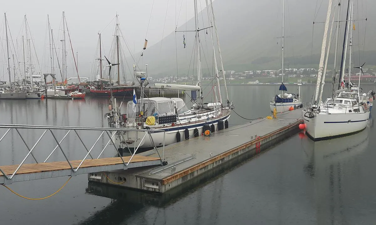
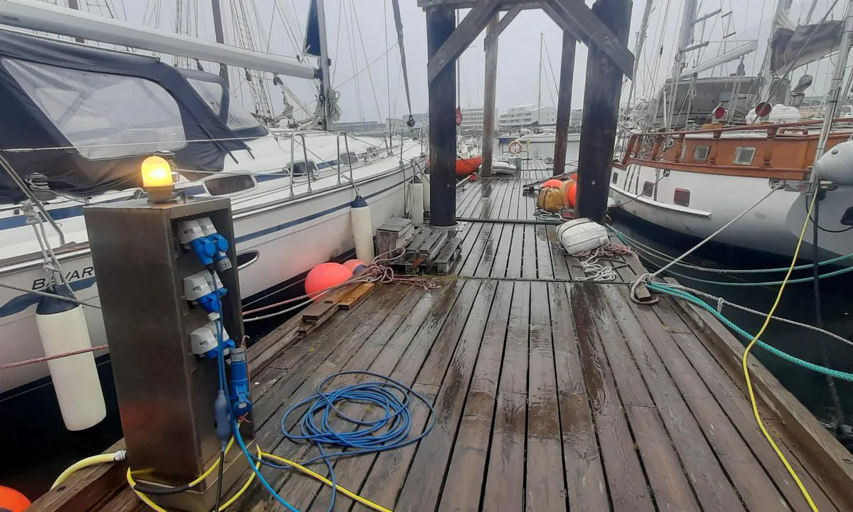
Klaksvík Harbour
marina
2 liker bildet
Image uploaded on 21. Apr 2025
Hamburgbukta
natural_harbour
2 liker bildet
Image uploaded on 27. Jun 2025
Appamiut
natural_harbour
2 liker bildet
Image uploaded on 15. Jun 2026
Housa Voe, Papa Stour
natural_harbour
2 liker bildet
Image uploaded on 21. Apr 2025
Appamiut
natural_harbour
2 liker bildet
Image uploaded on 15. Jun 2026
Housa Voe, Papa Stour
natural_harbour
2 liker bildet
Image uploaded on 21. Apr 2025
Moffen
natural_harbour
2 liker bildet
Image uploaded on 19. Jun 2025
Hamburgbukta
natural_harbour
2 liker bildet
Image uploaded on 27. Jun 2025
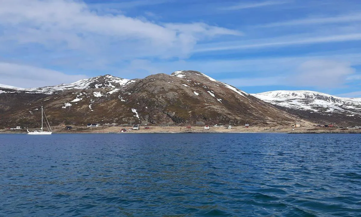
Gausvik
natural_harbour
2 liker bildet
Image uploaded on 3. May 2025
Elean A Tighe
natural_harbour
2 liker bildet
Image uploaded on 21. Apr 2025
Gausvik
natural_harbour
2 liker bildet
Image uploaded on 3. May 2025
Elean A Tighe
natural_harbour
2 liker bildet
Image uploaded on 21. Apr 2025
Hossvågen
natural_harbour
2 liker bildet
Image uploaded on 27. Mar 2025
Garbh Eilean
natural_harbour
2 liker bildet
Image uploaded on 21. Apr 2025
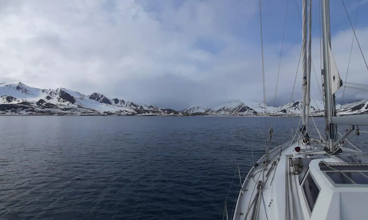
Veiðileysufjörður (upper reaches)
natural_harbour
2 liker bildet
Image uploaded on 27. Jul 2025
Tovqussaq
natural_harbour
2 liker bildet
Image uploaded on 10. Jun 2026
Lingbukta
natural_harbour
2 liker bildet
Image uploaded on 18. Jun 2025
Norskøysund
natural_harbour
2 liker bildet
Image uploaded on 25. Jun 2025
Tovqussaq
natural_harbour
2 liker bildet
Image uploaded on 10. Jun 2026
Norskøysund
natural_harbour
2 liker bildet
Image uploaded on 25. Jun 2025
Tovqussaq
natural_harbour
2 liker bildet
Image uploaded on 10. Jun 2026
Nilspollen
natural_harbour
2 liker bildet
Image uploaded on 29. Jun 2025
Tovqussaq
natural_harbour
2 liker bildet
Image uploaded on 10. Jun 2026
Tovqussaq (Inderhavn Ankerbugt)
natural_harbour
2 liker bildet
Image uploaded on 10. Jun 2026
Veiðileysufjörður (upper reaches)
natural_harbour
2 liker bildet
Image uploaded on 27. Jul 2025
Veiðileysufjörður (upper reaches)
natural_harbour
2 liker bildet
Image uploaded on 27. Jul 2025
Paamiut
marina
2 liker bildet
Image uploaded on 26. May 2026
Trinityhamna
natural_harbour
2 liker bildet
Image uploaded on 25. Jun 2025
Paamiut
marina
2 liker bildet
Image uploaded on 26. May 2026
Trinityhamna
natural_harbour
2 liker bildet
Image uploaded on 25. Jun 2025
Trinityhamna
natural_harbour
2 liker bildet
Image uploaded on 25. Jun 2025
Paamiut
marina
2 liker bildet
Image uploaded on 26. May 2026
Signehamna
natural_harbour
2 liker bildet
Image uploaded on 29. Jun 2025
Signehamna
natural_harbour
2 liker bildet
Image uploaded on 29. Jun 2025
Josephbukta
natural_harbour
2 liker bildet
Image uploaded on 21. May 2025
Kangaarssuk
natural_harbour
2 liker bildet
Image uploaded on 20. May 2026
Ebeltofthamna
natural_harbour
2 liker bildet
Image uploaded on 27. Jun 2025
Ebeltofthamna
natural_harbour
2 liker bildet
Image uploaded on 27. Jun 2025
Signehamna
natural_harbour

2 liker bildet
Image uploaded on 29. Jun 2025
Josephbukta
natural_harbour
2 liker bildet
Image uploaded on 21. May 2025
Virgohamna
natural_harbour
2 liker bildet
Image uploaded on 16. Jun 2025
Crique aux Bœufs Lamentins
natural_harbour
2 liker bildet
Image uploaded on 5. Aug 2025
Gåshamna
natural_harbour
2 liker bildet
Image uploaded on 18. May 2025
N-Ramsøy
natural_harbour
2 liker bildet
Image uploaded on 4. Apr 2025
Sallyhamna
natural_harbour
2 liker bildet
Image uploaded on 17. Jun 2025
Sallyhamna
natural_harbour
2 liker bildet
Image uploaded on 17. Jun 2025
Sallyhamna
natural_harbour
2 liker bildet
Image uploaded on 17. Jun 2025
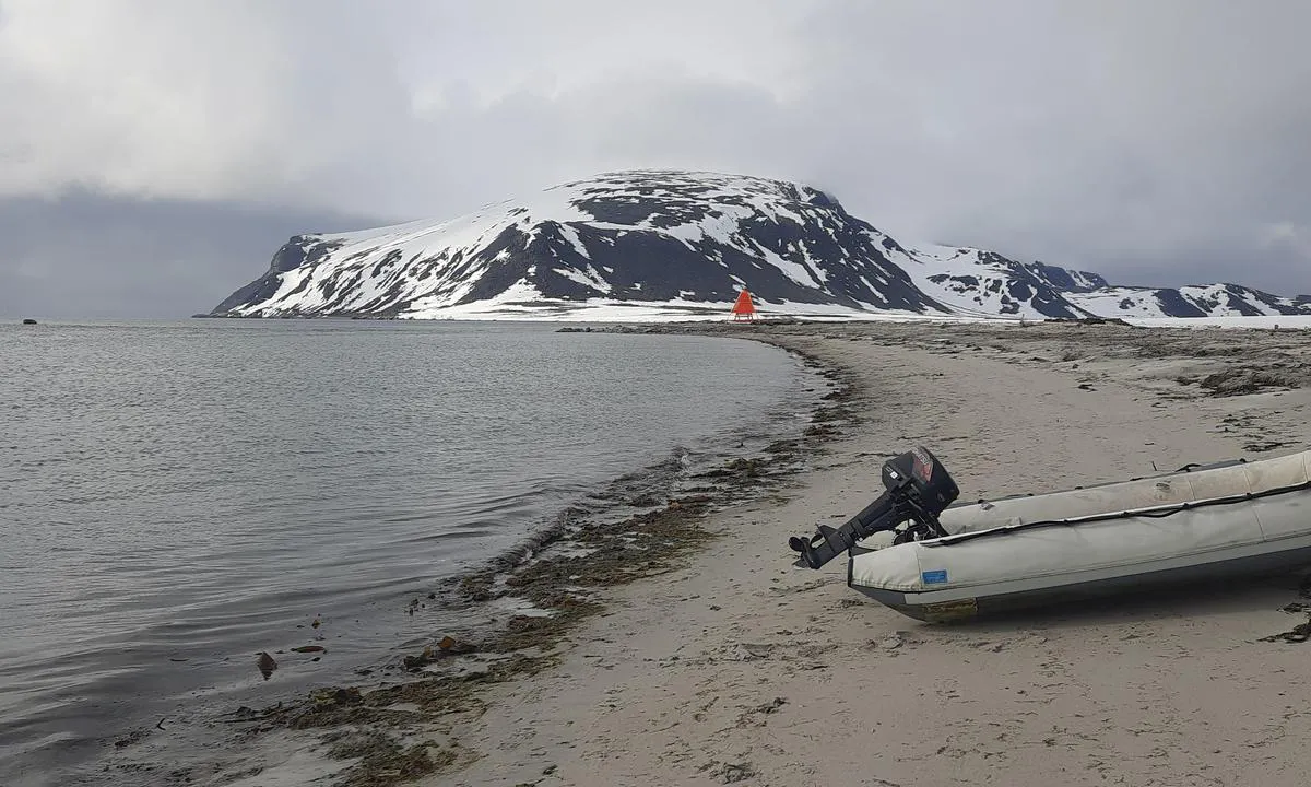
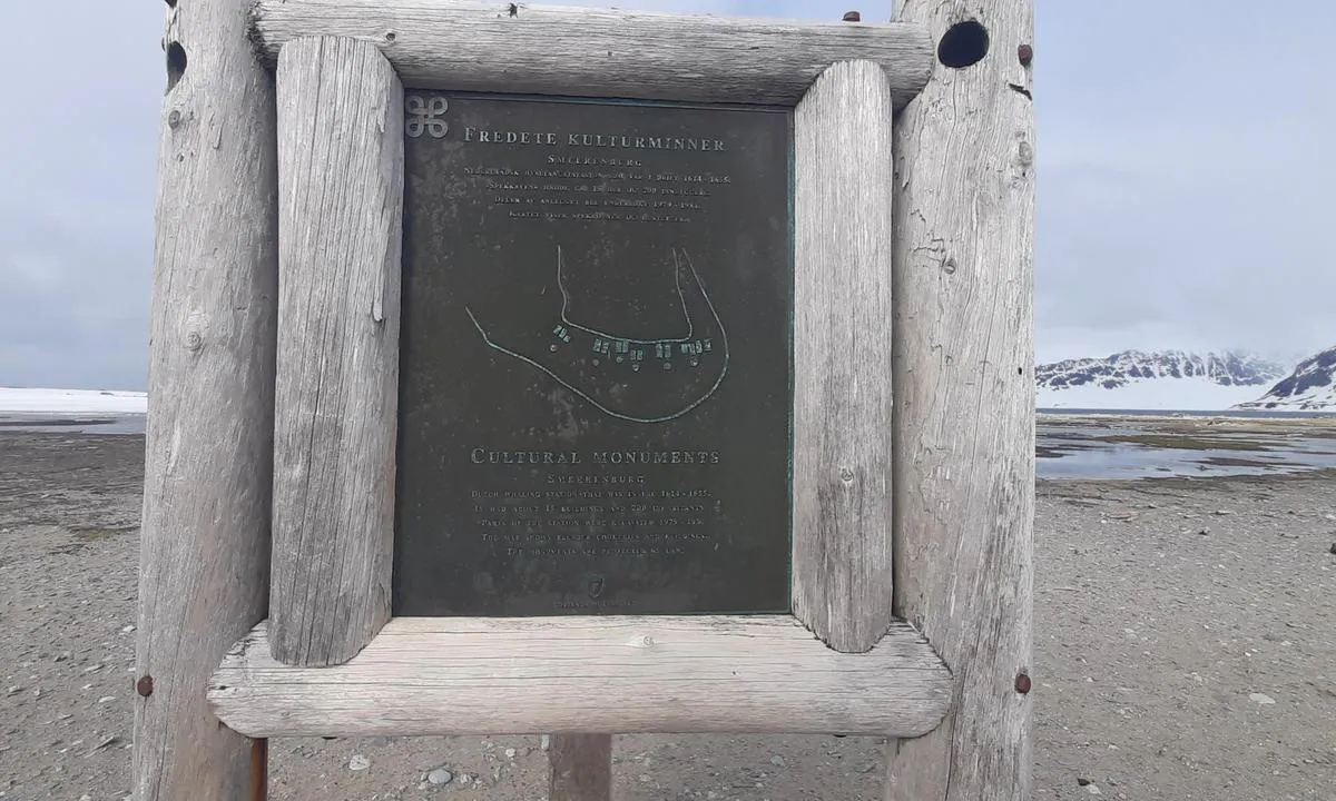
South Smeerenbukta
natural_harbour
2 liker bildet
Image uploaded on 16. Jun 2025
South Smeerenbukta
natural_harbour
2 liker bildet
Image uploaded on 16. Jun 2025
Enterprise Island (ship wreck of SS Guvernøren).
natural_harbour
2 liker bildet
Image uploaded on 28. Jul 2025
Port Charcot - Booth Island
natural_harbour
2 liker bildet
Image uploaded on 28. Jul 2025
Port Charcot - Booth Island
natural_harbour
2 liker bildet
Image uploaded on 28. Jul 2025
Zululand Yacht Club, Richards Bay
marina
2 liker bildet
Image uploaded on 12. Apr 2025
Ramsøyholmen
natural_harbour
2 liker bildet
Image uploaded on 3. Apr 2025
Vestervågen
natural_harbour
2 liker bildet
Image uploaded on 23. May 2025
Kobbefjorden
natural_harbour
2 liker bildet
Image uploaded on 13. Jun 2025
Krossbukta
natural_harbour
2 liker bildet
Image uploaded on 14. Jul 2025
Nordbukta
natural_harbour
2 liker bildet
Image uploaded on 14. Jul 2025
Yankee Harbour
natural_harbour
2 liker bildet
Image uploaded on 27. Jul 2025
Tálknafjörður höfn
marina
2 liker bildet
Image uploaded on 29. Jul 2025
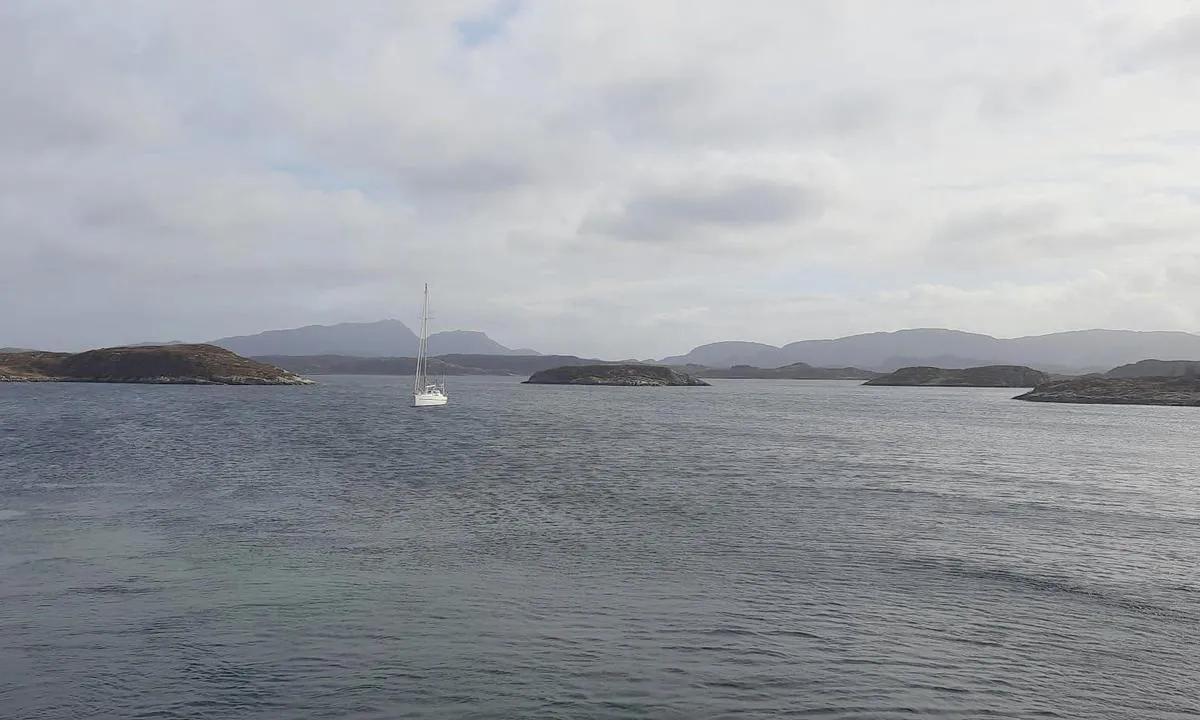
Reykjavik - Brokey
marina

2 liker bildet
Image uploaded on 19. Aug 2025
Fatutaka Island (Mitre Island)
natural_harbour
2 liker bildet
Image uploaded on 4. Aug 2025
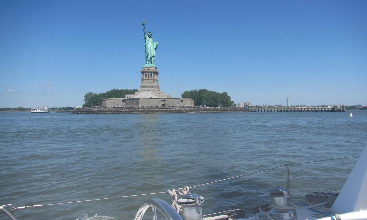
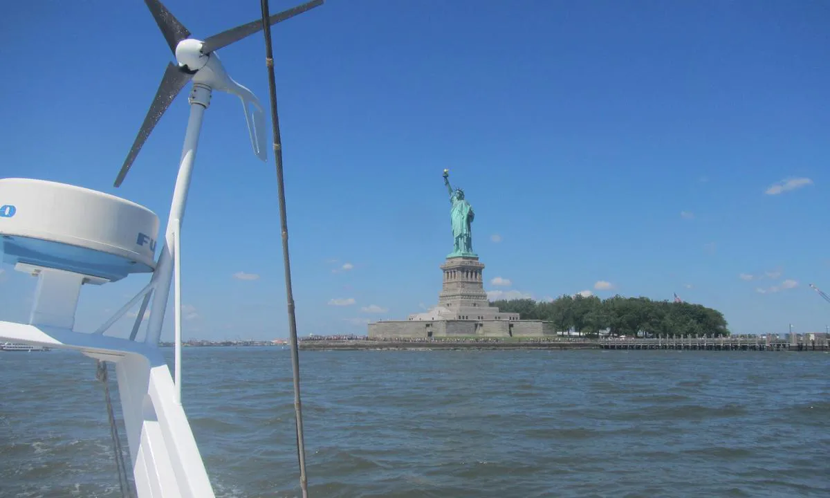
Statue of Liberty Anchorage
natural_harbour
2 liker bildet
Image uploaded on 5. Aug 2025
Qaqortoq
marina
2 liker bildet
Image uploaded on 29. May 2026
Ymerbukta
natural_harbour
2 liker bildet
Image uploaded on 9. Jun 2025
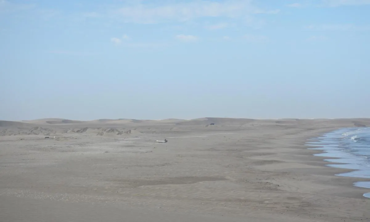
Ocean Harbour (New Fortuna Bay)
natural_harbour
2 liker bildet
Image uploaded on 26. Jul 2025
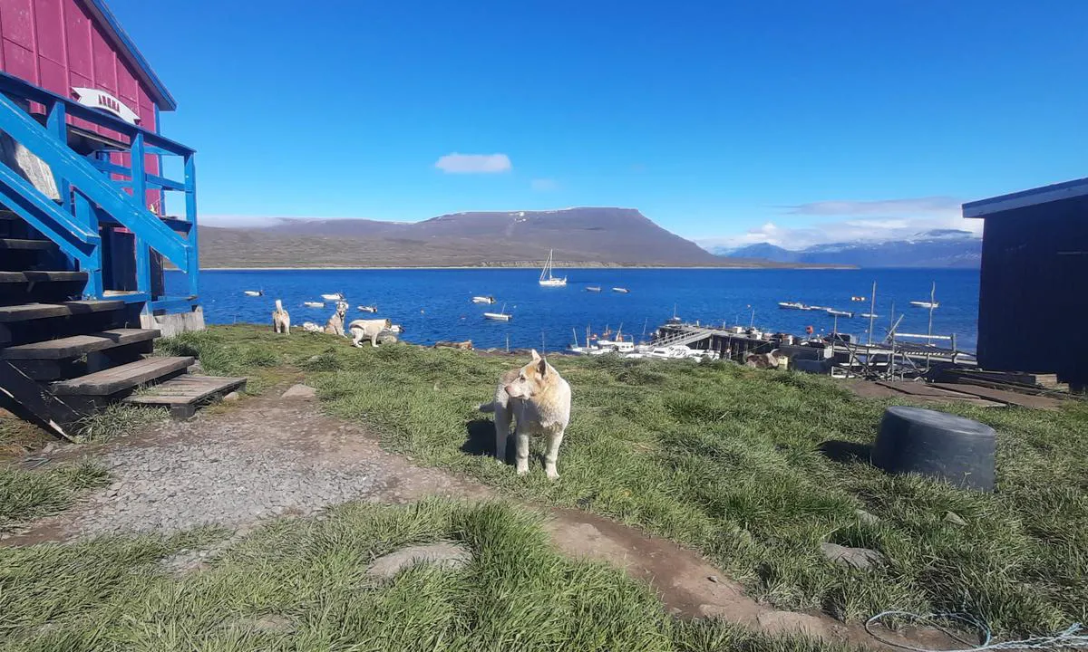
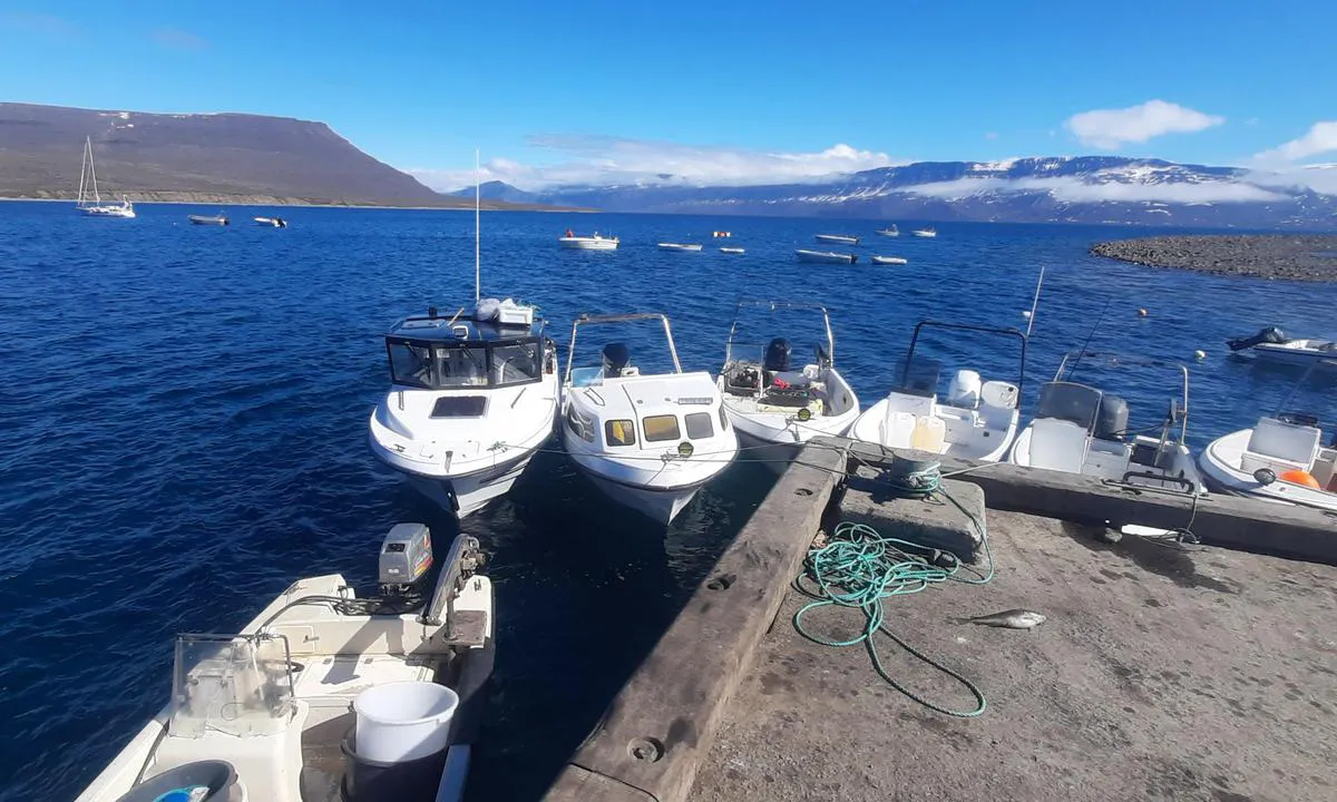
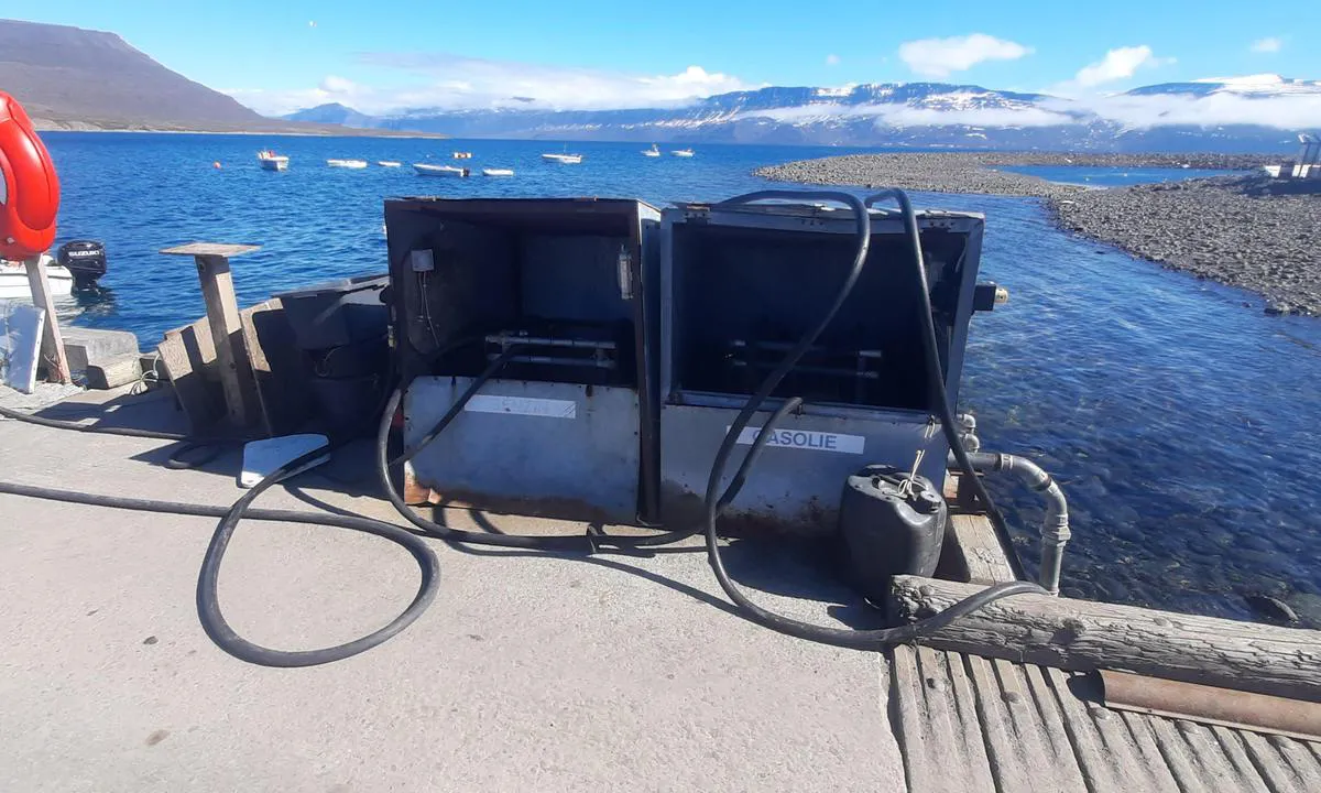
Ísafjörður
marina
1 liker bildet
Image uploaded on 22. Jul 2025
Djúpivogur
marina
1 liker bildet
Image uploaded on 7. Sep 2025
Ísafjörður
marina
1 liker bildet
Image uploaded on 22. Jul 2025
Djúpivogur
marina
1 liker bildet
Image uploaded on 7. Sep 2025
Simiutaq (Denmark) Close
natural_harbour
1 liker bildet
Image uploaded on 11. May 2026
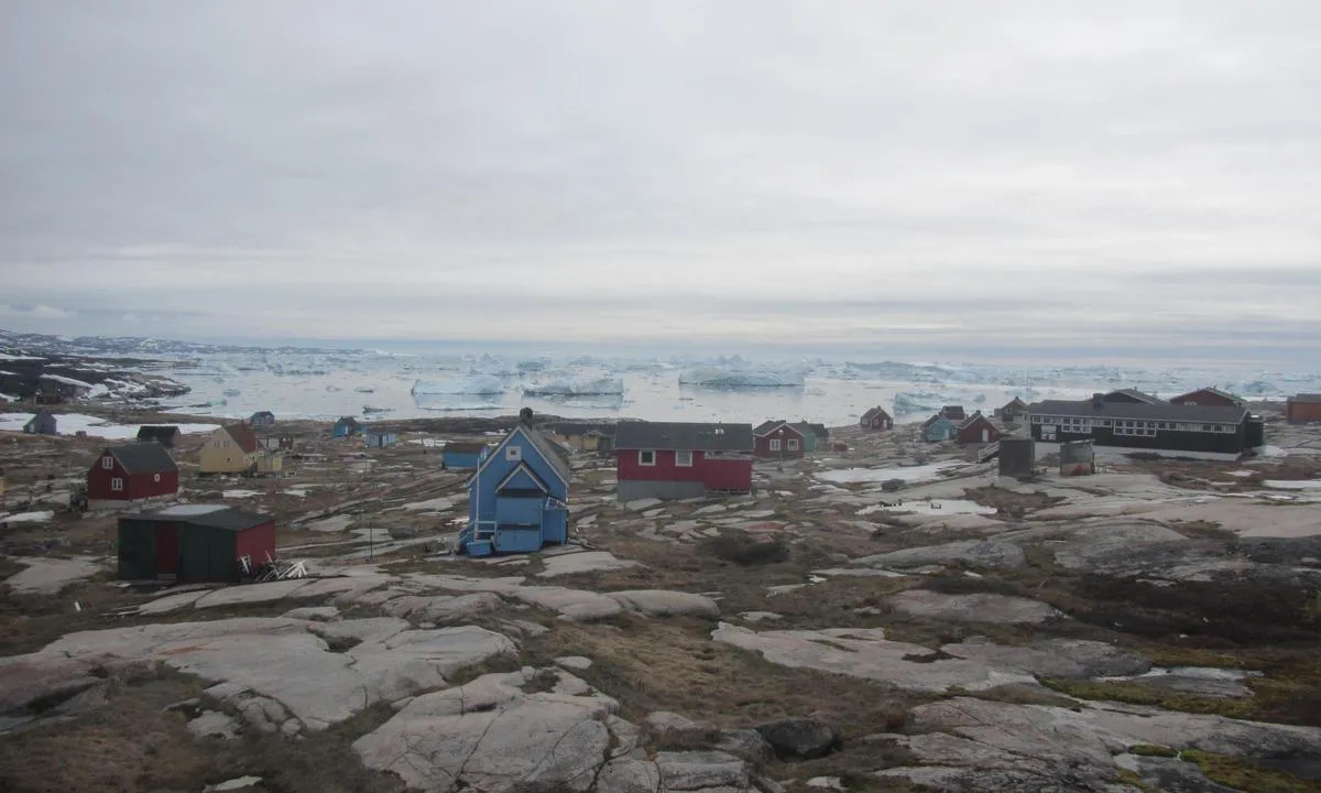
Qeqertarsuaq (Godhavn)
natural_harbour
1 liker bildet
Image uploaded on 25. Jun 2026
Qeqertarsuaq (Godhavn)
natural_harbour
1 liker bildet
Image uploaded on 25. Jun 2026
Qeqertarsuaq (Godhavn)
natural_harbour
1 liker bildet
Image uploaded on 25. Jun 2026
Cabo de Hornos – Lighthouse anchorage
natural_harbour
1 liker bildet
Image uploaded on 25. Jul 2025
Cabo de Hornos – Lighthouse anchorage
natural_harbour
1 liker bildet
Image uploaded on 25. Jul 2025
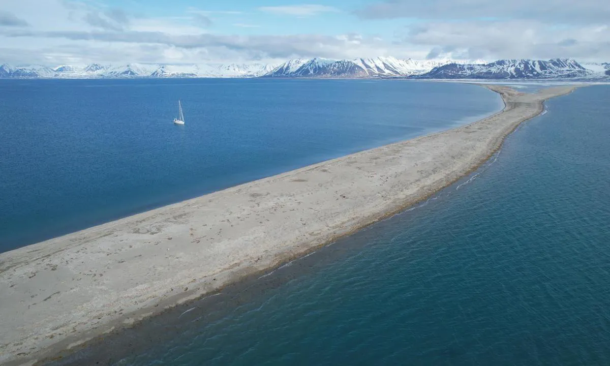
Sarstangen nord
natural_harbour
1 liker bildet
Image uploaded on 11. Jun 2025
Sarstangen nord
natural_harbour
1 liker bildet
Image uploaded on 11. Jun 2025
Mushamna
natural_harbour
1 liker bildet
Image uploaded on 22. Jun 2025
Værøy i Lofoten
natural_harbour
1 liker bildet
Image uploaded on 24. Apr 2025
Mushamna
natural_harbour
1 liker bildet
Image uploaded on 22. Jun 2025
Kvalrossbukta - Bjørnøya
natural_harbour
1 liker bildet
Image uploaded on 7. Feb 2026
Anchorage Bay
natural_harbour
1 liker bildet
Image uploaded on 26. Jul 2025
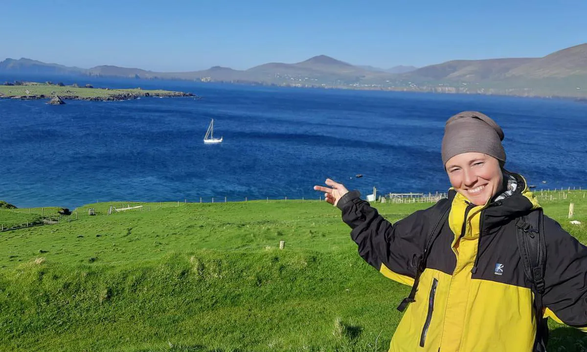
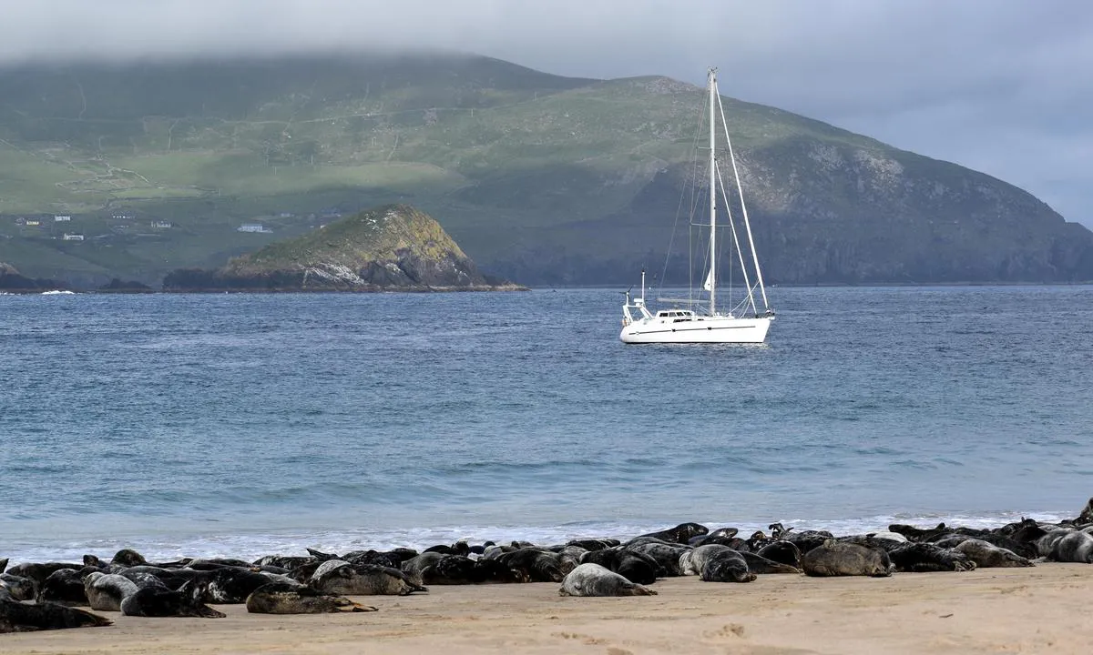
Great Blasket
natural_harbour
1 liker bildet
Image uploaded on 21. Apr 2025
Hamburgbukta
natural_harbour
1 liker bildet
Image uploaded on 27. Jun 2025
Garbh Eilean
natural_harbour
1 liker bildet
Image uploaded on 21. Apr 2025
Garbh Eilean
natural_harbour
1 liker bildet
Image uploaded on 21. Apr 2025
Lingbukta
natural_harbour
1 liker bildet
Image uploaded on 18. Jun 2025
Hestøya - Vinsternes
natural_harbour
1 liker bildet
Image uploaded on 7. Apr 2025
Kangerlua (Ravns Storø Harbour)
natural_harbour
1 liker bildet
Image uploaded on 31. May 2026
Kangerlua (Ravns Storø Harbour)
natural_harbour
1 liker bildet
Image uploaded on 31. May 2026
Kangerlua (Ravns Storø Harbour)
natural_harbour
1 liker bildet
Image uploaded on 31. May 2026
Barentsburg ankringsplass
natural_harbour
1 liker bildet
Image uploaded on 4. Jul 2025
Barentsburg ankringsplass
natural_harbour
1 liker bildet
Image uploaded on 4. Jul 2025
Barentsburg ankringsplass
natural_harbour
1 liker bildet
Image uploaded on 4. Jul 2025
Ebeltofthamna
natural_harbour
1 liker bildet
Image uploaded on 29. Jun 2025
Virgohamna
natural_harbour
1 liker bildet
Image uploaded on 16. Jun 2025
Ebeltofthamna
natural_harbour
1 liker bildet
Image uploaded on 29. Jun 2025
Virgohamna
natural_harbour
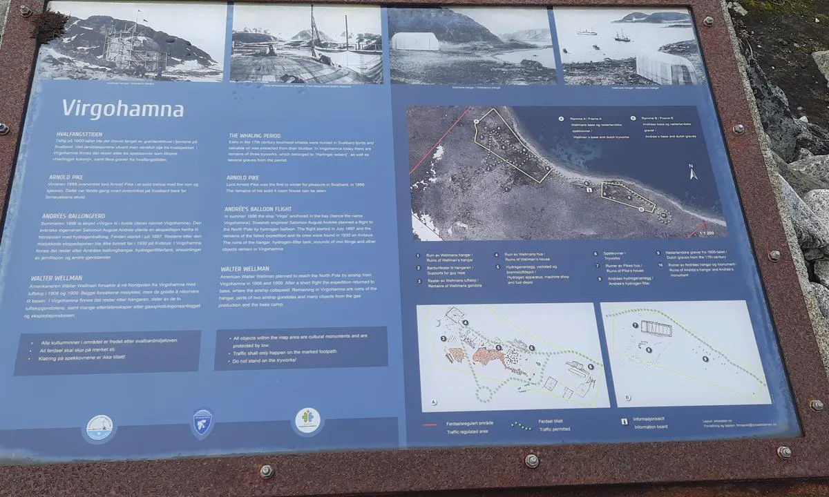
1 liker bildet
Image uploaded on 16. Jun 2025
Port of Akureyri
marina

1 liker bildet
Image uploaded on 7. Sep 2025
Port of Akureyri
marina
1 liker bildet
Image uploaded on 7. Sep 2025
Crique aux Bœufs Lamentins
natural_harbour
1 liker bildet
Image uploaded on 5. Aug 2025
Gåshamna
natural_harbour
1 liker bildet
Image uploaded on 18. May 2025
Baadeløb
natural_harbour
1 liker bildet
Image uploaded on 23. Jun 2026
Crique aux Bœufs Lamentins
natural_harbour
1 liker bildet
Image uploaded on 5. Aug 2025
Gåshamna
natural_harbour
1 liker bildet
Image uploaded on 18. May 2025
Småbåthamna, Longyearbyen
natural_harbour
1 liker bildet
Image uploaded on 5. Jun 2025
N-Ramsøy
natural_harbour
1 liker bildet
Image uploaded on 4. Apr 2025
Barentsburg
marina
1 liker bildet
Image uploaded on 4. Jul 2025
N-Ramsøy
natural_harbour
1 liker bildet
Image uploaded on 4. Apr 2025
Appat (Ritenbenk)
natural_harbour
1 liker bildet
Image uploaded on 30. Jun 2026
Svolværvågen
natural_harbour
1 liker bildet
Image uploaded on 29. Apr 2025
Appat (Ritenbenk)
natural_harbour
1 liker bildet
Image uploaded on 30. Jun 2026
Svolværvågen
natural_harbour
1 liker bildet
Image uploaded on 29. Apr 2025
Evenskjær
marina
1 liker bildet
Image uploaded on 2. May 2025
Evenskjær
marina
1 liker bildet
Image uploaded on 2. May 2025
Evenskjær
marina
1 liker bildet
Image uploaded on 2. May 2025
lmerigssoq
natural_harbour
1 liker bildet
Image uploaded on 23. Jun 2026
Nuussuaq (Bjørnefæld)
natural_harbour
1 liker bildet
Image uploaded on 2. Jul 2026
Evenskjær
marina
1 liker bildet
Image uploaded on 2. May 2025
Smallesund (Ikerasaarsunnguaq)
natural_harbour
1 liker bildet
Image uploaded on 20. May 2026
Atammik
marina
1 liker bildet
Image uploaded on 9. Jun 2026
Baadeløb
natural_harbour
1 liker bildet
Image uploaded on 23. Jun 2026
Evenskjær - Evenskjer
natural_harbour
1 liker bildet
Image uploaded on 2. May 2025
Hestøy
natural_harbour
1 liker bildet
Image uploaded on 5. May 2025
Kangerluluk (Ravns Storø Noth Harbour)
natural_harbour
1 liker bildet
Image uploaded on 31. May 2026
Hestøy
natural_harbour
1 liker bildet
Image uploaded on 5. May 2025
Baadeløb
natural_harbour
1 liker bildet
Image uploaded on 23. Jun 2026
Kangerluluk (Ravns Storø Noth Harbour)
natural_harbour
1 liker bildet
Image uploaded on 31. May 2026
lmerigssoq
natural_harbour
1 liker bildet
Image uploaded on 23. Jun 2026
Hamna Voe
natural_harbour
1 liker bildet
Image uploaded on 29. Apr 2025
Gipsvika, Sassenfjord
natural_harbour
1 liker bildet
Image uploaded on 5. Jun 2025
Kangerluluk (Ravns Storø Noth Harbour)
natural_harbour
1 liker bildet
Image uploaded on 31. May 2026
Kangaatsiaq
marina
1 liker bildet
Image uploaded on 21. Jun 2026
Hamna Voe
natural_harbour
1 liker bildet
Image uploaded on 29. Apr 2025
Kangaatsiaq
marina
1 liker bildet
Image uploaded on 21. Jun 2026
Kangaatsiaq
marina
1 liker bildet
Image uploaded on 21. Jun 2026
Ilulissat
marina
1 liker bildet
Image uploaded on 4. Jul 2026
Småbåthamna, Longyearbyen
natural_harbour
1 liker bildet
Image uploaded on 4. Jun 2025
South Smeerenbukta
natural_harbour
1 liker bildet
Image uploaded on 16. Jun 2025
South Smeerenbukta
natural_harbour
1 liker bildet
Image uploaded on 16. Jun 2025
Tálknafjörður
natural_harbour
1 liker bildet
Image uploaded on 30. Jul 2025
Sand Voe
natural_harbour
1 liker bildet
Image uploaded on 29. Apr 2025
Sand Voe
natural_harbour
1 liker bildet
Image uploaded on 29. Apr 2025
Tálknafjörður
natural_harbour

1 liker bildet
Image uploaded on 30. Jul 2025
Tálknafjörður höfn
marina

1 liker bildet
Image uploaded on 30. Jul 2025
Nuussuaq (Bjørnefæld)
natural_harbour
1 liker bildet
Image uploaded on 2. Jul 2026
Tálknafjörður höfn
marina
1 liker bildet
Image uploaded on 30. Jul 2025
Sand Voe
natural_harbour
1 liker bildet
Image uploaded on 29. Apr 2025
Smallesund (Ikerasaarsunnguaq)
natural_harbour
1 liker bildet
Image uploaded on 21. May 2026
Ilulissat
marina
1 liker bildet
Image uploaded on 2. Jul 2026
Ilulissat
marina
1 liker bildet
Image uploaded on 2. Jul 2026
Hottentot Bay
natural_harbour
1 liker bildet
Image uploaded on 5. Aug 2025
Hottentot Bay
natural_harbour
1 liker bildet
Image uploaded on 5. Aug 2025
Oqaatsut
natural_harbour
1 liker bildet
Image uploaded on 2. Jul 2026
Oqaatsut
natural_harbour
1 liker bildet
Image uploaded on 2. Jul 2026
Avigait
natural_harbour
1 liker bildet
Image uploaded on 29. May 2026
Hottentot Bay
natural_harbour
1 liker bildet
Image uploaded on 5. Aug 2025
Linesøya - Rødøya
natural_harbour
1 liker bildet
Image uploaded on 12. Apr 2025
Linesøya - Rødøya
natural_harbour
1 liker bildet
Image uploaded on 12. Apr 2025
Hottentot Bay
natural_harbour
1 liker bildet
Image uploaded on 5. Aug 2025
Rørøya
natural_harbour
1 liker bildet
Image uploaded on 15. Apr 2025
Rørøya
natural_harbour
1 liker bildet
Image uploaded on 15. Apr 2025
Tunulliatsiaap Nunaa
natural_harbour
1 liker bildet
Image uploaded on 13. May 2026
Thytur sailingclub
marina
1 liker bildet
Image uploaded on 20. May 2026
Hestøya - Vinsternes
natural_harbour
1 liker bildet
Image uploaded on 6. Apr 2025
Rørøya
natural_harbour
1 liker bildet
Image uploaded on 15. Apr 2025
Båtnes - Vega
natural_harbour
1 liker bildet
Image uploaded on 15. Apr 2025
Hestøya - Vinsternes
natural_harbour
1 liker bildet
Image uploaded on 6. Apr 2025
Båtnes - Vega
natural_harbour
1 liker bildet
Image uploaded on 15. Apr 2025
Zululand Yacht Club, Richards Bay
marina
1 liker bildet
Image uploaded on 12. Apr 2025
Zululand Yacht Club, Richards Bay
marina
1 liker bildet
Image uploaded on 12. Apr 2025
Tunulliatsiaap Nunaa
natural_harbour
1 liker bildet
Image uploaded on 13. May 2026
Tunulliatsiaap Nunaa
natural_harbour
1 liker bildet
Image uploaded on 13. May 2026
Veiðileysufjörður (upper reaches)
natural_harbour
1 liker bildet
Image uploaded on 29. Jul 2025
Ramsøyholmen
natural_harbour
1 liker bildet
Image uploaded on 3. Apr 2025
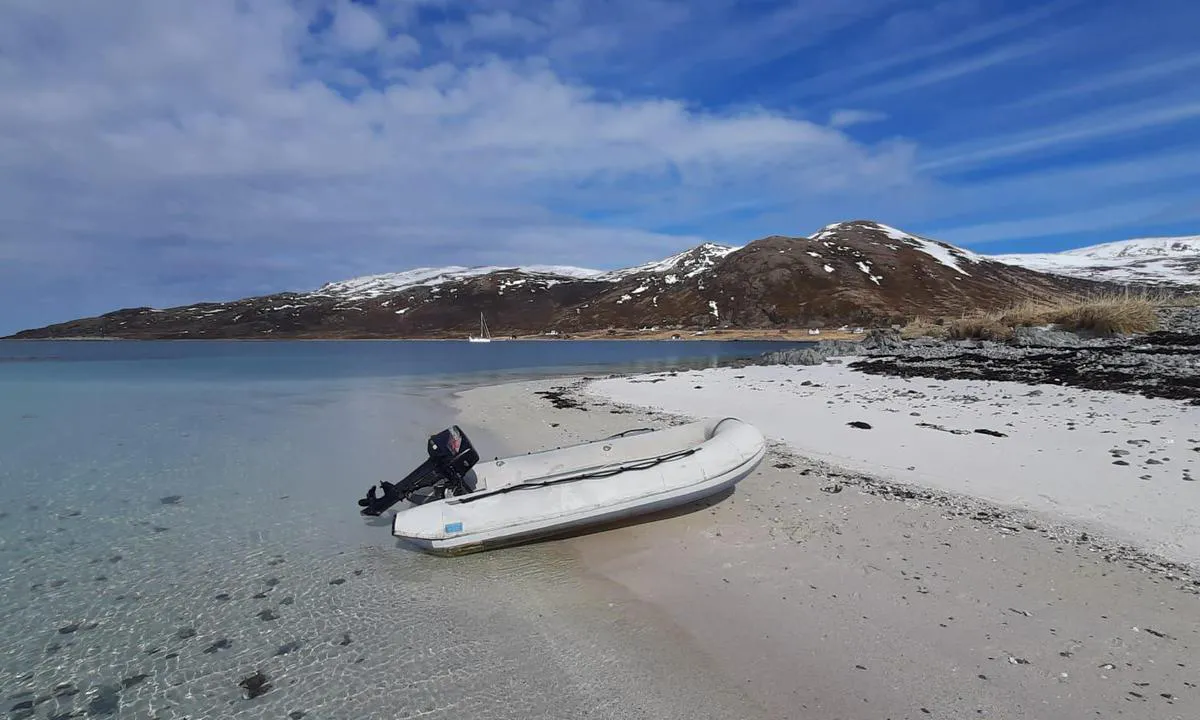
Sanden, Måstadvika
natural_harbour
1 liker bildet
Image uploaded on 25. Apr 2025
Arsuk
marina
1 liker bildet
Image uploaded on 17. May 2026
Avigait
natural_harbour
1 liker bildet
Image uploaded on 29. May 2026
Værøy i Lofoten
natural_harbour

1 liker bildet
Image uploaded on 25. Apr 2025
Avigait
natural_harbour
1 liker bildet
Image uploaded on 29. May 2026
Marraat Ikerat
natural_harbour
1 liker bildet
Image uploaded on 2. Jun 2026
Marraat Ikerat
natural_harbour
1 liker bildet
Image uploaded on 2. Jun 2026
Arsuk
marina
1 liker bildet
Image uploaded on 17. May 2026
North Marraaq
natural_harbour
1 liker bildet
Image uploaded on 2. Jun 2026
Krossbukta
natural_harbour
1 liker bildet
Image uploaded on 14. Jul 2025
Sandgerðisbót - Akureyri
marina
1 liker bildet
Image uploaded on 8. Sep 2025
North Marraaq
natural_harbour
1 liker bildet
Image uploaded on 2. Jun 2026
Sandgerðisbót - Akureyri
marina
1 liker bildet
Image uploaded on 8. Sep 2025
Kobbefjorden
natural_harbour
1 liker bildet
Image uploaded on 13. Jun 2025
Myken på Svai
natural_harbour
1 liker bildet
Image uploaded on 19. Apr 2025
Arsuk
marina
1 liker bildet
Image uploaded on 17. May 2026
Tálknafjörður höfn
marina
1 liker bildet
Image uploaded on 29. Jul 2025
Arsuk
marina
1 liker bildet
Image uploaded on 17. May 2026
Qeqertarsuaq (Godhavn)
natural_harbour
1 liker bildet
Image uploaded on 29. Jun 2026
Appat (Ritenbenk)
natural_harbour
1 liker bildet
Image uploaded on 30. Jun 2026
Krossbukta
natural_harbour
1 liker bildet
Image uploaded on 14. Jul 2025
Myken på Svai
natural_harbour
1 liker bildet
Image uploaded on 19. Apr 2025
Vestervågen
natural_harbour
1 liker bildet
Image uploaded on 23. Feb 2026
Vestervågen
natural_harbour
1 liker bildet
Image uploaded on 23. Feb 2026
Gunhildvågen - Florø
natural_harbour
1 liker bildet
Image uploaded on 28. Mar 2025
Midterhukhamna - Svalbard
natural_harbour
1 liker bildet
Image uploaded on 23. Feb 2026
Leirvik
marina
1 liker bildet
Image uploaded on 19. Apr 2025
Midterhukhamna - Svalbard
natural_harbour
1 liker bildet
Image uploaded on 23. Feb 2026
Leirvik
marina
1 liker bildet
Image uploaded on 19. Apr 2025
Leirvik
marina
1 liker bildet
Image uploaded on 19. Apr 2025
Russevåg
natural_harbour
1 liker bildet
Image uploaded on 4. May 2025
Narsaq Kujalleq (Frederiksdal)
marina
1 liker bildet
Image uploaded on 24. Jul 2025
Reykjavik - Brokey
marina
1 liker bildet
Image uploaded on 19. Aug 2025
Russevåg
natural_harbour
1 liker bildet
Image uploaded on 4. May 2025
Narsaq Kujalleq (Frederiksdal)
marina
1 liker bildet
Image uploaded on 24. Jul 2025
Reykjavik - Brokey
marina
1 liker bildet
Image uploaded on 19. Aug 2025
Lopra
natural_harbour
1 liker bildet
Image uploaded on 19. Apr 2025
Russevåg
natural_harbour
1 liker bildet
Image uploaded on 4. May 2025
Reykjavik - Brokey
marina
1 liker bildet
Image uploaded on 19. Aug 2025
Russevåg
natural_harbour
1 liker bildet
Image uploaded on 4. May 2025
Reykjavik - Brokey
marina
1 liker bildet
Image uploaded on 19. Aug 2025
Vágur
natural_harbour
1 liker bildet
Image uploaded on 19. Apr 2025
Miõvágur
natural_harbour
1 liker bildet
Image uploaded on 15. Apr 2025
Tvøroyri
natural_harbour
1 liker bildet
Image uploaded on 19. Apr 2025
Nordbukta
natural_harbour
1 liker bildet
Image uploaded on 13. Jul 2025
Sisimiut (Holsteinborg)
marina
1 liker bildet
Image uploaded on 19. Jun 2026
Statue of Liberty Anchorage
natural_harbour
1 liker bildet
Image uploaded on 5. Aug 2025
Sisimiut (Holsteinborg)
marina
1 liker bildet
Image uploaded on 19. Jun 2026
Statue of Liberty Anchorage
natural_harbour
1 liker bildet
Image uploaded on 5. Aug 2025
Sisimiut (Holsteinborg)
marina
1 liker bildet
Image uploaded on 19. Jun 2026
Statue of Liberty Anchorage
natural_harbour
1 liker bildet
Image uploaded on 5. Aug 2025
Børøypollen
natural_harbour
1 liker bildet
Image uploaded on 25. Mar 2025
Miõvágur
natural_harbour
1 liker bildet
Image uploaded on 15. Apr 2025
Qeqertarsuaq (Godhavn)
natural_harbour
1 liker bildet
Image uploaded on 27. Jun 2026
Colesbukta
natural_harbour
1 liker bildet
Image uploaded on 27. May 2025
Qeqertarsuaq (Godhavn)
natural_harbour
1 liker bildet
Image uploaded on 27. Jun 2026
Colesbukta
natural_harbour
1 liker bildet
Image uploaded on 27. May 2025
Ísafjörður Pollur
marina
1 liker bildet
Image uploaded on 22. Jul 2025
Appamiut Eastern Bay
natural_harbour
1 liker bildet
Image uploaded on 14. Jun 2026
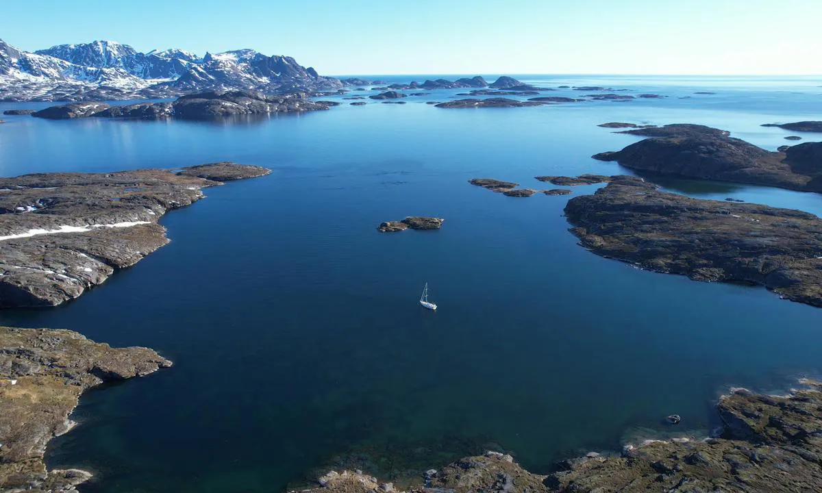
Aorrussaarssuk
natural_harbour
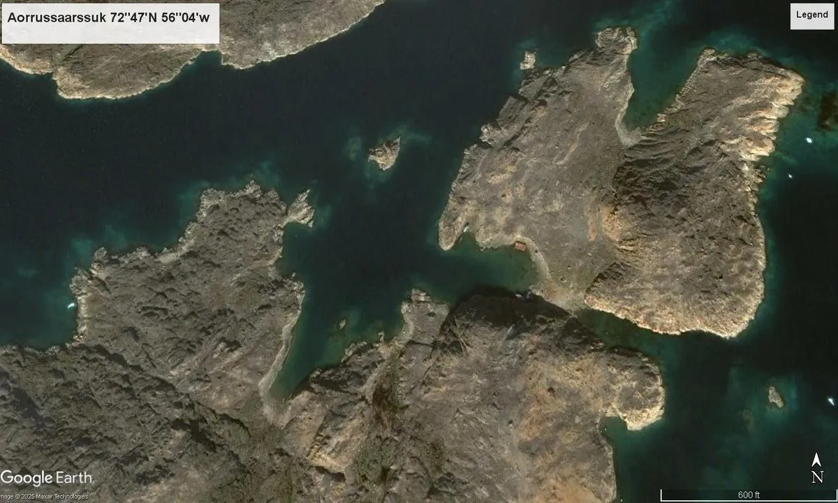
1 liker bildet
Image uploaded on 25. Jul 2025
Qaqortoq
marina
1 liker bildet
Image uploaded on 29. May 2026
Appamiut Eastern Bay
natural_harbour
1 liker bildet
Image uploaded on 14. Jun 2026
Ísafjörður Pollur
marina
1 liker bildet
Image uploaded on 22. Jul 2025
Kangaarssuk
natural_harbour
1 liker bildet
Image uploaded on 19. May 2026
Ísafjörður Pollur
marina
1 liker bildet
Image uploaded on 22. Jul 2025
Aorrussaarssuk
natural_harbour
1 liker bildet
Image uploaded on 25. Jul 2025
Ísafjörður Pollur
marina
1 liker bildet
Image uploaded on 22. Jul 2025
Aorrussaarssuk
natural_harbour
1 liker bildet
Image uploaded on 25. Jul 2025
Fatutaka Island (Mitre Island)
natural_harbour
1 liker bildet
Image uploaded on 4. Aug 2025
Ísafjörður Pollur
marina
1 liker bildet
Image uploaded on 22. Jul 2025
Aorrussaarssuk
natural_harbour
1 liker bildet
Image uploaded on 25. Jul 2025
Tovqussaq (Inderhavn Ankerbugt)
natural_harbour
1 liker bildet
Image uploaded on 11. Jun 2026
Tovqussaq (Inderhavn Ankerbugt)
natural_harbour
1 liker bildet
Image uploaded on 11. Jun 2026
Qaqortoq
marina
1 liker bildet
Image uploaded on 29. May 2026
Sarstangen nord
natural_harbour
1 liker bildet
Image uploaded on 12. Jun 2025
Kjerkevika
natural_harbour
1 liker bildet
Image uploaded on 9. May 2025
Kjerkevika
natural_harbour
1 liker bildet
Image uploaded on 9. May 2025
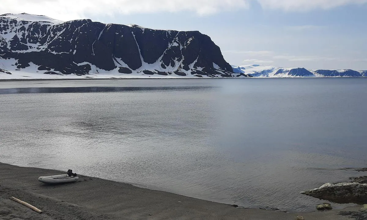
Selvågen - Svalbard
natural_harbour
1 liker bildet
Image uploaded on 11. Jun 2025
Atanikerdluk (lluara)
natural_harbour
1 liker bildet
Image uploaded on 30. Jun 2026
Selvågen - Svalbard
natural_harbour
1 liker bildet
Image uploaded on 11. Jun 2025
Ísafjörður Pollur anchorage
natural_harbour
1 liker bildet
Image uploaded on 22. Jul 2025
Hornsbrekpollen
natural_harbour
1 liker bildet
Image uploaded on 20. Jun 2025
Atammik
marina
1 liker bildet
Image uploaded on 8. Jun 2026
Hornsbrekpollen
natural_harbour
1 liker bildet
Image uploaded on 20. Jun 2025
Hornsbrekpollen
natural_harbour
1 liker bildet
Image uploaded on 20. Jun 2025
Djúpivogur
marina
1 liker bildet
Image uploaded on 7. Sep 2025
Djúpivogur
marina
1 liker bildet
Image uploaded on 7. Sep 2025
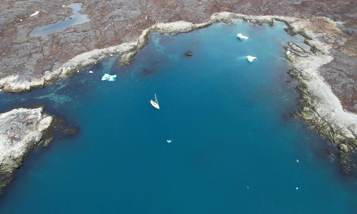
Uunartoq
natural_harbour
0 liker bildet
Image uploaded on 3. Jul 2026
Svolværvågen
natural_harbour
0 liker bildet
Image uploaded on 30. Apr 2025
Lingbukta
natural_harbour
0 liker bildet
Image uploaded on 18. Jun 2025
Umiarssuaqarfik
natural_harbour
0 liker bildet
Image uploaded on 10. Jul 2026
Umiarssuaqarfik
natural_harbour
0 liker bildet
Image uploaded on 10. Jul 2026
Umiarssuaqarfik
natural_harbour
0 liker bildet
Image uploaded on 10. Jul 2026
Sarpinat
natural_harbour
0 liker bildet
Image uploaded on 10. Jul 2026
Ikigait (Herjolfsnes)
natural_harbour
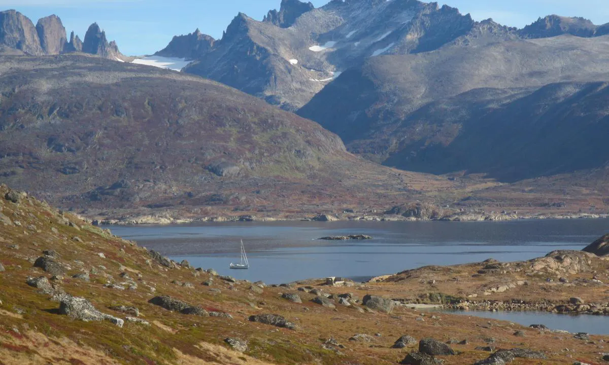
0 liker bildet
Image uploaded on 3. Jul 2026
Ikigait (Herjolfsnes)
natural_harbour
0 liker bildet
Image uploaded on 3. Jul 2026
Ikigait (Herjolfsnes)
natural_harbour
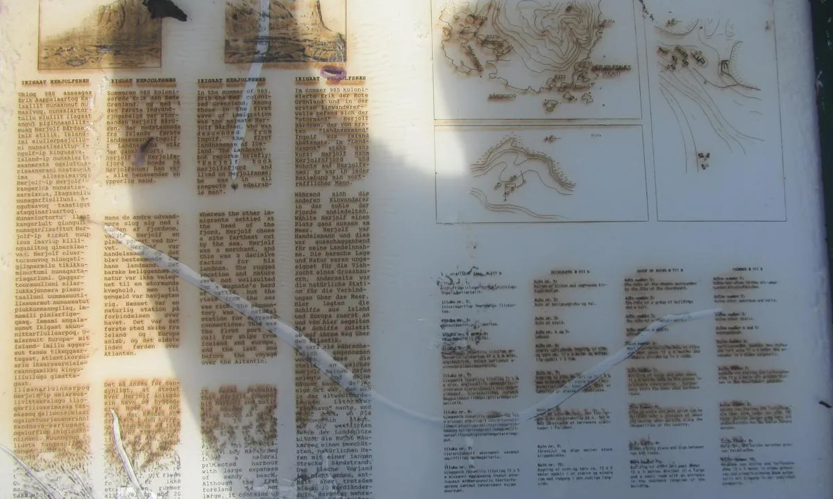
0 liker bildet
Image uploaded on 3. Jul 2026
Aasiaat
marina
0 liker bildet
Image uploaded on 4. Jul 2026
Aasiaat
marina
0 liker bildet
Image uploaded on 4. Jul 2026
Maligiaq (Svartenhavn)
natural_harbour
0 liker bildet
Image uploaded on 3. Jul 2026
Hestøya - Vinsternes
natural_harbour
0 liker bildet
Image uploaded on 6. Apr 2025
lglukasik Havn
natural_harbour
0 liker bildet
Image uploaded on 3. Jul 2026
Upernavik Kujalleq (Søndre Upernavik)
marina
0 liker bildet
Image uploaded on 4. Jul 2026
Upernavik Kujalleq (Søndre Upernavik)
marina
0 liker bildet
Image uploaded on 4. Jul 2026
Ramsøyholmen
natural_harbour
0 liker bildet
Image uploaded on 3. Apr 2025
Upernavik Kujalleq (Søndre Upernavik)
marina
0 liker bildet
Image uploaded on 4. Jul 2026
Upernavik
marina
0 liker bildet
Image uploaded on 8. Jul 2026
Upernavik
marina
0 liker bildet
Image uploaded on 8. Jul 2026
Upernavik
marina
0 liker bildet
Image uploaded on 8. Jul 2026
Ymerbukta
natural_harbour
0 liker bildet
Image uploaded on 9. Jun 2025
lglukasik Havn
natural_harbour
0 liker bildet
Image uploaded on 3. Jul 2026
Reviews
See a helpful review? Please click the 👍 below the review to let Chris SV Blue Peter know that you found it helpful.
Chris SV Blue Peter says:
area

maritime qualities
description
Charming place, very well sheltered, ideal for wintering on board your sailboat. The visitor port of Norheimsund can accommodate about twenty boats. It is well equipped with: washing machines, dryers, toilets, showers, electricity, water, wifi, and diesel at the dock - all in service even in winter.
Regular bus connections allow you to reach Bergen as well as the main ski slopes (Nordic and/or Alpine), located just 15 minutes away.
Norheimsund is a pleasant small town, with three supermarkets, several hardware stores, as well as medical and dental services.
A creative and enthusiastic community lives there.
2 x helpful | written on 20. Mar 2025 | updated_on 20. Mar 2025
Chris SV Blue Peter says:
area

maritime qualities
description
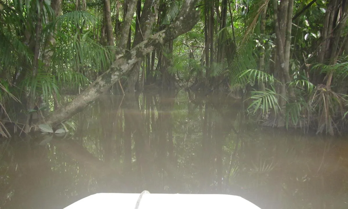
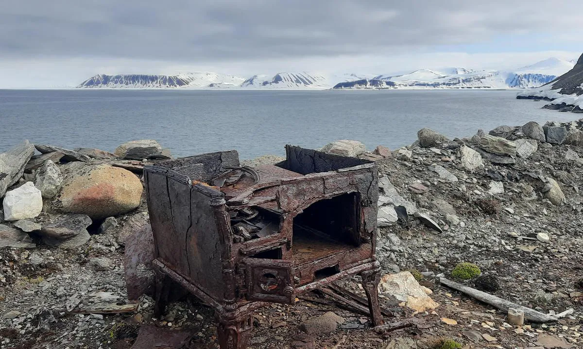
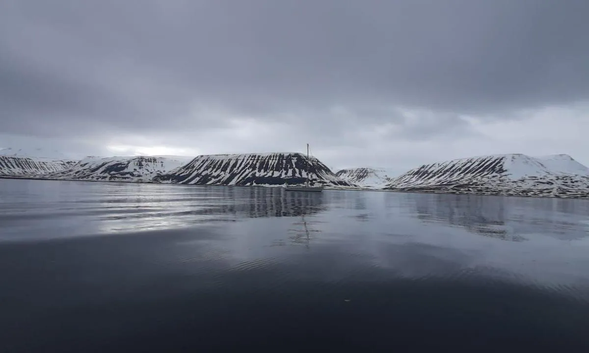
Colesbukta est l'une des rares baies où l’on peut se protéger des vents d’est.
On mouille au fond de la baie, sur la ligne des 20 mètres de profondeur. Le fond est composé d’un limon offrant une bonne tenue.
À terre, on trouve une ancienne mine de charbon soviétique abandonnée.
2 x helpful | written on 26. May 2025 | updated_on 27. May 2025
Chris SV Blue Peter says:
area
maritime qualities
description
Très bon mouillage, bien protégé. Mouiller par 7 à 9 mètres de profondeur sur un fond de sable et de vase offrant une bonne tenue.
Endroit appréciable pour attendre une fenêtre météo favorable.
2 x helpful | written on 3. Apr 2025 | updated_on 3. Apr 2025
Chris SV Blue Peter says:
area
maritime qualities
description
Good anchorage, better sheltered than it appears.
Approach: The East pass is very narrow and can be daunting. It should only be attempted in good conditions.
Anchoring in 12 to 13 meters of water, on sand.
2 x helpful | written on 12. Apr 2025
Chris SV Blue Peter says:
area
maritime qualities
description
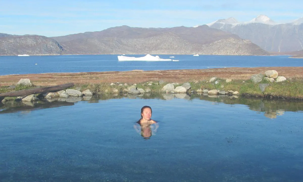
Cette île inhabitée abrite une source géothermique dont l'eau avoisine 37 à 38 °C. C'est le seul endroit du Groenland où l'eau est suffisamment chaude pour permettre la baignade.
Le site est chargé d'histoire. La source est connue depuis des siècles. Les sagas racontent même que Leif Erikson s'y serait baigné avant de partir vers l'Amérique du Nord, il y a environ 1 000 ans. Étrangement, l'île elle-même n'a jamais été habitée de façon permanente.
Mouillage : Il est possible de mouiller sur fond de sable, de part et d'autre de l'isthme, selon la direction du vent. Le côté ouest dispose d'un ponton protégé par une digue de gravier.
1 x helpful | written on 4. Jul 2026 | updated_on 4. Jul 2026
Chris SV Blue Peter says:
area
maritime qualities
description
Very beautiful place, protected from the offshore swell.
Mooring at a depth of 8-9 meters, on a seabed with good holding composed of hard sand and some scattered rocks.
Approach: unstable wind, with some accelerations in the surrounding channels.
During our stay, the mooring was well sheltered. However, due to the surrounding terrain, it is likely that katabatic winds may form in case of strong winds.
1 x helpful | written on 18. Apr 2025 | updated_on 18. Apr 2025
Chris SV Blue Peter says:
area
maritime qualities
description
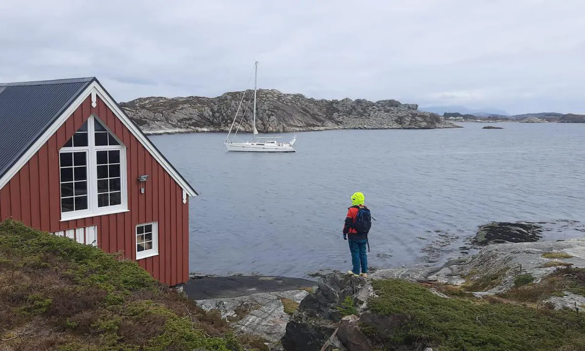
This is a beautiful marina, very well executed. The visitor dock is protected from all weather conditions. Very good reception. Electricity cards can be obtained from the harbor master. Wonderful hike over the pass to Leirvik, with a return via the old scenic route.
1 x helpful | written on 19. Apr 2025
Chris SV Blue Peter says:
area
maritime qualities
description
Pretty little marina with a few berths graciously made available for visiting boats. Be careful: the long pontoon on the right as you enter does not have bollards. Also be cautious when disembarking onto the wooden pontoons when they are wet, as they are very slippery. Beautiful hike over the pass to Norðragøta, with a return via the old scenic route.
1 x helpful | written on 19. Apr 2025
Chris SV Blue Peter says:
area
maritime qualities
description
Ideal marina to leave your sailboat while taking a shore excursion. Lock gate opens 2 hours before high tide and closes at high tide. Anchoring to port of the entrance channel and floating waiting pontoon to the left before the lock. Few places for visitors, but there's always the possibility to moor alongside while waiting for a berth to become available, which generally happens at each tide. It is highly advisable to announce your arrival by phone or email. Very efficient and friendly harbor master.
1 x helpful | written on 19. Apr 2025
Chris SV Blue Peter says:
area
maritime qualities
description
Anchorage by 17-18 meters on a hard mud bottom with good holding. The east wind enters the bay from the north but does not raise waves. It is possible to leave the dinghy at the floating dock of the easternmost port. It is also possible to berth the boat at the quay to take on water. There are several freshwater taps equipped with long hoses. Very beautiful hike along the old pass road and towards the cliffs to the west.
1 x helpful | written on 19. Apr 2025
Chris SV Blue Peter says:
area
maritime qualities
description
Vágur is a port of entry. For boats coming from abroad, it is preferable to moor at the quay.
Fair weather anchorage. Anchor in 4 to 5 meters of depth, on a soft mud and seaweed bottom. The holding of the anchor is unpredictable.
Near the jetty, there is an indoor swimming pool with an Olympic-size pool and a sauna.
1 x helpful | written on 19. Apr 2025
Chris SV Blue Peter says:
area
maritime qualities
description
Beautiful anchorage at 10 meters, on a hard mud bottom offering good holding. It is possible to leave your dinghy at one of the floating pontoons of the small fishing port located to the northeast of the bay. Freshwater refueling is also available there.
On the quay, there is a well-equipped locksmith and precision mechanics workshop, capable of manufacturing custom parts.
At the foot of the Bónus supermarket, a quay with a diesel station is accessible.
1 x helpful | written on 19. Apr 2025
Chris SV Blue Peter says:
area
maritime qualities
description
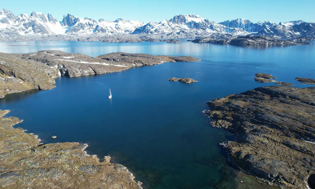
Aorrussaarssuk is the best anchorage in the region.
You can anchor in 3 to 6 meters of water, with shore lines. In July, this anchorage becomes popular with sailboats awaiting the Northwest Passage. It can accommodate 4 to 5 boats.
A river brings fresh and clear water.
By crossing the channel in a dinghy and then walking to the airport, you can reach Upernavik in less than an hour.
Right in the middle of the entrance to the eastern creek, the wreck of the 10-meter sailboat Dodo’s Delight lies at the bottom, after catching fire during wintering.
1 x helpful | written on 25. Jul 2025
Chris SV Blue Peter says:
area
maritime qualities
description
Small community with a mini-market. Diesel available at the dock when accessible.
The fishermen moor their motorboats at the dock, which does not always allow access. Attention: at low spring tide, the depth is less than one meter.
Anchorage: the 14-meter zone is occupied by buoys. It is possible to anchor next to them, in 17 to 19 meters, on a rocky and muddy bottom offering moderate holding.
1 x helpful | written on 4. Jul 2026
Chris SV Blue Peter says:
area
maritime qualities
description
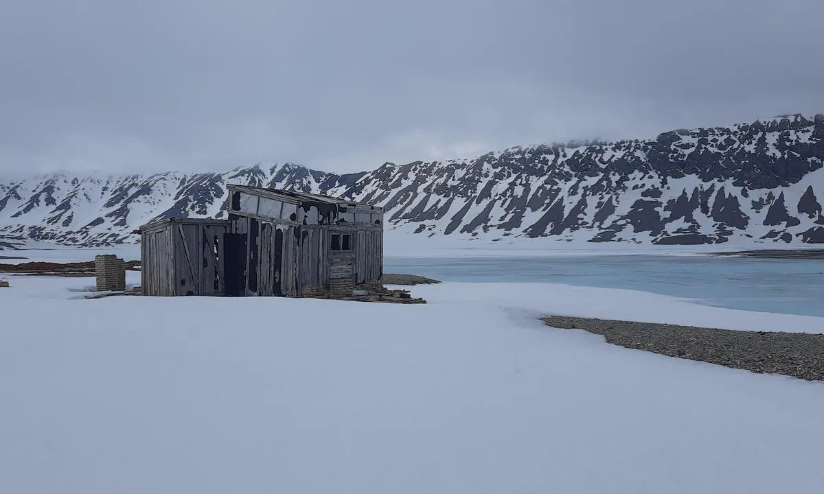
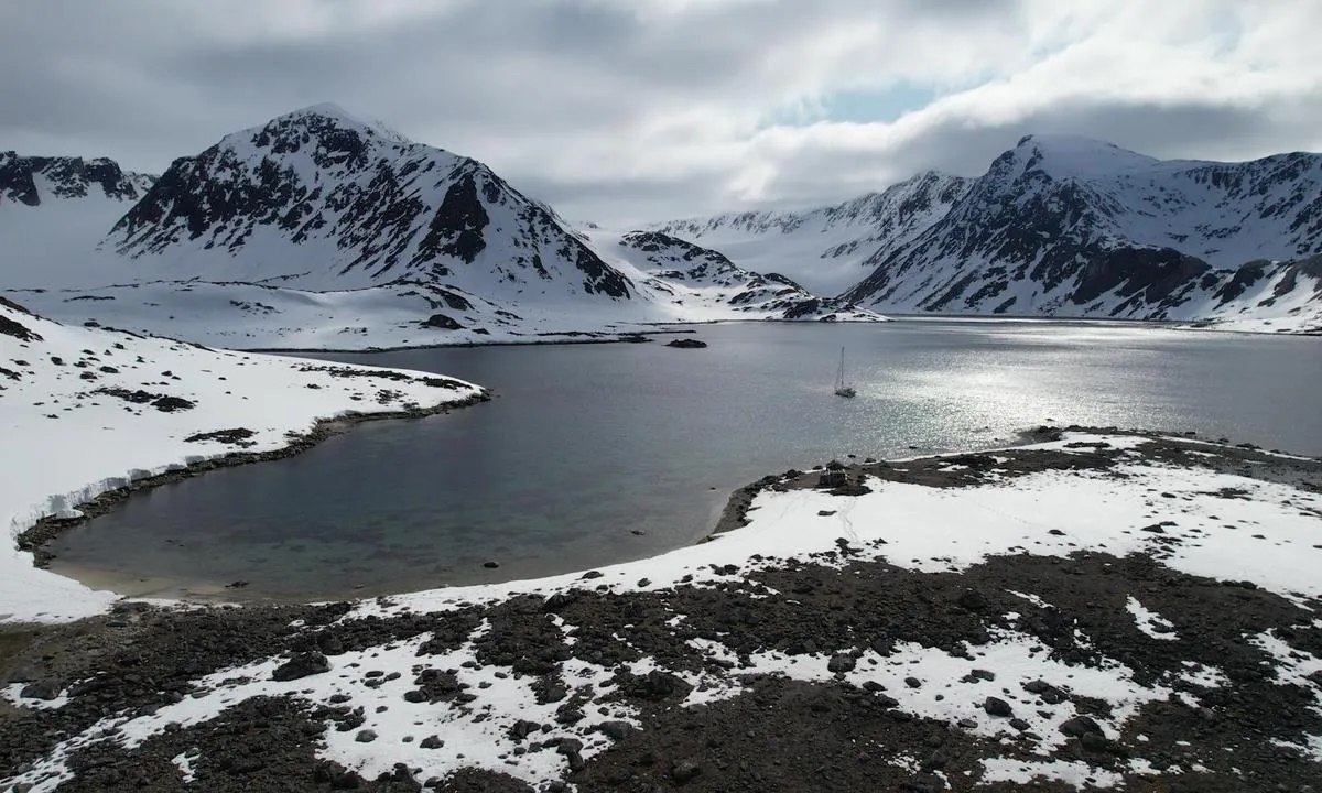
The bay is shallow. You can anchor there at the front in 10 to 15 meters of water, on a rocky and clay bottom with moderate holding. The anchorage offers good protection against east and north winds.
On shore, there is a trapper's hut, now owned by the Governor of Svalbard. There are also several graves.
1 x helpful | written on 17. Jun 2025
Chris SV Blue Peter says:
area
maritime qualities
description
The rocks of Myken offer an unusual stopover, home to a micro-community of around ten people whose main activity is operating a whisky distillery.
Approach: from the south or from the north.
The anchorage is well protected from offshore swells, even in strong winds. It is recommended to anchor in 8 to 10 meters of water. It is important to choose your anchorage point carefully, as the seabed is composed of hard sand and several areas covered with large seaweeds.
A small supermarket is located onshore, with a post office. A daily ferry connection to the mainland is provided.
1 x helpful | written on 21. Apr 2025
Chris SV Blue Peter says:
area
maritime qualities
description
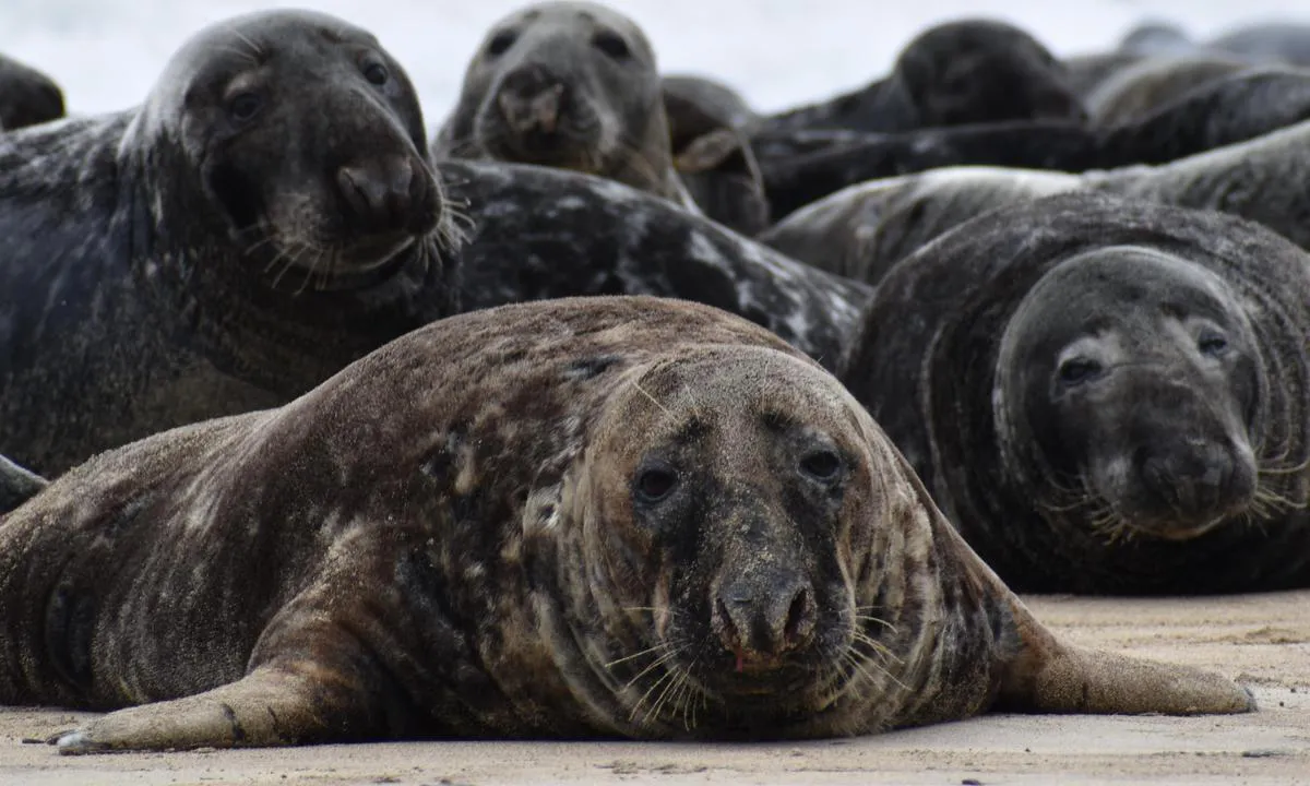
Magnificent place, with an island rich in history. On the beach, a colony of grey seals resides year-round, and, in season, impressive basking sharks pass through the anchorage. The island is uninhabited, but campers get dropped off to spend a few days. Beautiful hiking to do on site.
Anchorage: anchor in 10 to 12 meters on sand. Poorly protected and rolly, but the beauty of the place quickly makes you forget the discomfort.
Landing: in calm weather, it is possible to land either on the beach or at the small quay on the left, between the rocks.
1 x helpful | written on 21. Apr 2025
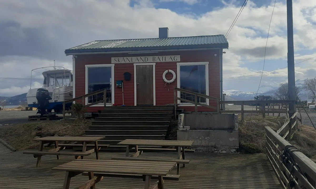
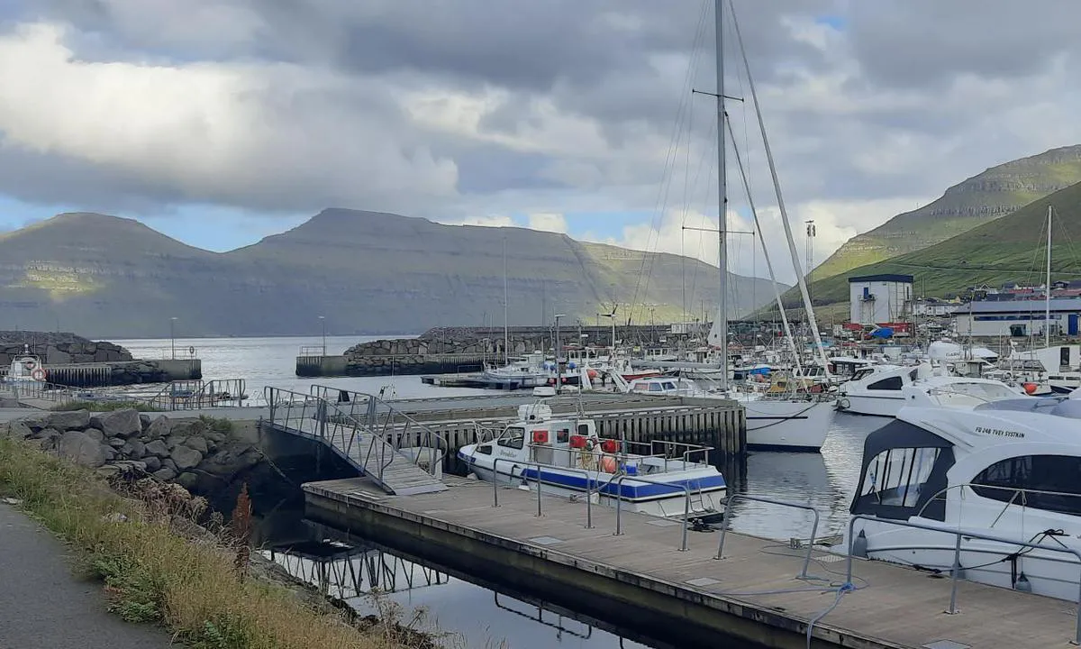
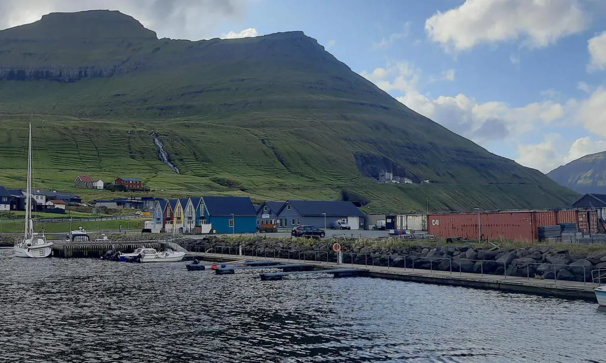
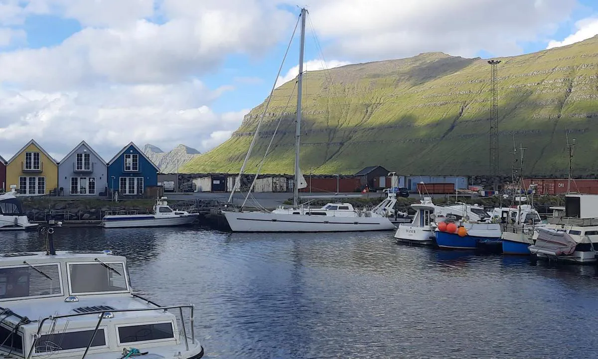
Chris SV Blue Peter says:
area
maritime qualities
description
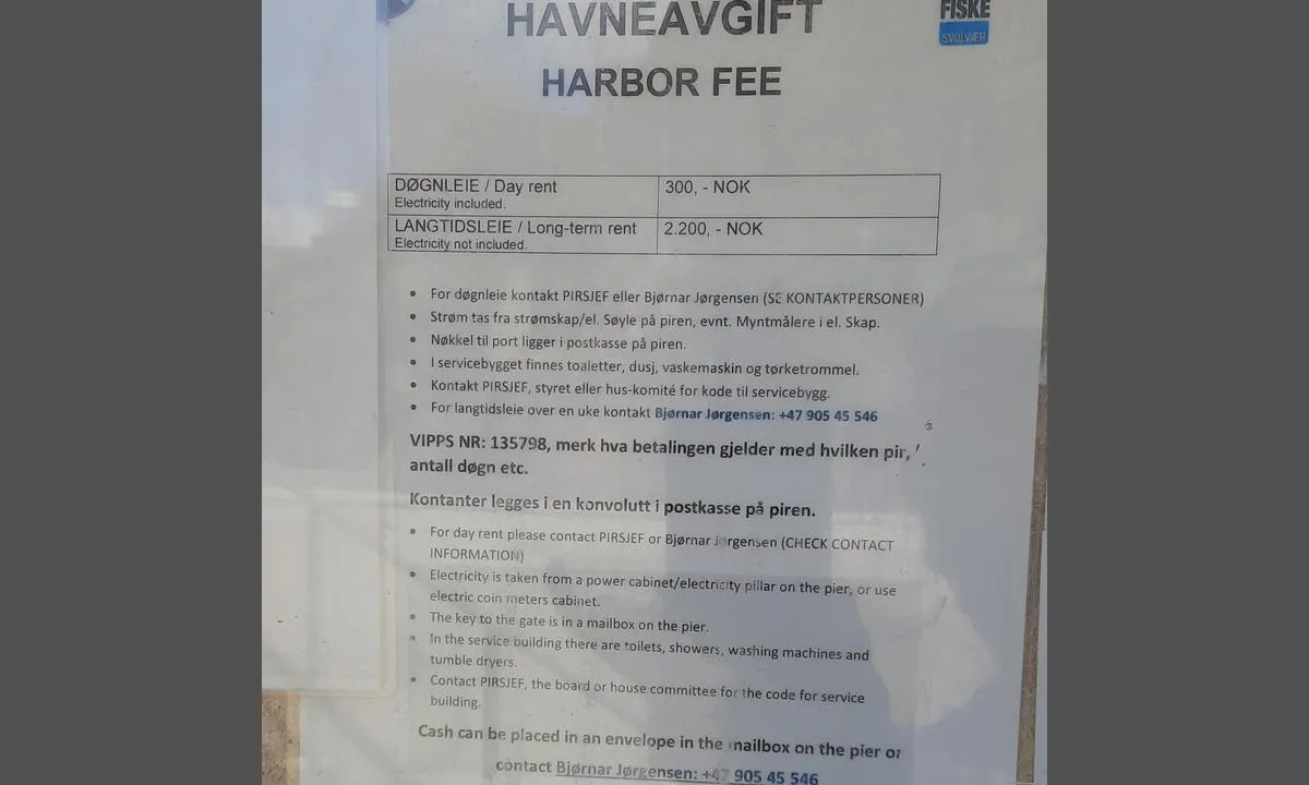
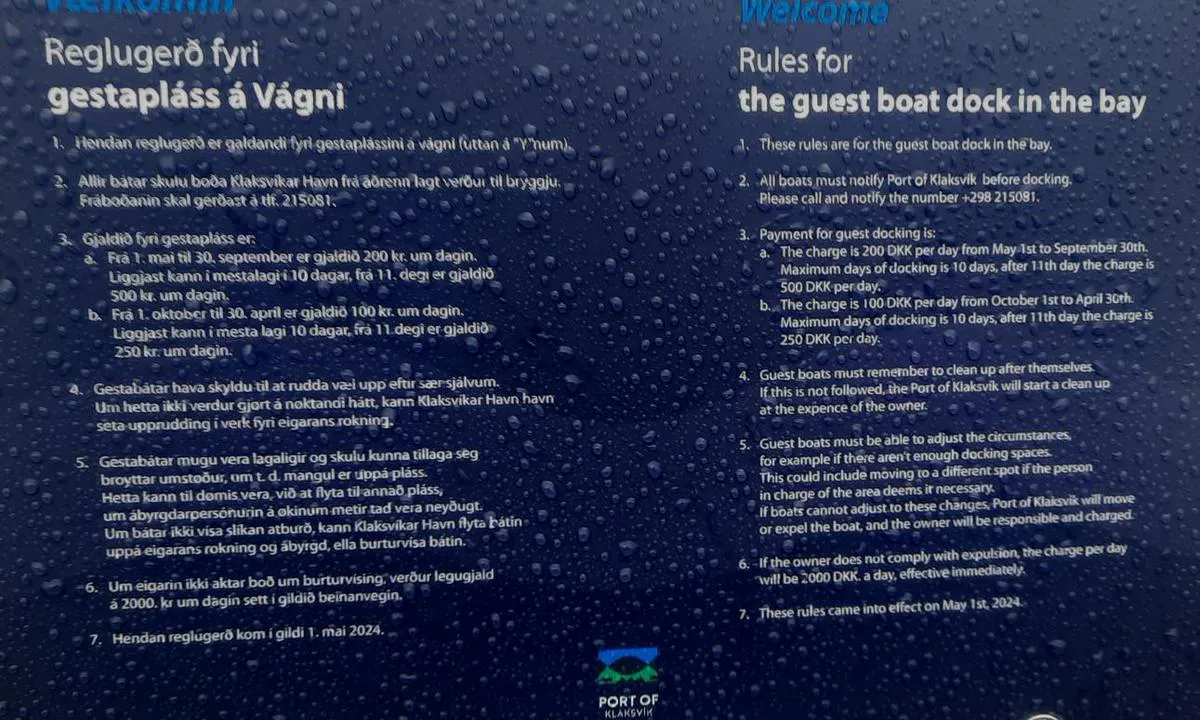
Klaksvík is one of the 6 entry ports of the Faroe Islands; the others are Tórshavn, Fuglafjørður, Klaksvík, Vágur, Tvøroyri, and Vestmanna. It is the port of the second largest city in the country after Tórshavn. Be cautious when disembarking on the wooden pontoon, as it is very slippery. From May 1, 2024, the visitor's pontoon will have a fee (200 DKK/day from 1 to 10 days, and from the 11th day onwards, 500 DKK/day, water and electricity included). For more details, refer to the photo titled 'Rule for guest boat in the bay'
1 x helpful | written on 21. Apr 2025
Chris SV Blue Peter says:
area
maritime qualities
description
Excellent anchorage, well protected. Anchor in 3 to 4 meters of water on a hard mud bottom offering good holding.
In the harbor, a floating pontoon is provided for tenders.
Diesel can be ordered directly at the quay, delivered by tanker truck. Price: €1.13/l. Contact: Ciaran (or Kieren) at +353 86 826 6002.
Baltimore is a pleasant small seaside town with good pubs and a gourmet restaurant.
1 x helpful | written on 21. Apr 2025
Chris SV Blue Peter says:
area
maritime qualities
description
Very beautiful anchorage, well protected. Drop the anchor in 4 to 5 meters on a sandy bottom offering good holding. The water is clear, and otters regularly swim around the boat.
You can moor your dinghy to the ladder of the small dock at the port, where fresh water is also available.
A walking trail goes all around the island, with access points on each side of the port. Grey seals are often visible in the northern bays.
A toilet, shower, and a kitchenette are available at the ferry terminal.
Although two ferries provide a daily connection with the main island, there are no shops on shore. This beautiful stopover is worth lingering.
1 x helpful | written on 21. Apr 2025
Chris SV Blue Peter says:
area
maritime qualities
description
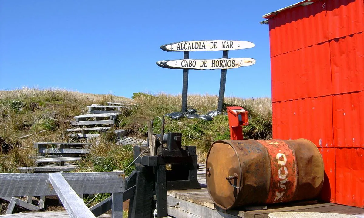
Type of anchorage: fair weather - temporary - exposed to rapid weather changes.
Seabed: 17 to 22 m - rock covered with kelp areas of random holding.
Approach and landing procedure:
Prior authorization required from the Armada de Chile, via the Puerto Williams harbor master.
Upon approaching the site, contact the lighthouse keepers via VHF to request permission to land.
Landing by dinghy on a small pebble beach - possible only if sea conditions allow.
It is strongly recommended to leave a crew member on the boat during landing.
On some occasions, the influx of passengers from cruise ships may affect the serenity of the site.
1 x helpful | written on 25. Jul 2025 | updated_on 25. Jul 2025
Chris SV Blue Peter says:
area
maritime qualities
description
Very convenient anchorage when the wind shifts to the north. Anchor in 14 to 16 meters on a rocky bottom. Beyond 20 knots of wind, the swell can circumvent the island and cause some rolling.
Landing: at low tide, the west beach is more regular, but composed of large, very slippery round stones. The east beach, on the other hand, is made of pebbles, but its lower part consists of large, angular rocks.
The islands are magnificent. Very beautiful hike on Eilean a’ Tighe, while the one on Garbh Eilean is more technical.
However, this anchorage is not recommended when the wind is shifting.
1 x helpful | written on 21. Apr 2025 | updated_on 21. Apr 2025
Chris SV Blue Peter says:
area
maritime qualities
description
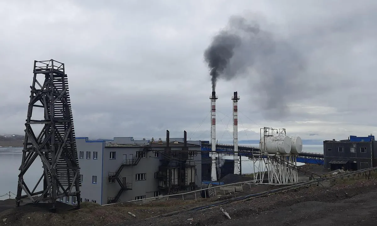
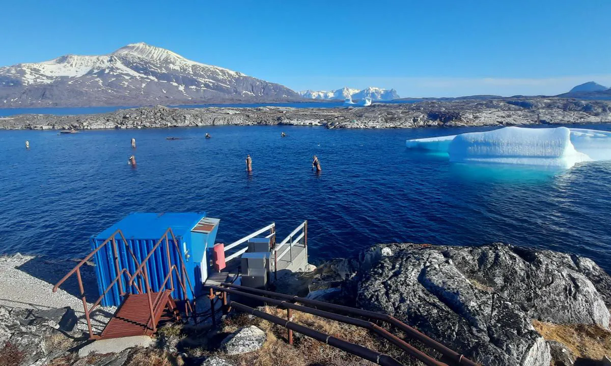
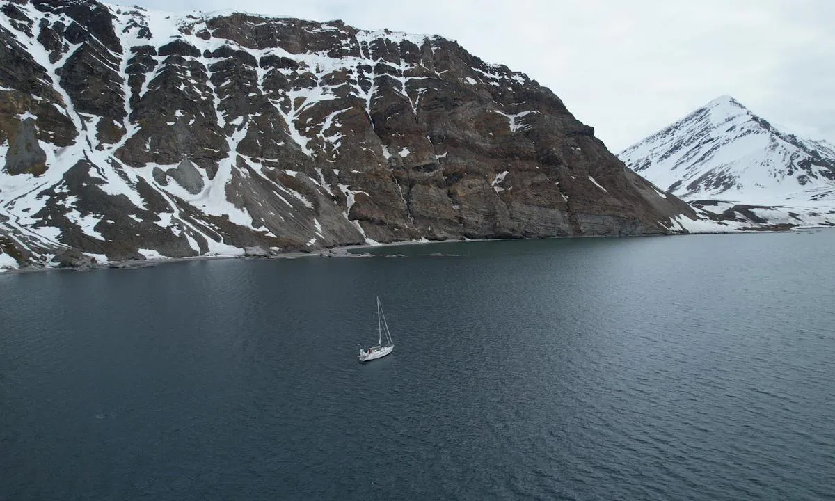
Longyearbyen is a small town without much charm, a bit dusty, torn between mining and tourism. Cruise ships and charter yachts dock there to embark their passengers, while sailing boats come to refuel with diesel. Apart from a supermarket, a fuel dock, and a few sporting goods stores, it is difficult to find anything there to repair or maintain your sailboat.
Mooring: the coast of Adventfjord is steep and the bottom quickly drops to 70 meters. Depending on the wind direction, it is possible to anchor on either side, but the best-protected area is in the small cove of the coal terminal. You anchor along the 20-meter line, between the orange buoys. The bottom consists of compact mud.
1 x helpful | written on 31. May 2025
Chris SV Blue Peter says:
area
maritime qualities
description
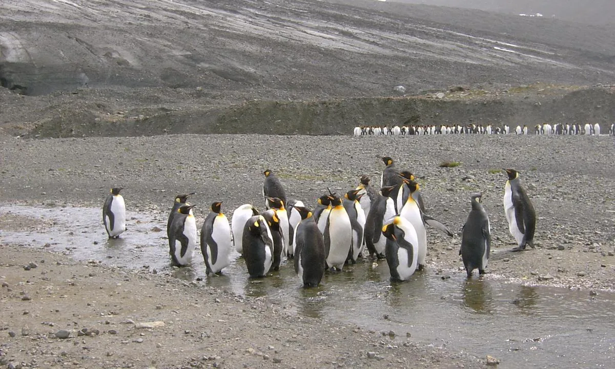
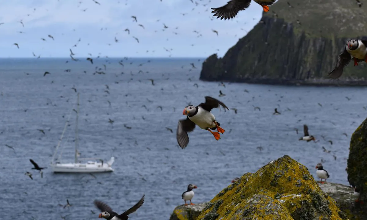
Archipelago inhabited by very large bird colonies. Tens of thousands of little penguins, guillemots, and puffins thrive in a spectacular landscape. An incredible experience.
Mooring: anchor to the north at 13 meters, on a sandy bottom. Further south, the bottom becomes rocky.
1 x helpful | written on 21. Apr 2025
Chris SV Blue Peter says:
area
maritime qualities
description
Lingbukta is a large anchorage well protected from south and east winds. It is located west of Biscayerhuken, but it is also possible to anchor on the east side.
Approach: The northern tip of the peninsula is not clear; it is advisable to round it well.
Anchorage: Drop anchor two cables from the coast, in 6 to 7 meters deep, composed of rock, sand, and seaweed.
On land, one can find some relics of old trappers.
1 x helpful | written on 18. Jun 2025
Chris SV Blue Peter says:
area
maritime qualities
description
With its 5,600 inhabitants, Sisimiut is the second largest town in Greenland. It is probably the last place where one can hope to find what they are desperately searching for. The town is also one of the few places in Greenland where it is possible to haul out your boat for winter storage, although this operation remains an adventure in itself.
The harbor offers good protection. It is possible to moor alongside a fishing boat tied up at the quay located on the port side when entering the harbor. Another option is to use the small quay of the slipway, located at the end of the harbor on the right. Since this quay is narrow, it is recommended to check with the shipyard regarding the planned movements of the slipway.
About 500 meters north of the harbor, in the northwest corner of the bay, there is a good anchorage with depths ranging from 4 to 8 meters on a muddy bottom.
1 x helpful | written on 18. Jun 2026 | updated_on 18. Jun 2026
Chris SV Blue Peter says:
area
maritime qualities
description
La baie est tout simplement spectaculaire.
Mouillage de beau temps : mouillez par 12 à 13 mètres, sur un fond rocheux de tenue aléatoire.
Dès que la brise se lève, des rafales descendent des falaises, et le col entre les deux massifs montagneux crée un effet Venturi.
Plusieurs magnifiques randonnées mènent au sommet des falaises. Cependant, il n’est pas facile de trouver un endroit pour accoster l’annexe. Le mieux est de traverser le plan d’eau jusqu’au village de Måstad, situé en face, et de s’amarrer sur le côté de la cale de mise à l’eau (slipway). De là part le sentier (voir photo pour les instructions et la carte).
1 x helpful | written on 24. Apr 2025 | updated_on 25. Apr 2025
Chris SV Blue Peter says:
area
maritime qualities
description
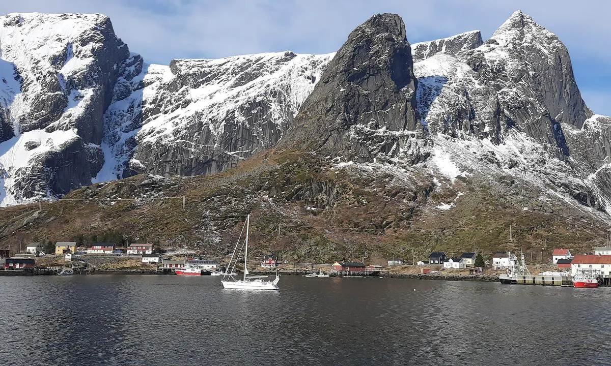
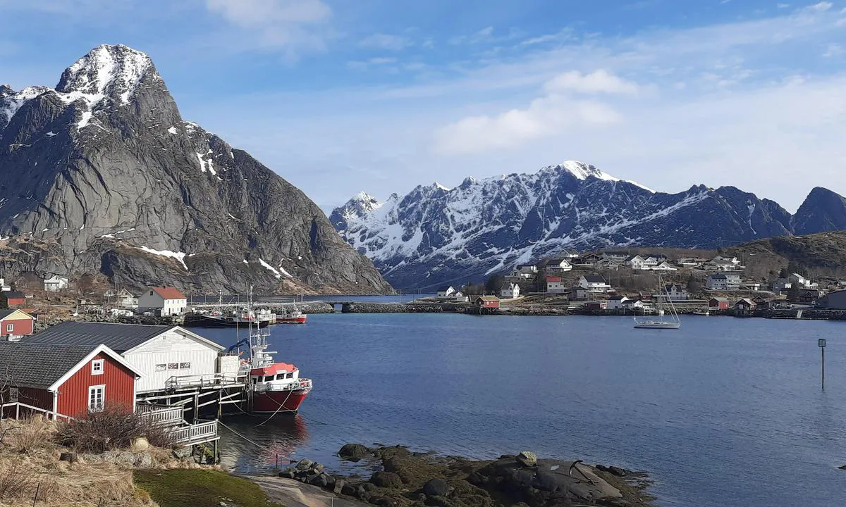
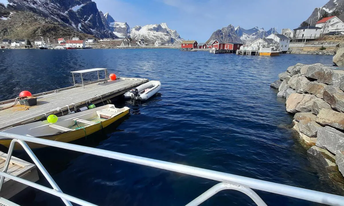
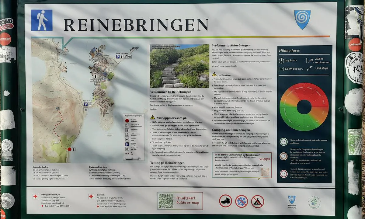
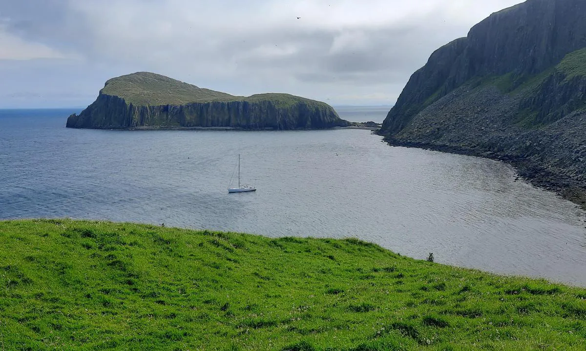
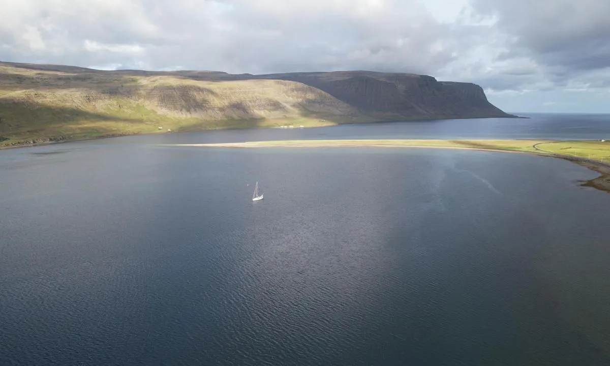
The bay, along with the village of Reine, is spectacular. It is a major site of Norwegian tourism and, in season, the place is very busy.
Mooring: anchor in 20 to 22 meters of depth, on a surface of hard mud, sand, areas of seaweed, and scattered rocks. As soon as the breeze picks up, gusts descend from the mountains; therefore, be generous with your chain.
This is where the ascent of Reinebringen begins, one of the most popular hikes in the Lofoten.
1 x helpful | written on 27. Apr 2025
Chris SV Blue Peter says:
area
maritime qualities
description
Mouillage dans la baie du port commercial, dont le charme reste relatif.
On mouille par 10 à 12 mètres de fond, sur une vase dure offrant une bonne tenue. Le mouillage est bien protégé de la houle. Le câble sous-marin, situé à l'est du mouillage, semble avoir été retiré..
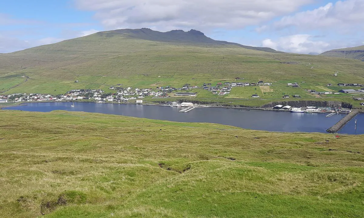
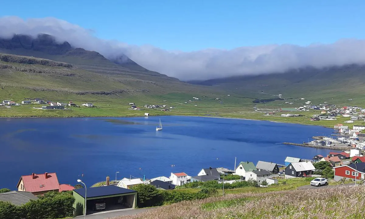
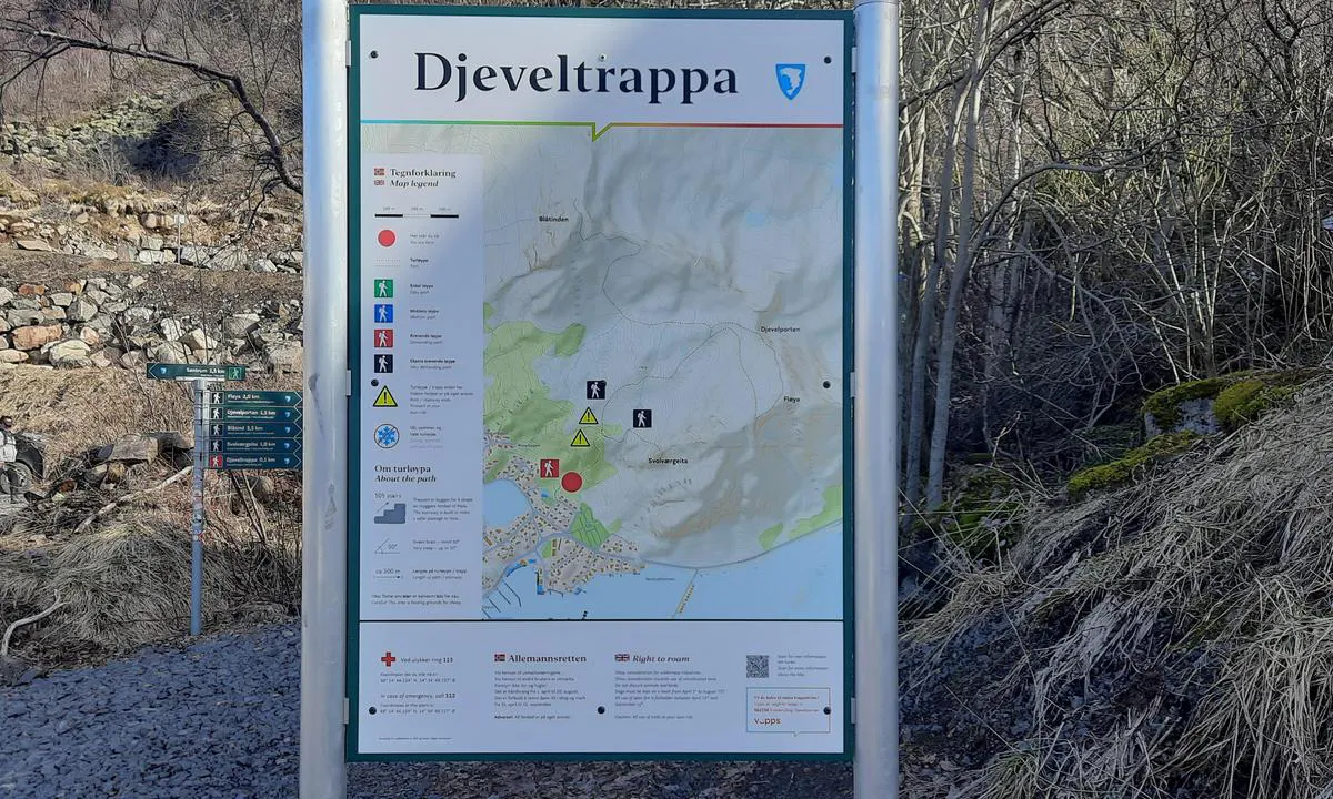
Svolvær, capitale des Lofoten, dispose d’un aéroport. De jolies randonnées partent depuis la marina, dont la fameuse montée de l’Escalier du Diable.
1 x helpful | written on 29. Apr 2025 | updated_on 30. Apr 2025
Chris SV Blue Peter says:
area
maritime qualities
description
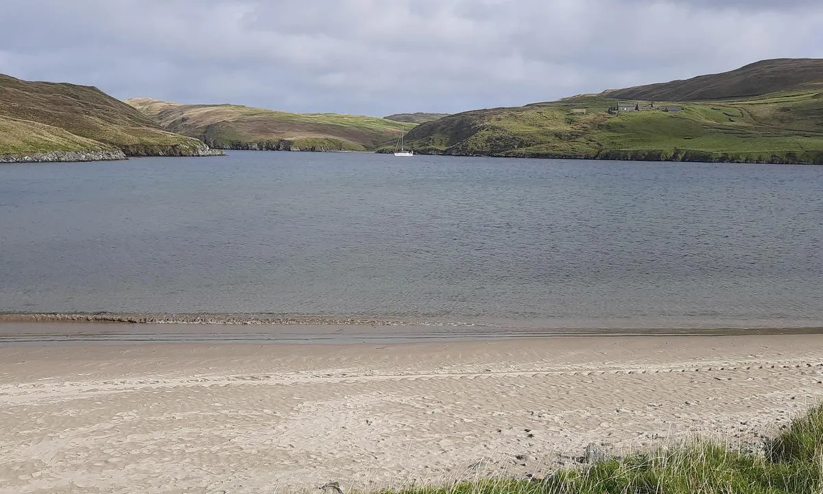
Charming anchorage, well protected. The channel is wide, but it is necessary to stay well in the center. Anchor is dropped at 7 meters depth, on good holding sand, despite the presence of some seaweed patches. One or two local fishermen use the dock for their activity, which attracts a few grey seals. Very beautiful hike to the Esha Ness lighthouse, with a return along the cliffs.
1 x helpful | written on 29. Apr 2025
Chris SV Blue Peter says:
area
maritime qualities
description
This beautiful location offers two anchorage options: in the first bay, in 10 meters of water, and at the entrance of the inner bay, in 3 meters of water over a well-holding mud bottom. In winds from south to northwest, the swell enters the bay and the boat may roll. Three very beautiful hikes lead up to the Point of Fethaland lighthouse, one of which starts to the east at the end of the beach.
1 x helpful | written on 29. Apr 2025
Chris SV Blue Peter says:
area
maritime qualities
description
Small port of about 1200 inhabitants, Paamiut, formerly Frederikshåb, is a good alternative if the ports further south are caught in the ice.
Approach: Carefully follow the alignment as the entrance channel is not straightforward. The visitor's quay is the northernmost one. It is wooden and easily accessible. The diesel/gasoline service station is located at its extreme north. Make sure to protect your side opposite the quay with fenders as it is not uncommon for a fishing boat to come alongside during the night.
Onshore, you will find two supermarkets, a small hospital, a post office, and an airport.
A second diesel/gasoline service station is located at the quay under the storage tanks.
1 x helpful | written on 26. May 2026
Chris SV Blue Peter says:
area
maritime qualities
description
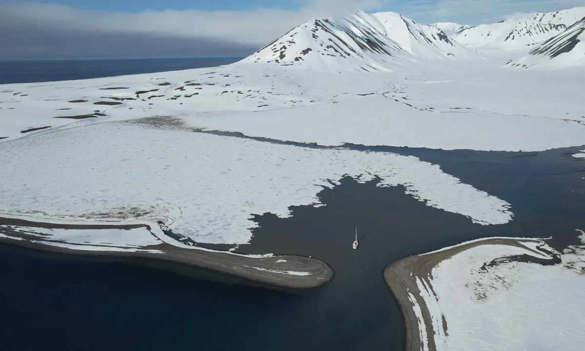
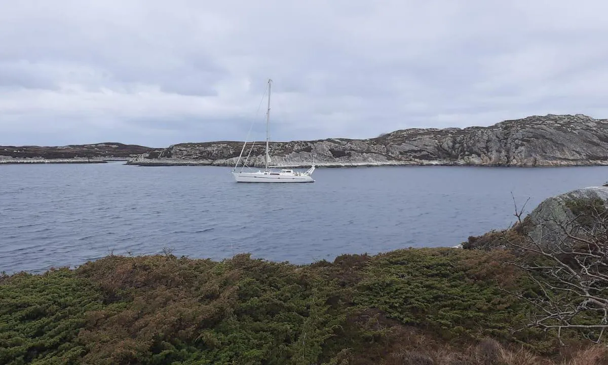
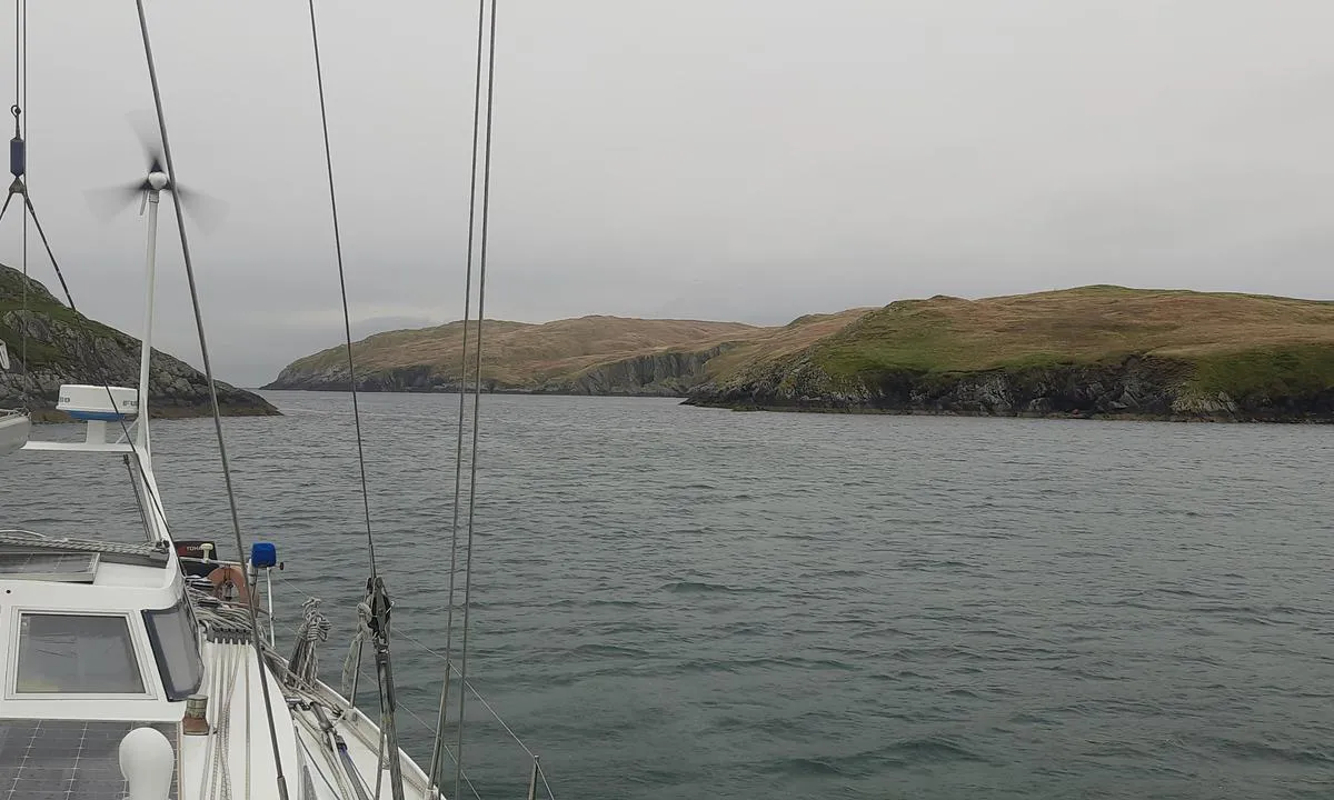
Ocean Harbour, also called New Fortuna Bay (not to be confused with Fortuna Bay), is a bay rich in history and natural beauty, offering good anchorage in rough seas.
You anchor in 9 to 11 meters of water, on a mix of sand and kelp.
However, under certain weather conditions, violent katabatic winds can push sailboats towards the shore. The wreck of the Bayard is a testament to this: torn from its anchor by a storm in 1911, it was thrown across the bay.
On the beach, remnants of the old whaling stations, which were active between 1909 and 1920, still remain.
This bay is also visited by cruise ships.
1 x helpful | written on 26. Jul 2025
Chris SV Blue Peter says:
area
maritime qualities
description
Beau mouillage avec le Monacobreen en toile de fond.
Il est bien abrité, mais présente un fond de moraine offrant une tenue moyenne, et la glace y pénètre fréquemment.
Au sud et à l’ouest du mouillage, les fonds remontent rapidement. On mouille de préférence au centre, par 19 à 21 mètres de profondeur, sur un fond rocheux dont la tenue est incertaine.
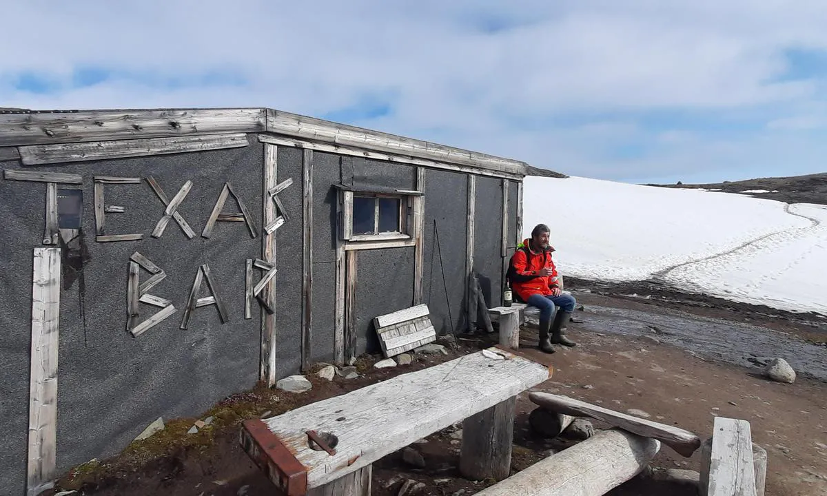
À environ 2 km au nord-est se trouve le Texas Bar, un refuge traditionnel où les visiteurs ont coutume de laisser une bouteille. On peut s’y rendre en 30 minutes à pied par la terre ou en annexe.
1 x helpful | written on 20. Jun 2025 | updated_on 21. Jun 2025
Chris SV Blue Peter says:
area
maritime qualities
description
Litlmolla est un magnifique mouillage, bien protégé, bordé de falaises et de plages de sable blanc.
Approche : la hauteur du câble électrique entre l’île de Sandøya et celle de Slokøya est de 28,5 mètres (certaines anciennes cartes indiquent une hauteur de seulement 10 mètres).
Il est possible de mouiller par 11 à 12 mètres de profondeur, sur un fond de sable.
Attention : une conduite d’eau sous-marine traverse la partie sud-est du mouillage
1 x helpful | written on 1. May 2025 | updated_on 2. May 2025
Chris SV Blue Peter says:
area
maritime qualities
description
Mouillage bien pratique pour les bateaux de plus de 35 pieds souhaitant faire escale à Evenskjær.
On mouille par 16 à 17 mètres de fond, sur un fond de sable et de vase dure, offrant une bonne tenue.
1 x helpful | written on 2. May 2025 | updated_on 3. May 2025
Chris SV Blue Peter says:
area
maritime qualities
description
Large anchorage where the bottom drops quickly beyond 20 meters. Therefore, the western part is to be preferred.
Anchor in 8 to 10 meters of water, on a sandy bottom with patches of seaweed.
1 x helpful | written on 3. May 2025
Chris SV Blue Peter says:
area
maritime qualities
description
Russevåg is a picturesque anchorage, fully protected, with a technically challenging entrance passage.
Approach: The passage is about 10 meters wide and is reputed to offer 1.5 meters of draft at the lowest tides (personally, I observed 1.2 meters). It is not marked. In calm weather and good light, the water is clear and the two sides of the channel are distinctly visible. See the aerial photo.
Anchoring is done at depths of 7 to 8 meters, on good holding mud.
In winter, the bay freezes quickly and thaws late. On May 4th, a thin layer of ice still covered the water surface.
1 x helpful | written on 4. May 2025
Chris SV Blue Peter says:
area
maritime qualities
description
Large anchorage located in the shelter of Hestøya, an island where several species of ducks, including the Eider, come to nest.
Approach: Clear from the north. From the south, pass over a 3-meter threshold.
Anchorage: Anchor between 6 and 12 meters deep, on a hard mud bottom.
1 x helpful | written on 5. May 2025
Chris SV Blue Peter says:
area
maritime qualities
description
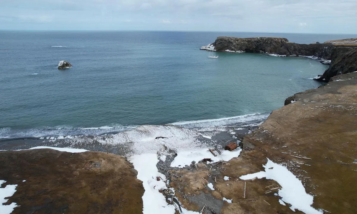
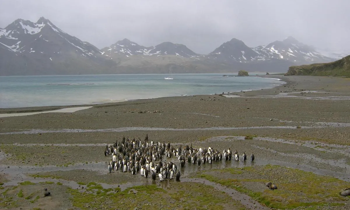
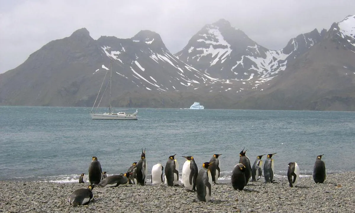
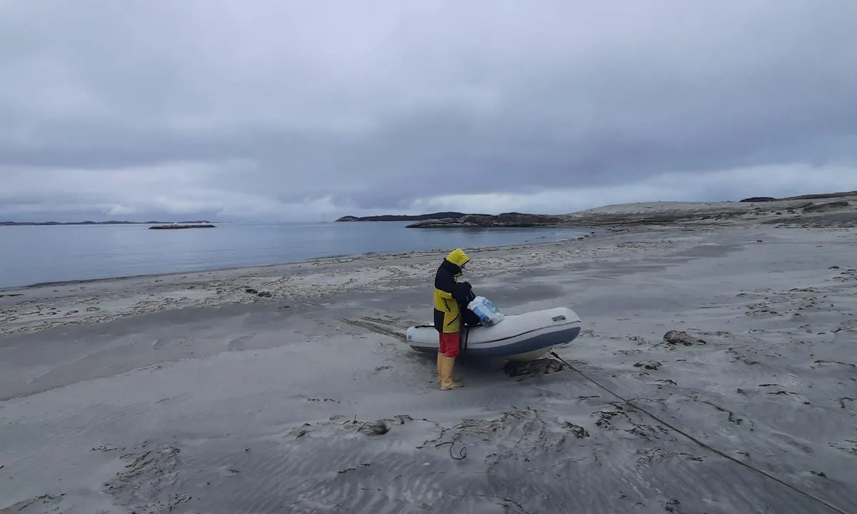
Anchorage Bay is located at the foot of the Fortuna Glacier.
You anchor in about 10 meters of water, on sand.
Although the bay appears calm after anchoring, sudden gusts can occur and easily take away a dinghy moored by a simple grapnel on the beach.
At the foot of the glacier, there is a significant colony of king penguins. Gentoo penguins, elephant seals, fur seals, and skuas can also be observed.
1 x helpful | written on 26. Jul 2025
Chris SV Blue Peter says:
area
maritime qualities
description
Agréable mouillage, avec à son est le village abandonné d'Avigait. À part une ou deux maisons qui servent de refuge aux chasseurs, la plupart des habitations sont en ruines.
Mouillage : La baie est relativement bien protégée, avec néanmoins une possibilité de fetch au sud-est-sud. La partie nord-est-nord est rocheuse et peu profonde. On ancre par 10 mètres sur un fond de vase et d'algues, de bonne tenue.
1 x helpful | written on 29. May 2026 | updated_on 29. May 2026
Chris SV Blue Peter says:
area
maritime qualities
description
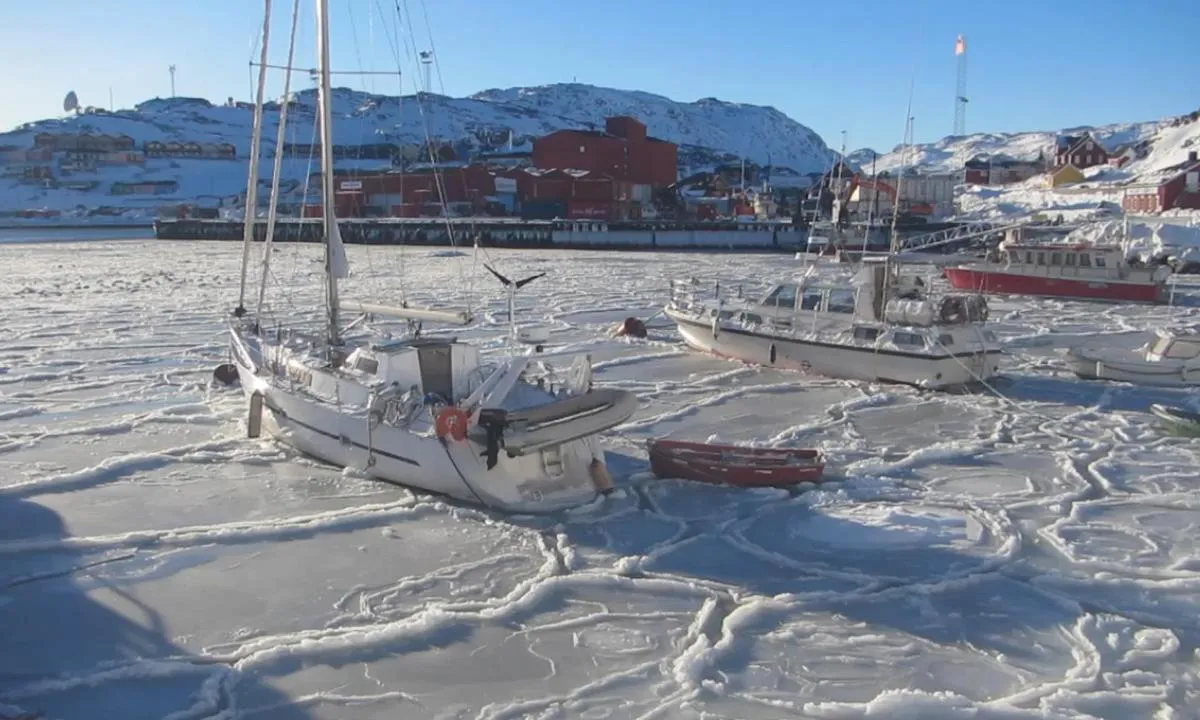
The winter of 2017-2018, we spent it in Qaqortoq, aboard our sailboat. We had the bow moored to a buoy and two stern lines pulled ashore. Although we found the experience quite tough, we never regretted it.
We keep from Qaqortoq and its inhabitants the memory of an exceptional place, as harsh as it is endearing.
1 x helpful | written on 30. May 2026 | updated_on 30. May 2026
Chris SV Blue Peter says:
area
maritime qualities
description
Pontoon equipped with an automatic diesel station for small boats and yachts. Fixed fenders line the sides of the pontoon. No gasoline available. However, a fresh water tap is available.
Very reasonable price. Payment by credit card directly at the pump.
Attention: strong currents near the approach.
1 x helpful | written on 6. May 2025
Chris SV Blue Peter says:
area
maritime qualities
description
With its 507 inhabitants, Kangaatsiaq is officially the second smallest 'city' in Greenland. It is a traditional community that occasionally receives tourists, and it is not uncommon for a local guide to offer their services on the quay.
Approach: Two rocks guard the entrance to the small bay of the port, one to the southwest, the other to the northeast.
The quay offers two berthing sides. The first, located to the east, is used by fishermen, while the second, directly to the south, is mainly used by the supply ship. The quay is equipped with a freshwater point.
At high tide, it is possible to refuel with diesel or gasoline at the small floating dock of the gas station.
1 x helpful | written on 21. Jun 2026 | updated_on 21. Jun 2026
Chris SV Blue Peter says:
area
maritime qualities
description
By crossing the road located just behind the marina, you will find a self-service gasoline and propane station, where it is possible to fill all international LPG gas bottles.
To do this, you must call the manager (tel.: 90722641), who will come specifically to carry out the filling. The contact number is also posted at the station.
1 x helpful | written on 6. May 2025 | updated_on 6. May 2025
Chris SV Blue Peter says:
area
maritime qualities
description
Yankee Harbour est un bon mouillage situé sur la côte sud-ouest de l’île Greenwich. Protégé par une Langue de terre à l’ouest, il offre une protection à 360°.
Approche : Rester près de la Langue de terre, à environ 75 mètres.
On y mouille par 10 à 15 mètres de fond, composé de sable et de vase compacte.
Sur la plage, on trouve une colonie importante de manchots papous, ainsi que des skuas, des pétrels de Wilson, des phoques à fourrure, des éléphants de mer et des phoques de Weddell.
Des reliques de l’époque des chasseurs de phoques subsistent sur la berge intérieure : fondations, trypot utilisé pour fondre la graisse, ainsi que des débris d’os de baleine.
Le site est utilisé depuis 1820, et une plaque commémorative rend hommage au capitaine Andrew MacFarlane, explorateur du littoral antarctique.
1 x helpful | written on 27. Jul 2025 | updated_on 27. Jul 2025
Chris SV Blue Peter says:
area
maritime qualities
description
The island of Helgøya is of breathtaking beauty.
Since 1999, it has been uninhabited. In winter, Kjerkevika takes on the appearance of a ghost village. However, although no one lives there year-round, some houses are used during the beautiful season, either as rentals or as secondary residences.
The island, along with its magnificent fine-sand banks, protects three anchorages: the first is sheltered from the south and east winds, the second from the north winds, and the last from the west winds.
The water is crystal clear, and it is easy to distinguish the areas of sand, seaweed, and rocks. The small port, with its unique pontoon, is private and reserved for clients.
Western anchorage (Kjerkevika): anchoring possible in 6 to 7 meters of water, on a bed of sand.
Beautiful hikes can be taken on the island.
1 x helpful | written on 9. May 2025
Chris SV Blue Peter says:
area
maritime qualities
description
The island of Helgøya is of stunning beauty.
Since 1999, it has been uninhabited. In winter, Kjerkevika takes on the appearance of a ghost village. However, although no one resides there year-round, some houses are used during the beautiful season, either for rental or as secondary residences.
The island, along with magnificent fine sandy banks, protects three anchorages: the first is sheltered from southern and eastern winds, the second from northern winds, and the last from western winds.
The water is crystal clear, and it is easy to distinguish the areas of sand, seaweed, and rocks. The small harbor, with its single pontoon, is private and reserved for clients.
Eastern anchorage (Skjåholmen - Helgøy): possible anchorage by 3 to 7 meters depth on sand.
Beautiful hikes can be taken on the island.
1 x helpful | written on 9. May 2025
Chris SV Blue Peter says:
area
maritime qualities
description
Très beau mouillage protégé sur 360°. Il est considéré comme l’un des meilleurs mouillages de Svalbard. L’Allemand Hauke Trinks y a hiverné à deux reprises avec son voilier de 10 mètres. Néanmoins, le 22 juin, nous avons trouvé la baie encore couverte de glace à 90 %, et nous avons dû mouiller près de la passe.
À deux ou trois kilomètres plus au nord se trouve une magnifique cabane de trappeur, construite avec des troncs d’arbres dérivés et récupérés sur la plage. Attention aux ours, qui ont l’habitude de passer par la plage.
1 x helpful | written on 22. Jun 2025 | updated_on 23. Jun 2025
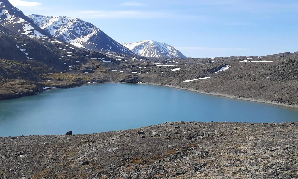
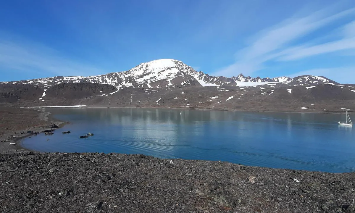
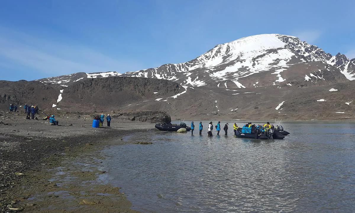
Chris SV Blue Peter says:
area
maritime qualities
description
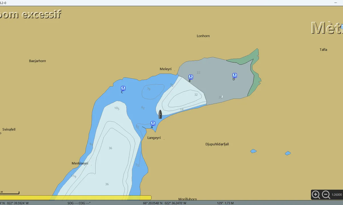
Au nord de Veidileysufjorddur, il y a quatre bons mouillages situés au pied de la réserve naturelle du Hornstrandir. Le départ de la randonnée se trouve sur la côte nord, à 800 mètres avant la fin du fjord. Il est conseillé de bien calculer la marée avant d’y laisser son annexe.
• Mouillage A : 66° 21.0920' N / 022° 39.7894' W. Bien protégé des vents du sud, qui, en s’engouffrant dans le fjord, ont tendance à se renforcer. Ancrage par 5 à 10 mètres de fond, sur substrat de boue compacte mêlée d’algues.
• Mouillage B : 66° 21.6476' N / 022° 38.5654' W. Bien protégé des vents du nord. On ancre par 20 à 24 mètres de profondeur, sur une vase compacte de bonne tenue.
Attention : toute la côte nord du fjord, non cartographiée, n’est pas franche. Il ne faut pas s’en approcher à moins de 400 mètres.
• Mouillage C : 66° 21.4952' N / 022° 40.8493' W. Très beau mouillage au pied des cascades. On jette l’ancre par 6 à 7 mètres de fond.
• Mouillage D : 66° 21.6707' N / 022° 37.0813' W. C’est le mouillage le plus proche du départ de la randonnée.
Approche : la zone n’est pas cartographiée ; la côte nord n’étant pas franche, on accède au mouillage en restant au milieu du fjord. On ancre par 20 à 24 mètres de profondeur, sur une vase compacte. Par vent du nord, les deux vallées produisent un effet venturi qui ne se ressent pas au mouillage A.
1 x helpful | written on 27. Jul 2025 | updated_on 28. Jul 2025
Chris SV Blue Peter says:
area
maritime qualities
description
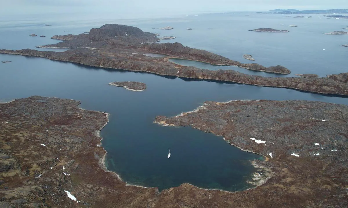
A very practical and easily accessible anchorage when coming from the south. Except for the southwest, this anchorage is well protected. Kangerlua is a former fishing camp built in the 1950s, now in ruins. White-tailed eagles (Haliaeetus albicilla) often nest on the entry rocks.
Approach: Direct access from the south, with a mark on the southwest entry rock and an alignment.
Anchorage: Anchor to the northwest, at the bottom of the bay, in 13-15 meters of water on a firm mud and seaweed bottom.
Beautiful hikes are possible on land.
1 x helpful | written on 31. May 2026 | updated_on 31. May 2026
Chris SV Blue Peter says:
area
maritime qualities
description
Beautiful anchorage located in the channel between Ytre Norskøya Island and Indre Norskøya.
Caution: to the north of the channel, a rock surfaces at a depth of one meter.
The channel is rocky, with large areas of seaweed; however, at its center, at a depth of 10 meters, there is a nice area of hard mud.
1 x helpful | written on 25. Jun 2025
Chris SV Blue Peter says:
area
maritime qualities
description
Kangerluluk is an old fishing camp, now in ruins, located in a very beautiful creek.
There are three anchorage possibilities:
By 10-15 meters in the first bay coming from the north.
By 8-9 meters in the second bay, on a bottom of mud and well-holding seaweed, but a buoy has been placed in its middle, which may interfere with swinging.
In the harbor, at the end of the creek, with mooring lines pulled ashore, but this last maneuver must be done with caution, as a heavy swell can enter.
Beautiful hikes lead to the telecommunications station and/or to the southern anchorage.
1 x helpful | written on 1. Jun 2026
Chris SV Blue Peter says:
area
maritime qualities
description
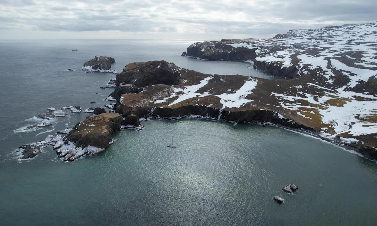
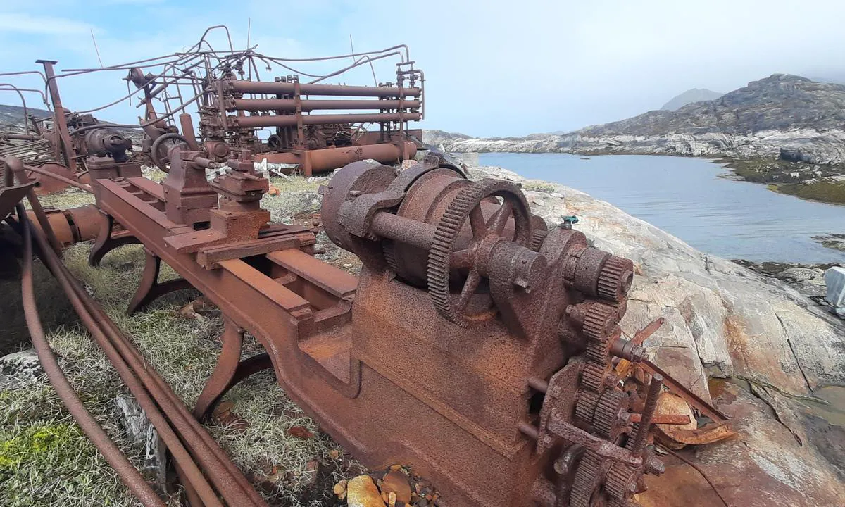
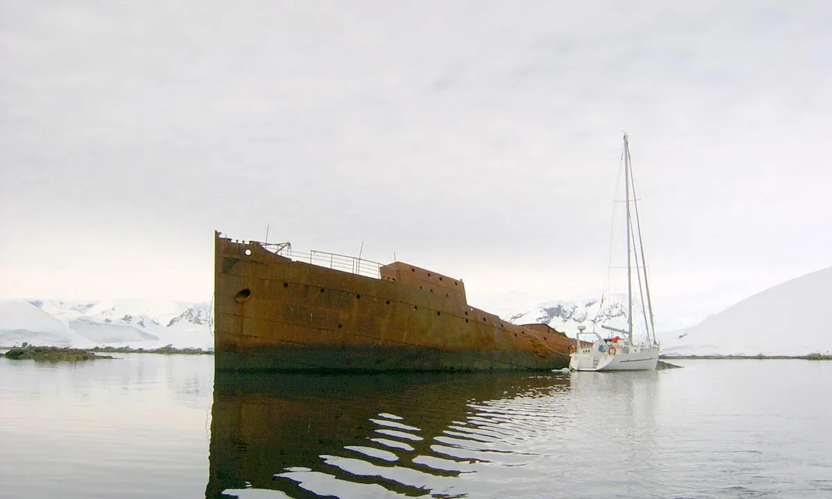
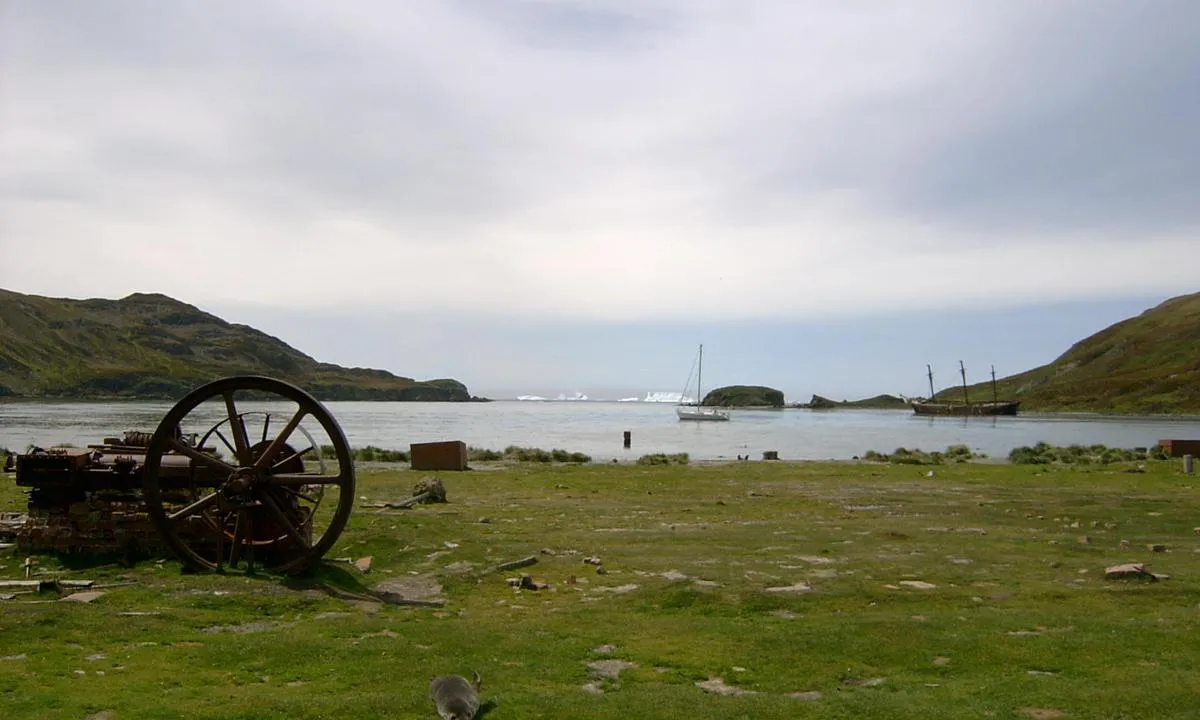
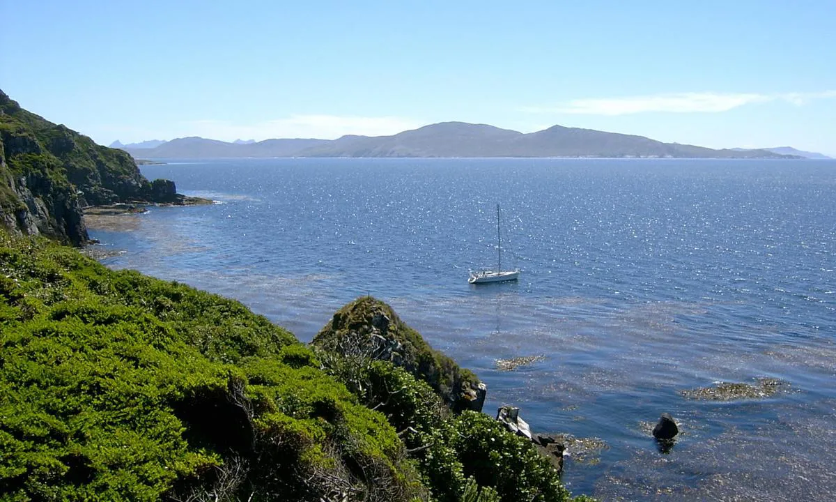
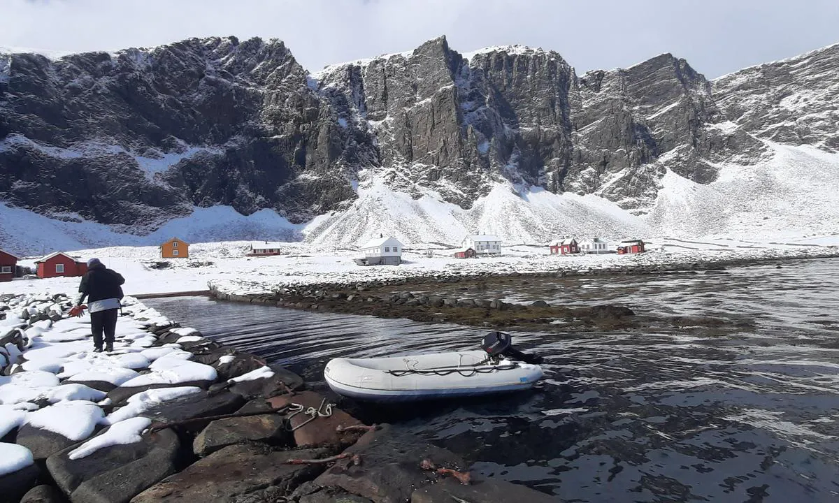
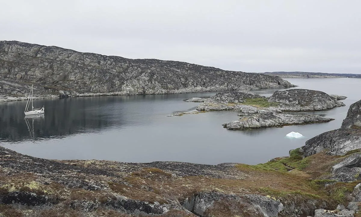
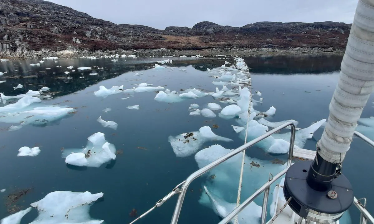
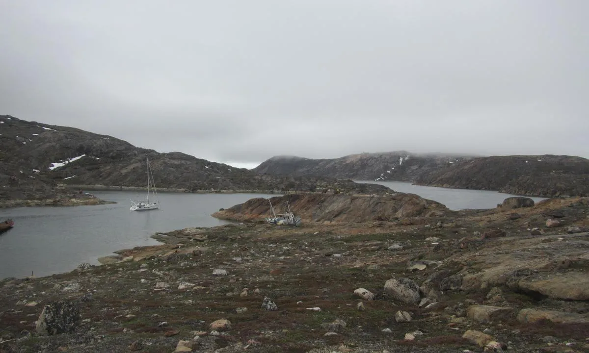
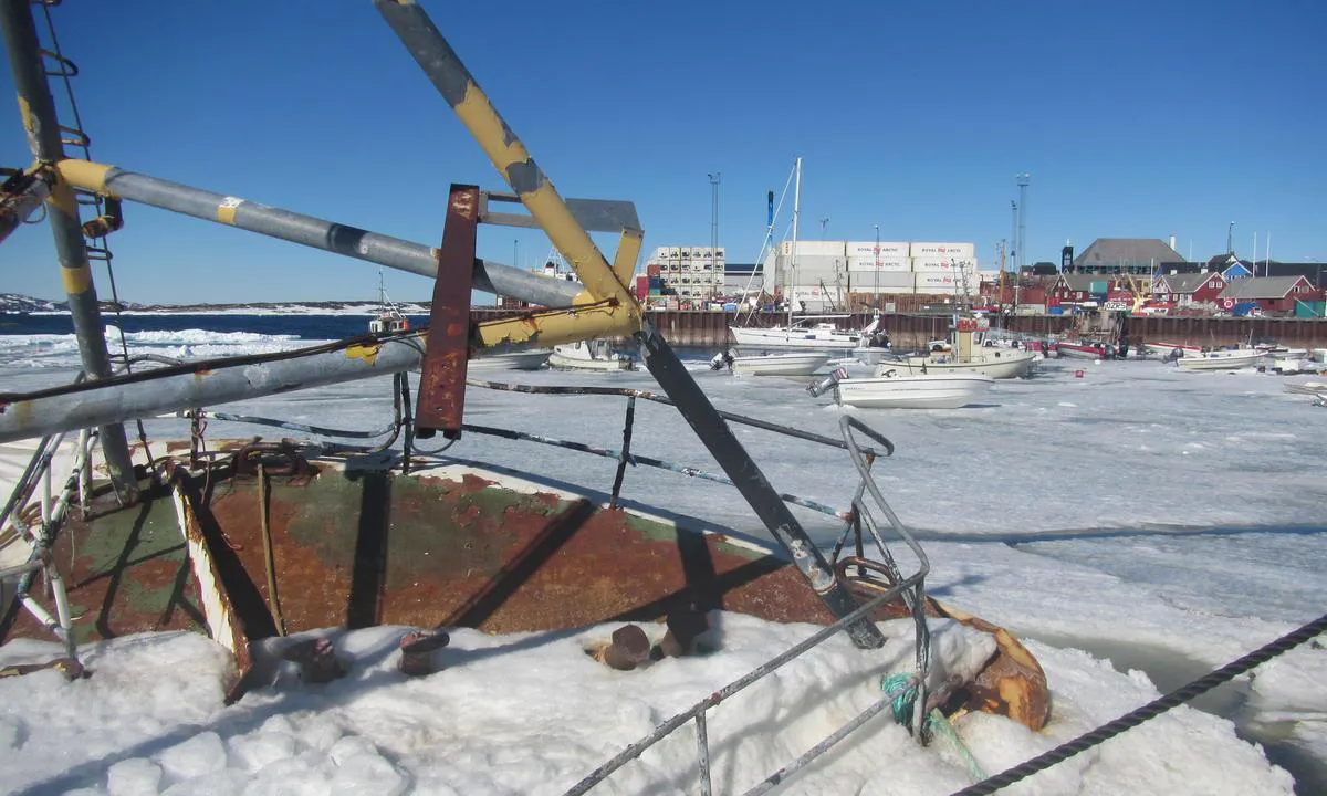
Enterprise is a safe and welcoming anchorage in case of a gale. The site was a frequent stopover for whaling ships at the beginning of the 20th century, notably around the factory ship SS Guvernøren, which caught fire and was then scuttled in 1915. Its wreck, still clearly visible today, can serve as an improvised quay.
Approach:
The approach is made from the southeast or northeast, paying attention to the sounder.
The seabed is cluttered with cables and various debris, making anchorage uncertain.
It is therefore advisable to moor directly along the wreck, securing the moorings to the bollards or to rocks onshore, especially in case of swell.
Fresh meltwater can be collected nearby.
The glacier calves regularly: caution is required regarding falling ice.
The deck of the wreck is now occupied by colonies of Antarctic terns.
1 x helpful | written on 28. Jul 2025
Chris SV Blue Peter says:
area
maritime qualities
description
Trinityhamna est l’un des meilleurs mouillages de la côte ouest pour se protéger des vents d’ouest et du sud. Néanmoins, le glacier de Waggonwaybreen est très actif et le fjord peut être couvert de growlers en quelques heures.
Ancien site d’une station baleinière britannique active jusqu’en 1623, le lieu est désormais classé monument culturel. Après la fermeture de la station, il a continué d’être utilisé comme lieu de sépulture.
C’est également une escale privilégiée pour les navires de croisière, qui y organisent souvent des visites à terre. Il est recommandé d’éviter de débarquer en même temps qu’eux, car ces visites sont soumises à des règles strictes, que vous devrez respecter si vous êtes à terre en même temps qu’eux.
On peut mouiller devant la plage par 6 à 7 mètres de fond sur du sable, ou par 15 à 20 mètres sur un fond de vase dure.
Le gouverneur y dispose d’un refuge, et deux officiers y résident pendant la saison de navigation.
1 x helpful | written on 25. Jun 2025 | updated_on 27. Jun 2025
Chris SV Blue Peter says:
area
maritime qualities
description
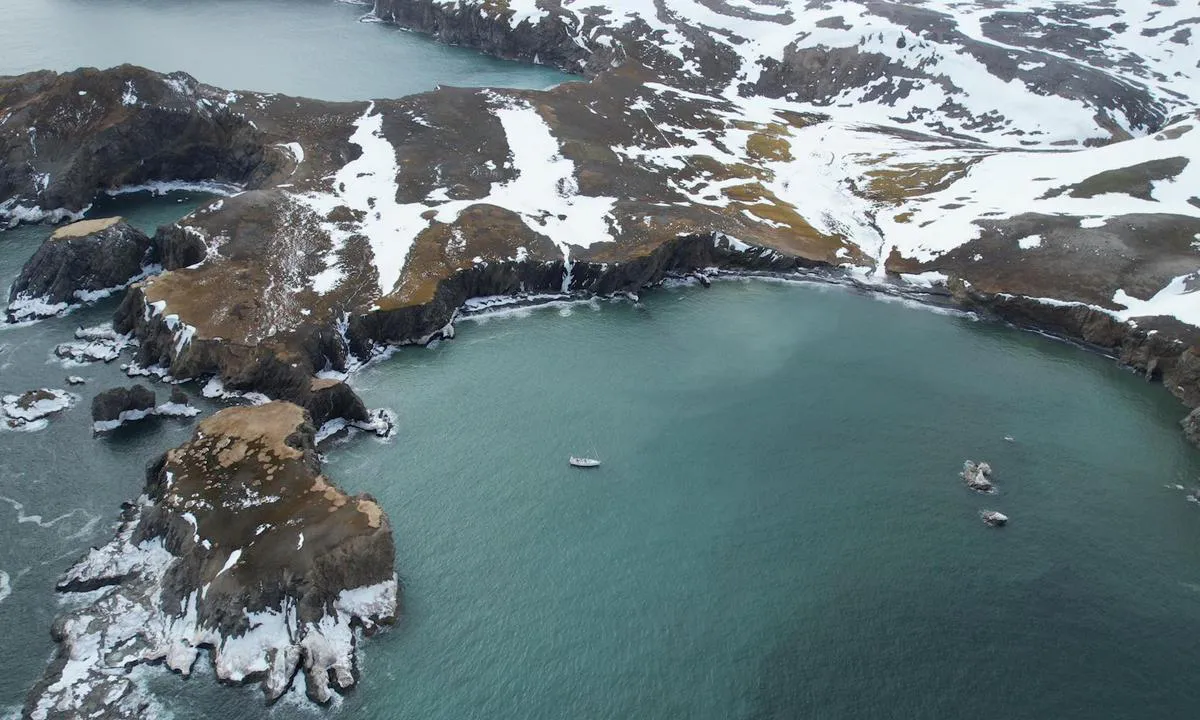
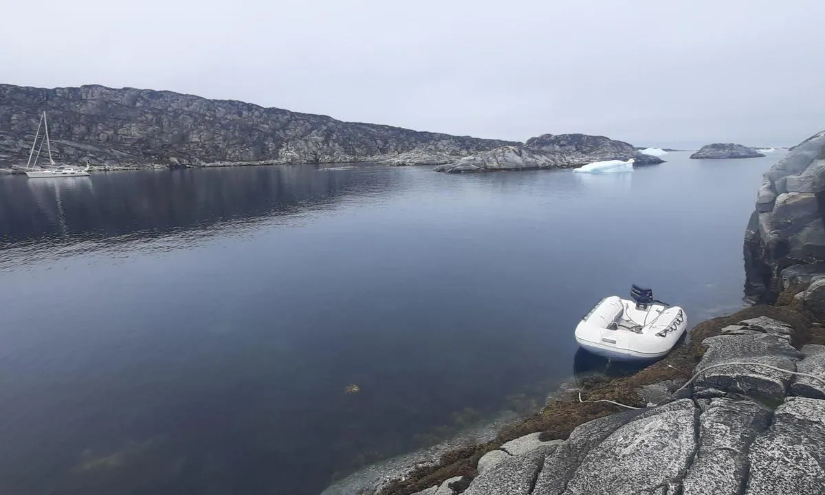
Fair-weather anchorage, exposed to the presence of ice. The site is named after the French explorer Jean-Baptiste Charcot, who wintered here during his expeditions in the early 20th century.
Approach: The entrance to the bay can be tricky due to drifting ice, especially at the beginning of the summer season.
Anchoring is done with an anchor, accompanied by mooring lines tied to the rocks.
Gentoo penguins, seals, and petrels are regularly observed here.
1 x helpful | written on 28. Jul 2025
Chris SV Blue Peter says:
area
maritime qualities
description
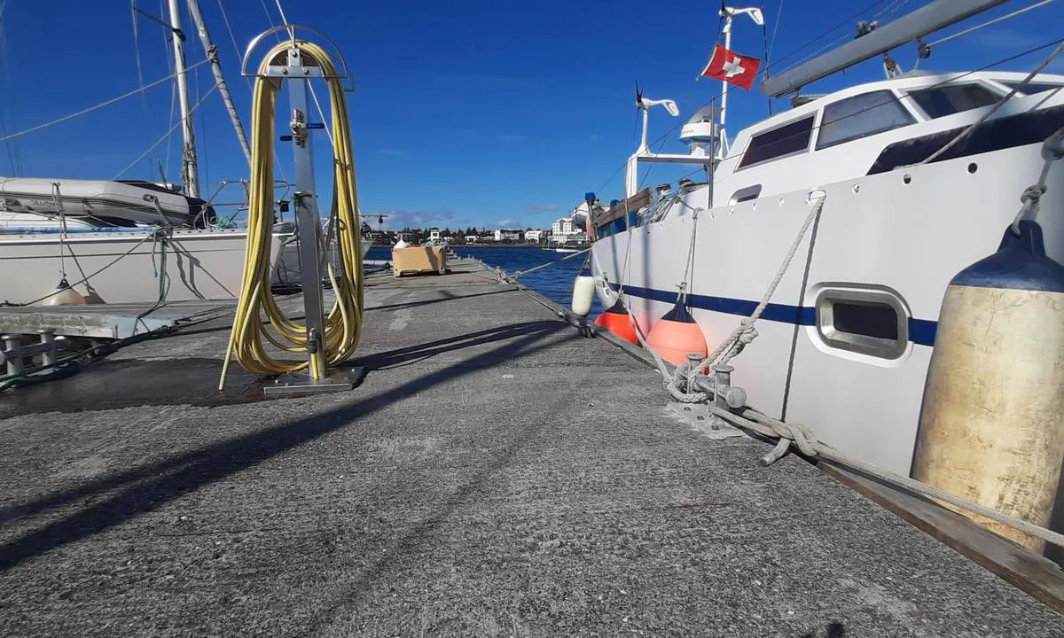
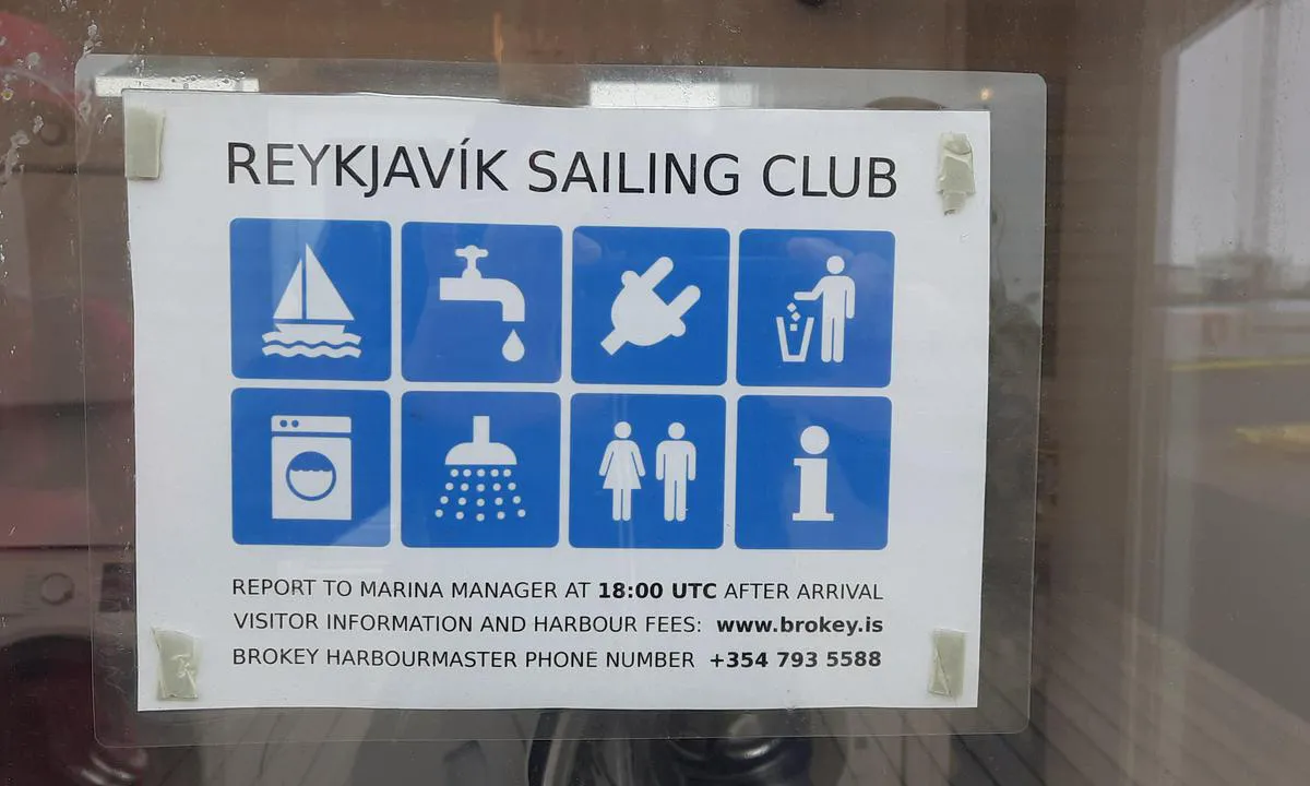
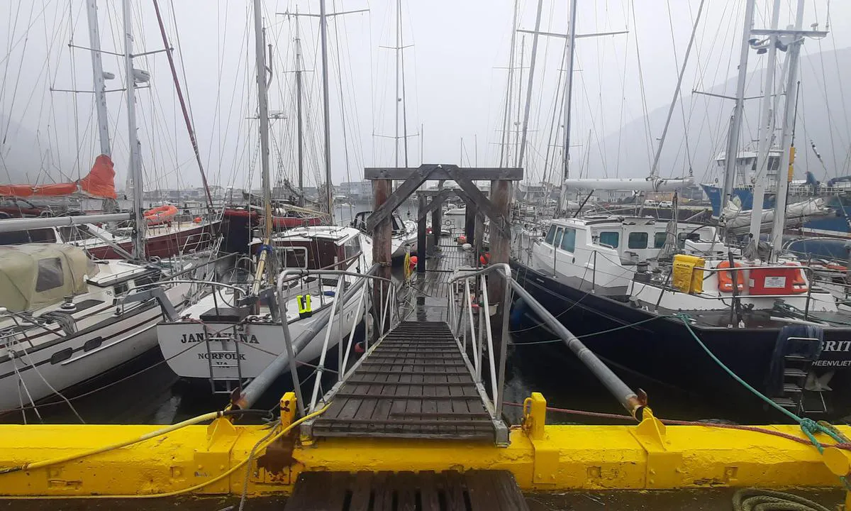
Le Club de voile de Reykjavik met à disposition deux pontons pour visiteurs situés au cœur de la capitale, faisant de ce lieu une escale idéale pour une visite de la ville. Ces places sont principalement prévues pour des séjours de courte durée. En hiver, le club est fermé.
Aucune réservation n’est possible : les places sont attribuées selon le principe du « premier arrivé, premier servi ». Si les emplacements le long du ponton sont complets, il est d’usage de s’amarrer à couple. Veuillez contacter le club le jour de votre arrivée, avant 18 h, afin de vous enregistrer et de recevoir le code d’accès aux sanitaires.
1 x helpful | written on 19. Aug 2025 | updated_on 21. Aug 2025
Chris SV Blue Peter says:
area
maritime qualities
description
Large bay surrounded by high sand dunes.
Direct approach from the south.
Arrival from the north requires navigating around numerous rocks and should only be attempted in good weather conditions.
The bay offers two beautiful anchorage areas:
1. To the northwest, at a depth of 7 to 8 meters. This anchorage is the most sheltered, but the seabed alternates between rocky and sandy areas.
2. To the north, at a depth of 9 to 10 meters, on an excellent holding sandy bottom.
The beach has a gentle slope, which requires hauling the dinghy up several tens of meters to secure it.
1 x helpful | written on 2. Jun 2026
Chris SV Blue Peter says:
area
maritime qualities
description
Very beautiful anchorage protected on 360°. In strong south winds, some fetch can still form.
Approach: from the south or from the north, staying on the west side of the channel.
Anchorage at 7 to 8 meters on a sandy bottom with patchy large algae.
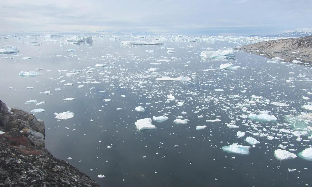
Unobstructed view from the top of Uigordleq over the icebergs and Disko Bay. Beware of rocks that can be slippery in wet weather.
1 x helpful | written on 23. Jun 2026 | updated_on 23. Jun 2026
Chris SV Blue Peter says:
area
maritime qualities
description
Beautiful bay surrounded by high sand dunes.
Approach: The presence of many rocks requires careful piloting and favorable weather conditions.
Anchorage: The east-southeast sector of the bay is sandy. Anchor to the west on a sandy bottom with excellent holding.
High dunes border the beach directly, requiring some effort to reach the mainland.
1 x helpful | written on 2. Jun 2026
Chris SV Blue Peter says:
area
maritime qualities
description
Histoire : Au cœur de la baie de Disko, Imerigssoq demeure aujourd’hui un village fantôme, témoin silencieux d’une histoire arctique brève mais intense. Fondé en 1778 autour de la chasse à la baleine, le comptoir connut un essor fulgurant avant de disparaître en 1826, épuisé par le déclin des ressources. Renaissant en 1888 comme centre commercial inuit, le village devint un refuge vivant de pêcheurs, avec son école, son magasin et ses entrepôts. Après avoir atteint son apogée dans les années 1960 avec près d’une centaine d’habitants, Imerigssoq s’éteignit peu à peu. En 1968, le village fut abandonné.
L’approche se fait par le nord-est
Ce mouillage est ouvert au nord-est. On ancre devant le village sur 6-7 mètres d’eau.
1 x helpful | written on 23. Jun 2026 | updated_on 24. Jun 2026
Chris SV Blue Peter says:
area
maritime qualities
description
Upernavik, with a population of about 1,050 inhabitants, is the northernmost town in Greenland. It serves as the main gathering point for boats before they set out on the Northwest Passage. Even though one can never be certain to find everything needed, with a bit of luck, one can reasonably expect to solve most common problems there.
There are three nautical hardware stores, propane, diesel, and gasoline available at the dock, a supermarket, a hospital, a dentist, and an airport served by domestic flights.
The port has two docks and in its northern part, an anchorage area that can accommodate several sailboats. Anchoring is at 7 to 15 meters on a rock and mud bottom, with the possibility of tying a line ashore if the number of yachts at anchor increases.
When weather conditions deteriorate, it is preferable to anchor to the northeast of the island, in the excellent anchorage of Aorrussaarssuk.
1 x helpful | written on 8. Jul 2026 | updated_on 8. Jul 2026
Chris SV Blue Peter says:
area
maritime qualities
description
Le port ne semble pas prévu pour accueillir les bateaux visiteurs. Il y a un ponton à diesel, mais la pompe ne fonctionne qu’avec un badge (tag). Néanmoins, ce ponton peut être le bienvenu en cas de besoin.
Le port n’ayant pas été dragué, il convient de faire attention aux sondes, notamment par basse mer.
1 x helpful | written on 29. Jul 2025 | updated_on 4. Aug 2025
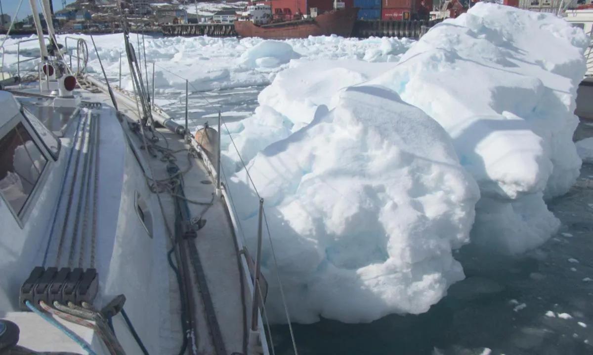
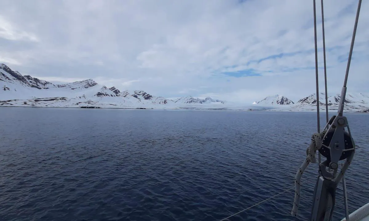
Chris SV Blue Peter says:
area
maritime qualities
description
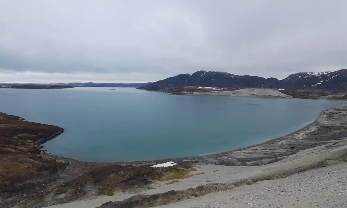
Gipsvika, located in the Sassenfjord, is a large bay open towards the west. You can anchor there along the eastern coast, in 10 to 13 meters of water, on a hard mud bottom.
1 x helpful | written on 5. Jun 2025
Chris SV Blue Peter says:
area
maritime qualities
description
Beautiful anchorage in a moraine lagoon carved by the glacier.
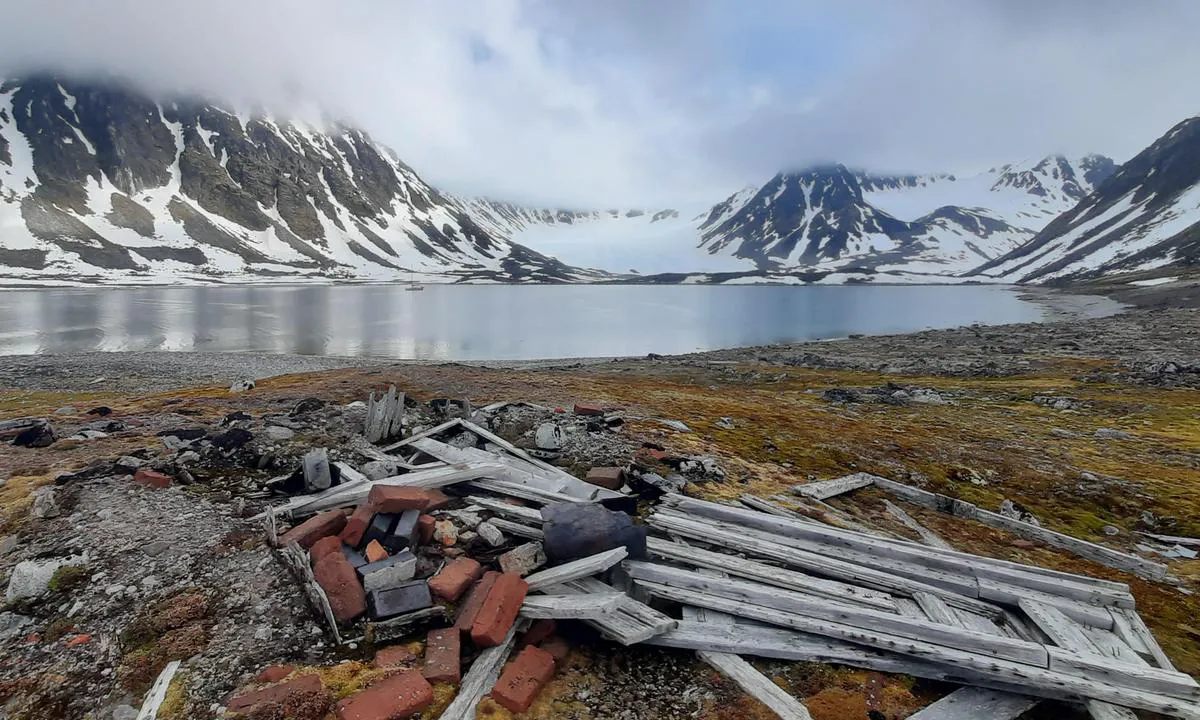
Despite its reassuring appearance, Hamburgerbukta is considered a fair-weather anchorage. As soon as the wind picks up, strong katabatic winds descend from the glacier.
Approach: Due to the overflow of rocks to the south, and to a lesser extent to the north, the navigable part of the pass is relatively narrow.
Anchor in 12 to 16 meters of water, on silt offering moderate holding.
On land, you will find relics from the whaling era, as well as a few graves.
1 x helpful | written on 27. Jun 2025
Chris SV Blue Peter says:
area
maritime qualities
description
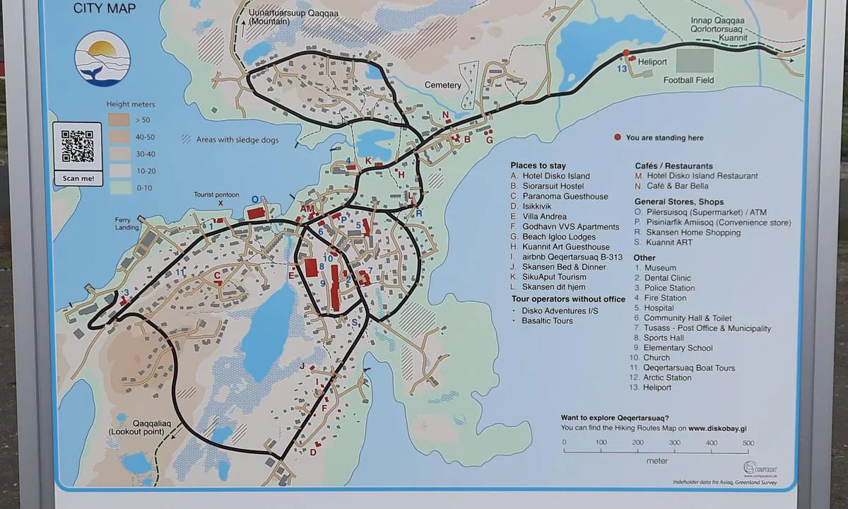
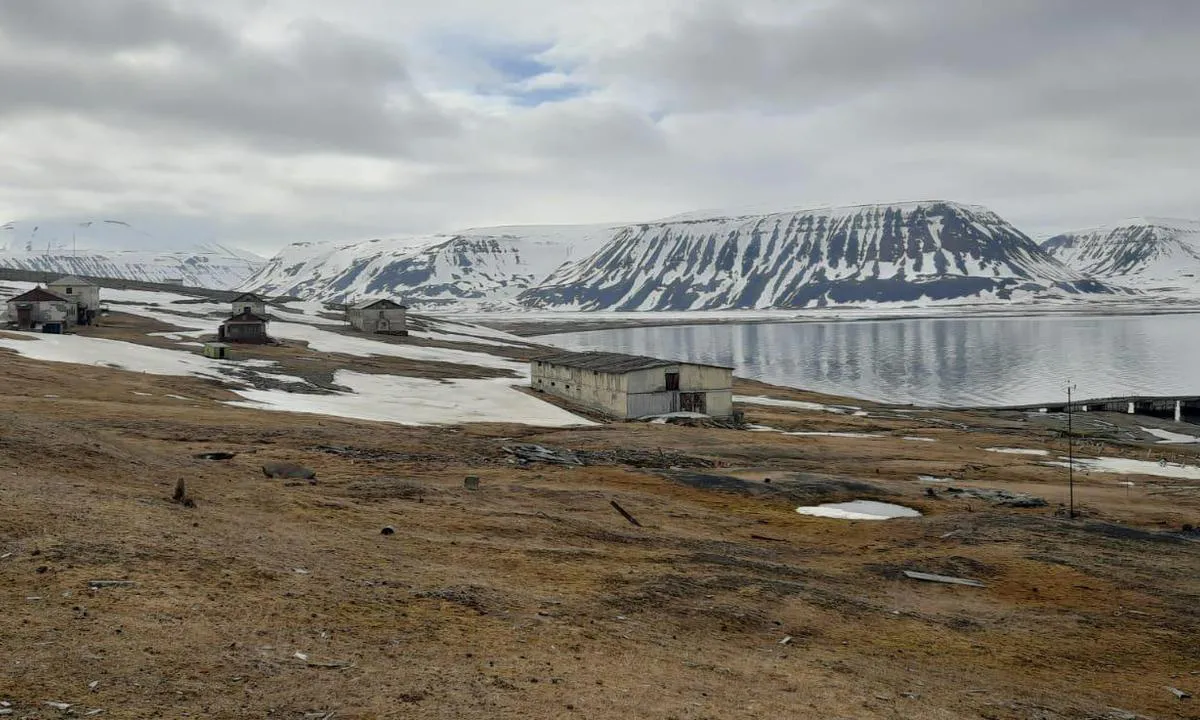
Port bien abrité. Qeqertarsuaq est une escale agréable d'où débutent plusieurs belles randonnées dominant la baie de Disko et ses icebergs. Il est préférable d'entreprendre ces randonnées en fin d'après-midi afin de profiter pleinement de la lumière.
Approche : L'alignement d'entrée est au 061° ; il faut bien le respecter, car le chenal est étroit et l'on passe relativement près des roches.
Le quai et le mouillage se trouvent dans l'Eulners Bugt, bras sud-ouest du port. Le deuxième bras situé à l’est est peu profond et offre une protection moindre.
Mouillage : Ancrage par 12 m de fond. Tenue moyenne à bonne. Possibilité de frapper des aussières à terre. Il est également possible de s'amarrer au quai situé au fond du bras, mais le trafic portuaire y est important.
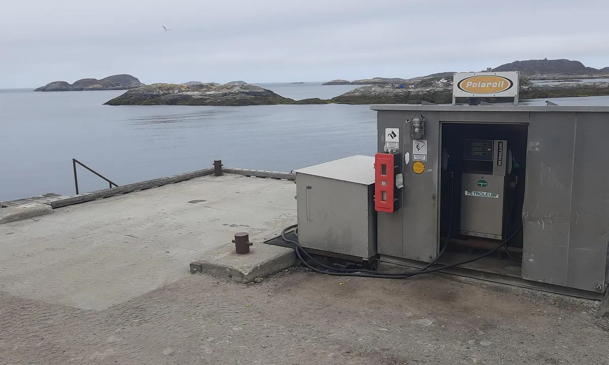
Carburant : Petit ponton de distribution de diesel et d'essence, solide et bien aménagé, situé au fond du bras. La profondeur à marée basse est supérieure à 3 m. L'espace de manœuvre est limité ; il est préférable d'effectuer le ravitaillement par temps calme. La station fonctionne en libre-service, par carte de crédit, 24 h/24.
1 x helpful | written on 25. Jun 2026 | updated_on 29. Jun 2026
Chris SV Blue Peter says:
area
maritime qualities
description
Tálknafjörður est un bon mouillage, protégé par une langue de terre. Néanmoins, par vents de sud à est, il peut y avoir du fetch.
Approche : La passe est matérialisée par l’alignement de deux marques jaunes faiblement éclairées. En cas de mauvaise visibilité, elles sont difficiles à distinguer. Côté langue de sable, une bouée bâbord lumineuse signale les hauts-fonds. Juste après celle-ci, on peut virer à bâbord pour accéder au mouillage.
Mouillage : On jette l’ancre par 14 à 18 mètres de fond, sur un substrat composé de sable, de vase, de roche et d’algues. Une fois l’ancre bien crochée, le mouillage offre une bonne tenue. Attention toutefois : le fond remonte rapidement, et du côté du port, il y a deux lignes électriques sous-marines.
À moins d’une heure de marche le long de la route du fjord, on trouve des sources chaudes avec un bain public. L’endroit est gratuit et accessible 24h/24, 7j/7 — à ne pas manquer.
1 x helpful | written on 30. Jul 2025 | updated_on 3. Aug 2025
Chris SV Blue Peter says:
area
maritime qualities
description
Approche : Assurez-vous d’avoir pris connaissance des conditions de glace, des courants et du mascaret propres à Bjørnøya.
Le mouillage est bien protégé des vents du sud et de l’ouest. Mouillez du côté sud de la petite baie, par 5 à 6 mètres de fond, sur un fond de roches et de galets. Kvalrossbukta est considéré comme le mouillage le moins rouleur de Bjørnøya.
Même par temps calme, le débarquement nécessite une grande prudence. La plage de galets présente une pente abrupte, et des déferlantes peuvent se former à marée haute, même si la mer semble calme à marée basse. À terre, subsistent quelques vestiges d’une station baleinière datant du début du XXe siècle. On y trouve également le départ de quelques randonnées.
1 x helpful | written on 17. May 2025 | updated_on 18. May 2025
Chris SV Blue Peter says:
area
maritime qualities
description
Large bay well-protected from southern winds and their swell.
Anchorage possible at depths of 6 to 10 meters, on a hard mud substrate scattered with large algae. At the beginning of the season, the anchorage may be exposed to drifting ice, and for the rest of the summer, to that coming from the glaciers.
Landing is done on a beach of sand and small pebbles. On land, there are ruins of several old whaling stations.
1 x helpful | written on 18. May 2025
Chris SV Blue Peter says:
area
maritime qualities
description
Ebeltofthamna is a shallow bay that offers relative protection against west to north winds.
You can anchor here in 4 to 6 meters of water, on a sandy bed well-covered with seaweed. The holding is quite moderate.
Onshore, you can observe reindeer as well as remnants from the whalers' era.
1 x helpful | written on 28. Jun 2025
Chris SV Blue Peter says:
area
maritime qualities
description
Atammik is the first village located north of Nuuk. About 150 inhabitants live there, primarily from fishing.
The village has two quays. The first, encountered upon arrival, is reserved for the service station and the supply ship. The second quay is just behind the rock, in front of the fish processing hangar. It is possible to moor there, but fishing boats regularly dock to unload their fish cargo using a crane.
Another option is to anchor in the bay, between the rocks.
Atammik has a Pilersuisoq grocery store.
Approach:
The side of the entry channel on the village side is safe and rock-free.
Fuel:
The service station is equipped with three pumps: diesel, gasoline, and kerosene. It is not self-service. The fuel is distributed at the quay, but payment is made at the Pilersuisoq grocery store.
1 x helpful | written on 9. Jun 2026 | updated_on 9. Jun 2026
Chris SV Blue Peter says:
area
maritime qualities
description
Magnifique mouillage au pied du glacier Esmarkbreen.
Il y a deux possibilités de mouillage :
Sur le seuil, par 15 à 16 mètres de profondeur, sur un fond de roches et de vase.
Juste après le seuil, à l’est, par 12 à 15 mètres de profondeur, sur un fond vaseux. Au-delà de cette profondeur, le fond plonge rapidement.
Le glacier ne vêle pas, et il est possible de longer la moraine en annexe.
1 x helpful | written on 8. Jun 2025 | updated_on 9. Jun 2025
Chris SV Blue Peter says:
area
maritime qualities
description
Bon mouillage, ouvert au nord et à l’est, mais bien abrité des vents du sud et de l’ouest. Bien que le glacier ne soit pas visible depuis cet endroit, la vue sur les montagnes environnantes est splendide.
Le mouillage se fait par 10 à 13 mètres de fond, sur un fond de vase dure offrant une bonne tenue, ponctué de zones d’algues.
À marée basse, la plage se découvre largement ; il est donc conseillé de choisir soigneusement l’horaire du débarquement.
Une colonie de rennes sauvages fréquente les environs, offrant parfois de belles observations.
1 x helpful | written on 20. May 2025 | updated_on 23. May 2025
Chris SV Blue Peter says:
area
maritime qualities
description
Ancienne station baleinière, Tovqussaq est un mouillage de temps calme. Par condition plus soutenue, il est préférable de mouiller à Inderhavn (Ankerbugt), baie située à 1 Nm au nord.
Histoire : Camp établi au XIXe siècle, dans les années 1930, Tovqussaq devint un comptoir de traite de pêche. En 1962, toute l’usine a été détruite par un incendie et le site a été abandonné.
Approche : Direct par le sud. Lorsqu’on vient du nord, on peut prendre l’étroite passe au nord de l’île Langø en serrant côté sud afin d’éviter la roche au nord.
Mouillage : La zone de mouillage est relativement petite. On mouille par 10-12 mètres sur un fond rocheux et d'algues, de tenue aléatoire.
1 x helpful | written on 10. Jun 2026 | updated_on 10. Jun 2026
Chris SV Blue Peter says:
area
maritime qualities
description
If you have a sailboat with a shallow draft, Nilspollen offers an ideal shelter. A Danish boat spent the winter of 2002-2003 there.
Anchor in two meters of water, with shore lines secured if the wind picks up.
1 x helpful | written on 29. Jun 2025
Chris SV Blue Peter says:
area
maritime qualities
description
Signehamna is a good anchorage, well protected from north, west, and south winds. However, due to the proximity of Lilliehöökbreen, the bay can fill with ice in a few hours.
Anchorage: between 4 and 13 meters depth, on a muddy bottom offering good holding.
Beautiful hikes are possible on land, with some remnants, notably those of a German weather station from World War II, bombed by Norwegian troops.
It is also a stop included in the itinerary of some cruise ships.
1 x helpful | written on 29. Jun 2025
Chris SV Blue Peter says:
area
maritime qualities
description
Good anchorage located in the glacier moraine. Drift ice rarely penetrates here.
Except for easterly winds, it is well protected from all other directions. However, strong south and west winds can cause katabatic gusts.
Anchor in 5 to 7 meters of water, on a hard mud bottom that offers good holding.
It is common to observe reindeer here, and occasionally a group of walruses may come to rest for long periods on the peninsula.
1 x helpful | written on 21. May 2025
Chris SV Blue Peter says:
area
maritime qualities
description
Très beau mouillage situé à moins de deux milles d’Upernavik, offrant une bonne protection contre tous les vents, à l’exception des vents de nord. À terre, de belles randonnées invitent à la balade. Une petite plage permet de débarquer en annexe.
La baie est divisée en deux criques par un promontoire.
La crique sud-ouest offre davantage d’espace d’évitage. On y mouille par 13 à 15 mètres sur un fond de roche et de vase de bonne tenue. Attention à la sonde de 2 mètres, qui correspond en réalité à une roche découvrant à marée basse de vive-eau.
La crique sud-est est plus petite et nécessite de frapper une ou deux aussières à terre. Par vent de secteur sud, le col génère un effet Venturi qui accélère le vent dans cette partie du mouillage.
1 x helpful | written on 11. Jul 2026 | updated_on 13. Jul 2026
Chris SV Blue Peter says:
area
maritime qualities
description
Magnificent anchorage located near Upernavik.
Approach: Watch out for numerous rocks, as the area is poorly or even not charted.
Anchor in the north-west bay, just after the small island, in 10 to 12 meters on a good holding ground.
The island of Langøe offers great hiking opportunities.
1 x helpful | written on 11. Jul 2026
Chris SV Blue Peter says:
area
maritime qualities
description
Beautiful anchorage with a clear water river at its bottom. Except for a small opening to the west, Inderhavn is protected on all other sides.
Approach: Directly from the south, avoiding the rocks to the east at the entrance of the bay. Coming from the north, one can take the narrow pass located north of Langø Island, keeping close to the south side to avoid the rock found to the north.
Anchor in the north of the bay in Ankerbugt in 8-10 meters of water over a muddy bottom with large algae patches.
Landing with a dinghy is not the most comfortable. When going ashore, it is advisable to moor your dinghy at high tide to avoid finding it stranded on the rocks. At high tide, the clear water river invites you to refill your water supply and/or do some good laundry.
1 x helpful | written on 11. Jun 2026 | updated_on 11. Jun 2026
Chris SV Blue Peter says:
area
maritime qualities
description
Private harbor located in the industrial zone. For transient sailboats, the port of Akureyri, located downtown, is more suitable.
1 x helpful | written on 8. Sep 2025
Chris SV Blue Peter says:
area
maritime qualities
description
Akureyri is the largest city in northern Iceland and serves as a port of entry. The port, located in the heart of the city, is very well sheltered. The floating pontoon has two spaces for visitors, with water and electricity, but no other amenities.
1 x helpful | written on 8. Sep 2025
Chris SV Blue Peter says:
area
maritime qualities
description
Djúpivogur is a charming village located in a magnificent isolated region. Its harbour is very well protected and several sailing boats have already wintered there.
Approach: The access channel is narrow and cluttered with rocks. The buoyage is not very obvious in poor visibility. If it is not clearly discernible, it is advisable to head up the fjord and anchor in a clearer area while waiting for an improvement.
In the surroundings, there are very beautiful hiking trails.
1 x helpful | written on 8. Sep 2025
Chris SV Blue Peter says:
area
maritime qualities
description
Ce mouillage peut devenir intéressant en début de saison pour un atterrissage lorsque Nanortalik, Qaqortoq ou les deux sont pris dans les glaces. C'est également un excellent mouillage pour se protéger des coups de vent d'ouest à nord. Par vent du sud, la houle peut y entrer.
On y mouille au fond de la crique par 10 mètres sur un substrat composé de boue, d’algue et roche, avec des aussières tirées à terre. Il est déconseillé de mouiller par 20 mètres de fond, car des icebergs y pénètrent fréquemment. De hautes antennes de télécommunications sont installées au sommet de l'île. De petites randonnées sont possibles à terre.
1 x helpful | written on 11. May 2026 | updated_on 12. May 2026
Chris SV Blue Peter says:
area
maritime qualities
description
Situated between the Eidembreen and Vennerrbreen glaciers, Farmhamna is a good anchorage, offering good protection from southern winds. In case of eastern winds, due to acceleration of the flow caused by the glaciers, the wind speed can easily double.
Anchor at depths of 6 to 10 meters, on a muddy substrate scattered with algae. The holding depends on the location; do not hesitate to re-anchor until you are satisfied.
On land, a family of trappers resides there year-round.
1 x helpful | written on 10. Jun 2025
Chris SV Blue Peter says:
area
maritime qualities
description
Tunulliatsiaap Nunaa 60°47.9896'N-047°14.6765'W
En cas de coup de vent dans la région, c’est ici qu’il faut venir. Avec une protection presque totale à 360°, Tunulliatsiaap Nunaa est un mouillage que j’apprécie beaucoup, car il permet de relâcher sans trop se soucier de la météo.
Approche : Les 3 petites baies se ressemblent un peu. Attention à celle de l'est : elle est dangereuse. À marée basse, le seuil de cette dernière est à 0,80 mètre et une grosse roche se trouve en son milieu. Les mouillages du milieu et de l'ouest sont praticables.
Le seuil d’entrée est de 3,5 mètres et on mouille par 5,5 mètres sur un fond de vase dure et de bonne tenue. Dans ce mouillage, il est d’usage de tirer des aussières à terre. Si le temps est calme et que l’ancre suffit, il est possible de mouiller dans la petite crique adjacente, côté ouest.
1 x helpful | written on 13. May 2026 | updated_on 20. May 2026
Chris SV Blue Peter says:
area
maritime qualities
description
Beau mouillage situé au pied des falaises, souvent utilisé par les trappeurs et les expéditions.
Midterhukhamna signifie « le port du promontoire central » Deux cabanes de chasseurs se trouvent sur la péninsule : la première, située sur la plage, date de 1898 ; la seconde, construite en 2014, à l’arrière.
Le mouillage est encadré par des récifs, à l’est comme à l’ouest.
On jette l’ancre au milieu de la petite baie, par 7 à 8 mètres de profondeur, sur un fond de vase, de roche, ponctué de zones d’algues. La tenue est moyenne. Par vent de sud-est à nord-est, la vallée située juste à l’est du mouillage crée un effet venturi : de fortes rafales balaient alors la zone et le mouillage devient rapidement intenable.
L’accès à terre se fait par une plage. Des rennes y sont fréquemment observés.
Au nord, une réserve ornithologique abrite de nombreuses espèces d’oiseaux. Durant la période de nidification, il est interdit de s’en approcher à moins de 300 mètres.
1 x helpful | written on 25. May 2025 | updated_on 14. Jun 2025
Chris SV Blue Peter says:
area
maritime qualities
description
Even though a small point may protect from the chop coming from the north, Selvågen is, above all, a good anchorage for sheltering from southern winds.
There are several anchoring options: either on the threshold, at a depth of 16 to 17 meters, or on one of the sides, at a depth of 4 to 10 meters, on a seabed of mud and shells.
On land, several groups of reindeer can be seen grazing.
1 x helpful | written on 11. Jun 2025
Chris SV Blue Peter says:
area
maritime qualities
description
Port pour voiliers visiteurs conçu pour résister aux tempêtes hivernales.
L’installation comprend deux pontons flottants ainsi qu’un quai, tous équipés en eau douce et en électricité.
Le capitaine du port est très serviable et l’ambiance générale est chaleureuse.
Ísafjörður Pollur est un port d’entrée.
1 x helpful | written on 22. Jul 2025 | updated_on 23. Jul 2025
Chris SV Blue Peter says:
area
maritime qualities
description
Très beau mouillage atypique, protégé par un cordon littoral s’étendant sur plus de 3 milles nautiques. Ce cordon, composé de sable, s’est formé en remplacement de l’estran tel que représenté sur les cartes marines, offrant une bonne protection contre la houle de secteur sud. À l’extrémité de ce cordon, plusieurs colonies de morses sont fréquemment observées.
Approche : le courant du chenal peut être assez vif. De H-3 à H+3 par rapport à la pleine mer, le flot porte vers le nord.
Mouillage : on mouille par 5 à 6 mètres d’eau, sur fond de sable, à environ 3 encablures à l’ouest du phare, sensiblement à mi-distance entre celui-ci et l’extrémité ouest de la péninsule.
1 x helpful | written on 11. Jun 2025 | updated_on 11. Jun 2025
Chris SV Blue Peter says:
area
maritime qualities
description
Pollur is a large anchorage with depths ranging from 10 to 13 meters. It is possible to disembark and leave your dinghy at one of the two floating pontoons in the port of Pollur.
1 x helpful | written on 22. Jul 2025
Chris SV Blue Peter says:
area
maritime qualities
description
Spectacular anchorage. It happens that an impressive number of large icebergs penetrate through the deep waters of the channel, giving this place a unique atmosphere.
Ritenbenk is a former Danish trading post founded in 1795. At the beginning of the 20th century, it reached its peak with around 130 inhabitants. In 1942, Ritenbenk lost its colony status and in 1959, the village was permanently abandoned.
Today, this place is called Appat. During the salmon season, fishermen from the surrounding villages come here to traditionally smoke freshly caught salmon using bearberry wood (bearberries).
Approach: The landing area is not charted, but the approach from the west is considered safe.
Anchorage: To benefit from the best protection against drifting icebergs, anchor in front of the old village in 10 meters of water, on a sandy and seaweed bottom offering medium to good holding. It is then recommended to tie one or two lines ashore to maintain between 3 and 4 meters of water under the keel at low tide, as the shallow depth then acts as a natural barrier against large ice.
1 x helpful | written on 30. Jun 2026 | updated_on 30. Jun 2026
Chris SV Blue Peter says:
area
maritime qualities
description
This port is used by small local vessels; the harbour for visiting sailboats is Ísafjörður Pollur, located on the other side of the peninsula.
1 x helpful | written on 22. Jul 2025
Chris SV Blue Peter says:
area
maritime qualities
description
Beautiful anchorage, well sheltered from all winds. Beware of the two submarine cables that cross it in its middle. Diesel pontoon with water and electricity,
Norheimsund is a pleasant small town, with three supermarkets, several hardware stores, medical and dental services, regular bus connections, as well as beautiful hikes to discover in the surroundings.
A creative and enthusiastic community lives there.
1 x helpful | written on 20. Mar 2025 | updated_on 20. Mar 2025
Chris SV Blue Peter says:
area
maritime qualities
description
Belle baie protectrice bordée, au sud, par un magnifique massif montagneux.
De nombreuses roches frangeantes parsèment l’approche. Celle-ci est plus aisée en empruntant l’Hamborgersund. Attention à la grosse roche frangeante qui occupe la moitié sud-est de l’entrée du mouillage.
La baie offre deux possibilités de mouillage :
1. Entre l’îlot et la côte ouest, avec des aussières frappées à terre. On mouille par 12 mètres sur un fond de vase de bonne tenue.
2. Dans la deuxième partie de la baie, par 2,1 mètres d’eau (basse mer de vive-eau), sur un fond de vase parsemé de grosses algues offrant une bonne tenue.
Belle randonnée à terre, notamment vers les ruines d’Appamiut.
1 x helpful | written on 15. Jun 2026 | updated_on 15. Jun 2026
Chris SV Blue Peter says:
area
maritime qualities
description
Magnificent anchorage at a depth of 18-19 meters, offering good holding. The high rocks surrounding it significantly attenuate strong winds. Due to the swing room of the chain, the first boat generally occupies the entire area to the south. However, in good weather, it is customary to run one or two shore lines (bring pitons).
1 x helpful | written on 25. Mar 2025 | updated_on 25. Mar 2025
Chris SV Blue Peter says:
area
maritime qualities
description
Sur le port, de vieux bâtiments industriels cachent un charmant village. En été, 120 à 150 habitants y résident, pour la plupart des scientifiques. On y trouve un petit aéroport avec trois vols par semaine, un bureau de poste, un magasin de souvenirs et surtout la dernière bonne occasion de faire le plein de diesel.
Mouillage : entre le port et l’ancien quai endommagé. On mouille par 6 à 8 mètres sur un fond de sable et de zones d’algues.
On peut laisser son annexe sur la petite plage qui se trouve à gauche de l’ancien quai.
Il n’y a pas de poubelle publique à Ny-Ålesund ; le conteneur le plus proche se trouve à Longyearbyen.
1 x helpful | written on 12. Jun 2025 | updated_on 13. Jun 2025
Chris SV Blue Peter says:
area
maritime qualities
description
Grande baie ouverte à la glace. Lorsqu'on va au nord, Atanikerdluk constitue un mouillage pratique pour attendre des conditions favorables.
On mouille par 7 à 8 mètres de fond, juste derrière la langue de terre de Nunguaq, sur un fond de sable et de galets. En raison de la pente prononcée du fond, qui plonge rapidement, la tenue est moyenne à faible. Il est possible de frapper des aussières à terre.
Par marée de vive-eau, la langue de terre peut être partiellement submergé.
1 x helpful | written on 30. Jun 2026 | updated_on 30. Jun 2026
Chris SV Blue Peter says:
area
maritime qualities
description
Très bon mouillage sur un fond de vase offrant une bonne tenue, dans un endroit protégé et idyllique.
Attention lors d’une approche par le sud : un grand pont est en construction. Comme il n’est pas encore cartographié, une vigilance accrue est nécessaire. Ce pont n’est pas visible depuis le mouillage et n’en altère pas le charme.
1 x helpful | written on 27. Mar 2025 | updated_on 27. Mar 2025
Chris SV Blue Peter says:
area
maritime qualities
description
Arsuk est un joli petit port de pêche ouvert sur la mer. Même par temps calme ou par vent du nord, il y a toujours un résidu de houle qui rentre, et de la grosse glace y pénètre.
Mouillage par temps calme : À l'est du quai, le fond remonte rapidement. Il est préférable de mouiller devant celui-ci, par 20 mètres, sur un fond de vase et de roche. À l’ouest de la péninsule qui sépare le village de l’île, il y a 3 grosses bittes d’amarrage où l’on peut tirer des aussières à terre. Attention : par marée haute, elles sont recouvertes d’eau.
Pieux métalliques : À l'entrée du chenal entre l'île et le village, deux chaînes immergées à 4 mètres de profondeur protègent la zone des growlers. Des pieux métalliques ont été installés pour s'y amarrer à l'avant et à l'arrière du bateau, mais ils semblent aujourd'hui à l'abandon et on ne peut plus vraiment s’y fier. Attention : De nombreux cordages flottent en surface.
Quai : Par temps calme, il est possible de se mettre au quai, mais comme le port est ouvert à la houle, il est déconseillé d'y passer la nuit.
Carburant : Une station essence-diesel en self-service par carte Visa/Mastercard, ouverte 24h/24, est disponible dans le chenal entre l'île et le village. Le ponton flottant a été enlevé, il n'est donc plus possible d'y accoster avec son voilier. À marée haute, il est possible de bidonner avec son annexe.
Histoire : Le village en tant que tel existe depuis 1805. L’église luthérienne en bois a été construite en 1830.
1 x helpful | written on 17. May 2026 | updated_on 18. May 2026
Chris SV Blue Peter says:
area
maritime qualities
description
Fatutaka is the most unusual anchorage one can imagine: a miter-shaped rock, appearing out of nowhere, set in the middle of the ocean.
It is an anchorage accessible only in calm conditions - which often happens in this intertropical convergence zone (doldrums).
Once or twice a month, fishermen come in outrigger canoes from Anuda Island, located 26 miles northwest, to fish.
Approach and anchorage:
The approach is made at night, to arrive by early morning.
You anchor in 10 to 15 meters over a rocky seabed.
You stay for the day for swimming, then leave before sunset.
Warning:
You must constantly watch the horizon to see if a squall is forming and be ready to set sail if needed.
1 x helpful | written on 4. Aug 2025
Chris SV Blue Peter says:
area
maritime qualities
description
Fair weather anchorage. Appamiut is a former Inuit settlement now abandoned. The village has been officially uninhabited since 1962. Its population reached its known maximum towards the end of World War II, with 109 inhabitants. In 1960, it was down to just 17 inhabitants.
The approach is easy via the small pass located to the east-southeast, coming from Hamborgersund.
Anchorage is between the rocks in 15 to 17 meters of water, with the option to tie lines ashore.
One mile to the east are the anchorages of Appamiut Eastern Bay, which are more suitable if the weather deteriorates.
1 x helpful | written on 15. Jun 2026
Chris SV Blue Peter says:
area
maritime qualities
description
Petit mouillage pour 1 à 2 bateaux, situé à gauche juste après les balises d’entrée du port. On mouille par 6-7 mètres de fond, sur une vase dure offrant une bonne tenue. De là, l’usine de farine de poisson n’est pas visible, et l’aéroport à proximité a un impact limité sur l’endroit. En ville, un grand magasin d’accastillage, très bien achalandé, est à disposition.
1 x helpful | written on 28. Mar 2025 | updated_on 28. Mar 2025
Chris SV Blue Peter says:
area
maritime qualities
description
Beautiful anchorage, bordered by a few fishermen's huts.
Approach: In heavy seas, the passage can become choppy. Particular attention must be paid to the number of waterways, which can be confusing during a first entry.
Anchor in 7 to 8 meters on a well-holding muddy bottom.
In rainy weather, the hiking trail can quickly become flooded.
1 x helpful | written on 29. Mar 2025
Chris SV Blue Peter says:
area
maritime qualities
description
Kobbefjorden est un bon mouillage, protégé des vents du nord et du sud. Par vent d’est, des rafales descendent du chemin de crête, et par vent d’ouest, ce mouillage devient intenable.
Approche : La passe a 4 mètres de fond, avec une à deux roches à 2 mètres.
Mouillage : Une fois la passe franchie, on mouille au fond du lagon par 10 à 20 mètres de profondeur, sur un fond de sable et d'argile, parsemé de zones d’algues offrant une tenue de moyenne à bonne.
1 x helpful | written on 13. Jun 2025 | updated_on 16. Jun 2025
Chris SV Blue Peter says:
area
maritime qualities
description
If you wish to experience an Amazonian ambiance, the Crique aux Bœufs Lamentins immerses you in the heart of the largest tropical forest on the planet.
Approach: Unlike the Maroni River, whose depths oscillate around a few meters, this tributary can reach more than 20 meters deep despite its narrow width.
Navigation technique: Always keep an eye up to watch for branches and the mast. In curves, it is advisable to hug the outer side.
Anchoring: It is recommended to anchor in the middle of the waterway on a straight section: the current will naturally keep the sailboat aligned.
Excursion: Do not miss a dinghy or canoe trip in the lush vegetation. It is common to spot monkeys or even sloths. Be cautious of tarantulas, which can hide under large leaves, especially those of banana trees.
1 x helpful | written on 5. Aug 2025
Chris SV Blue Peter says:
area
maritime qualities
description
Good anchorage at 16-17 meters of sand and mud, well protected. With 30 knots of southwest wind, no swell would enter. However, in strong wind, katabatic winds sweep across the water.
Approach: The alignment of the channel, marked by two thin red bands, is not very visible in poor visibility.
Beautiful fine sandy beach where it may be possible to ground a centerboard boat.
1 x helpful | written on 1. Apr 2025
Chris SV Blue Peter says:
area
maritime qualities
description
Mouillage avec un petit charme sauvage. Mouiller par 15 à 17 mètres de fond sur du sable, juste au nord de l'île du sud. Nous étions bien abrités d’un vent de sud-sud-ouest de 20 nœuds. Le village dispose d’un petit port pour les barques de pêcheurs, où il est possible de laisser son annexe.
1 x helpful | written on 2. Apr 2025 | updated_on 2. Apr 2025
Chris SV Blue Peter says:
area
maritime qualities
description
34 nautical miles north of Lüderitz, Hottentot Bay reveals a rare anchorage of stark and mesmerizing beauty. Nestled between the heat of the Namib dunes and the cold waters of the Atlantic, it fades into the mists of the Benguela, delivering a striking spectacle of light and solitude. Isolated and preserved, the bay exudes an almost unreal magic, sure to captivate the navigator in search of the unknown.
Approach: Round the peninsula, lined with rocks both on its outer coast and on its inner side, facing the bay.
Anchorage: Sandy bottom offering excellent holding.
Landing: Carefully calculate the tide before landing, as the beach extensively uncovers at low tide.
Lobster fishermen regularly come to set their traps in the bay. They are always happy to trade a few for one or two bottles of wine or some beers.
1 x helpful | written on 5. Aug 2025 | updated_on 5. Aug 2025
Chris SV Blue Peter says:
area
maritime qualities
description
Anchoring at the foot of the Statue of Liberty offers a unique perspective of New York - its noise, its smell, its excitement - from the calm of your cockpit.
Allowed
• You may anchor outside the security perimeter of Liberty Island and Ellis Island.
Prohibited or restricted
• Security zone: A perimeter of 150 to 200 yards around the Statue is strictly prohibited for anchoring.
• Landing on Liberty Island from your personal dinghy is prohibited: only authorized commercial ferries may disembark passengers on the island.
Navigation and security rules
• You must stay out of the heavily trafficked ferry channel between Manhattan, Liberty Island, and Staten Island.
• Be well anchored: currents can exceed 3 knots, and waves caused by ferries are substantial.
• Have an active VHF, monitor channel 16, and be ready to respond to calls from authorities if you are observed near the sensitive area.
1 x helpful | written on 5. Aug 2025
Chris SV Blue Peter says:
area
maritime qualities
description
Very beautiful fair-weather anchorage. Anchoring depth of 12 to 13 meters over a bottom composed of sand, rocks, and algae, providing moderate holding.
Approach: The West passage should only be considered in good conditions. Caution: an electric line with a height of 18 meters crosses the South passage.
1 x helpful | written on 4. Apr 2025
Chris SV Blue Peter says:
area
maritime qualities
description
Bjørnefæld, qui signifie « piège à ours », est un site historique datant de l'époque nordique (viking), construit vraisemblablement entre le XIᵉ et le XVᵉ siècle. On y trouve les ruines de ce que l'on croyait être un piège à ours. Toutefois, à la suite de nouvelles fouilles menées en 2019, les archéologues penchent désormais plutôt pour l'hypothèse d'une chambre funéraire.
Approche : Par le sud-ouest en longeant le sud des deux îles balisées, ou par le nord-ouest en empruntant le chenal (voir la carte ci-contre).
Mouillage : Mouiller devant les deux huttes par 6 à 8 mètres d'eau, sur un fond de vase et de grandes algues.
1 x helpful | written on 2. Jul 2026 | updated_on 2. Jul 2026
Chris SV Blue Peter says:
area
maritime qualities
description
Joli mouillage de beau temps, bien abrité de la houle. Ancrage entre 11 et 13 mètres, sur fond alternant sable, roche et zones d’algues — bonne tenue possible en visant les clairières de sable.
Belle randonnée populaire d’environ 2h30 jusqu’au sommet de la colline. Départ depuis la plage ou bien depuis le ponton flottant situé à l’est du mouillage.
1 x helpful | written on 6. Apr 2025 | updated_on 7. Apr 2025
Chris SV Blue Peter says:
area
maritime qualities
description
Mouillage de beau temps, rapidement rouleur, offrant néanmoins une certaine protection contre les vents du sud. Situé au pied du volcan, dès que le vent se renforce, de puissants vents catabatiques peuvent se former rapidement. À conditions égales, il est préférable de privilégier le mouillage de Krossbukta, situé à un demi-mille nautique à l'ouest.
1 x helpful | written on 13. Jul 2025 | updated_on 14. Jul 2025
Chris SV Blue Peter says:
area
maritime qualities
description
Good stopover in a large bay protected 360°.
Approach: When approaching in line with the entrance, be careful of a false channel that can be misleading. The real channel to use is more to starboard, hidden behind the rocks at the entrance.
Anchorage: In strong southwest wind, to reduce the fetch, it is preferable to anchor in the northwest of the bay, in 13 to 14 meters of depth, on a mix of sand and hard mud offering good holding.
Convenience store right behind the marina.
1 x helpful | written on 10. Apr 2025
Chris SV Blue Peter says:
area
maritime qualities
description
Yacht Club and Marina to the northwest of a large bay protected 360°.
Approach: When aligning with the entrance during your approach, be aware of a false pass that can be misleading. The real pass to take is more to starboard, hidden behind the rocks at the entrance.
At low tide, the northeastern part of the visitor dock only has a draft of 1 to 1.2 meters. To avoid any risk of damaging the rudder, it is recommended to dock with the bow facing the land.
In winter, the Yacht Club is closed and the fresh water supply is cut off; however, the visitor dock remains accessible.
Grocery store just behind the marina.
1 x helpful | written on 10. Apr 2025
Chris SV Blue Peter says:
area
maritime qualities
description
No village, no ruins. Kangaarssuk Havn is a beautiful anchorage in the heart of nature, sheltered by an archipelago of rocks and islets.
Anchor at the entrance of the cove located in the northeast of the bay, at 14 meters on a sandy and rocky bottom. Note: at the end of the cove, two rocks emerge at low tide. Large glacier ice enters there.
1 x helpful | written on 20. May 2026
Chris SV Blue Peter says:
area
maritime qualities
description
Petite baie protégée à 360°, Smallesund peut servir de refuge utile en cas de coup de vent. On mouille en son milieu par 7 mètres, sur un fond de vase dure et de roches, avec la possibilité de tirer des aussières à terre.
Approche par le sud-ouest en évitant les nombreuses roches sous-affleurantes.
Au fond du mouillage, une rivière permet de faire un avitaillement en eau douce et/ou une lessive. De belles randonnées sont possibles à terre.
1 x helpful | written on 20. May 2026 | updated_on 26. May 2026
Chris SV Blue Peter says:
area
maritime qualities
description
Premier yacht club en venant de l’océan Indien, le ZYC est un passage obligé – ne vous en privez pas !
Approche : En arrivant de l’étranger, commencez par appeler « Port Control » sur le canal 16 de la VHF, puis amarrez-vous au quai international du port de Tuzi Gazi pour effectuer les formalités d’entrée.
Une fois celles-ci terminées, vous pouvez vous rendre au ZYC.
Un accueil mémorable dans un lieu exceptionnel. Ne soyez pas surpris si un hippopotame ou un crocodile passe entre les pontons, ou si un singe vient vous réveiller un peu trop tôt le matin.
Un excellent endroit pour se reposer, visiter les parcs animaliers, ou encore effectuer soi-même l’entretien de son voilier.
Un magasin d’accastillage bien achalandé est disponible au Yacht Club. En ville, une zone industrielle permet de trouver pratiquement tout ce dont votre voilier peut avoir besoin.
1 x helpful | written on 12. Apr 2025 | updated_on 13. Apr 2025
Chris SV Blue Peter says:
area
maritime qualities
description
The first hamlet coming from the south, Narsaq Kujalleq is a charming fishing village. Moor at the quay when the supply boat is not present.
The store, very well stocked, serves as a post office, café, supermarket, and hardware store, with all the necessary equipment for fishing and hunting. Water can be found about fifty meters from the quay, in the blue cabin. There is diesel and gasoline, but the pump's position is not very well suited for docking: it may be preferable to refuel using jerry cans.
The Norse settlement of Herjolfsnes (Ikigait), with the ruins of its church, is 2 nautical miles away, on the other side of the fjord.
1 x helpful | written on 24. Jul 2025
Chris SV Blue Peter says:
area
maritime qualities
description
Rørøya is the ferry terminal. Additionally, a submarine cable crosses the anchorage area in the middle, making it difficult to find space to anchor. It is preferable to anchor in the very beautiful anchorage of Båtnes - Vega, located 1 mile to the south.
1 x helpful | written on 15. Apr 2025
Chris SV Blue Peter says:
area
maritime qualities
description
Very beautiful anchorage with 360° protection. Anchor in 14 to 16 meters of depth, with good holding, composed of sand and mud.
The northeast beach slopes very gently, making it difficult to beach the dinghy due to the tides in the area. Larger dinghies will benefit from heading to the Rørøya dock, located 6 cables to the northeast.
The Vega Archipelago is listed as a UNESCO World Heritage site.
1 x helpful | written on 15. Apr 2025
Chris SV Blue Peter says:
area
maritime qualities
description
Le Club de Voile du Þytur est situé dans l’une des régions les moins ventées de la côte islandaise.
Le club dispose d’un ponton avec deux places visiteurs équipées d’eau et d’électricité toute l’année. Elles sont disponibles sur réservation pour des bateaux souhaitant hiverner avec équipage à bord.
Dans la baie, une bouée permet également d’y laisser son bateau.
Dans le port, un slipway permet de caréner. Il y a également un terre-plein où l’on sort les bateaux à l’aide d’un camion-grue.
La zone portuaire dispose d’un travel-lift ainsi que d’ateliers de réparation (soudure acier/aluminium, etc.). Les tarifs sont relativement élevés.
À proximité de l’aéroport de Keflavík, le chantier naval de Njarðvík dispose d’un terre-plein offrant la possibilité d’hivernage à des tarifs généralement plus compétitifs.
Approche :
Si les conditions ne permettent pas de se mettre au ponton, il est possible d’utiliser l’une des deux bouées orange situées dans la baie ou de mouiller.
Le club fonctionne grâce au bénévolat et ne dispose pas de personnel d’accueil ; il est donc recommandé d’annoncer votre ETA par téléphone ou par e-mail afin qu’un membre puisse venir vous remettre la carte d’accès au ponton et aux sanitaires.
Attention : le port connaît des marnages pouvant atteindre 4,5 m. Dans la seconde section du ponton visiteur, côté terre, la profondeur d’eau remonte à 1,3 m.
1 x helpful | written on 9. Aug 2025 | updated_on 20. Feb 2026
Chris SV Blue Peter says:
area
maritime qualities
description
Beau mouillage chargé d'histoire, Herjolfsnæs est un site historique groenlandais majeur. Fondée à la fin du Xe siècle (vers 985) par le chef Herjolf Bardsson, compagnon d'Érik le Rouge, Herjolfsnæs était le port d'entrée des Vikings venus d'Islande et d'Europe. Devenu un lieu de passage incontournable, Herjolfsnæs fut un important centre commercial et d'échanges et joua un rôle clé dans les sagas de la découverte de l'Amérique du Nord.
La disparition de cette colonie demeure mystérieuse. Toutefois, le nom groenlandais actuel de l'ancien établissement nordique, Ikigait, signifie « le lieu détruit par le feu ».
Ce mouillage agréable, qui mérite une visite, offre un bon abri dans la plupart des conditions. Il est toutefois exposé au nord-est. Attention au rocher non signalé sur la carte marine, situé au nord de la zone de mouillage.
1 x helpful | written on 3. Jul 2026 | updated_on 4. Jul 2026
Chris SV Blue Peter says:
area
maritime qualities
description
Excellent anchorage, perhaps the best in all the Faroe Islands.
Anchorage in 3 to 5 meters of depth, on a hard mud with good holding. 360° protection. Westerly winds, channeled by the terrain, tend to slightly strengthen, while southeasterly winds diminish. It is the perfect place to leave your boat for a sightseeing tour.
Connection via highway tunnel to the main other islands. Car rental agency at the port. International airport 7 km away. Bus stop nearby. Two supermarkets. Bank with ATM.
Self-service diesel dispenser on floating dock, with credit card payment.
Excellent hiking opportunities in the surrounding area.
1 x helpful | written on 15. Apr 2025
Chris SV Blue Peter says:
area
maritime qualities
description
Large shallow bay, open to swell and ice.
Approach from the south: a rocky area extends more than 3 miles from the coast, to be widely circumvented from the west.
Anchorage: anchor in 3 to 7 meters on a seabed composed of large pebbles, mud, and seaweed, offering uncertain holding. Do not hesitate to re-anchor until satisfactory holding is achieved.
1 x helpful | written on 3. Jul 2026
Chris SV Blue Peter says:
area
maritime qualities
description
Barentsburg est une petite ville minière post-soviétique d’environ 400 à 500 habitants, tous employés par la compagnie minière. Les infrastructures y sont étonnamment développées : hôpital récent, cabinet dentaire moderne, belle piscine couverte, sauna, bar, hôtel, restaurant russe et musée. Barentsburg vaut assurément le détour.
Seul bémol : deux grosses cheminées enfument tout le fjord.
Mouillage de beau temps composé de sable et de grandes algues. Le fond remonte rapidement pour offrir, à 3 à 4 mètres de profondeur, une jolie zone de mouillage qui s’élève progressivement jusqu’à la plage. Il est possible d’y laisser son annexe ; le centre de Barentsburg se trouve à environ 25 minutes de marche.
1 x helpful | written on 4. Jul 2025 | updated_on 5. Jul 2025
Chris SV Blue Peter says:
area
maritime qualities
description
Pretty village with its port protected by a narrow channel bordered by islands and rocks. The wooden quay is equipped with a diesel and gasoline service station, open 24 hours a day, with payment by credit card. The supermarket is located just behind the quay.
It is also possible to anchor in the transit channel at depths of 12 to 14 meters.
Wooden stairs lead to the telecommunications station, which offers a breathtaking view of the port and the surrounding fjords.
1 x helpful | written on 16. Jun 2026
Chris SV Blue Peter says:
area
maritime qualities
description
Excellent anchorage protected on all sides. Anchor in depths of 10 to 12 meters, with good holding.
Approach via the inner route, staying well in the center of the passage.
Possibility to fasten mooring lines ashore.
1 x helpful | written on 3. Jul 2026
Chris SV Blue Peter says:
area
maritime qualities
description
Virgohamna is a historic site.
Since 1633, the Dutch were the first to use this anchorage as a whaling base. Then, in 1897 and 1898, S.A. Andrée built a hangar there as part of his attempt to reach the North Pole by balloon - an attempt that unfortunately proved fatal. On the spot, numerous relics still bear witness to that era.
In 2025, the Governor of Svalbard established landing zones, making any prior visit requests unnecessary.
Anchorage:
Anchor at a depth of 10 to 14 meters, on a substrate of clay and seaweed. Don’t hesitate to re-anchor until you get a satisfactory hold.
The site is a passage area for polar bears.
1 x helpful | written on 16. Jun 2025
Chris SV Blue Peter says:
area
maritime qualities
description
Site historique : Smeerenburg était une colonie baleinière fondée par les Danois et les Hollandais en 1619. Environ 200 personnes y travaillaient. Sur la zone plate de la pointe sud-est, on trouve plusieurs reliques de cuves à graisse. En 2019, un film d’animation intitulé Klaus, se déroulant dans ce village, a vu le jour.
Mouillage : La côte sud de Smeerenburg est peu profonde ; il est difficile de mouiller à moins de 2 ou 3 encablures de la côte. Le courant du chenal entre les deux îles peut être fort. Le meilleur compromis est de mouiller par 10 à 15 mètres de fond dans l’anse située entre la fin de la montagne et le début de la plage.
À l’extrémité sud-est de cette plage, une colonie de morses aime venir s’y reposer pour de longues siestes.
1 x helpful | written on 16. Jun 2025 | updated_on 16. Jun 2025
Chris SV Blue Peter says:
area
maritime qualities
description
Barentsburg dispose de deux pontons flottants pour accueillir les bateaux de passage. Ils sont équipés de prises électriques, mais ne disposent ni d’eau ni de conteneur à déchets.
Deuxième agglomération du Svalbard par sa population, Barentsburg est une bourgade minière fondée en 1932, aujourd’hui marquée par une atmosphère post-soviétique. Elle compte entre 400 et 500 habitants, tous employés par la compagnie charbonnière.
Malgré sa taille modeste, ses infrastructures sont étonnamment bien développées : un hôpital récent, un cabinet dentaire moderne, une élégante piscine couverte, un sauna, un bar convivial, un hôtel, un restaurant russe authentique, ainsi qu’un musée local retraçant l’histoire de la région. Seul bémol : deux grosses cheminées enfument tout le fjord.
1 x helpful | written on 4. Jul 2025 | updated_on 5. Jul 2025
Chris SV Blue Peter says:
area
maritime qualities
description
Beautiful anchorage located at the foot of Beerenberg, which reaches a height of 2,277 meters, the northernmost active volcano on the planet.
Krossbukta is a good anchorage, offering protection against east to south winds and swell. However, it is important to keep in mind that as soon as the wind strengthens, violent katabatic winds can descend from the volcano.
Anchor in 17 to 20 meters of water, on sand that gradually ascends.
For all landings, refer to the regulations: https://jan.mayen.no/
1 x helpful | written on 14. Jul 2025
Chris SV Blue Peter says:
area
maritime qualities
description
80° 00.7985' N / 014° 26.2872' E corresponds to the anchorage of Moffen, one of the northernmost points on the planet. It is a flat island, made up of sand, with a lagoon at its center. This area is a strict nature reserve, home to walruses and numerous birds. It is forbidden to approach within 300 meters.
Approach: The surroundings of Moffen are clear and free of rocks. Most nautical charts do not cover areas north of latitude 80°. However, the site https://routeinfo.no/ offers all Norwegian maritime charts for free, but only online.
Anchorage: At a depth of 7 to 8 meters, on a sandy bottom.
0 x helpful | written on 19. Jun 2025
