Contributions by Stein Ødegård
Stein Ødegård
 has uploaded 32 images and written 46 reviews. Click on the images and reviews below to see the harbour pages.
Stein Ødegård has 1151 contribution points and is a top contributor to this site. See all the top contributing users.
Harbour images
See an image you like? Please click the 👍 below the image to let Stein Ødegård know you liked it. The images are sorted by popularity.
Nautnes Fiskevær
marina

2 liker bildet
Image uploaded on 8. Jul 2021
Mandal Gjestehavn
marina

2 liker bildet
Image uploaded on 1. Aug 2021
Søre fanøyvåg
marina

2 liker bildet
Image uploaded on 18. Jul 2021
Rosenlund Marina - Sandshamn
marina


1 liker bildet
Image uploaded on 30. Jul 2024
Jørpelandsholmen
marina

1 liker bildet
Image uploaded on 26. Jul 2021
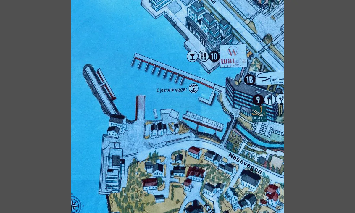
Ulsteinvik
marina

1 liker bildet
Image uploaded on 29. Jul 2024
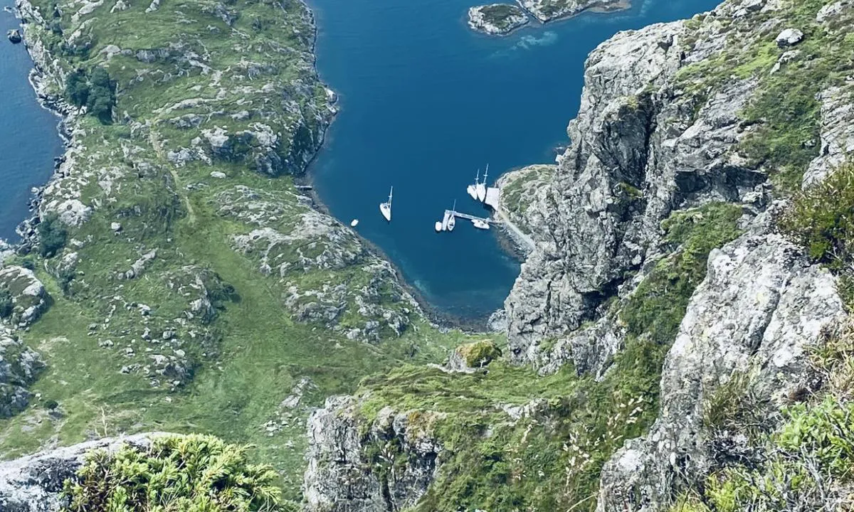
Alden - Norskehesten
natural_harbour

1 liker bildet
Image uploaded on 13. Jul 2021
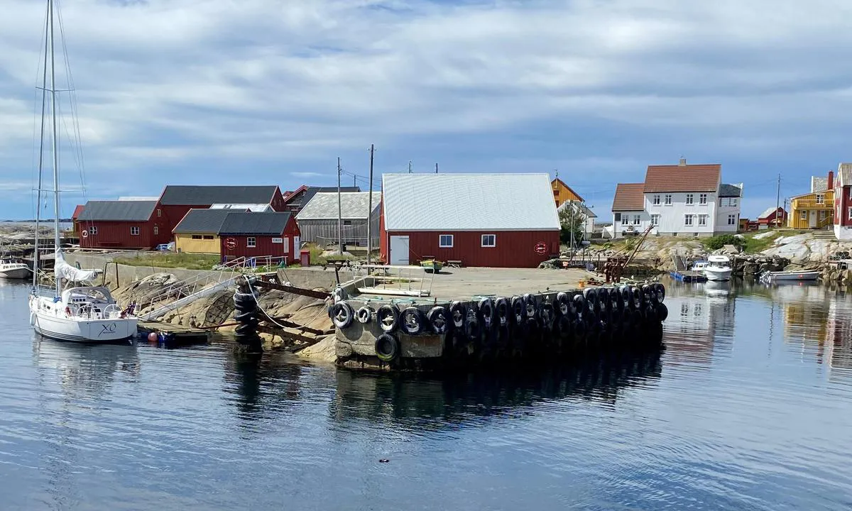
Grip
marina

1 liker bildet
Image uploaded on 19. Jun 2024
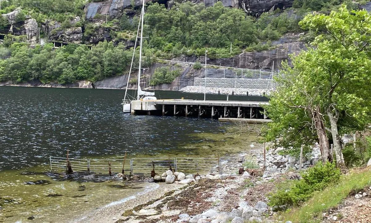
Lysebotn
marina

1 liker bildet
Image uploaded on 17. Jul 2022
Lysebotn
marina
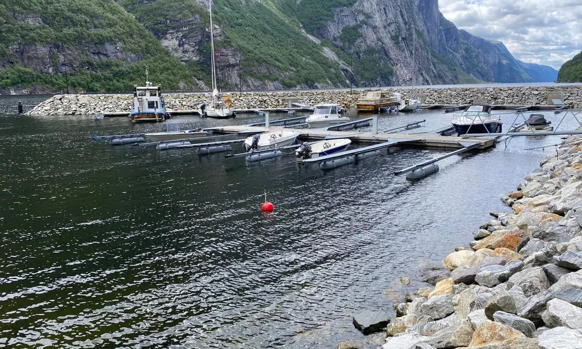

1 liker bildet
Image uploaded on 17. Jul 2022
Læsø Østerby Havn
marina
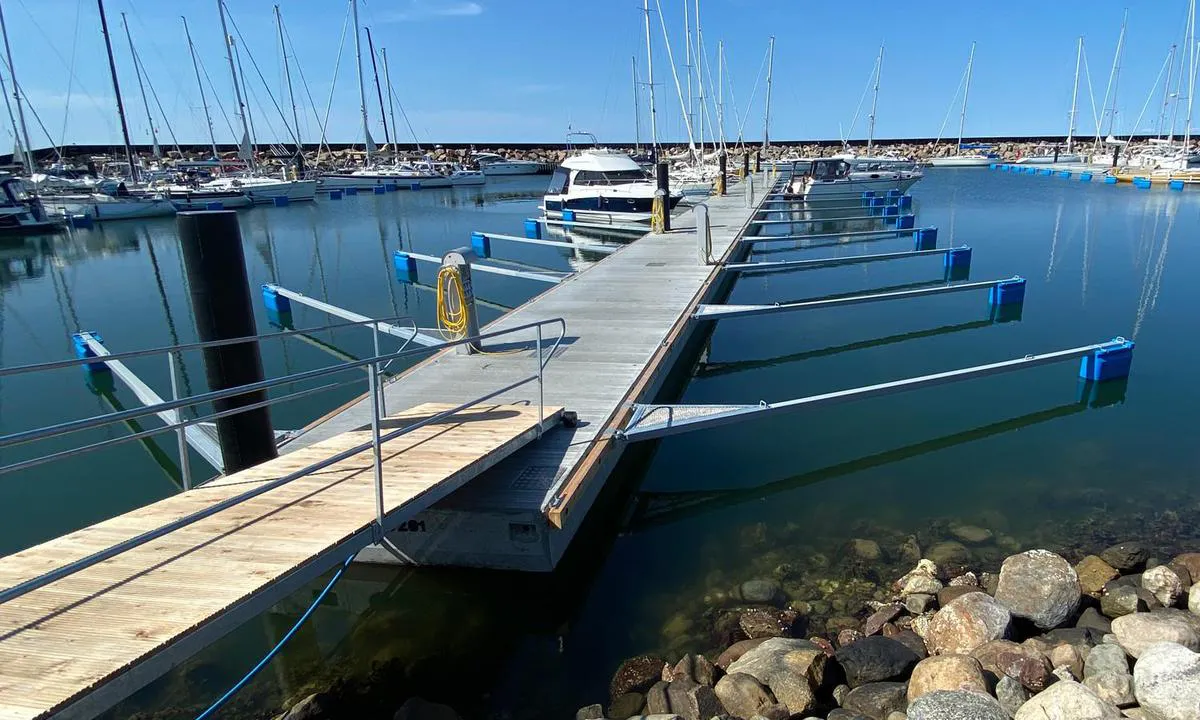

1 liker bildet
Image uploaded on 14. Jun 2025
Læsø Østerby Havn
marina
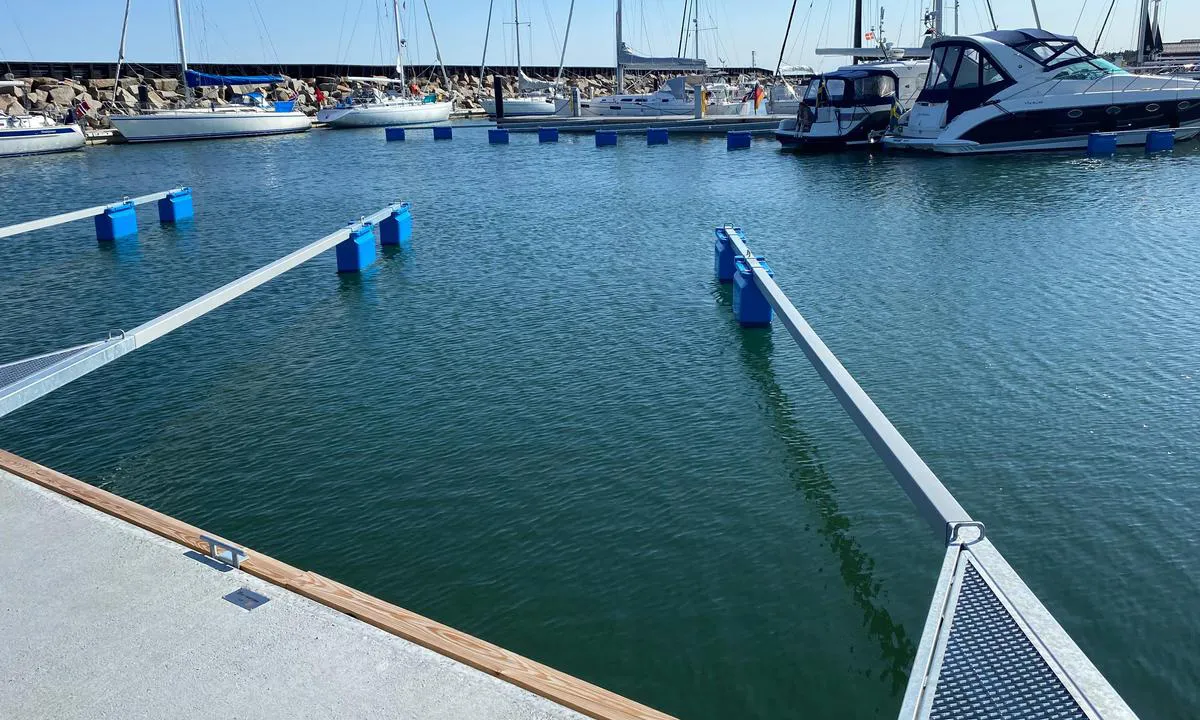

1 liker bildet
Image uploaded on 14. Jun 2025
Læsø Østerby Havn
marina
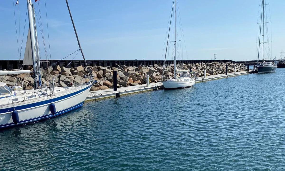

1 liker bildet
Image uploaded on 14. Jun 2025
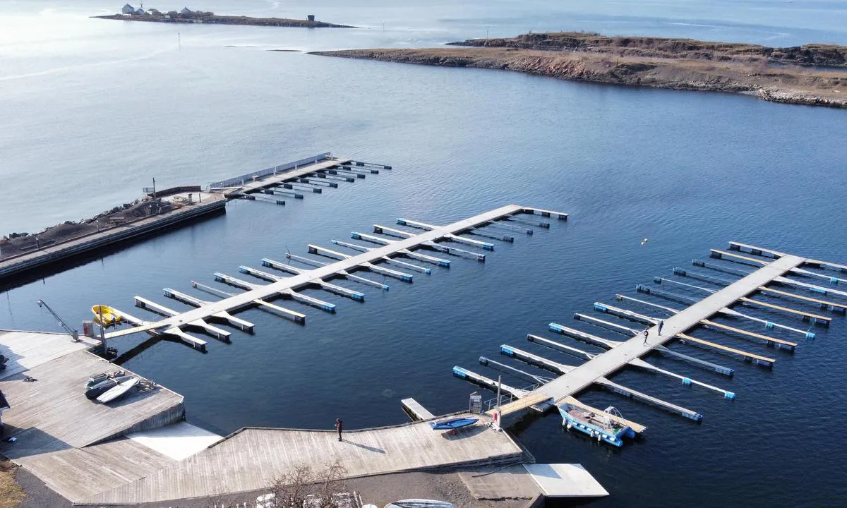
Steilene - Nesodden seilforening
marina

1 liker bildet
Image uploaded on 14. Jun 2025
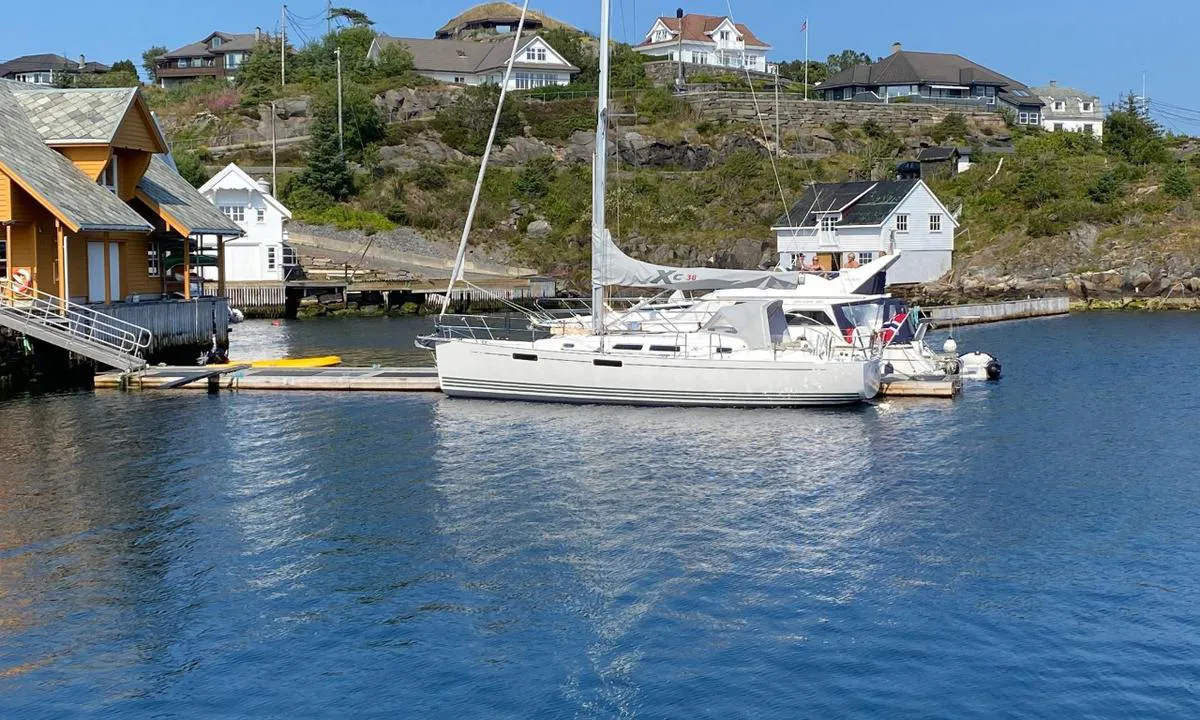
Glesvær
marina

1 liker bildet
Image uploaded on 23. Jul 2021
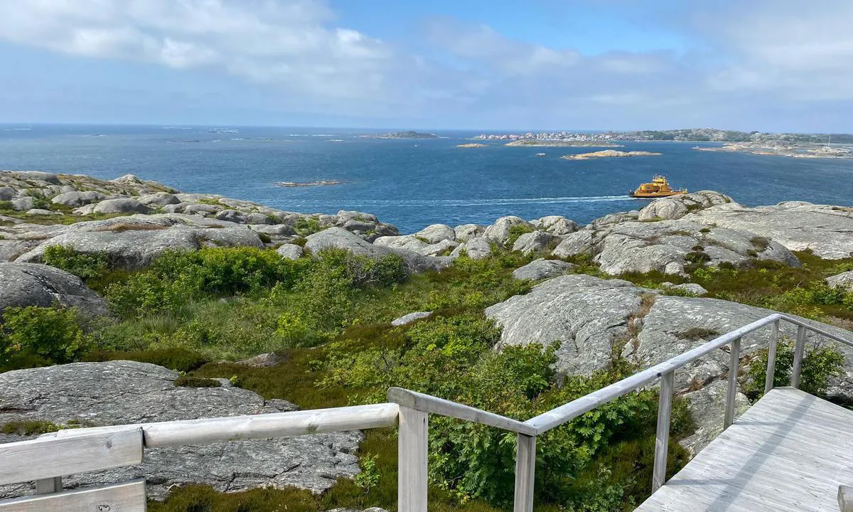
Knippla Gästhamn
marina

1 liker bildet
Image uploaded on 22. Jun 2025
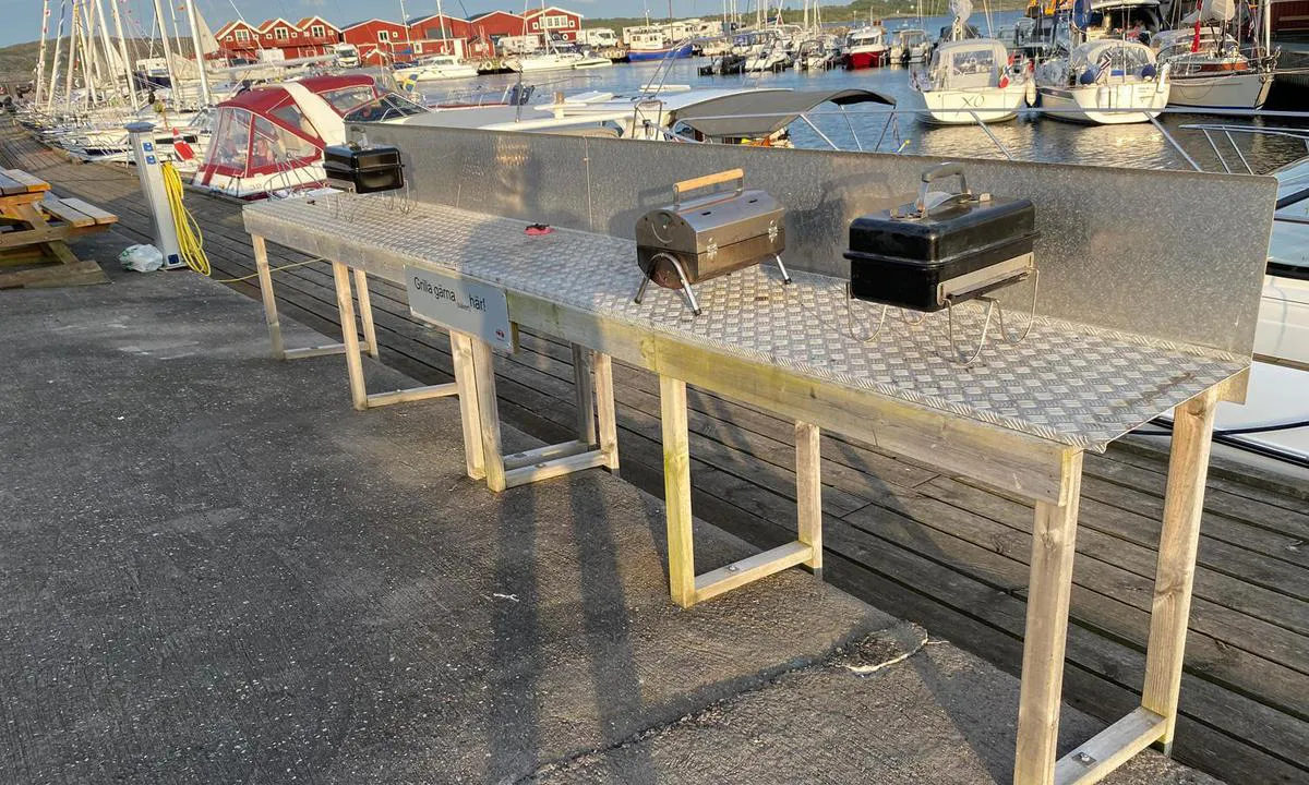
Knippla Gästhamn
marina

1 liker bildet
Image uploaded on 22. Jun 2025
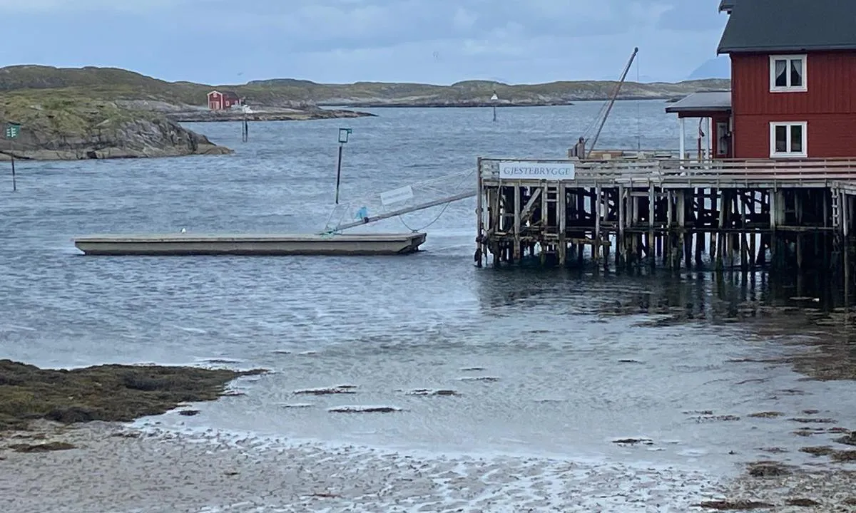
Lovund Gjestehavn
marina

1 liker bildet
Image uploaded on 30. Jun 2024
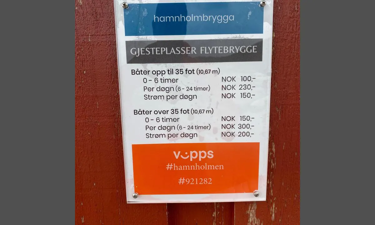
Lovund, Hamnholmen
marina

1 liker bildet
Image uploaded on 30. Jun 2024
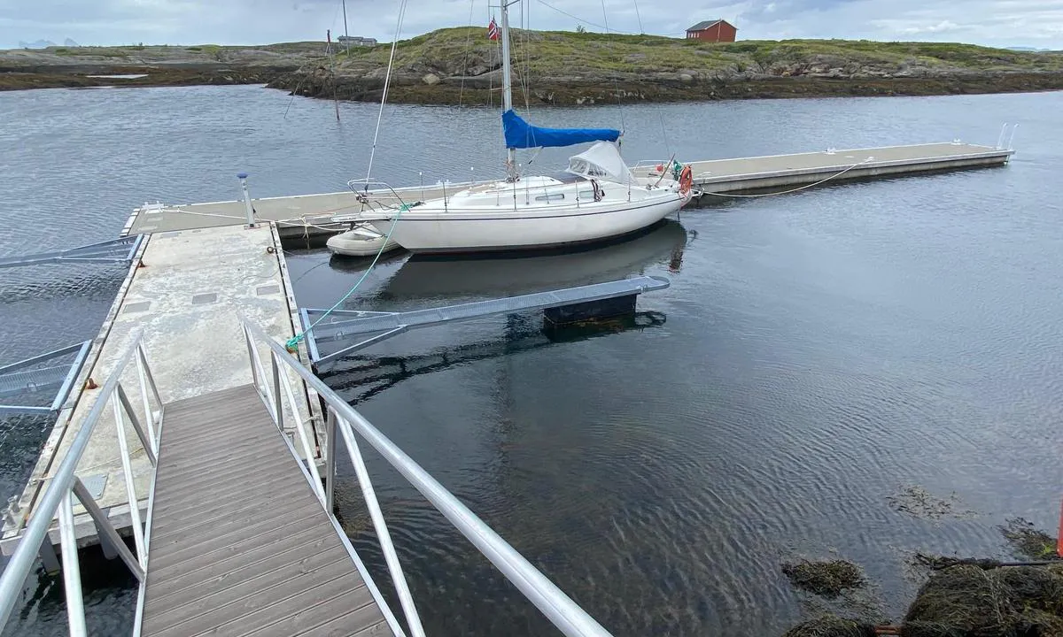
Lovund, Hamnholmen
marina

1 liker bildet
Image uploaded on 30. Jun 2024
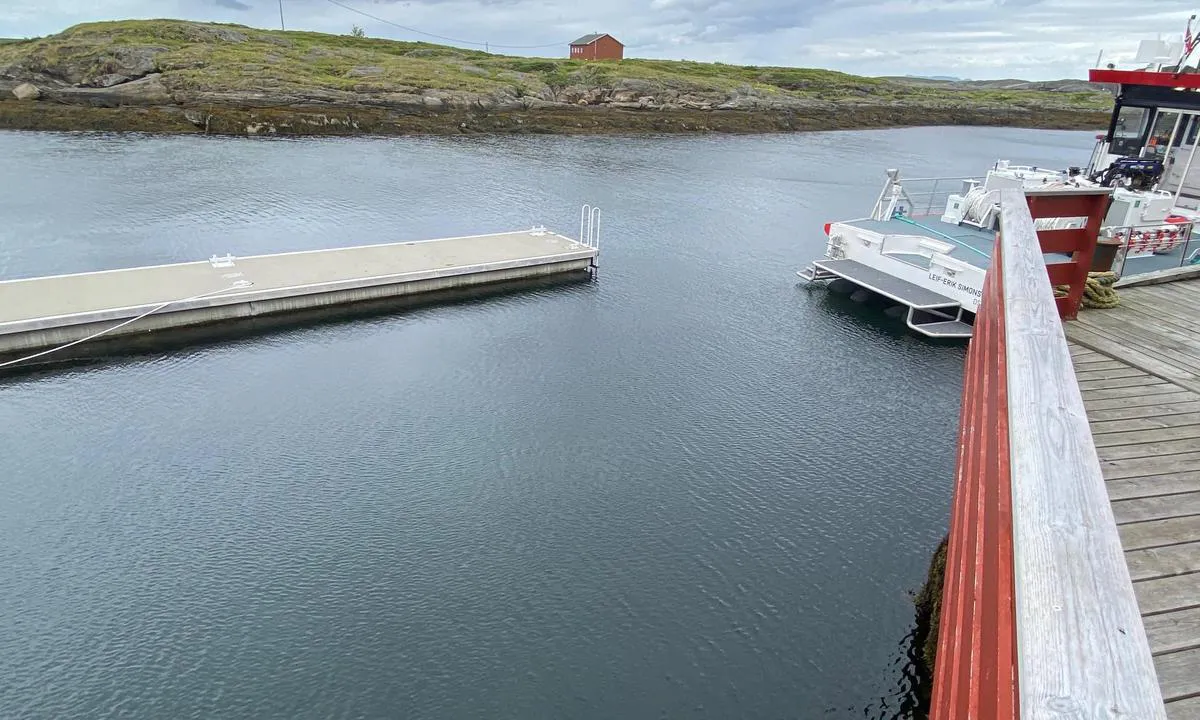
Lovund, Hamnholmen
marina

1 liker bildet
Image uploaded on 30. Jun 2024
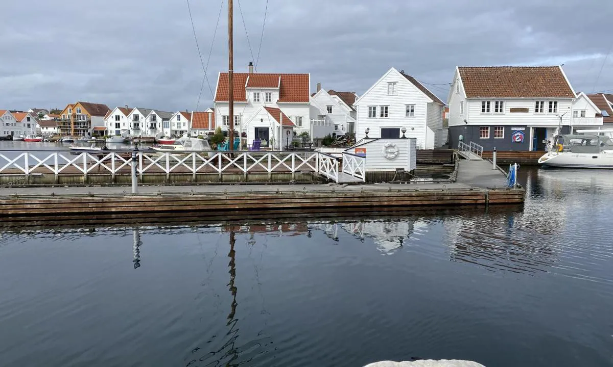
Skudeneshavn Gjestehavn - Karmøy
marina

1 liker bildet
Image uploaded on 27. Jul 2022
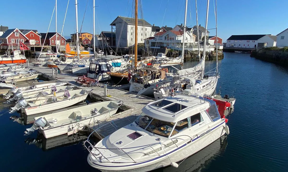
Veiholmen
marina

1 liker bildet
Image uploaded on 25. Jul 2024
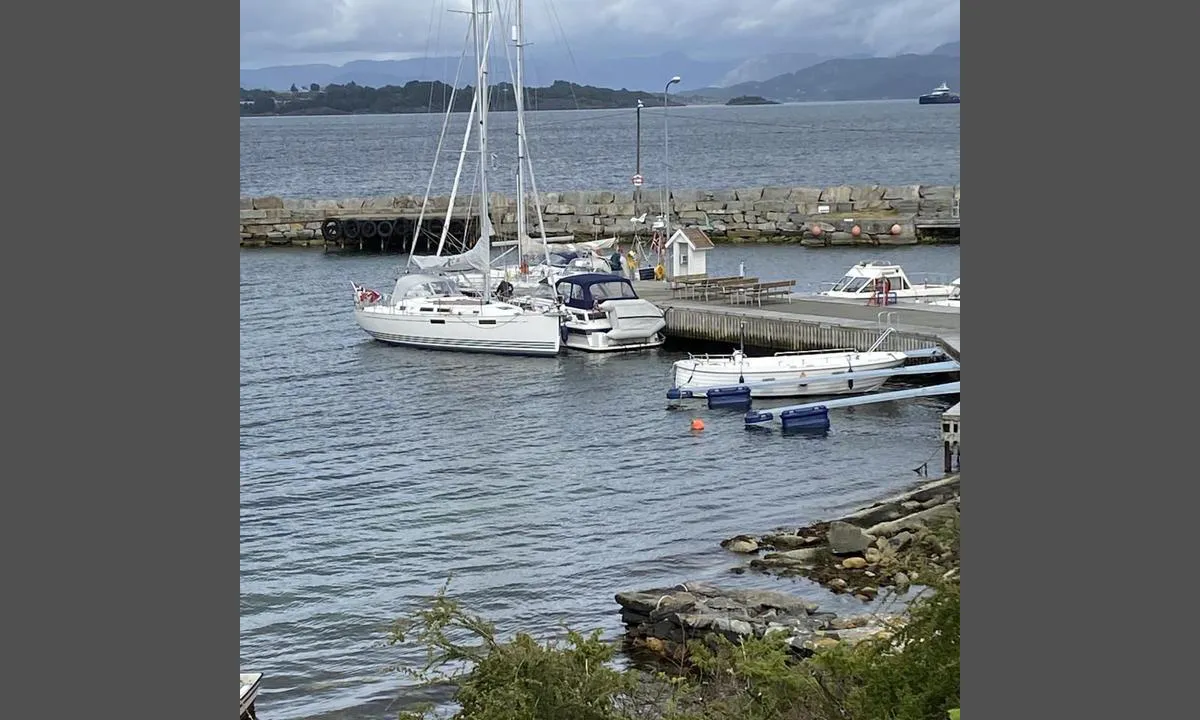
Østhusvik
marina

0 liker bildet
Image uploaded on 14. Jul 2022
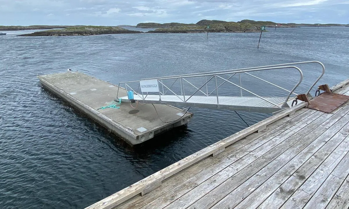
Lovund Gjestehavn
marina

0 liker bildet
Image uploaded on 30. Jun 2024
Lovund, Hamnholmen
marina

0 liker bildet
Image uploaded on 30. Jun 2024
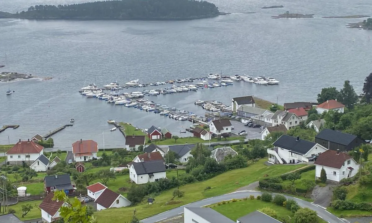
Nedstrand Båtforening
marina

0 liker bildet
Image uploaded on 27. Jul 2022
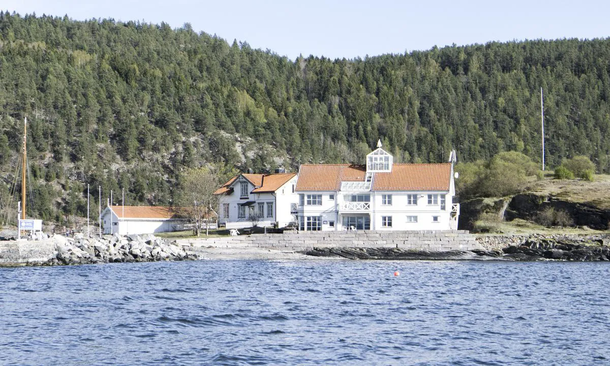
Steilene - Nesodden seilforening
marina

0 liker bildet
Image uploaded on 5. Jun 2024
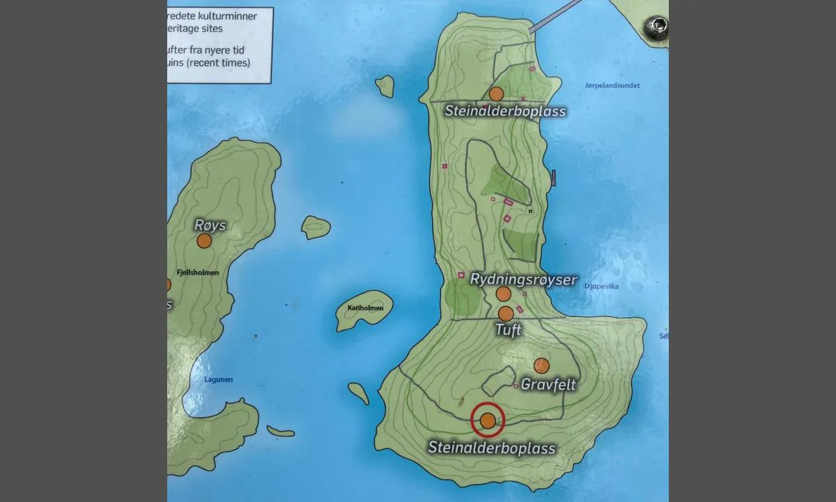
Jørpelandsholmen
marina

0 liker bildet
Image uploaded on 26. Jul 2021
Rognaldsvåg
marina
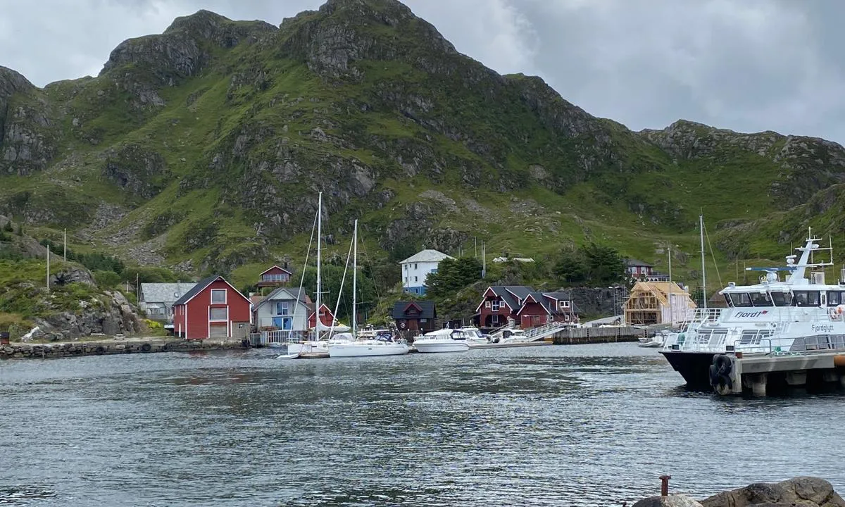

0 liker bildet
Image uploaded on 15. Jul 2021
Golta
natural_harbour
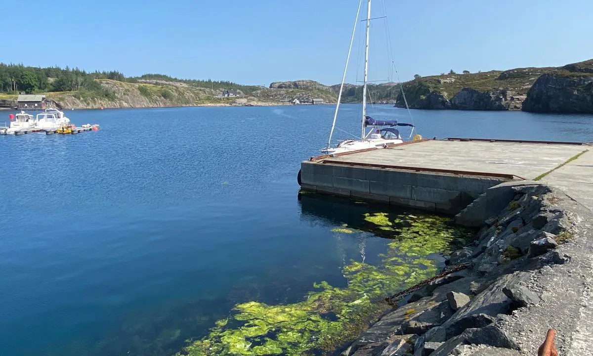

0 liker bildet
Image uploaded on 23. Jul 2021
Hardbakke Hamn
marina
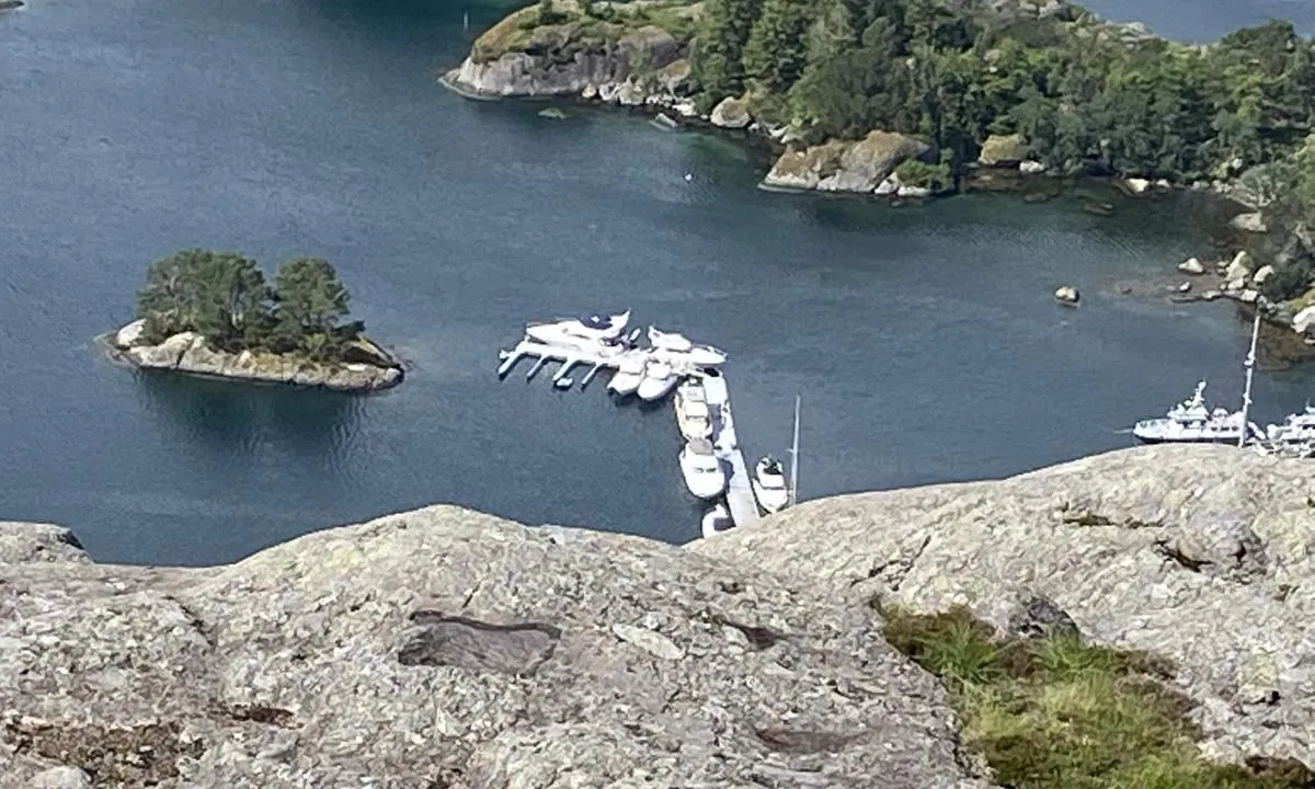

0 liker bildet
Image uploaded on 11. Jul 2021
Reviews
See a helpful review? Please click the 👍 below the review to let Stein Ødegård know that you found it helpful.
Stein Ødegård says:
description
Approach and maritime conditions: Hardbakke is the administrative center of Solund municipality. The harbor is located in a well-protected bay. There are entries from both the north and south, but sailboats must be aware of bridges and power lines in the area. The southern approach is limited by a bridge with a clearance of 15m. From the north, the easiest approach is between Lågøyna and Hågøyna, where the power line has a clearance of 30m. The approach south of Færøyna has a power line with a clearance of 20m.
Docking: The guest harbor was expanded in 2021 with two new floating docks extending from the old one. Docking is done both alongside and in berths. The berths were very narrow in July 2021.
The area: There is a small nice sandy beach for children in the harbor. Diesel pump with card payment. Grocery store a short distance away from the harbor. There are good hiking opportunities in the area, such as a hike to the nearby Ramnenipa peak or a walk around Ramnenipa. Another exciting hike is to the top of Pollatinden. The hike starts close to the main road at Pollen, about 4 km northeast of Hardbakke and 1 km northeast of Solund Verft. The trail is marked with cairns upwards and has a steady ascent all 541 meters above sea level to the top. Sognesjøhytta is a day-trip cabin located south of Hardbakke, near Hopsosen. There is a marked trail about 3km from Hardbakke.

3 x helpful | written on 11. Jul 2021
Stein Ødegård says:
area


maritime qualities


description
New in 2022: New guest berths and bathing spot east in the innermost harbor.

3 x helpful | written on 27. Jul 2022
Stein Ødegård says:
area


maritime qualities


description
Moor with the bow towards the quay and stern attachment to laid-out buoys. There are varying depths along the quay, but many places are deep enough for sailboats. Waves from passing express boats cause some choppiness, so it's recommended to moor with some distance from the quay. There are excellent hiking opportunities in the area. The staircase along the old pipeline has 4,444 steps and takes you up to 740 meters above sea level. There are several other hiking trails of varying lengths, but it is steep everywhere. The old turbine hall contains a fine exhibition on the history of the power plant. There is also a restaurant in the building.

3 x helpful | written on 17. Jul 2022
Stein Ødegård says:
description
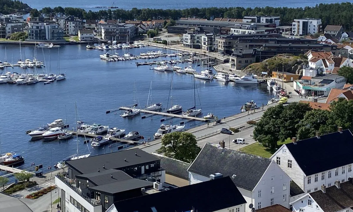
Approach and maritime conditions: The harbor is located a couple of hundred meters up the river, after two 90-degree turns. The guest harbor consists of floating docks (alongside) outside the service building and floating docks (berths) before the bridge, on the western bank of the river. It is also possible to moor along the quay.
Mooring: Mooring in berths on floating docks closest to the bridge, or alongside outside the service building (quay and floating dock without berths). There is somewhat limited depth for sailboats on the east side of the river. There is often quite a strong southward current in the harbor, as this is indeed a river estuary.
The area: The harbor is located in the middle of the city with all amenities. Beautiful sandy beaches at Sjøsanden and further west.

2 x helpful | written on 1. Aug 2021
Stein Ødegård says:
area


maritime qualities


description
The floating jetty will be in its usual place on June 18, 2024, as will the kittiwakes. Grip is a great spot with a long history. No permanent residents here now, but many summer visitors. The harbor is good, but it is small. The harbor should only be visited in good weather.

2 x helpful | written on 19. Jun 2024
Stein Ødegård says:
area


maritime qualities


description
Nice port facilities and service building. Nearby convenience store. The restaurant at the quay hotel was temporarily closed (June 19, 2024).

2 x helpful | written on 19. Jun 2024
Stein Ødegård says:
area


maritime qualities


description
This old fishing village on the Namdal coast is protected. Sør-Gjæslingan was once one of the largest south of Lofoten with up to 4000 men and women gathered in the peak season. The Coastal Museum makes a great effort to maintain buildings and quay facilities. The place is a somewhat unknown gem, without much tourism. Many authentic fishermen's cabins are preserved. Definitely worth a visit. The harbor is a fair-weather harbor, the approach is challenging in bad weather. Tidal differences in the harbor are up to 2 meters.

2 x helpful | written on 23. Jun 2024 | updated_on 23. Jun 2024
Stein Ødegård says:
description
Approach and maritime conditions: Approaching from the south via Tofteosen is easy. The floating pier by the café is a bit worn, but has adequate depth for sailboats. There is also a new guest pier at Sjøvang water sports center. Both sides at the outer end of this floating pier can be used. Depths along the concrete quay are a bit uncertain, but large cutters have docked here in the past. Good harbor, but southerly winds are quite noticeable.
Mooring: One can moor along floating piers or along the unprotected concrete quay. If there are no activities, one can also moor at Sjøvang's water sports center just north of the guest pier.
The area: Beautiful place with a cozy trading post, a cafeteria with all rights open every day (good food). Art and coastal environment, a paradise if you bring a kayak.

2 x helpful | written on 23. Jul 2021 | updated_on 2. Apr 2024
Stein Ødegård says:
area


maritime qualities


description
Nice starting point for a trip to Torghatten. Approximately 3.5 km to walk/bike before the path up starts. The path was upgraded in 2023 with beautiful stone steps. New steps/path have been laid down on the other side of the hole, so it is possible to take a round trip.

2 x helpful | written on 25. Jun 2024
Stein Ødegård says:
description
Approach and maritime conditions: Nåra is located on the eastern side of Ytre Sula. Nåra has a store that "has everything" as in the old days. The store is frequently used by the islanders around. Nice dock and well worth a stop. Diesel pump with card machine.
Mooring: There are only 2 guest spots for overnight stays at the store. One alongside spot at a floating dock, and one quay spot on the south side of the quay by the store. The quay spot does not have enough depth for sailboats. The rest of the quay is used by the route boat twice daily.
The area: There is a well-marked hiking trail up to the top of Håfjellet. The trail is 2.5 km long. Great view from the top!

2 x helpful | written on 10. Jul 2021
Stein Ødegård says:
area


maritime qualities


description
The building on the pier is finished, but it is not a service building. There is no water and electricity at the outermost floating dock by the breakwater. The World Heritage Center is great, open 10-17.

2 x helpful | written on 26. Jun 2024 | updated_on 27. Jun 2024
Stein Ødegård says:
description
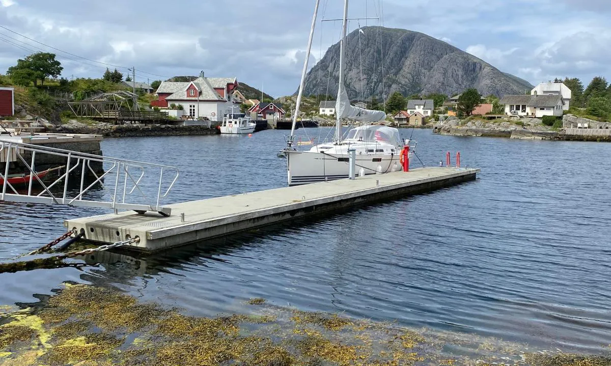
Approach and maritime conditions: Fanøy is located a bit NW of Florø, south of Batalden, north of Skorpa. Somewhat narrow approach, but well marked. Watch out for an unmarked 1.8m shoal right before the guest dock. The easiest approach is from the north. From the south, there are several channels, but sailboats must be aware of overhead wires, which are plentiful in the area.
Berthing: New floating dock with 2 longside berths on each side. Good depth along the entire dock. Shore power available on the dock.
The area: Pleasant area with some small roads. Small shop at the quay. Marked hiking trail in flat and easy terrain.

2 x helpful | written on 18. Jul 2021
Stein Ødegård says:
area


maritime qualities


description
Skärhamn is a well-organized guest harbor with many berths. At the floating docks, fixed bottom anchors with laid-out ropes are used. Along the quays on both sides of the harbor, there are longside berths. Dockspot's reserved berths are limited to one side of a floating dock; the rest of the berths are regular guest spots. Map of the harbor here:
https://www.skarhamnsgasthamn.se/service/vid-ankomst/

2 x helpful | written on 7. Jun 2025
Stein Ødegård says:
area


maritime qualities


description
This floating dock is located right behind the mooring space of the Rescue Society, and just before the guest dock at the Rorbu hotel. Mooring alongside and in a couple of berths.

2 x helpful | written on 30. Jun 2024 | updated_on 30. Jun 2024
Stein Ødegård says:
description
Entrance and maritime conditions: Rognaldsvåg has two harbors, one northern and one south-western.
Docking: The guest pier is in the northern harbor so if you want to dock in the south-western one, you need to check with the locals if it's allowed.
Area: Cozy bay with a shop and a ferry in the northern harbor. Playground and ball court near the school. Marked hiking trail to the top.

2 x helpful | written on 15. Jul 2021
Stein Ødegård says:
area


maritime qualities


description
There are no longer any guest spots here. All spots are occupied by the dock's fishing boats. We tried to find a place for a 38-foot sailboat but were rejected when we contacted them by phone.

2 x helpful | written on 18. Jul 2024
Stein Ødegård says:
description
The floating dock outside the fishing facility A. Johansen has many spots and good depths. There is electricity on the dock. A water hose is available in a small storage shed on land, the water is desalinated seawater. The high floating dock outside the municipal quay is reserved for the Rescue Company on one side. There is water on this dock, but no electricity.

2 x helpful | written on 6. Jul 2024
Stein Ødegård says:
area


maritime qualities


description
There are berths at Biekronå to the south. Furthermore, there are guest spots north of the shop, 'Kaia til Rolf'. It is also possible to moor on the other side, at the red house with the large dock on Kjeholmen. You must arrange with the owner, Dagfinn Paulsen, to moor at Kjeholmen.

2 x helpful | written on 21. Jul 2022
Stein Ødegård says:
area


maritime qualities


description
The harbour was upgraded in the spring of 2025. There are now 3 new floating docks with mooring arms. These arms are angled at 45 degrees, making it easier to enter/exit. The downside is that it is not optimal to moor stern-in. The clearance in the berths is 4.5m, and some are 4m right near the shore. There are alongside berths along the entire breakwater, partially along the quay and partially along the new floating dock. The harbour has a large capacity, but it is also very popular. It’s definitely smart to arrive relatively early during the high season. The harbour fee is paid via an automatic machine, with no option for online payment.

2 x helpful | written on 14. Jun 2025
Stein Ødegård says:
area


maritime qualities


description
New in 2024 are new piers on the outermost part. Many of the berths are now double berths.

2 x helpful | written on 13. Aug 2024
Stein Ødegård says:
area


maritime qualities


description
There are 6 guest berths at the floating dock in front of Coop Marked. 5 berths with stern or bow moorings towards the dock, 1 alongside berth at the end of the dock. Additionally, there are a couple of alongside berths in front of the restaurant Veiholmen Brygge. The approach to the harbour has good depths, but it is narrow in some places.

1 x helpful | written on 25. Jul 2024
Stein Ødegård says:
area


maritime qualities


description
Havnen er enkel å anløpe dag og natt, og den gir god beskyttelse ved alle vindretninger. Vær oppmerksom på utgående trafikk fra fiskefartøyer, noen av disse er store trålere.
Skagen gjestehavn er området mellom Gamle Pier og Pier 2 i mellombassenget, sør for de røde pakkhusene med restaurantene. Det fortøyes longside langs kaikantene og langs broen i midten av det ene bassenget. Ved flytebryggene benyttes eget anker for fortøyning med hekken eller baugen mot brygga.
Havnekontor og toaletter/dusj/vaskerom er i bygget på kaien mellom de to gjestebassengene.
Dieselpumpe med kortautomat ytterst på denne kaien.

1 x helpful | written on 17. Jun 2025 | updated_on 17. Jun 2025
Stein Ødegård says:
area


maritime qualities


description
Nice harbor with floating docks and quays. The harbor is somewhat exposed in strong winds from the NW.

1 x helpful | written on 11. Jun 2024
Stein Ødegård says:
area


maritime qualities


description
Long sandy beach on the west side, a short distance from the harbor. Pleasant little road past well-kept houses and gardens. No permanent residents here now.

1 x helpful | written on 11. Jul 2024
Stein Ødegård says:
description
Docking: Floating piers and quays. Varying depths at the quay.

1 x helpful | written on 26. Jul 2021
Stein Ødegård says:
area


maritime qualities


description
New docks at Quality Hotel with alongside berths on the outside and slips with long outriggers on the inside. Water and electricity on the docks, good depths. Short distance to shops and bakery. Harbor fee is paid at the reception.

1 x helpful | written on 30. Jul 2024
Stein Ødegård says:
description
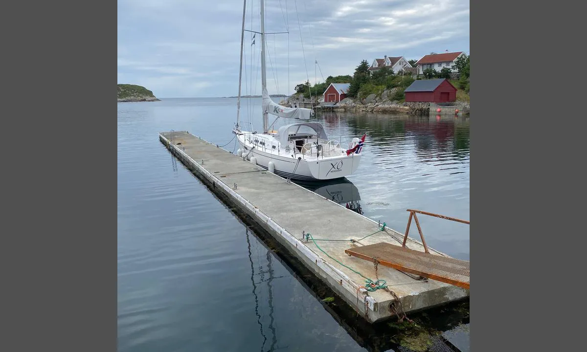
Entrance and maritime conditions: The harbor is located at the northernmost part of Øygarden, on the west side. Enter from the west using alignment markers. Enter from the north by following the coastline on the west side of Førehjelmo and Seløyna. Continuing through Laksholmsundet.
Docking: Floating dock at Nautnes fishing village with mooring on both sides. Good depth. No current and water on the dock in July 2021. Slightly exposed to swells in the harbor with strong winds from SW-W, otherwise a good harbor.
The area: The dock is located at Nautnes fishing village, a facility for fishing tourism. Apartments and boat rentals. There are hiking trails in the area (North Sea trails). The old Hjelme church is worth a visit. Bus connection to Hellesøy harbor and to Bergen.

1 x helpful | written on 8. Jul 2021
Stein Ødegård says:
description
Approach and maritime conditions: Easy approach and arrival, but watch out for two shoals of 1.5m at the narrowest point of the entrance. Good depth at the floating docks.
Some commercial traffic.
Well-protected harbor for all wind directions.
Mooring: Mooring to floating dock.
The area: The 1000-year site at Gulating is worth a visit. Here, Vikings held assemblies, and the country's first laws were introduced more than a thousand years ago. Shop and diesel pump on the quay.

1 x helpful | written on 21. Jul 2021
Stein Ødegård says:
description
Approach and maritime conditions: Large and well-protected harbor on Frøya.
Mooring: Old docks without cross cleats, making it difficult to moor for a solo sailor if there is some wind. Plenty of space on several floating docks plus some spots along the quay at Knutholmen. Good depths except for the inside of the innermost floating dock on the north side of the harbor. Arrive before 9 PM, otherwise, you will go to bed hungry.
The area: Good dining place at Knutholmen. Two places with washing machines and dryers. Grocery store on the quay. Nice hiking trails in the area.

1 x helpful | written on 17. Jul 2021
Stein Ødegård says:
description
Approach and maritime conditions: The guest harbor in Svanøybukt has electricity and water on the floating dock. In the 24-hour open sanitary facility you will find toilets, showers, washing machines, and dryers.
Mooring: Well-protected harbor with several floating docks and quays. Mooring is alongside the floating docks. The northernmost floating dock is close to the quay for the local boat, so it can become a bit unsettled.
The area: Pub and shop on the quay. Several hiking trails on the island, marked as North Sea trails. Norwegian Deer Center on the other side of the island.

1 x helpful | written on 19. Jul 2021
Stein Ødegård says:
area


maritime qualities


description
There are 2 buoys from the Oslofjord Outdoor Council in the harbor.

1 x helpful | written on 31. Jul 2023
Stein Ødegård says:
area


maritime qualities


description
The floating dock is extended at a 90-degree angle towards SW. This provides 2-3 extra alongside berths on each side. There is no electricity or water on this part of the dock (June 26, 2024). There is a notice that mooring is not allowed in winds over 15 m/s.

1 x helpful | written on 26. Jun 2024
Stein Ødegård says:
area


maritime qualities


description
Good space along the outside of the floating docks. Also some spaces on the inside of the western floating dock. There are great hiking opportunities nearby, such as the hike to the famous viewpoint Himakånå. The hike starts 3km from the harbour, on the road towards Hindarvåg. There is a gravel road/path all the way to the top which is at 357m. Great view over large areas!

1 x helpful | written on 27. Jul 2022
Stein Ødegård says:
area


maritime qualities


description
The harbour is also called Alvekilen. It is a good swinging harbour that is well protected in all wind directions except from NE to E. The best spot is in the bay by the point 'Lille Danmark', but the bay further in is also fine. Beware of two shoals on the north side right after 'Lille Danmark'. Further in, it is shallow in the narrow strait, and there are several pipelines on the bottom. I have not been that far in.

1 x helpful | written on 1. Aug 2023
Stein Ødegård says:
area


maritime qualities


description
Long guest pier on the inside of the wave breaker (large plastic tube). Good depths. Nice service house managed by the boat association. Store nearby. Pier pub closed until June 2024. Good food and good service at the farm restaurant '3 Calves,' 1km from the harbor.

1 x helpful | written on 27. Jun 2024
Stein Ødegård says:
description
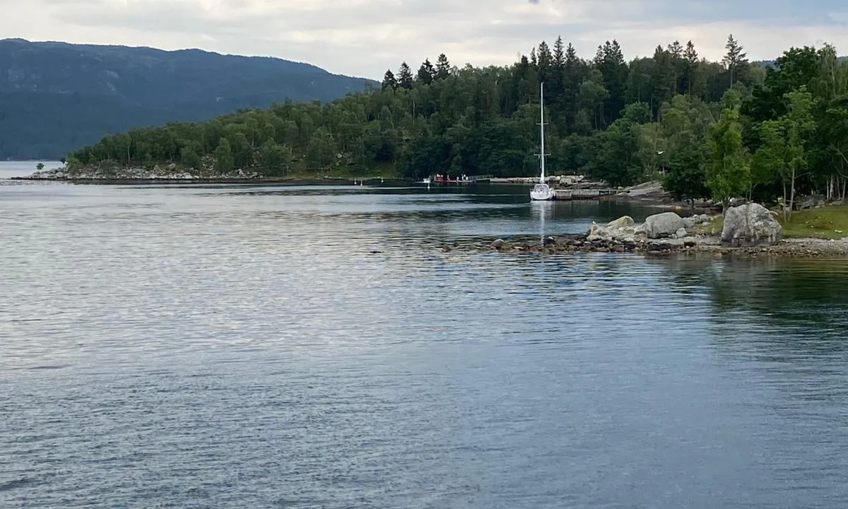
Navigation and maritime conditions: Jørpelandsholmen is located just outside Jørpeland harbor. Follow the approach to Jørpeland harbor, and turn west between the light on the promontory by the steelworks and the red marker.
Mooring: There is a wooden quay with approximately 2.1m depth on the outside. Measured at normal low tide. It is slightly shallower at the southernmost end of the pier. It is possible to anchor in the bay.
The area: Jørpelandsholmen is a great recreational area with nice hiking trails. Many signs provide information about life on the islet since it emerged from the sea 10,000 years ago. Traces of Stone Age settlements have been found. A footbridge makes it possible to visit Jørpeland center, which offers many amenities. There is a swimming pier (floating dock) a little south of the quay.

1 x helpful | written on 26. Jul 2021
Stein Ødegård says:
area


maritime qualities


description
The Coastal Culture Center is worth a visit. Great museum showcasing the history and biodiversity of Lovund. The latest addition to the museum in 2024 is the new building with the Lovund boat. This boat is dated to the Middle Ages, around 1460. The remnants of the boat were found where the bathing facility is now.
The harbor provides good protection against the sea, but there can be strong and unpredictable gusts of wind during gale conditions.

1 x helpful | written on 29. Jun 2024 | updated_on 30. Jun 2024
Stein Ødegård says:
area


maritime qualities


description
Small guest dock at the Coastal Culture Center, Fjellgårdsbrygga. Good depths on both sides. The Coastal Culture Center is worth a visit. Beautiful museum that showcases Lovund's history and biodiversity. The latest addition to the museum in 2024 is the new building with the Lovund boat. This boat is dated to the Middle Ages, around 1460. The remains of the boat were found where the bathing facility is now.

1 x helpful | written on 30. Jun 2024
Stein Ødegård says:
area


maritime qualities


description
Moor at Østhusvik Boat Association's quay, NW side and to the end. There is good depth at the end of the quay, somewhat less inward on the NW side. Electricity and water on the quay. The hotel does not appear to have a guest dock. The large concrete quay N in the harbor is reserved for fast ferry docking. Thus, the harbor only has space for a few boats. There is a hotel with a restaurant in the harbor. Grocery store 100m from the harbor.

1 x helpful | written on 14. Jul 2022
Stein Ødegård says:
area


maritime qualities


description
There are 2 buoys from the Oslofjord Outdoor Council in this bay. It is about 25m deep in the middle of the harbor where the buoys are located. It is not as deep further in, but there are also some unmarked shallows of 1m. The harbor is somewhat exposed to waves from ferries and cargo ships. Wind from SW to NW raises waves in the harbor. In calm weather, this is a pleasant harbor with plenty of evening sun.

1 x helpful | written on 2. Aug 2023
Stein Ødegård says:
area


maritime qualities


description
Lysebotn has a small guest harbor behind a breakwater. The harbor is narrow, mostly with narrow berths. It is tight to maneuver there. Depths are not specified but are probably okay. There is also a quay along the land at the same place where depths are limited. Larger boats can moor at the end of the large concrete pier south of the ferry quay. There is good fendering with large car tires. A plank between the tires and the fenders is recommended. It is 5 meters deep at the end of the pier. There is no electricity or water. You are exposed when the wind blows into the fjord.
There are several nice hiking opportunities in the area.

1 x helpful | written on 17. Jul 2022 | updated_on 17. Jul 2022
Stein Ødegård says:
description
Approach and maritime conditions: Golta lies west of Sotra, not far from Glesvær. Easy approach from the sea to the west.
Anchorage: There is only one public quay with good depth. It is also possible to anchor, but the depth is about 16m.
The area: Golta is separated from the island of Sotra by a narrow channel called Goltastraumen. Over this runs the Golta bridge. Fishing was abundant in the bays around Golta, and schools of herring and mackerel frequently swam into the narrow inlets that could be closed off with nets. The island's inhabitants were therefore wealthy in the 18th and 19th centuries. From the late 1800s, fishing was organized into a seine net team, which operated until around 1950.

1 x helpful | written on 23. Jul 2021
Stein Ødegård says:
area


maritime qualities


description
The sloop 'Restauration' is now at the easternmost part of the municipal quay. The berths for guests are located inside the sloop. There is somewhat limited depth in the berths, and there is a lot of seaweed.

1 x helpful | written on 21. Jul 2022
Stein Ødegård says:
area


maritime qualities


description
Good harbor with many berths along the floating dock. Good depths. Electricity and water at the innermost part of the dock. Shop on the quay. No waste disposal service for boats in July 2024.

1 x helpful | written on 8. Jul 2024 | updated_on 10. Jul 2024
Stein Ødegård says:
area


maritime qualities


description
Havna er Nesodden Seilforenings anlegg på Steilene. Havna er oppgradert med nye flytebrygger våren 2025. Gjesteplasser er merket med grønne skilt. I tillegg benyttes faste plasser til gjester når plassen er ledig. Langs kaia ved moloen er det gjesteplasser for motorbåter, det er litt liten dybde for seilbåter der. Normalt er det ca 30 gjesteplasser tilgjengelig i havna. I helgene kan du ringe havnevakta på 993 00 095 for å få anvist plass. Det er ikke mulig å forhåndsbestille plass. Kiosk med salg av is, brus, kaffe og vafler er åpen i helgene. Havna og kiosken drives på dugnad av foreningens medlemmer. Inntektene går i sin helhet til drift av foreningens mange aktiviteter for barn og unge.

1 x helpful | written on 5. Jun 2024 | updated_on 14. Jun 2025
Stein Ødegård says:
area


maritime qualities


description
The guest pier has alongside berths for 4 boats. Additionally, it is possible to moor at the end of the T-pier on both sides. Kjerringøy Trading Post is a uniquely preserved site that offers a fascinating insight into life here in the 1800s. There are guided tours in the main house.
Grocery store nearby. Fuel pumps are on land at the innermost part of the guest pier, but there is no dedicated dock there.

1 x helpful | written on 10. Jul 2024 | updated_on 10. Jul 2024


