


Contributions by Dan Mossmann
Dan Mossmann has uploaded 92 images and written 50 reviews. Click on the images and reviews below to see the harbour pages.
Dan Mossmann has 3350 contribution points and is a top contributor to this site. See all the top contributing users.
Harbour images
See an image you like? Please click the 👍 below the image to let Dan Mossmann know you liked it. The images are sorted by popularity.
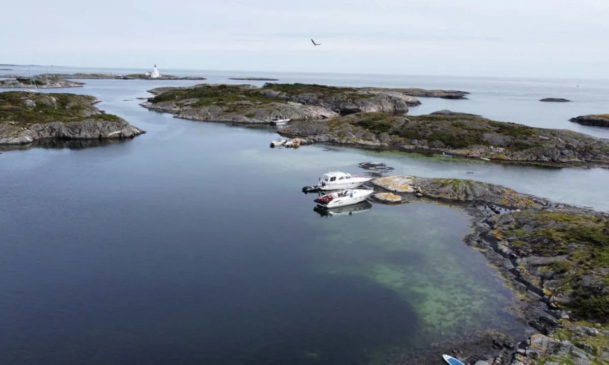
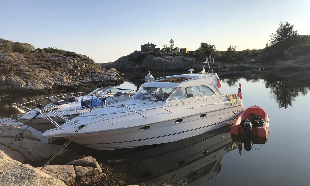
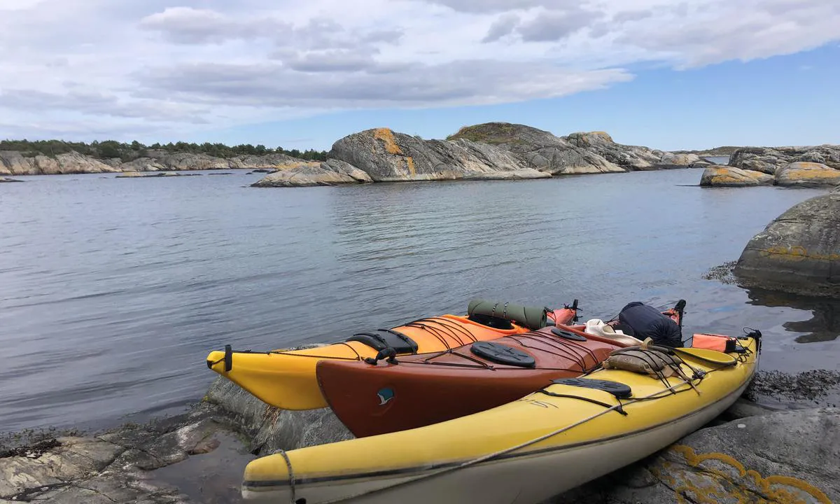
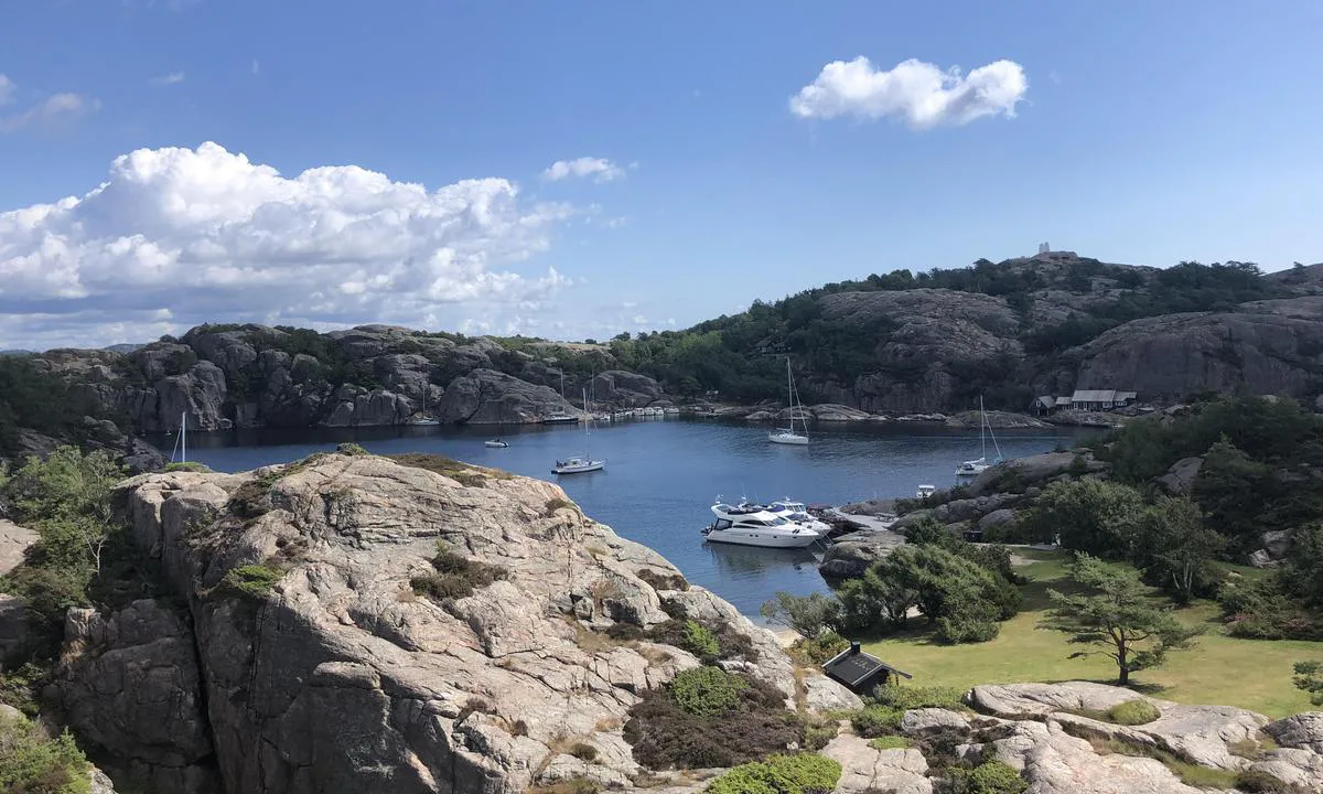
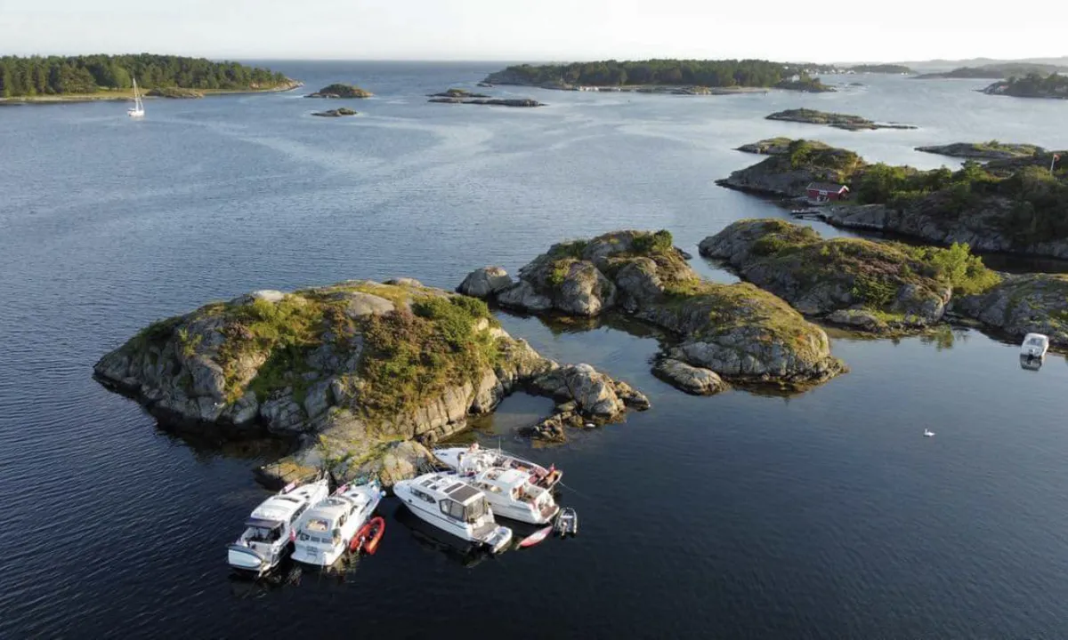
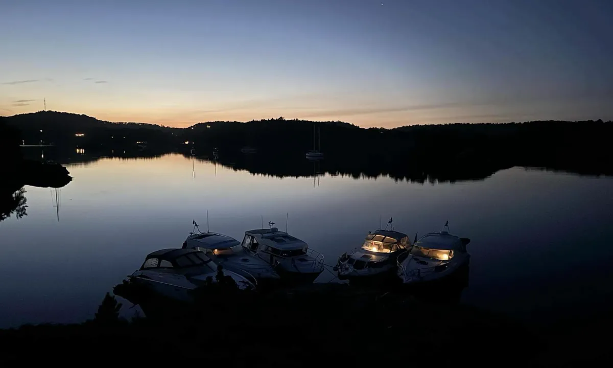
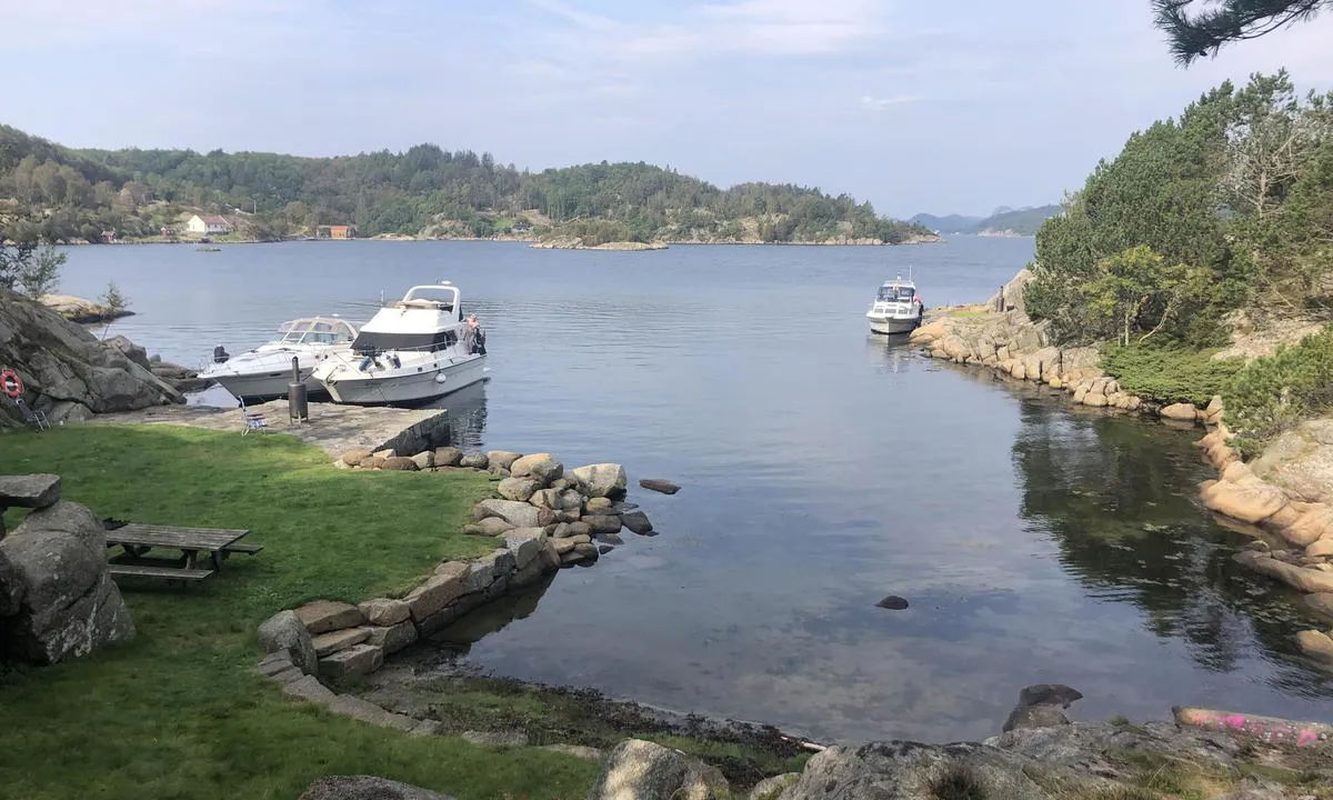
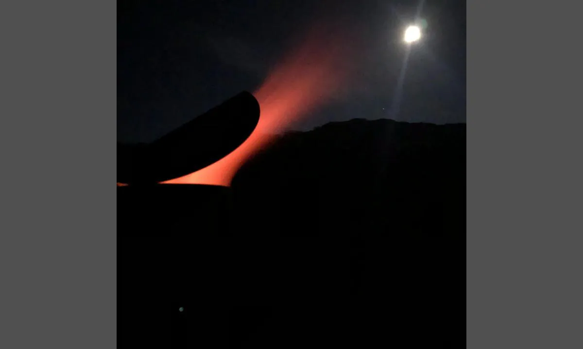
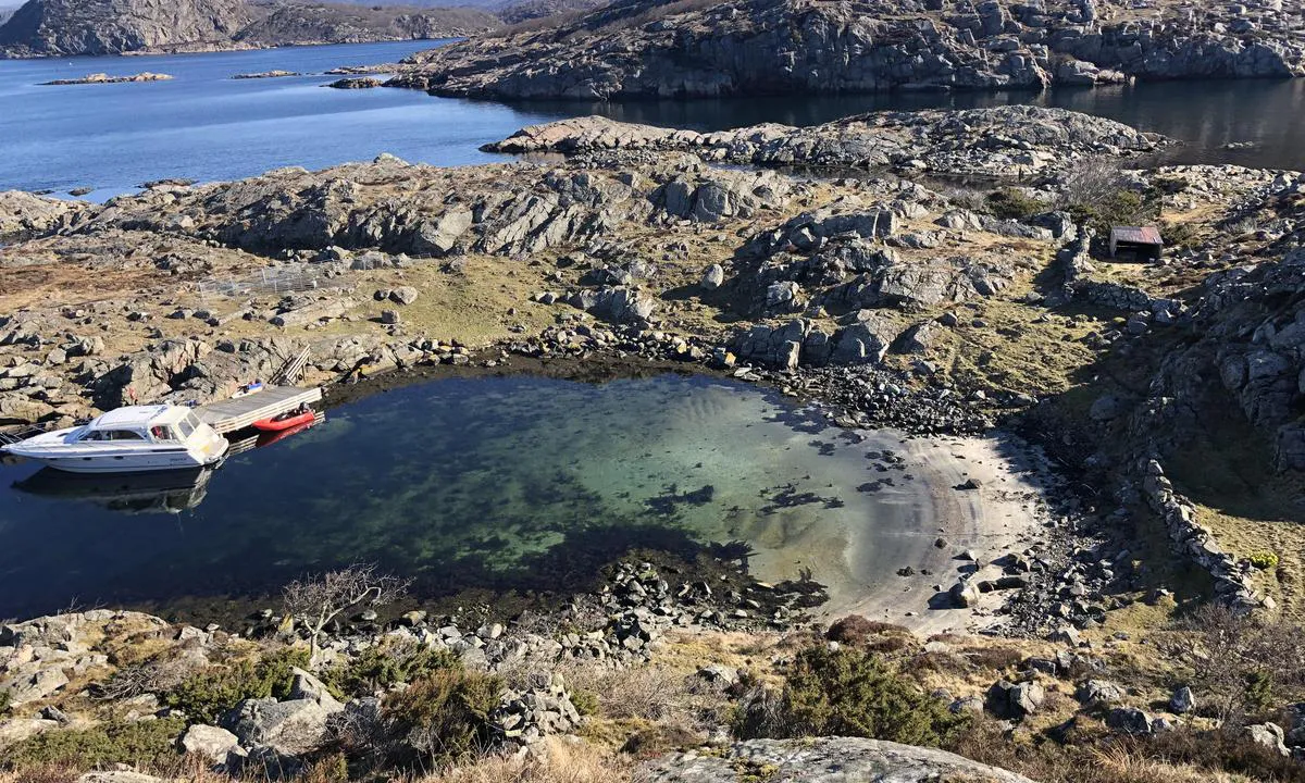
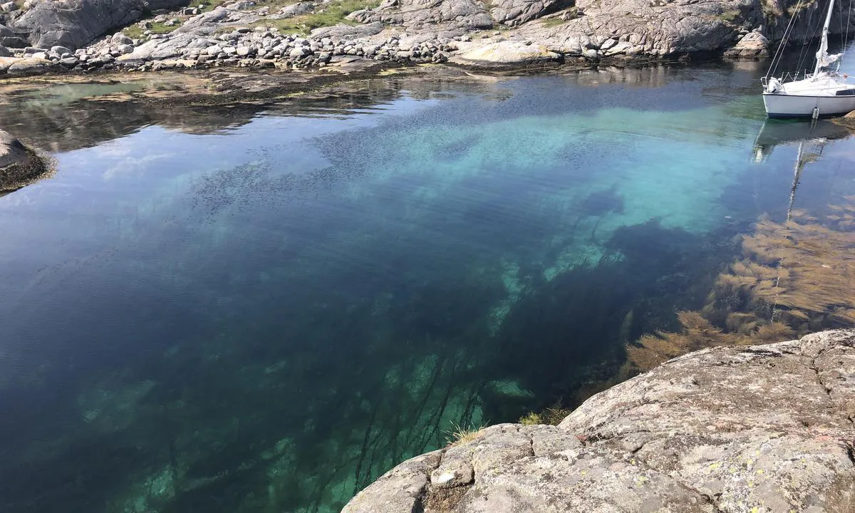
Øster Kuholmen
natural_harbour
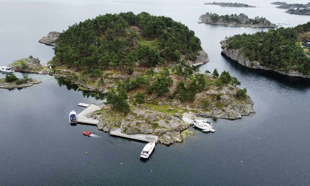

3 liker bildet
Image uploaded on 4. Aug 2024
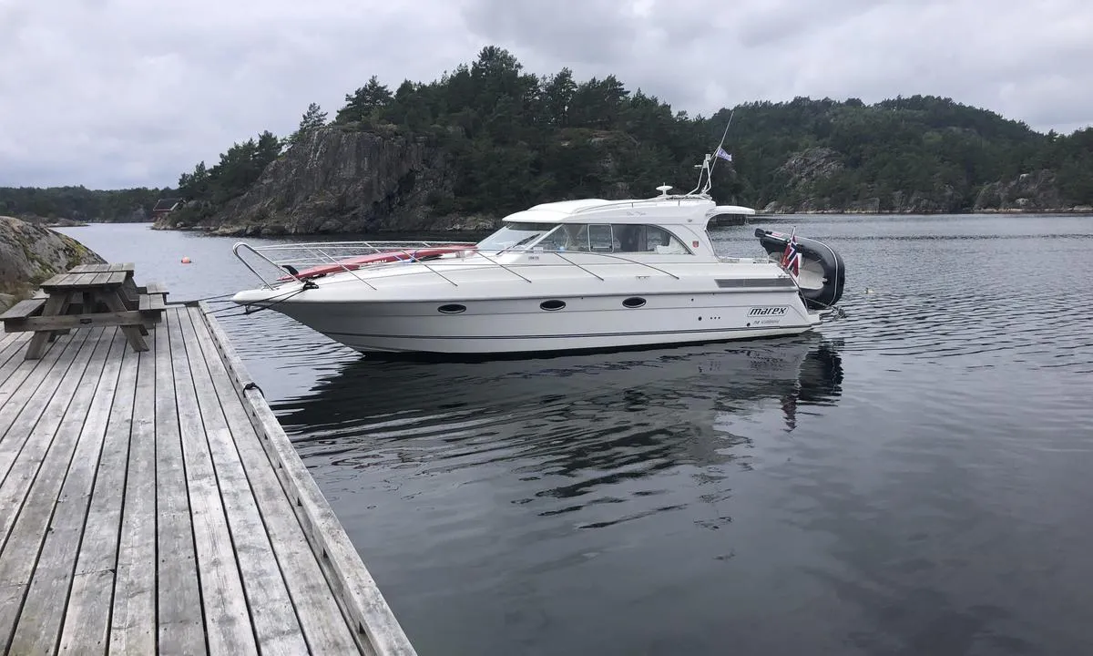
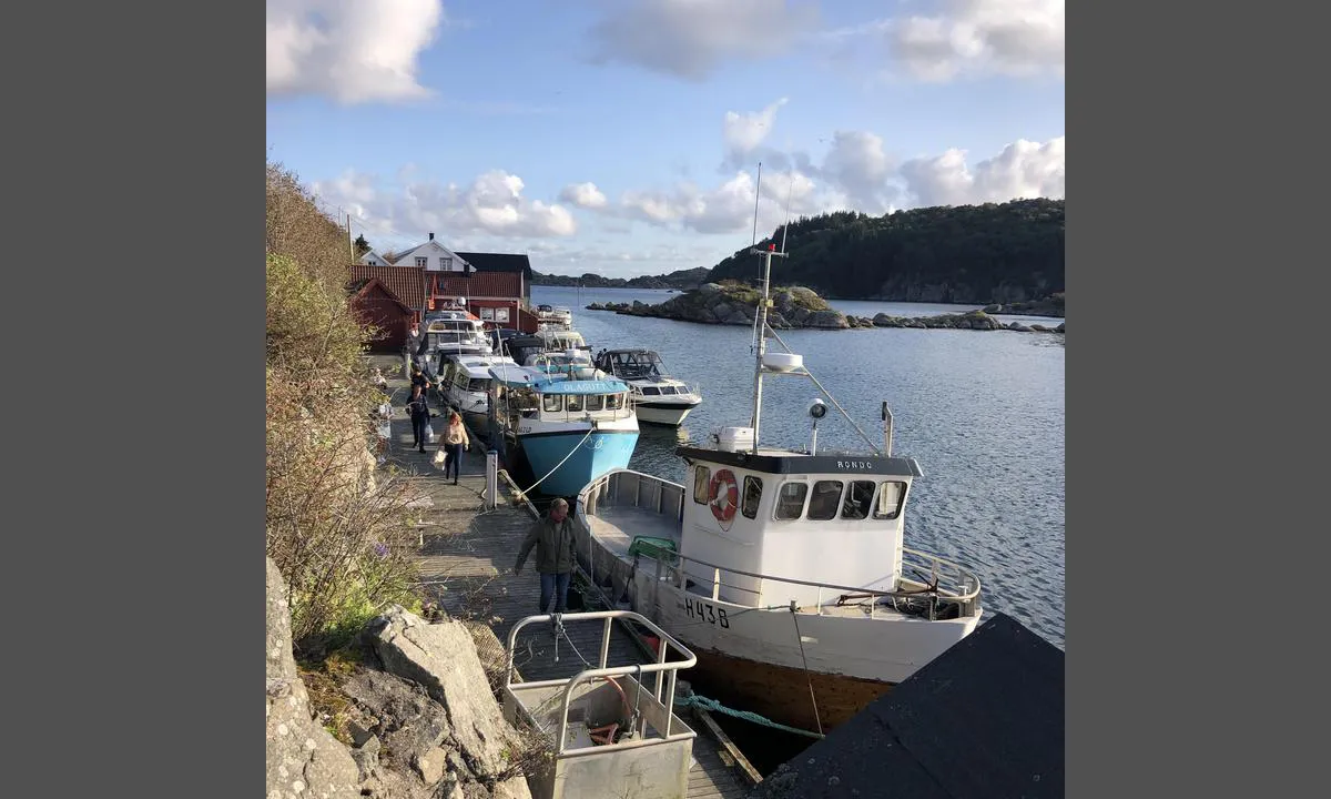
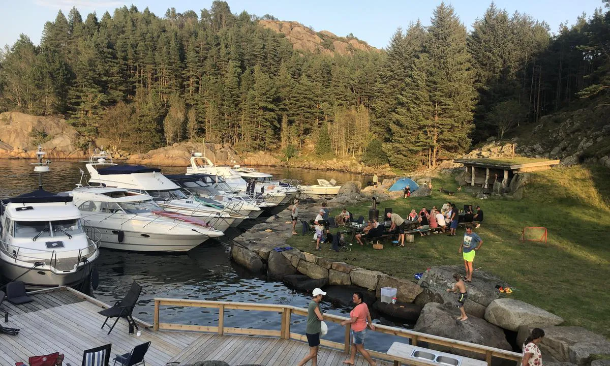
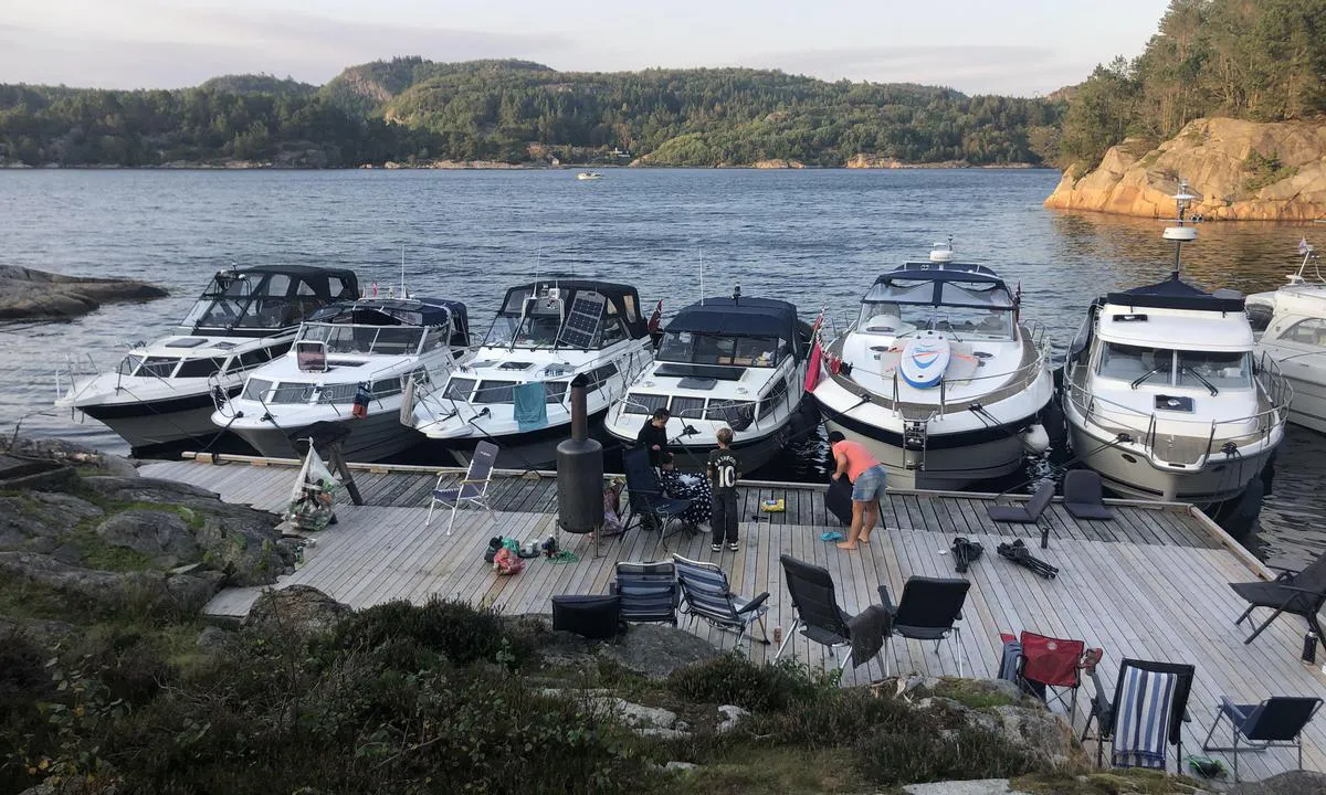
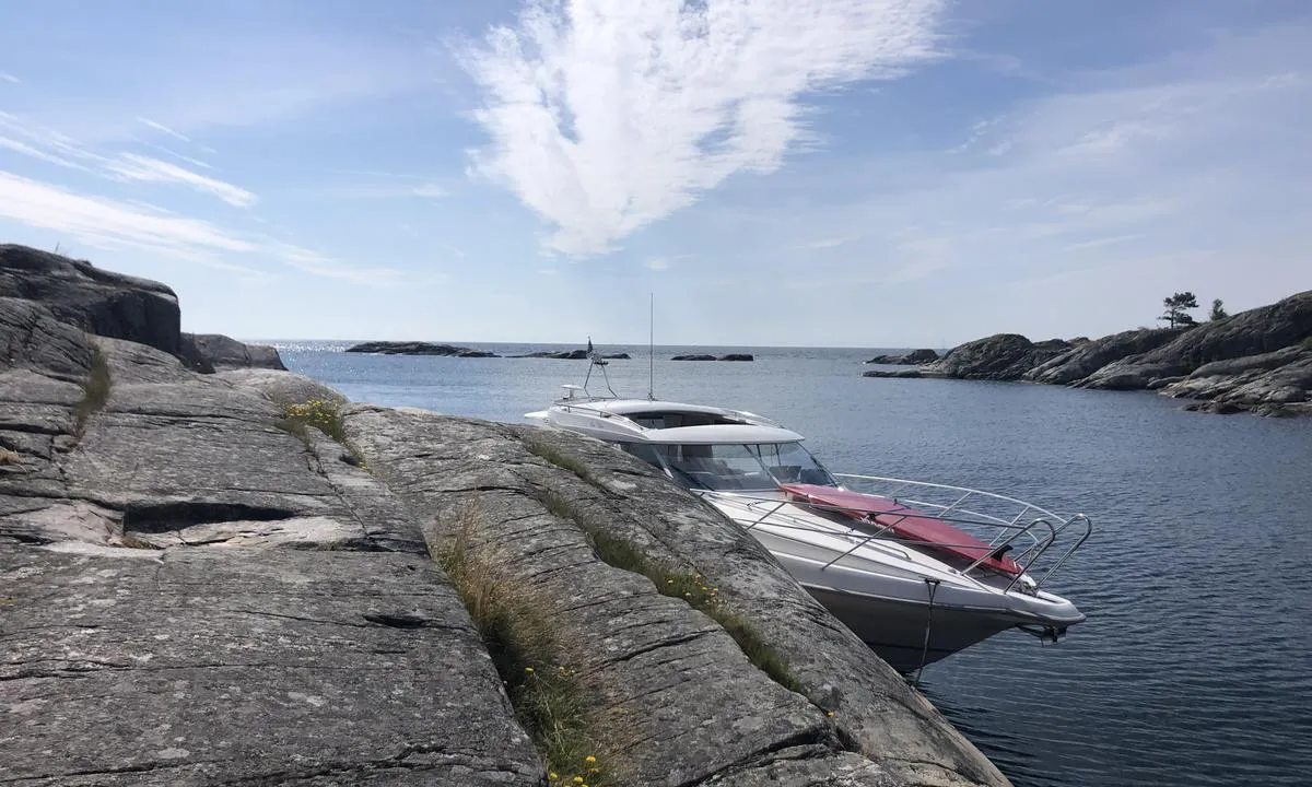
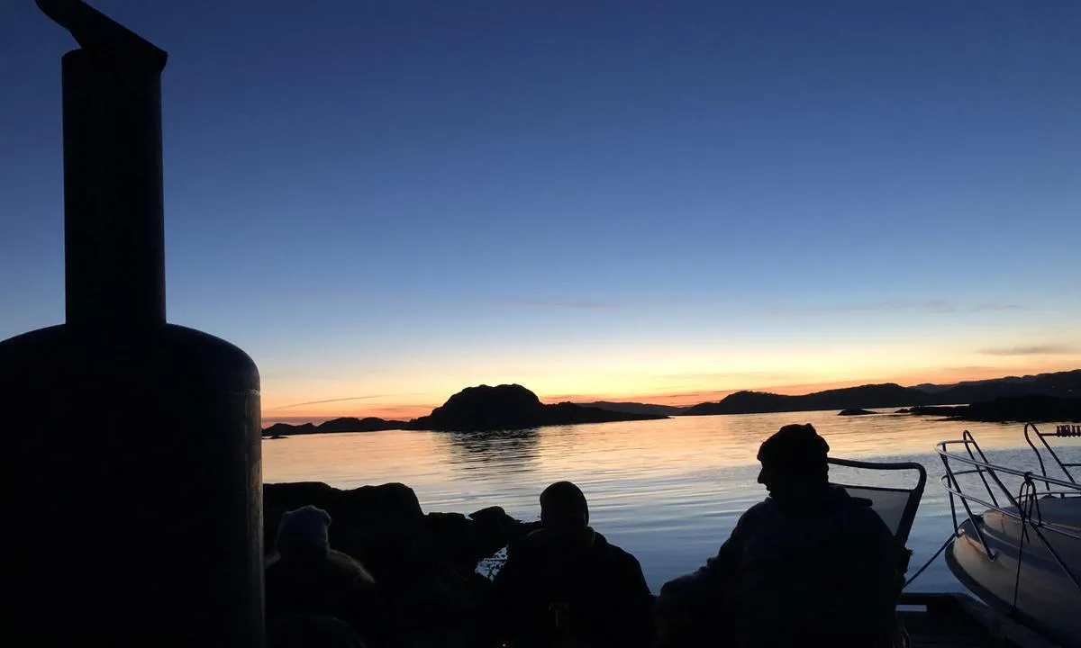
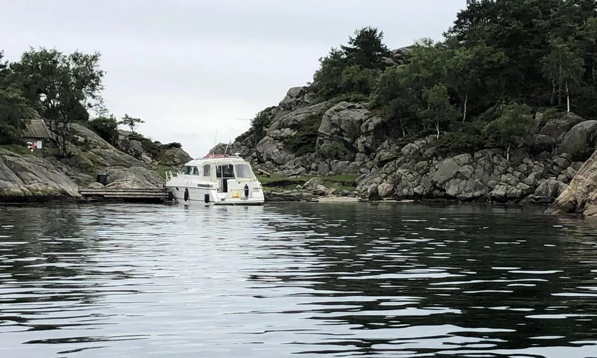
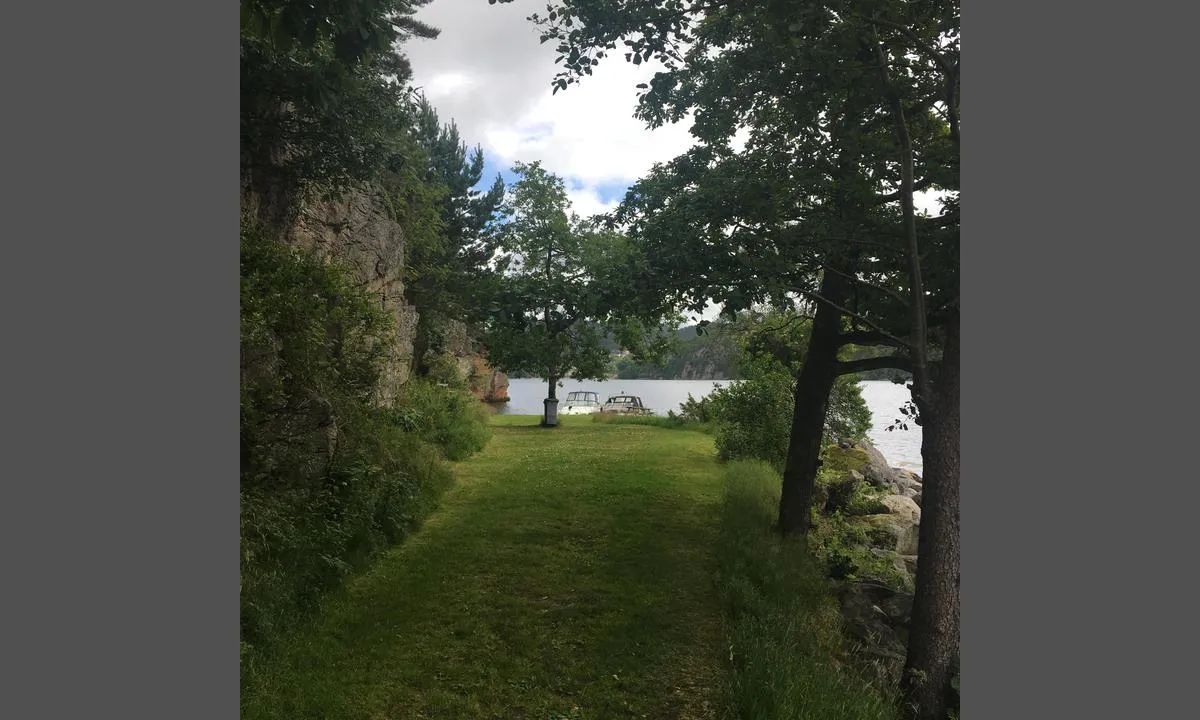
Tregde Marina
marina
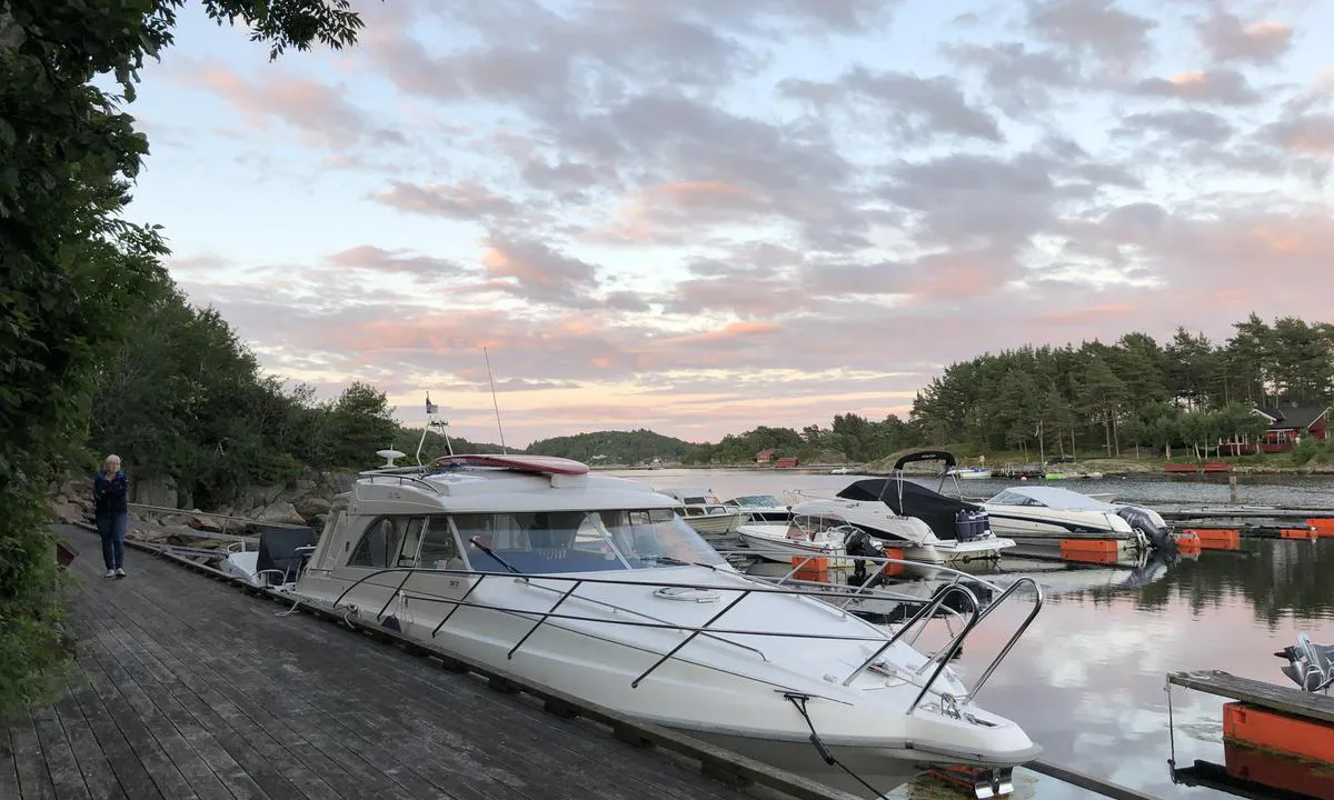
3 liker bildet
Image uploaded on 2. Sep 2023
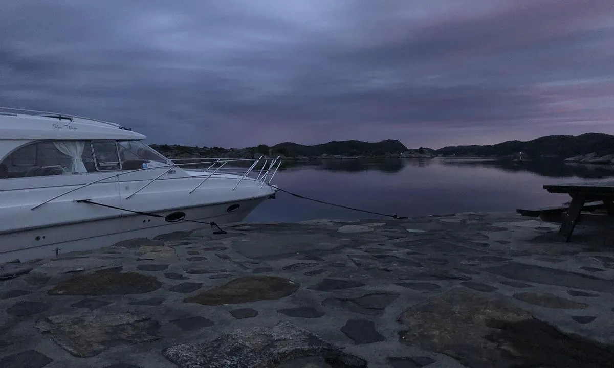
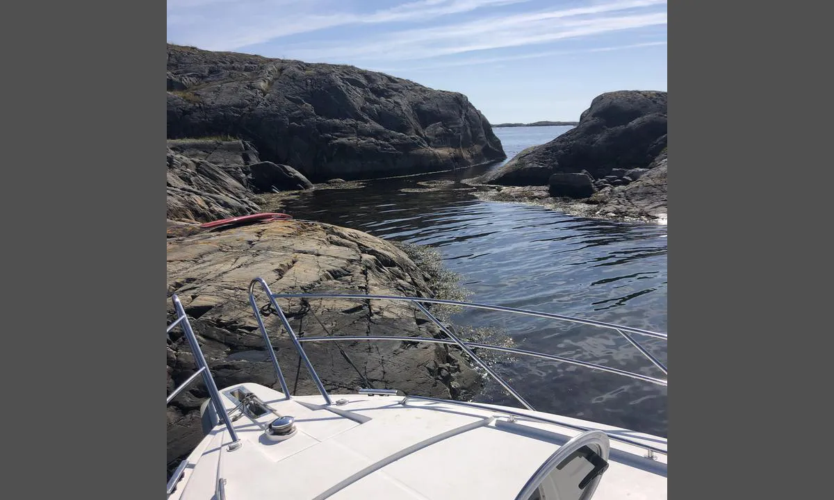
Maløyene
natural_harbour
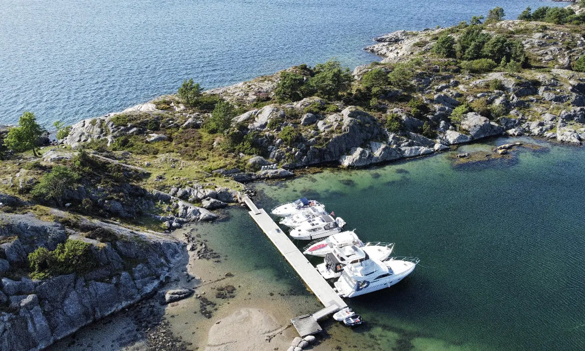
2 liker bildet
Image uploaded on 30. Jul 2024
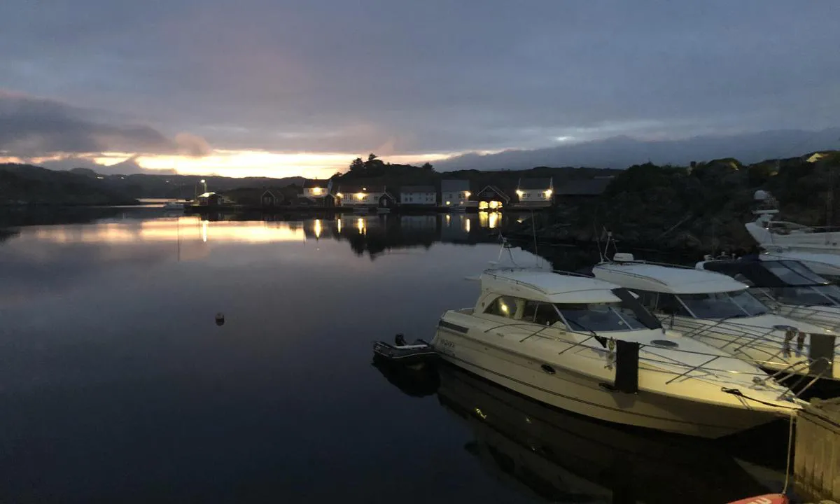
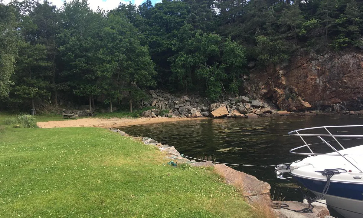
Dålibukta
natural_harbour
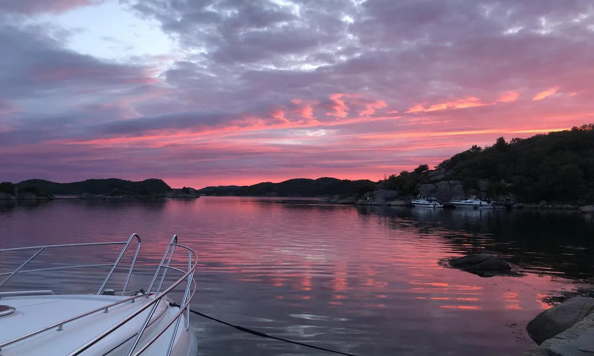
2 liker bildet
Image uploaded on 24. Sep 2023
Kalvøyene - Grimstad
natural_harbour
2 liker bildet
Image uploaded on 29. Jul 2024
Kalvøyhavn
natural_harbour
2 liker bildet
Image uploaded on 19. Jul 2024
Vikkilen
natural_harbour
2 liker bildet
Image uploaded on 30. Aug 2023
Kjøpsøy
natural_harbour
2 liker bildet
Image uploaded on 30. Aug 2023
Lille Bjørnen
natural_harbour
2 liker bildet
Image uploaded on 30. Aug 2023
Sæløer
natural_harbour
2 liker bildet
Image uploaded on 30. Aug 2023
Søndre Vassøy
natural_harbour
2 liker bildet
Image uploaded on 30. Aug 2023
Nilen
natural_harbour
2 liker bildet
Image uploaded on 2. Aug 2024
Abrahamsodden
natural_harbour
1 liker bildet
Image uploaded on 23. Jul 2024
Sutnøy
natural_harbour
1 liker bildet
Image uploaded on 8. Aug 2024
Kråkeholmen
natural_harbour
1 liker bildet
Image uploaded on 24. Sep 2023
Kalvøyene - Grimstad
natural_harbour
1 liker bildet
Image uploaded on 29. Jul 2024
Vestre Hestholmbukta
natural_harbour
1 liker bildet
Image uploaded on 15. Jul 2024
Vikingheim - Vervågen
natural_harbour
1 liker bildet
Image uploaded on 2. Jun 2025
Vikingheim - Vervågen
natural_harbour
1 liker bildet
Image uploaded on 2. Jun 2025
Vikingheim - Vervågen
natural_harbour
1 liker bildet
Image uploaded on 2. Jun 2025
Bjørkøy
natural_harbour
1 liker bildet
Image uploaded on 24. Jul 2024
Auesøya - Breivig
natural_harbour
1 liker bildet
Image uploaded on 16. Oct 2023
Auesøya v/Bjørkøy
natural_harbour
1 liker bildet
Image uploaded on 26. Jul 2024
Auesøya v/Bjørkøy
natural_harbour
1 liker bildet
Image uploaded on 26. Jul 2024
Håholmen - Brekkestø
natural_harbour
1 liker bildet
Image uploaded on 16. Jul 2024
Torkelsodden - Farsund
natural_harbour
1 liker bildet
Image uploaded on 31. Aug 2024
Torkelsodden - Farsund
natural_harbour
1 liker bildet
Image uploaded on 31. Aug 2024
Øster Kuholmen
natural_harbour
1 liker bildet
Image uploaded on 3. Aug 2024
Torkelsodden - Farsund
natural_harbour
1 liker bildet
Image uploaded on 31. Aug 2024
Kalvøyene - Grimstad
natural_harbour
1 liker bildet
Image uploaded on 16. Jul 2024
Gulaberget - Våre
natural_harbour
1 liker bildet
Image uploaded on 12. Aug 2024
Gulaberget - Våre
natural_harbour

1 liker bildet
Image uploaded on 12. Aug 2024
Auesøya - Breivig
natural_harbour
1 liker bildet
Image uploaded on 29. Jul 2024
Ny-Hellesund - Olavsundet
natural_harbour
1 liker bildet
Image uploaded on 14. Sep 2023
Ny-Hellesund - Olavsundet
natural_harbour
1 liker bildet
Image uploaded on 14. Sep 2023
Teistholmen
natural_harbour
1 liker bildet
Image uploaded on 4. Aug 2024
Korshavn Gjestehavn
marina
1 liker bildet
Image uploaded on 30. Aug 2023
Malungdalsholman
natural_harbour
1 liker bildet
Image uploaded on 30. Aug 2023
Vikkilen
natural_harbour
1 liker bildet
Image uploaded on 30. Aug 2023
Dåliholman
natural_harbour
1 liker bildet
Image uploaded on 30. Aug 2023
Malungdalsholman
natural_harbour
1 liker bildet
Image uploaded on 30. Aug 2023
Hovekilen - st.Helena
natural_harbour
1 liker bildet
Image uploaded on 1. Aug 2024
Hovekilen - st.Helena
natural_harbour
1 liker bildet
Image uploaded on 1. Aug 2024
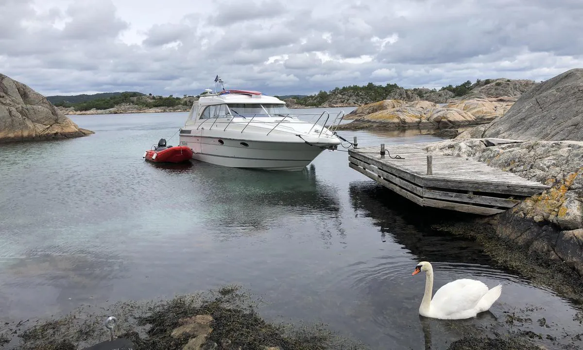
Kjeldevika
natural_harbour
1 liker bildet
Image uploaded on 7. Sep 2024
Kjeldevika
natural_harbour
1 liker bildet
Image uploaded on 7. Sep 2024
Skudeholman
natural_harbour
1 liker bildet
Image uploaded on 30. Aug 2023
Skudeholman
natural_harbour
1 liker bildet
Image uploaded on 30. Aug 2023
Kusundholmen - Grimstad
natural_harbour
1 liker bildet
Image uploaded on 22. Aug 2024
Merdø
natural_harbour
1 liker bildet
Image uploaded on 16. Aug 2024
Vestre Kjeldevika - «Amadores»
natural_harbour
1 liker bildet
Image uploaded on 8. Sep 2024
Sutnøy
natural_harbour
1 liker bildet
Image uploaded on 16. Aug 2024
Kjerkesundet - Lillesand
natural_harbour
1 liker bildet
Image uploaded on 24. Aug 2024
Kjerkesundet - Lillesand
natural_harbour
1 liker bildet
Image uploaded on 24. Aug 2024
Kjerkesundet - Lillesand
natural_harbour
1 liker bildet
Image uploaded on 24. Aug 2024
Lamholmen -Lillesand
natural_harbour
1 liker bildet
Image uploaded on 28. Jul 2024
Bjørkøy
natural_harbour
1 liker bildet
Image uploaded on 31. Aug 2023
Kalvøyhavn
natural_harbour
1 liker bildet
Image uploaded on 1. Sep 2023
Auesøya v/Bjørkøy
natural_harbour
1 liker bildet
Image uploaded on 25. Jul 2024
Lyngholmen - Lillesand
natural_harbour
1 liker bildet
Image uploaded on 2. Sep 2023
Lyngholmen - Lillesand
natural_harbour
1 liker bildet
Image uploaded on 2. Sep 2023
Hesnesøya - Grimstad
natural_harbour
1 liker bildet
Image uploaded on 18. Aug 2024
Steinsøy
natural_harbour
1 liker bildet
Image uploaded on 2. Sep 2023
Bjorviga
natural_harbour
1 liker bildet
Image uploaded on 8. Jun 2025
Mandal Gjestehavn
marina
1 liker bildet
Image uploaded on 3. Sep 2023
Bjorviga
natural_harbour

1 liker bildet
Image uploaded on 8. Jun 2025
Sutnøy
natural_harbour
1 liker bildet
Image uploaded on 3. Sep 2023
Malungdalsholman
natural_harbour
0 liker bildet
Image uploaded on 8. Sep 2023
Malungdalsholman
natural_harbour
0 liker bildet
Image uploaded on 8. Sep 2023
Dålibukta
natural_harbour
0 liker bildet
Image uploaded on 24. Sep 2023
Sæløer
natural_harbour
0 liker bildet
Image uploaded on 24. Sep 2023
Kjøstveitholmen
natural_harbour
0 liker bildet
Image uploaded on 2. Nov 2023
Vragholmen / Medholmen
natural_harbour
0 liker bildet
Image uploaded on 3. Nov 2023
Maløyene
natural_harbour
0 liker bildet
Image uploaded on 15. Jul 2024
Maløyene
natural_harbour
0 liker bildet
Image uploaded on 15. Jul 2024
Auesøya - Breivig
natural_harbour
0 liker bildet
Image uploaded on 16. Oct 2023
Kjøpsøy
natural_harbour
0 liker bildet
Image uploaded on 14. Sep 2023
Malungdalsholman
natural_harbour
0 liker bildet
Image uploaded on 30. Aug 2023
Kalvøyhavn
natural_harbour
0 liker bildet
Image uploaded on 19. Jul 2024
Vikkilen
natural_harbour
0 liker bildet
Image uploaded on 30. Aug 2023
Lille Bjørnen
natural_harbour
0 liker bildet
Image uploaded on 30. Aug 2023
Søndre Vassøy
natural_harbour
0 liker bildet
Image uploaded on 30. Aug 2023
Skudeholman
natural_harbour
0 liker bildet
Image uploaded on 30. Aug 2023
Skudeholman
natural_harbour
0 liker bildet
Image uploaded on 30. Aug 2023
Kusundholmen - Grimstad
natural_harbour
0 liker bildet
Image uploaded on 22. Aug 2024
Underøy (Indre)
natural_harbour
0 liker bildet
Image uploaded on 31. Aug 2023
Underøy (Indre)
natural_harbour
0 liker bildet
Image uploaded on 31. Aug 2023
Åløya
natural_harbour
0 liker bildet
Image uploaded on 31. Aug 2023
Slåttholmen
natural_harbour
0 liker bildet
Image uploaded on 28. Jul 2024
Slåttholmen
natural_harbour
0 liker bildet
Image uploaded on 28. Jul 2024
Auesøya v/Bjørkøy
natural_harbour
0 liker bildet
Image uploaded on 25. Jul 2024
Lyngholmen - Lillesand
natural_harbour
0 liker bildet
Image uploaded on 2. Sep 2023
Hammerøy
natural_harbour
0 liker bildet
Image uploaded on 2. Sep 2023
Reviews
See a helpful review? Please click the 👍 below the review to let Dan Mossmann know that you found it helpful.
Dan Mossmann says:
area


maritime qualities
description
Here you arrive directly from the north.
Dock up against the rocky shore/cliff on the west side of this bay, 2.5 meters depth.
Good with several cracks for wedges.
Visit the magnificent privateering harbor Loshavn which was notorious for its skilled privateer captains during the Napoleonic Wars 1807-14.
Short distance to the campsite at Lomsesanden with beautiful beaches and a small shop and kiosk.
Great hiking trails around Einarsneset and up to the day-trip cabin between Loshavn and Lomsen.
2 x helpful | written on 16. Aug 2024 | updated_on 16. Aug 2024
Dan Mossmann says:
description
The middle red mooring buoy has a mark similar to a Neptune trident. This means that the buoy is primarily for use by members of NHK (Norsk Havseiler og krysserklubb) but only if they have a sailboat with a visible name and a trident flag on the port stay. In other words, HC parking for 270 members.
The other buoys are public.
2 x helpful | written on 16. Aug 2024 | updated_on 16. Aug 2024
Dan Mossmann says:
area
maritime qualities
description
Brygga på styrbord side brukes longside. Rimelig dypt langt inn. Seilbåt ligger fint ytterst.
Brygga foran rødt båthus(Tilhører Lista og Seløer kystlag) kan en legge seg på moringen som ligger foran denne, eller dregg. Bolter i fjell på babord side. (Utenom sesong kan legge seg longside også her da det er dypt nok til det for motorbåter.
Den gule hytta er under renovering og blir trolig klar for utleie som kystledhytte i 2025.
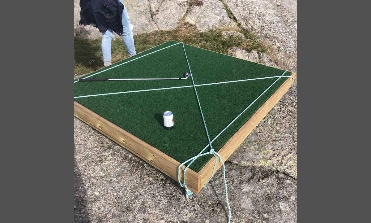
Flotte merkede turstier f.eks opp til kompassrosa (datert til år 1520) som finnes på toppen, midt på øya, med utsikt mot Korshavn.("Fløyet")
Havgolf på den sydøstlige toppen. Utstyr kjøpes/leies av Korshavn rorbuer.
Historisk har denne øya fungert som handelsplass for spesielt treller, mellom år 750-1200 Evt. (Interneringsleir)
Øya het da Kefsir. Flere slike øyer ligger langs kysten vår, og hadde da samme navn og funksjon.
2 x helpful | written on 30. Aug 2023 | updated_on 3. Jun 2025
Dan Mossmann says:
area
maritime qualities
description
Beautiful historic outpost facing the sea!
Here lay the ancient boundary between the western and eastern parts of Norway. (All place names in Norway with 'sel' or 'sal' originate from their use as overnight/resting places.)
There are 3 places to moor inside the bay, besides anchoring between the Seløyene islands.
-The first public dock is on the port side with a small red shed.
-The next one is further in on the starboard side. A concrete dock without a skirt, it is public.
-The last mooring spot is by the breakwater. Here, one can use one of the two mooring buoys.
Swimming should be done on the outside of the breakwater at a well-arranged area.
There is an outhouse by the schoolhouse on Østre Seløer. There is also a shower room under the half-roof of the schoolhouse intended for visitors to the island!
Great hiking trails lead up to, for example, the compass rose 'Kompasen,' dated to 1550 AD, on Vestre Seløer.
A small hike is also recommended to the ruins of the chapel (probably built in the 1200s) which previously stood here with a burial ground for washed-ashore bodies and for seafarers who died of plague/cholera. The burial ground was in use until 1835. (Potato field from the early 1900s!)
The hiking trail to Selihovden, where the lighthouse keeper for the Lindesnes lighthouses used to reside, is recommended!
Good view of the former twin lighthouses at Lindesnes/Markøy. (Lindesnes lighthouse, which consisted of 12 stearin candles and a reflector, was first lit in 1656. Later, the twin lighthouses operated together from 1725 to distinguish them from the Skagen lighthouse in Denmark which only had one light.)
2 x helpful | written on 30. Aug 2023 | updated_on 8. Aug 2024
Dan Mossmann says:
area
description
Dock alongside in here. Space for two boats. Easy entrance, but narrow.
At the top of Vikilen, there are burial mounds along the entire strait towards Ullerøy.
There is also one right near the dock. The mounds were placed along the rowing route where people traveled. On the way to Farsund/Lista, there are very many mounds along the rowing route. These could easily be reused and moved, and some were also built upon.
(All are dated to the Migration Period, around 400-600 AD.)
2 x helpful | written on 30. Aug 2023 | updated_on 29. Feb 2024
Dan Mossmann says:
area
maritime qualities
description
There are 3 routes into this quiet lagoon with a beautiful sandy bottom.
If you have a sailboat, it is perhaps safest to enter from the sea. 4 meters depth.
Otherwise, there are 1.6 m and 2 meters at the other entrances.
Trash cans and toilet on Drevholmen
Short distance to Homborsund lighthouse, which is definitely worth a visit!
2 x helpful | written on 16. Jul 2024 | updated_on 16. Jul 2024
Dan Mossmann says:
area
maritime qualities
description
Looks a bit sketchy to enter directly from the south, but it is deep enough, also for sailboats.
Most people prefer to enter from the east, but watch out for shallows on the chart if you have a sailboat.
Beautiful place with a nice marina, shop, and restaurant.
Great to take the relatively short walk to Tregde on the Old Tregde Road.
Sun-warmed large pool on the pier, and a new beautiful sauna that can be rented on an hourly basis.
2 x helpful | written on 2. Sep 2023 | updated_on 29. Jul 2024
Dan Mossmann says:
area
maritime qualities
description
Guest berths are now moved to the 'middle' floating dock. Payment is at the machine at the end of the dock.
There is a small kiosk with some maritime equipment by the quay.
Kiwi is located 400 meters further north.
After passing the restaurant 'Under', Kråkeviga is a great swimming spot.
The fish shop 'Jentan på Båly' at the quay offers many tempting treats.
2 x helpful | written on 3. Sep 2023
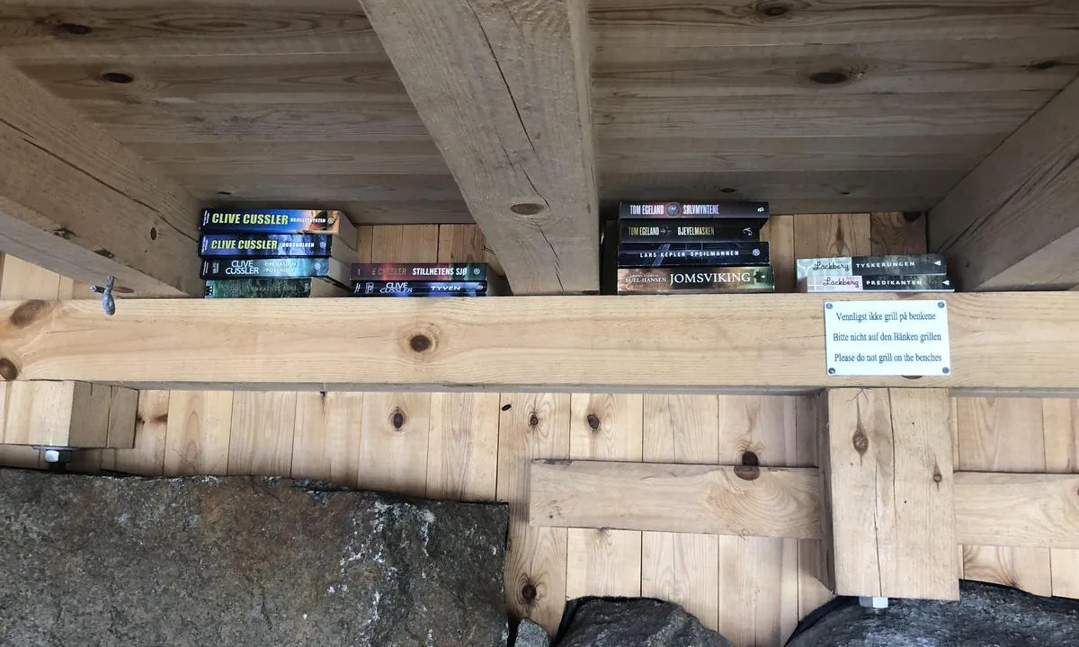
Dan Mossmann says:
area
maritime qualities
description
Good quay to moor alongside, also for sailboats.
One must only moor on the northern part of the quay to avoid obstructing potential other boat traffic.
A library with book exchange is available on the quay.
Narestø is actually one of Norway's oldest breakwater harbors - already in the 18th century, a small breakwater was built here.
Narestø is a coastal settlement from the 17th century.
Flosta Church is located nearby. This is a so-called votive church that has been funded by seamen over the years. (They might have promised God that if they just survived this storm, then they would........!)
2 x helpful | written on 17. Sep 2024 | updated_on 17. Sep 2024
Dan Mossmann says:
description
Popular and safe bay to moor in, especially sailboats that anchor here.
One can also easily moor close to the shore on the port side inside the bay.
Watch out for the 0.7-meter shallow area after the entrance on the starboard side.
Good holding ground in muddy bottom.
Furthest inside to starboard is consecrated ground which was used as a burial site for shipwrecked sailors and seafarers who died of plague/cholera. 6 Icelanders were buried here after a shipwreck just outside Vikelen in the early 1800s. The work was done by those who were allowed to keep wreckage such as ropes and sails/materials found after the shipwreck.
One of these had to be dug up again in the presence of the sheriff after some time. The reason for this was ugly rumors that they were buried shallow, naked, without prayer/hymns, and not in consecrated ground. The rumors were then put to shame, and the malicious rumor-mongers were punished. (The sheriff couldn't verify all of them as they were in such an advanced state of decomposition.)
2 x helpful | written on 27. Sep 2023 | updated_on 27. Sep 2023
Dan Mossmann says:
description
Very safe and good place to dock with winds from S and SW. The entrance to this spot from the east, just north of Bjørkøy, looks a bit sketchy, but enter cautiously through the middle of the narrow strait. There is a depth of 1.5 meters here.
Sailboats reach this spot by sailing around the north side of Auesøya.
1 x helpful | written on 25. Jul 2024 | updated_on 25. Jul 2024
Dan Mossmann says:
description
Many great places to dock here in Isefjærfjorden, which is known for having some of the warmest bathing water in Sørlandet.
Mud bottom.
Short distance to the campsite all the way in the north.
Sent the kids in here to buy ice cream. They came back crestfallen, without ice cream, as they had seen many naked old people in there. Lost the desire for ice cream and candy.
Nudist camping.
The country store at Indre Årsnes/Høvåg is just a short dinghy trip from here. They have EVERYTHING!
(A bit south, and then towards the west.)
1 x helpful | written on 3. Nov 2023 | updated_on 3. Nov 2023
Dan Mossmann says:
area
maritime qualities
description
Nice harbour near Lillesand. Several spots have a depth of 10-15 meters right up to the shore, which can make it a bit difficult to get enough length on the anchor. Watch the depth if you choose to go up to the rusty bolts on the northeast side. It can be a bit shallow here. (0.9-1.2 meters).
1 x helpful | written on 28. Jul 2024 | updated_on 3. Aug 2024
Dan Mossmann says:
area
maritime qualities
description
Very safe and good place to dock if it’s not too windy.
There is some traffic passing by, but it usually goes at 5 knots and therefore doesn't create much waves.
It has about 2 meters depth if you anchor towards the rocky shore.
You can also very well lie at anchor here.
1 x helpful | written on 22. Aug 2024
Dan Mossmann says:
description
Poem carved by a student under the lid of a school desk at Våre school:
The sea gives, mackerel and pirate.
The sea takes, traps and dad!
1 x helpful | written on 23. Aug 2024 | updated_on 23. Aug 2024
Dan Mossmann says:
area
maritime qualities
description
The deepest entrance to this reasonably well-protected strait can be found in the southeast with a depth of 6 meters.
If you use the other entrances, you must proceed with caution.
There is a shoal with a depth of 1.7 meters in the strait that sailboats should be aware of. Keep the boat towards the east side to be safe.
A visit to Saltholmen lighthouse nearby is highly recommended.
New toilet facilities are located at Kjeholmen.
1 x helpful | written on 24. Aug 2024 | updated_on 24. Aug 2024
Dan Mossmann says:
area
maritime qualities
description
Nice new stone pier built by the archipelago service.
There are toilets and a barbecue area with benches.
Check the different depths along the pier before mooring alongside.
It is a short distance to the trail in Kirkeskaret. (Trail between Lomsesanden and Loshavn)
1 x helpful | written on 31. Aug 2024
Dan Mossmann says:
area
maritime qualities
description
Gå inn med holmen på styrbord side. Sikt deretter på odden som ligger på babord side lenger inne. Dette for å unngå grunner på 0,8 og 0,6 meter.
4 meter dybde innenfor grunnene.
Her inne ligger du absolutt helt ute av vind/trekk om nordvesten blir for sterk!
Kort vei til selvbetjent butikk i Korshamn.
Fine turstier i gammelt kulturlandskap!
1 x helpful | written on 2. Jun 2025 | updated_on 3. Jun 2025
Dan Mossmann says:
description
Here you will find many nice places to moor. It is nice to be able to choose between Merdø, with its beautiful paths and the restaurant there, and the same on Hove, with only a short dinghy trip. Fantastic beautiful beach on Gjessøya!
1 x helpful | written on 1. Aug 2024
Dan Mossmann says:
area
maritime qualities
description
Mooring of motorboats can be done against the rocks inside the bay.
Sailboats can dock against the shoreline on the largest point between the bays on this western side.
Several wonderful tent places by the beach and further inland.
Many hiking trails to choose from on Skauerøya.
1 x helpful | written on 15. Jul 2024 | updated_on 27. Jul 2024
Dan Mossmann says:
area
maritime qualities
description
Popular natural harbor with a beautiful sandy beach. All vessels dock longside here, and a 35' motorboat can comfortably dock on either side. Sailboats dock on both sides of the floating dock. (If it's full, you can just dock alongside.)
Toilet and trash bins. Shelter with a fireplace and hooks in the ceiling for hammocks. Book exchange shelf. Firewood for sale.
Nice spots for setting up tents.
Short distance to a self-service store in Korshavn. Fuel and a pub are also available there.
Great hiking trails leading to an old abandoned settlement. (1936) Quartz and feldspar open-pit mine on the southwestern side. You can continue along the southern side towards the east to walk around Brennevinsfjellet.
1 x helpful | written on 30. Aug 2023 | updated_on 16. Aug 2024
Dan Mossmann says:
area
maritime qualities
description
Easy to dock at the wooden pier. (Sailboats can dock alongside at the very end of the pier.)
To dock at the islet, watch out for a shallow area at the innermost part of the bay, but with caution, it is fine. (1.5-2 meters depth)
Nice hiking trails up to the top of Ullerøy.
Fireplace on the pier for evening relaxation!
1 x helpful | written on 30. Aug 2023 | updated_on 26. Sep 2023
Dan Mossmann says:
area
maritime qualities
description
One enters most easily on the north/east side of the islets to moor against the rock face.
Use wedges and make sure you get a good anchor hold. In some wind, it can slip.
(The inside is for those familiar with the area, but it's alright if you use the chart well. There are some shallows here, but these are at 1 - 1.5 meters)
1 x helpful | written on 30. Aug 2023 | updated_on 30. Aug 2023
Dan Mossmann says:
description
You can go around the entire Lille Bjørnen to moor on the cliffs on its north side, both on the east and west sides.
Anchor and go bow-in. Use wedges, but there are some bolts in the rock.
It is nice to anchor in the area north of Bjørnan.
The definition of lying as in a duck pond comes into its own here.
You can also nicely moor on the cliffs on Store Bjørnen. It is best on the northwest tip of the island.
If you have a SUP board or kayak, this is a beautiful area and the trip between Krabbøy and Finnøy is very stylish.
1 x helpful | written on 30. Aug 2023 | updated_on 12. Nov 2023
Dan Mossmann says:
description
Easy approach to Krabbøy from the north. There are several bolts on the rocky shore to the west of the bay. Great spot sheltered from east and south winds.
1 x helpful | written on 30. Aug 2023 | updated_on 12. Nov 2023
Dan Mossmann says:
area
maritime qualities
description
Here, there is an old reliable quay to moor at, and there is good anchorage in the bay. Drop the anchor as close to the rock opposite the quay as possible.
You can also moor at the rock surface just outside the wooden building. Bolts can be found in the rock.
A calm and beautiful natural harbor where there is also space for tents on the grass inside the bay.
An outhouse is also available here.
1 x helpful | written on 30. Aug 2023 | updated_on 14. Sep 2023
Dan Mossmann says:
area
maritime qualities
description
Well-protected natural harbor. Was used as a wintering harbor in the age of sailing ships. Out here, it rarely froze over with ice!
Proceed cautiously when entering from the west. There are several 0.6m shallow areas on this side, but they are well marked on the chart. Sailboats can dock in the western inlet, while motorboats can enter the inner inlet with depths of 1-1.5 meters. Great swimming spot with a sandy bottom!
There are some bolts in the rock here, but you should also be prepared to use wedges.
Good anchorage.
1 x helpful | written on 30. Aug 2023 | updated_on 14. Sep 2023
Dan Mossmann says:
area
maritime qualities
description
This is a very safe and good harbour primarily for motorboats that can hide completely behind this point. Sailboats can anchor closer to the opening in the lagoon. There is also a blue buoy here that serves as a mooring.
Easy to dock. Bolts in the rock, but you might need to wedge something extra.
Enter carefully and keep a little distance from the tip of the point as it is somewhat shallow right there. Do not use the propeller more than necessary to avoid stirring up sediment from the bottom.
Space for 2 boats at the innermost part and 2-3 boats on the starboard side at the entrance.
1 x helpful | written on 31. Aug 2023 | updated_on 16. Aug 2024
Dan Mossmann says:
description
You can approach this place from the west if you can get under the bridge span of 3.5 meters over Navarsundet. If you have a flybridge, sailboat, or a boat larger than 40 feet, consider entering from the east side, but watch out for Sniksrevet out in the fjord. Navigate on the right side of the marker there!
Use a dredge and the many bolts in the rock for mooring.
Nice hiking trails all over Underøy. Several nice beaches. Several burial mounds from the Migration Period all the way out at 'Draiet'.
1 x helpful | written on 31. Aug 2023 | updated_on 31. Aug 2023
Dan Mossmann says:
area
maritime qualities
description
Well-protected lagoon with many places to dock.
Sailboats usually anchor. There is a lot of seagrass here, so make sure to have the right anchor. Sailboats also dock along the rocks on the starboard side entering the bay on the point that juts out there. 4 meters deep right up to the rock. Bolts in the rock.
Additionally, there are several bolts along the entire Bukkmannsholmen. At the innermost, you can dock alongside the rock with a motorboat.
To dock at the islet in the middle, proceed with some caution between two shallows.
Short distance to Trysnes marina, which has a store, water, fuel, and a restaurant.
1 x helpful | written on 31. Aug 2023
Dan Mossmann says:
area
maritime qualities
description
Simple and straightforward arrival to this great spot. Good anchoring ground.
Here you will find a communal shelter and new toilet facilities.
You can walk 70 meters over to 'Amadores,' which is the bay to the west.
1 x helpful | written on 7. Sep 2024
Dan Mossmann says:
area
maritime qualities
description
A well-protected spot with several mooring bolts around the entire bay.
Sailboats can anchor, and it can be seen that several do so in Nordmannsviga, which is located a few meters further out and is a bit deeper.
A short distance to Breivik camping, which has a small shop.
Also a short trip to Homborsund landhandel, which is excellent!
1 x helpful | written on 1. Sep 2023 | updated_on 17. Aug 2024
Dan Mossmann says:
area
maritime qualities
description
Safe and good harbor where you can have a bit more space to yourself compared to inside the Nile.
The innermost entrance from the east has a depth of 2 meters.
Enter with caution. Sailboats stay a bit further out.
There are some skerries coming in from the south, but keep towards Risøya and you'll be fine.
Beautiful hiking trails on Kalvøya where you can have your morning exercise.
1 x helpful | written on 1. Sep 2023 | updated_on 19. Jul 2024
Dan Mossmann says:
area
maritime qualities
description
Easy access to the docks. 3-4 meters depth.
Great location with plenty of evening sun.
1 x helpful | written on 8. Sep 2024 | updated_on 8. Sep 2024
Dan Mossmann says:
area
maritime qualities
description
Incredibly safe and pleasant harbor with plenty of evening sun. There are bolts along almost the entire strait. 3 meters depth.
1 x helpful | written on 1. Sep 2023
Dan Mossmann says:
area
maritime qualities
description
With the right wind conditions, you will be very well situated here.
The boat traffic that passes by usually goes at low speed and creates no waves.
Perfect for anchoring with good holding ground.
1 x helpful | written on 2. Sep 2023
Dan Mossmann says:
area
maritime qualities
description
Easy to dock inside the bay. T-bolts on the pier.
Deep enough all over. (2.5 meters)
40 meters from the pier lies 'Kjærlighetshaven', an engagement gift from the English lobster dealer John Harden to the maid Gina Marie at Hammerø Guesthouse, which was run by her father Gabriel. The customs house was also located at Hammerøy.
The garden used to be full of all kinds of roses and fruit trees. All the soil in the garden is ballast soil from England brought by the lobster boats from there. (Late 1870s)
Mr. Harden was washed overboard during a stormy crossing over the North Sea before any wedding could be arranged. (It turns out he was already married in England, leaving a widow there!) Gina Marie married a captain from Nøtterøy shortly thereafter.
1 x helpful | written on 2. Sep 2023 | updated_on 12. Nov 2023
Dan Mossmann says:
area
maritime qualities
description
This beautiful spot is easy to pass by. You have to get up close to see its qualities. Great area!
It's alright to anchor near the dock.
There is some debris on the starboard side on the way in. Enter with caution. No side-to mooring.
Lovely little sandy beach inside.
There is also an outdoor toilet.
1 x helpful | written on 2. Sep 2023 | updated_on 2. Sep 2023
Dan Mossmann says:
area
maritime qualities
description
If the harbor seems full at first glance, one should consider whether one can pass under the footbridge which has a height of 4.0 meters above the river. There are also some dock spaces here.
If one has the desire and ability to go even further up, past the old E18 bridge which has a clearance of 2.9 meters above sea level, one will reach the shopping center where one can dock right at the door.
1 x helpful | written on 3. Sep 2023 | updated_on 3. Sep 2023
Dan Mossmann says:
area
maritime qualities
description
Great place.
Sailboats can moor on the port side of the dock as it is deeper here.
Otherwise, the area just north of the dock is used for anchoring.
Very child-friendly bay on the islet that can be accessed via large stones. Seaweed and kelp between these stones prevent, for example, jellyfish from coming in.
Space for tents on the lawn, outhouse, and grill are available on this islet.
Short distance to Furuholmen where you can find, among other things, a store and local sales of warm fish cakes in season.
1 x helpful | written on 3. Sep 2023 | updated_on 14. Oct 2023
Dan Mossmann says:
description
Motorboats can easily anchor near the pier, while larger boats should moor against the rock on the port side. (Alternatively, on the other side of the point.)
An excellent tent site for kayakers.
A nice sandy beach where the little ones can spend the whole day catching crabs.
1 x helpful | written on 4. Aug 2024
Dan Mossmann says:
area
maritime qualities
description
Nice and quiet "fjord" along Flostaleia.
The entrance should be made cautiously on either side of the stakes. NOT between them!
Depth of 2.5 meters. (I see the northernmost entrance is the most used)
Muddy bottom with good holding.
You can moor up against the rocks either on the southern end of this inlet or up against the islet in the middle.
It is nice to anchor here where there are no waves, current, or significant wind.
Feel free to take the dinghy over to the road that runs along the fjord. From here, you can walk to either picturesque Narestø or to the nearest shop in Kilsund.
1 x helpful | written on 17. Sep 2024 | updated_on 17. Sep 2024
Dan Mossmann says:
description
Good sheltered harbor in winds other than west and north-west. Here you can dock alongside outside the season, otherwise it is preferred that the two moorings available here are used. Toilet and water are available on the quay. Nice little sandy beach for children a few meters further inside the bay. Perfect for crab fishing. Nice hiking trails around Korshavn on Revøy, such as up to Kikkerheia where you can find newer rock carvings.
1 x helpful | written on 13. Sep 2023
Dan Mossmann says:
description
Sailboats arrive at this pond from the south because there is a power line 12 meters above sea level at the northern passage. In the inner passage lies the reef 'Heksa Gygra' with a small beacon on it. The ferry 'Høllen' also runs through this passage several times a day. Great hiking trails can be found around Kapelløya to the west and Helgøya to the east. The restaurant 'Verftet' is open seasonally and is well worth the beautiful walk on the excellent path. Several good spots to camp on the grassy plains of Kapelløya.
The store inside Høllen is only a small dinghy trip away. They sell all sorts of things.
1 x helpful | written on 14. Sep 2023 | updated_on 22. Sep 2024
Dan Mossmann says:
area
maritime qualities
description
In this bay, there are many good opportunities to spend a night or two for sailors.
At the entrance of the bay, immediately portside to the north, there is a nice wooden pier with plenty of space. Bolts in the smooth rocks can also be found outside the pier.
Further in and east of the bay, there is a large, nice stone pier, also with bolts in the rock south of this. (Smaller boats can fit nicely into the wedge behind this point.)
West in the bay by Dåliholman, you can anchor up against the smooth rocks. (Use wedges)
The bay is also nice for anchoring if you prefer that.
1 x helpful | written on 24. Sep 2023 | updated_on 24. Sep 2023
Dan Mossmann says:
description
Here, you can stay well-sheltered from boat traffic on the inner passage between Korshamn and Farsund. You can navigate around the entire islet, but the safest approach is from the west. You can moor alongside the natural rock pier or anchor. Use chocks. Sandy bottom.
1 x helpful | written on 24. Sep 2023
Dan Mossmann says:
description
In this harbor, you get a feeling of being absolutely southerly in Norway!!
A fantastic area for SUP boards or dinghies!!
-The entrance to the harbor from the north is narrow, but has a depth of about 4 meters. Sailboats can anchor in the basin here. Rocky bottom.
In towards the cliffs to the north and east, as well as towards the stone pier, it gets shallower. Therefore, deep-draft boats must be careful.
There are bolts in the rock if you place yourself on the point hard to starboard after the entrance. Normally, boats anchor towards the stone pier.
-The entrance to the harbor from the south is straightforward, but watch out for a shallow area on the port side when you get inside. Anchor in the basin, or you can place yourself on the cliffs on both sides. Use fenders, but there are some bolts in the rock.
1 x helpful | written on 26. Sep 2023 | updated_on 2. Nov 2023
Dan Mossmann says:
area
maritime qualities
description
This islet is a little paradise in this cove near Randøyene. You will most likely arrive from the south, but there are also possibilities to come from both the west and north with a motorboat. (Nåløye and Skippergada)
Be aware of some debris near the small islets straight out from Buholmen.
Deep water all the way to the point north of the islet. Several bolts in the rock, but also have your own wedges ready. Bottom with eelgrass. Great swimming spot, and absolutely fantastic for small children on the shallow eastern side of the islet. Sailboats also lie well next to the islet, but many choose to anchor right by it.
Short distance to Tømmerstø with the dinghy. Here you will find fuel, water, a self-service store, and a pizza restaurant.
1 x helpful | written on 15. Oct 2023
Dan Mossmann says:
description
The beach is named after Company Linge from the Second World War. After the war, this company had access to the cabin located east of the beach, but the cabin is no longer used in this way.
1 x helpful | written on 15. Oct 2023 | updated_on 30. Mar 2024
Dan Mossmann says:
description
I denne bukta ligger en godt i le for øst- og sydlige vinder.
Innerst har en to odder hvor det er tilrettelagte plasser hvor en kan fortøye på bolter i fjell.
Ellers kan en ligge på mye av svaberget på styrbord side her inne.
Midt i bukta, litt om styrbord, ligger en grunne på 1,1 meter.
Jurist og dommerfullmektig Henrik Lundh (1905-85) var bekymret over at folk i distriktet solgte fine strandsteder til ”rike østlendinger” og kjøpte derfor denne øya som han testamenterte til kommunen med forutsetninger om å opprettholde landskapet gjennom vern og skjøte området med bl.a. kulturbeite. Området skulle sikres til bruk for allmennheten.
Flotte turstier på øya med sin mangfoldige flor og fauna.
Gravhauger ligger strategisk plassert langs den gamle ro-leden som da gikk over Eidet lenger inne på øya.
1 x helpful | written on 16. Oct 2023 | updated_on 22. May 2025
